|
|
||
.jpg) |
|
|
|
|
||
|
|
||
|
|
|
|
|
|
||
|
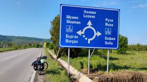
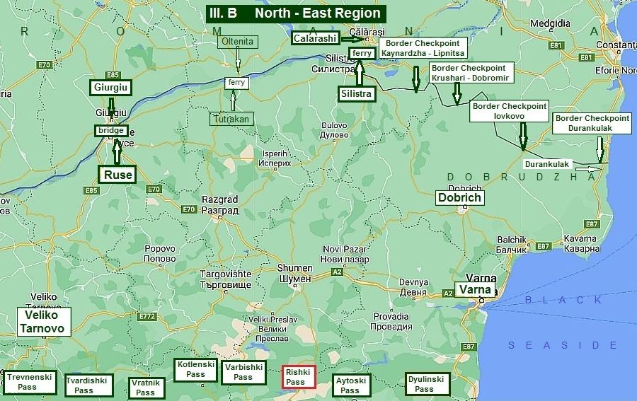
III. B North - East Region |
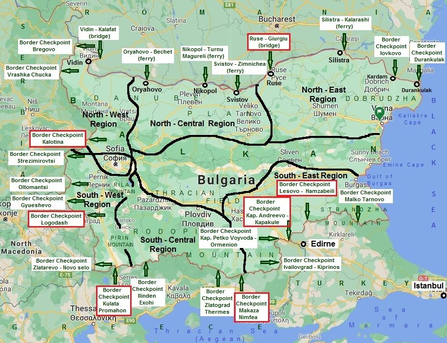
When the bicyclists begin planning a tour including crossing Bulgaria from north to south or from south to north, my suggestion is to follow the next algorithm: - Define the point of entering in the country; - Define the point of leaving the country; - Choose the pass, where to cross Balkan: I have given detailed information about Balkan passes in: Chapter I. Passes in Balkan: Sector I. B & Sector I. C |
|
|||
|
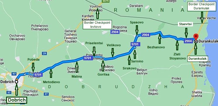
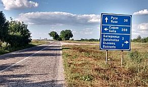
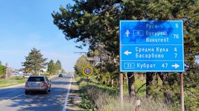
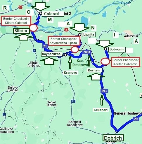
1. Giurgiu – Ruse: bridge (and a ferry, still a project) 2. Oltenita - Tutrakan: ferry (still a project only). 3. Calarashi – Silistra: ferry. - Constanta – Silistra (Border Checkpoint Silistra). |
|
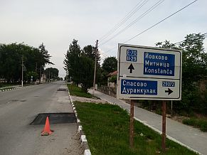
The next two border checkpoints are of local meanings: - Border Checkpoint Kaynardzha - Lipnitsa - open 2017; - Border Checkpoint Krushari - Dobromir - open 2018; 4. Negru Voda – Kardam (Border Checkpoint Iovkovo); 5. Mangalia – Durankulak (Border Checkpoint Durankulak) |
|
|
|
||
|
I will connect these points with the passes in the Balkans (pointing on the map above) along roads avoiding traffic as much as possible. I will give some opportunities as well. Bicyclists crossing the country from north to south toward the Bulgaria / Greece border and the Bulgaria / Turkey border need to look here: |
Chapter III. Crossing Bulgaria from north to south (from Romania to Turkey & Greece): Bicyclists intending to pedal along Danube river can look in: Chapter V. Bicycling along Danube river |
|
|
|
||
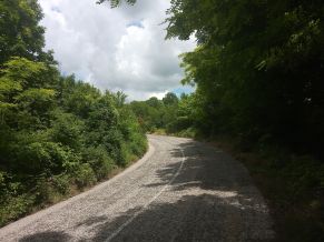
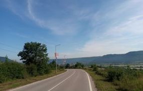
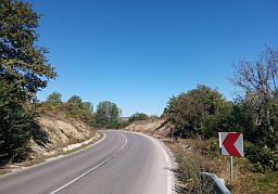
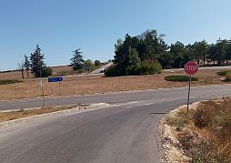
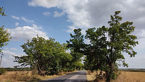
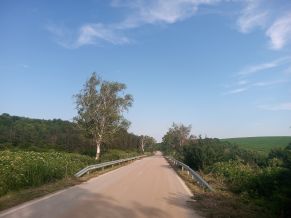
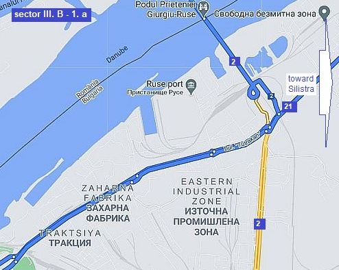
.jpg) 1. Giurgiu - Ruse: bridge I do not recommend entering or leaving Bulgaria here. The bridge and the approach to it is narrow and the traffic is very intensive. https://www.youtube.com/watch?v=2f-vQZxMaOY There is an idea a new bridge to be built 2 kilometers east from the old one, but God only knows if and when that may happen. There is a plan for a ferry at the same point as well. According to this plan, the ferry will be available June 2024 . . . we will see ... Maybe it will be better for bicyclists! As it can be seen on the next map there are five possibilities to leave/enter Ruse: |
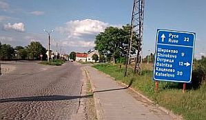
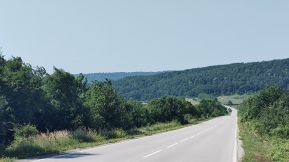
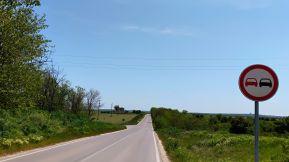
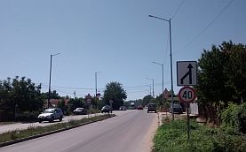
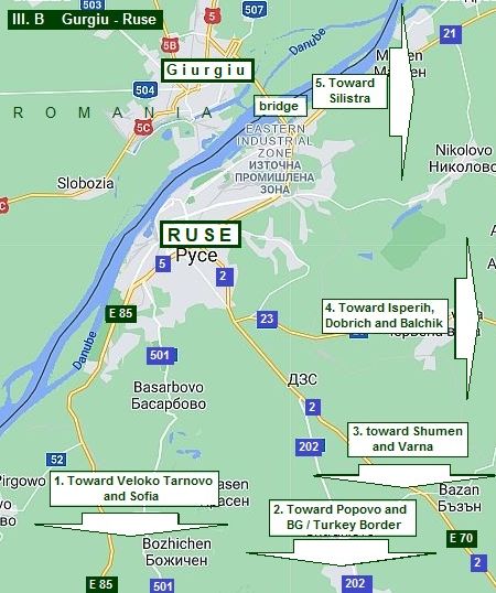 1. Towards Veliiko Tarnovo and BG/TU & BG/GR borders (this is the route toward Sofia, too): - Road N5, or E85 – an international road, which MUST be avoided because of the terrible traffic along it. It is the one of 2 - 3 deadliest roads in Bulgaria; - ALWAYS to pedal the next route, road 501 (in either direction). It can be used when leaving Ruse in a southern direction, again towards Byala and Sofia, Elena, Veliko Tarnovo and the BG/TU and the BG/GR borders. Because it is not easy to find this road in Ruse, later, I will give information on where to leave Ruse;
2. Road N202 toward Popovo, Omurtag, Varbitsa and BG/TU and BG/GR borders;
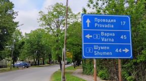
3. Road N2, or E70: toward Razgrad, Shumen, Provadia and and BG/TU, or Varna (the Black seaside); again a busy road, it is better to avoid it;
4. Road N23: toward Isperih to Dobrich to Balchik (the Black Sea);
5. Road N21: toward Tutrakan and Silistra (and east to the Black Seaside. (described in the Chapter: V. Bicycling along Danube river ). These are the points of the content of my next description. I will give here some opportunities as well. |
|
|
|
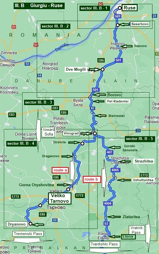
1. 1 From Ruse to Veliko Tarnovo (route a) and Elena (route b)
As it can be seen from the map in left, once choosing the pass where you will cross the Balkans, you reach Veliko Tarnovo (route a), or Elena (route b) continue reading I divide routes in 4 sectors.
In this area please have in mind the road E85
from Ruse to VelikoTarnovo
is extremely dangerous because of the very heavy traffic. The routes I would suggest will be away from it. |
|
|
||
|
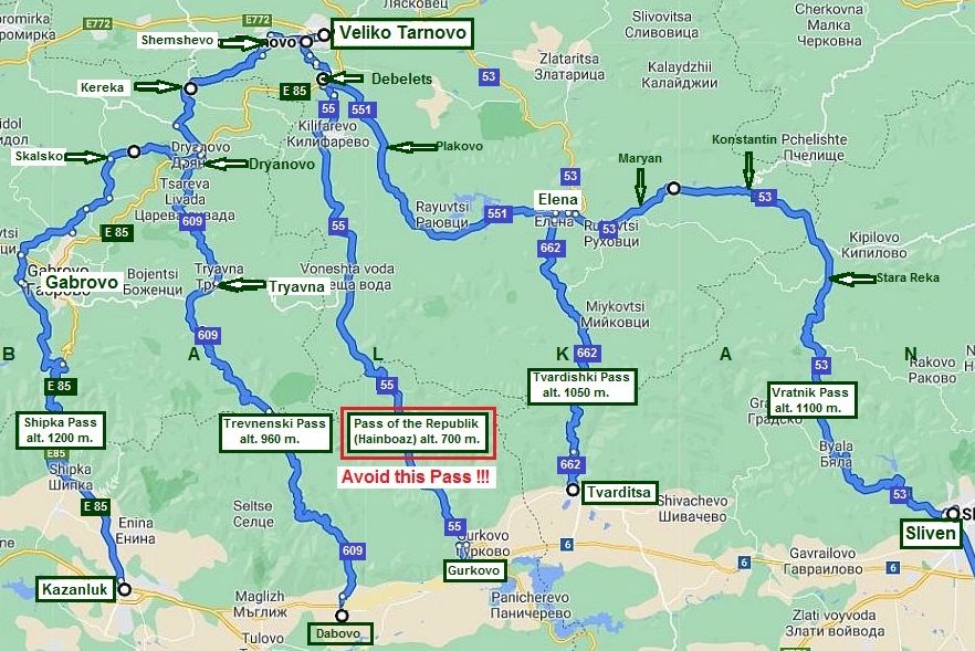
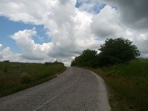
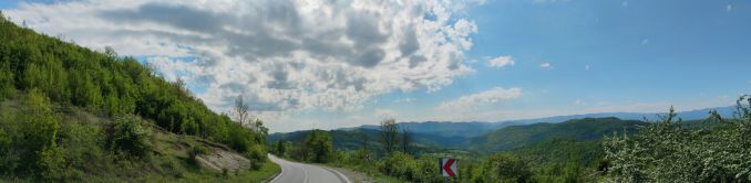
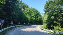
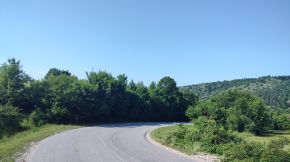
On the next map below you can see the passes in Balkan where bicyclists can cross the Balkan heading south toward Greece or Turkey borders. The west to east passes are:
- Shipka Pass; -Trevnenski Pass; - Pass of the Republic (Hainboaz - road 55) - AVOID IT ! Extremely busy road ! - Tvardishki Pass; - Vratnik Pass.
|
|
So, if you cross the Romania/Bulgarian border here, heading to Greece or Turkey, please look also in: Chapter I. Passes in Balkan Sector I. B , points: 7. Shipka Pass; 8. Trevnenski Pass; 9. Pass of the Republik (Hainboaz); 10. Tvardishki Pass; 11. Vratnik Pass; Sector I. E , points: 22. Kazanlak to Stara Zagora; 23. Gurkovo to Nova Zagora; 24. Tvarditsa to Nova Zagora. |
 |
||
|
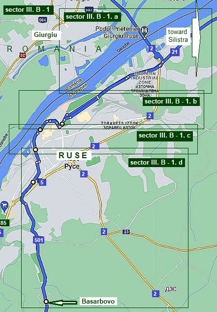
Sector III. B - 1
Leaving / entering in Ruse
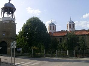
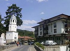
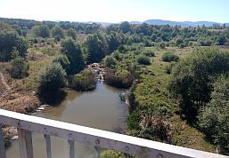
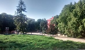
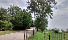
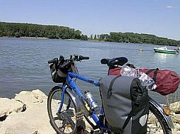
The city of Ruse is the biggest BG city on the Danube River. At the bridge Ruse - Giurgiu, it is easy here to cross Danube River, although I am not sure if it is safe for bicyclists. The bridge is old and narrow, and there can be lots of traffic. There is a rumour of a new bridge to be built next to this one, but nobody knows when it will happen. There is a plan as well for a ferry to be built at the same point. According to the plan, the ferry will be available June 2022 . . . we will see ... Maybe it will be better for bicyclists! . . . it is still not available April 2024 :))))) Good information is available in Internet concerning Ruse here: http://en.wikipedia.org/wiki/Ruse,_Bulgaria http://www.guide-bulgaria.com/NC/rousse/rousse/rousse
For more detail description I will split this sector in fore. |
|
sector III. B - 1. a
Use this route when you head south direction (towards Elena, Veliko Tarnovo, Sofia and BG/TU & BG/GR borders: road N501).
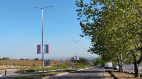
Entering Bulgaria from Romania via the bridge you will turn right and head toward Ruse. Here is the East Industrial zone of the town.
Further I will post several maps, I think it is easy to find the road N501 looking at them one by one.
Just after the bridge, you have to leave the road E85 (N2, E70) and enter its industrial zone. |
.jpg) |
.jpg) |
.jpg) |
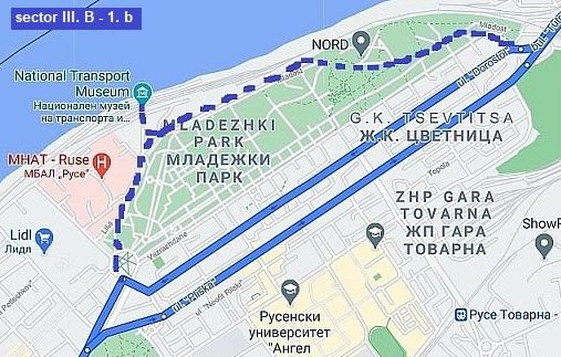
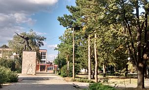
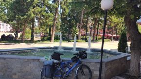
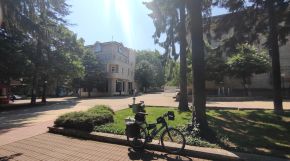
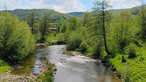
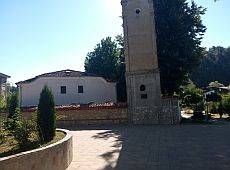
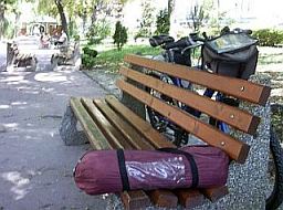
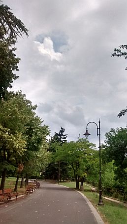
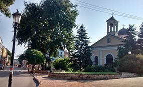
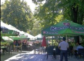
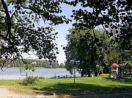
sector III. B - 1. b Consider visiting the town garden located along Danube River. You can use different park lanes. You can pedal closer to Danube River. In the park is located the National Transport Museum, there are a lot of old steam engines in the park to see. |
.jpg) |
.jpg) |
.jpg) |
|
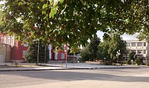
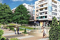
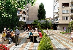
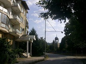
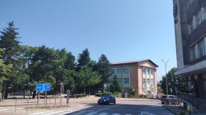
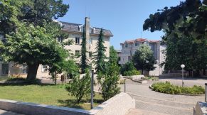
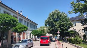
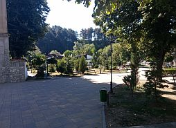
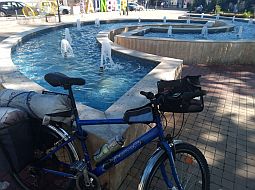
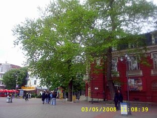
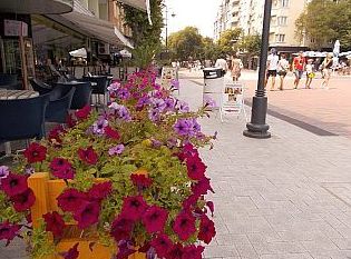
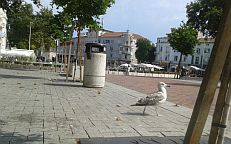
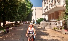
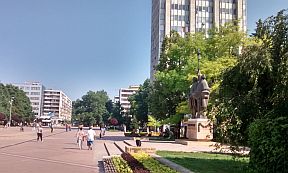
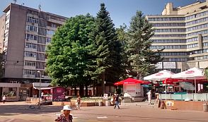
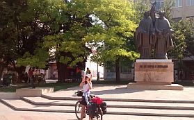
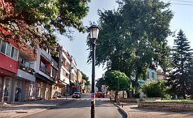
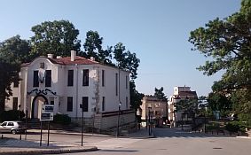
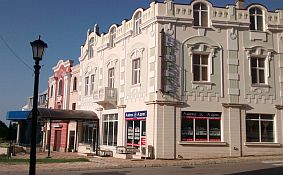
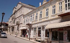
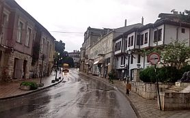
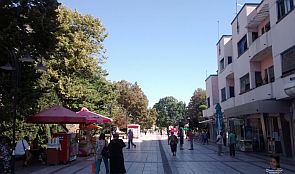
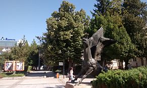
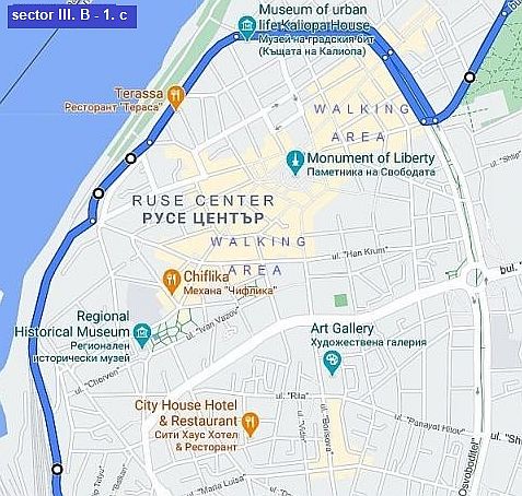
sector III. B - 1. c Pedalling further, you will enter in the City center. It is a walking area. |
||
.jpg) |
||
|
|
.jpg) |
.jpg) |
.jpg) |
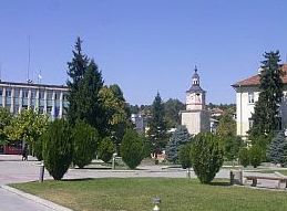
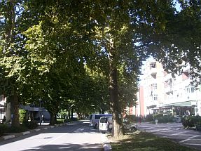
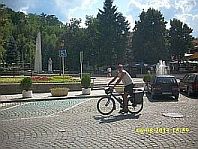
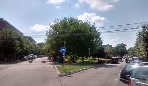
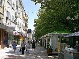
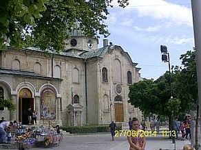
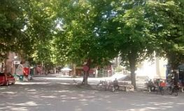
The walking area of the Ruse City
|
.jpg) |
.jpg) |
.jpg) |
|
.jpg) |
.jpg) |
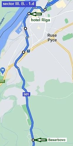 |
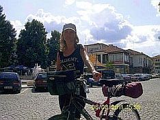
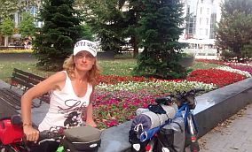
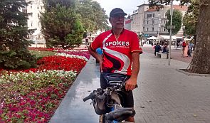
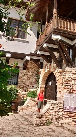
sector III. B - 1. d From the city center, you will be heading towards the Danube River. It will not be difficult. Simply turn to the right and you will see the place on the photo - just before Hotel Riga. Many years ago I lived for a year in Ruse, I used to enjoy watching the sun going down . . . Forgotten emotions are coming up as I look at this place and write about this town . . .
|
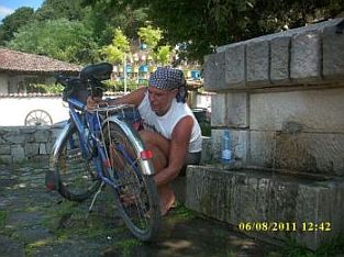
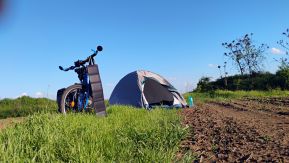
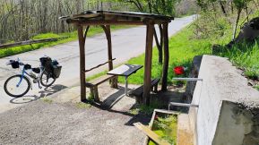
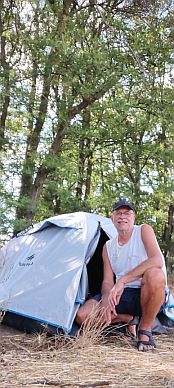
| Upon leaving Ruse you will traverse a hill and will reach Basarbovo. Pedling up the next hill, you will experience a grade on the right riverside (Rusenski Lom River) - my camp place. |
.jpg) |
.jpg) |
.jpg) |
| Entering Ruse from the south to the north is not a problem. Simply do not enter the bridge of road E85. Enter in the Industrial zone and follow my line, or take "Struma" Str. |
.JPG) |
|
.jpg) |
.jpg) |
.jpg) |
|
|
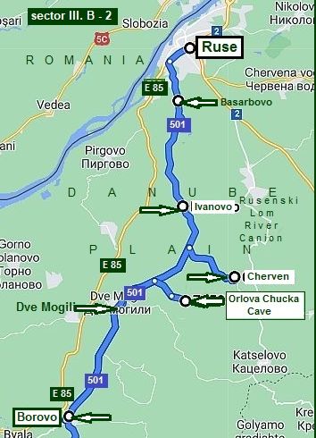
Sector III. B - 2
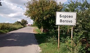
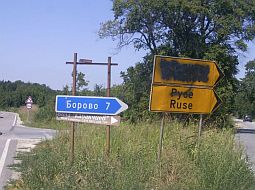
The route from Ruse to Borovo (road 501)
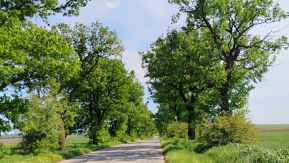
This is one of my favourite routes in this area. I pedalled it many times, it always brings me great pleasure to be here again.
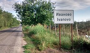
From Ruse to Basarbovo to Ivanovo to Dve Mogili to Borovo.
Remember, it is very important to avoid road E 85. It is one of the extremely dangerous roads in Bulgaria.
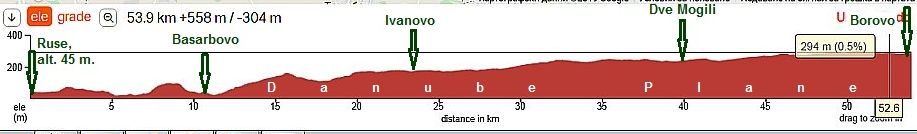
As it can be seen from the road profile chart, the road from Ruse to Borovo is a not steep. A steeper hill is the one from Basarbovo to Ivanovo.
Bicyclists heading toward Sofia have to follow the same route ! |
 |
|
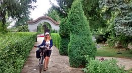
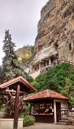
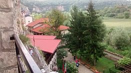
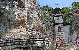
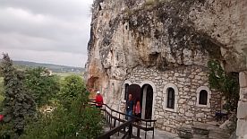
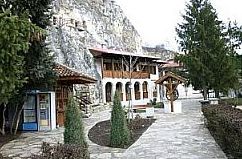
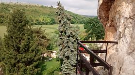
٭An opportunity: An interesting Rock Monastery can be seen near Basarbovo (the road toward it is signed well): https://www.bulgariamonasteries.com/en/basarbovo_monastery.html |
||
 |
 |
 |
 |
 |
 |
 |
 |
|
 |
 |
|
|
Leaving Ivanovo you will enjoy of beautiful descending toward Basarbovo. |
||
 |
 |
 |
|
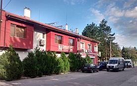
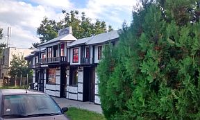
Next village along the road is Ivanovo. there are two hotels in it. |
||
 |
 |
 |
 |
 |
 |
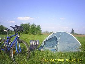
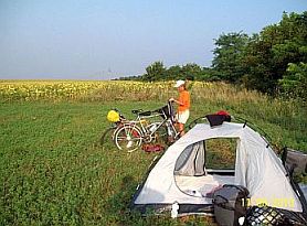
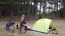
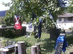
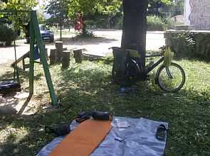
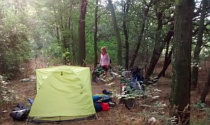
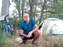
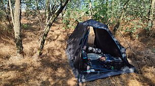
| Needless to say, the entire area is very nice to camp. | ||
 |
 |
 |
|
٭Opportunities: |
||
|
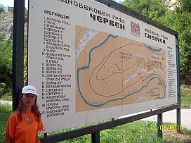
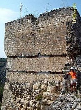
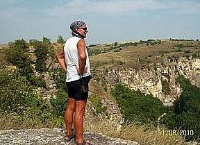
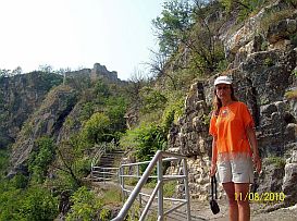
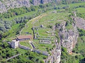
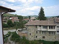
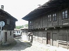
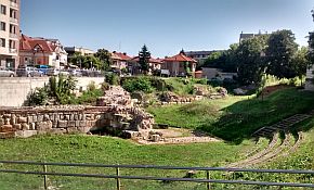
The remains of Cherven mediaeval fortress are located several kilometers to Dve Mogili. The road to the fortress is signed well. The fortress is in Rusenski Lom River Canyon, a very scenic place. |
The area near Rusenski Lom River is a National Reserve: https://en.wikipedia.org/wiki/Rusenski_Lom_Nature_Park And a link for the fortress remains near Cherven: |
 |
 |
 |
 |
 |
|
|
|
||
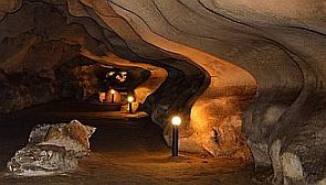
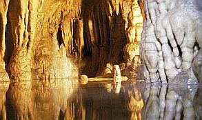
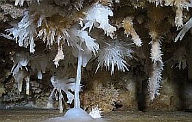
| Several kilometers further toward Dve Mogili you will see a sign for Orlova Chucka Cave. The cave is located just over the Canyon of Rusenski Lom River. The cave is very attractive, it is worth visiting. | Near the cave is nice place to set up a tent. There is a water there, too. Coffee and drinks are available in the little info center. |
 |
 |
 |
|
Orlova Chucka Cave: https://en.wikipedia.org/wiki/Orlova_Chuka |
||
 |
 |
 |
|
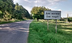
The next little town along your route is Dve Mogili. Some information about the area can be seen here: https://en.wikipedia.org/wiki/Dve_Mogili http://www.guide-bulgaria.com/NC/rousse/dve_mogili/dve_mogili Photos from Dve Mogili and the countryside after it. |
||
 |
 |
 |
 |
 |
 |
|
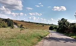
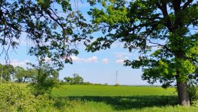
Next several photos are the countryside from Dve Mogili toward Borovo. Some information about Borovo: |
||
 |
 |
 |
 |
 |
 |
 |
 |
 |
|
|
||
|
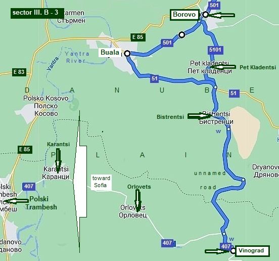
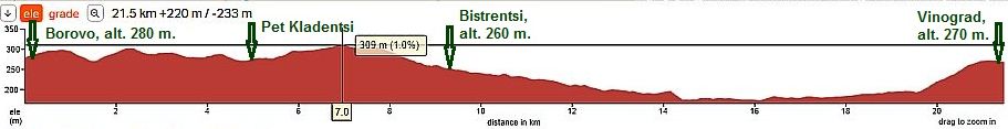
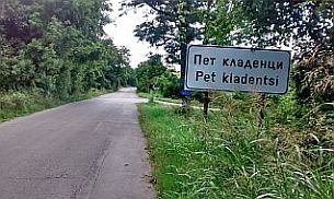
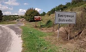
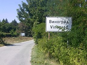
Sector III. B - 3 The route from Borovo to Vinograd
From Borovo (road 5101) to Pet Kladentsi to Bistrentsi to Vinograd.
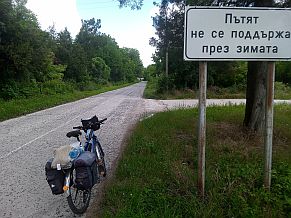
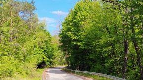
Unfortunately the road in this sector is not well marked, so GPS device would be very helpful. There is very little traffic on this road and the road is in very nice condition.
Bicyclists heading to Sofia have to take the road 407 just before Vinogradi: Toward Orlovets to Karantsi to Polski Tranbesh.
A very detail description of this route can be seen in the VI. Crossing Bulgaria from west to east. Routes: Route 3. From Sofia to Varna: The route along Danube River Plain. |
|
|
|
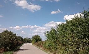
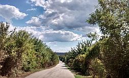
The next several photos are the beautiful countryside from Borovo toward Pet Kladentsi and Bistrentsi (Pet in Bulgarian means 5). |
For Pet Kladentsi I do not remember, but in Bistrentsi there was a food shop, if my memory serves, it did not work 2 - 5 pm. |
 |
 |
 |
 |
 |
 |
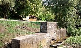
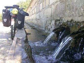
| A nice spring of fresh and cold water is available in the middle of the road 5-6 km south from Bistrenti. | From the other side of the road, above the spring is available a nice shelter. |
 |
 |
 |
|
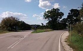
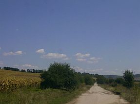
When I was in the area between Bistrantsi and Vinograd, in August '18, the road is not labelled. Hopefully, by now things have improved. The countryside was beautiful and I assume it is just as beautiful today. |
Be careful in this area. I am afraid it is very easy to lose your direction here. Maybe a GPS would be useful here. Other than that, there are no problems visiting this area. |
 |
 |
 |
 |
 |
|
 |
 |
|
|
Again, just before Vinograd there is a nice springs of fresh cool water, unfortunately there is not a nice shade, where to relax for 2 - 3 hours. |
||
 |
 |
 |
|
٭An opportunity: |
||
|
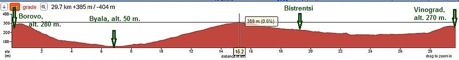
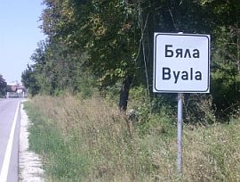
There are no overnight accommodations in Dve Mogili or Borovo. You will need to go to Byala to find accommodations. |
Byala is close to the Yantra River. If visiting Byala, you will have an additional climbing, as you can see from the next road profile charts below. |
|
Down toward Byala |
||
 |
 |
 |
|
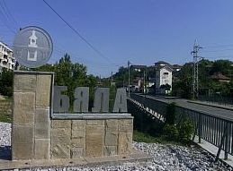
Overnight accommodations in Byala is available, some information about it is available here: https://en.wikipedia.org/wiki/Byala,_Ruse_Province http://www.guide-bulgaria.com/NC/rousse/byala |
||
 |
 |
 |
|
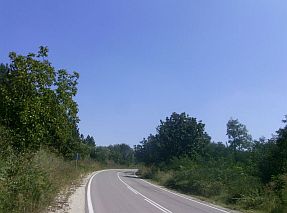
If you decide to visit Byala, the only not so intensive traffic you will see is when you leave it along road N51, no more than 7 - 8 kilometers. |
This road is in very nice conditions; the next photos: are taken from Byala toward Bistrentsi up the road 51. |
 |
 |
 |
|
|
||
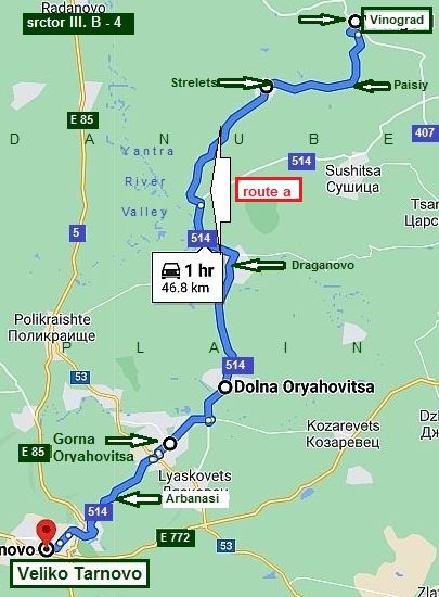
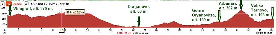
Sector III. B - 4 The route from Vinograd to Veliko Tarnovo
route a This is a nice route for bicyclists intending:
From Vinograd to Paisiy to Strelets to Draginovo to Dolna Oryahovitsa to Gorna Oryahovitsa to Arbanasi to Veliko Tarnovo.
I have pedalled this route. Unfortunately I have only several photos to share here. |
|
|
|
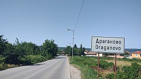
From Draganovono toward Dolna Oryahovitsa |
||
 |
 |
 |
|
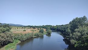
A view from the hill next to Dolna Oryahovitsa toward Draganovo an valley of Yantra River.
|
||
|
Gorna Oryahovitsa is a big railway center. The lines crosses Bulgaria from east to east and from north to south. Overnight accommodation is available here. Information is here: http://www.guide-bulgaria.com/NC/veliko_turnovo/gorna_oryahovitsa/gorna_oryahovitsa |
||
 |
 |
 |
|
In the Chapter III. A. North - Central Region, Sector III. A - 3, Route c: From Svistov to Veliko Tarnovo; Sector III. A - 3. c I have given information for the route from Gorna Oryahovitsa to Arbanasi and Veliko |
Tarnovo, as well as information and photos for them. I have shown how to reach Dryanovo and head toward Gabrovo and Shipka Pass, or toward Elena. It is not necessary to repeat all that here again. |
|
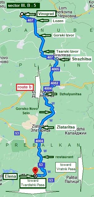
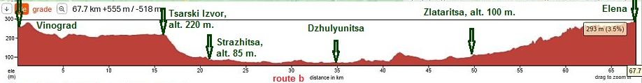
Sector III. B - 5 The route from Vinograd to Elena route b |
||
|
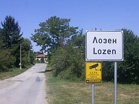
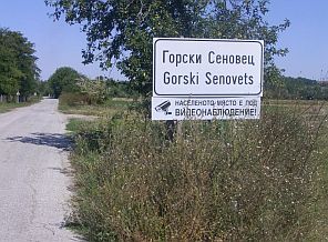
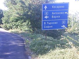
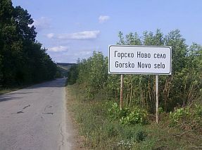
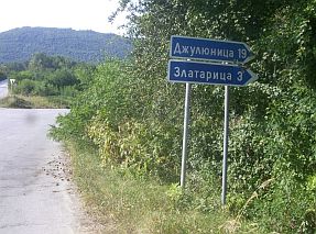
From Vinograd (road 407) to Lozen to Gorski Senovets to Tsarski Izvor to Strazhitsa to Dzhulyunitsa to Gorsko Novo Selo to Zlataritsa to Elena. |
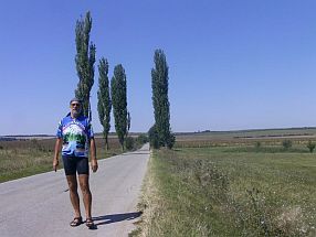
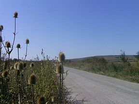
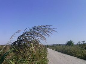
The route from Vinograd to Tsarski Izvor is almost flat, which is unusual for the Danube Plane, consisting mostly of rolling hills. It is extreme pleasant countryside to travel, without any traffic. |
|
 |
 |
 |
 |
 |
|
 |
 |
|
 |
||
|
Strazhitsa is a little town, located in a low area, it was destroyed totally by an earthquake 1986. |
Overnight accommodation is available in Strazhitsa; some information can be found here: |
 |
 |
 |
|
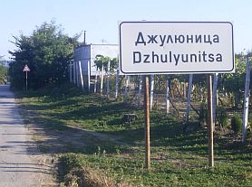
Crossing road E772 (you are on road 4005). If my memory serves me, the road was not signed well. You may need to be careful finding the road toward |
Dzhulyunitsa. The same is true for the opposite direction, travelling from Dzhulyunitsa toward Strazhitsa. |
 |
 |
 |
 |
 |
|
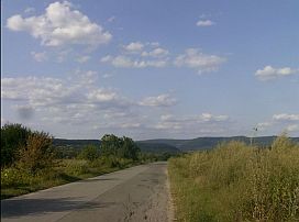 |
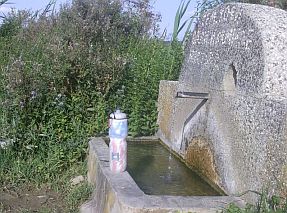
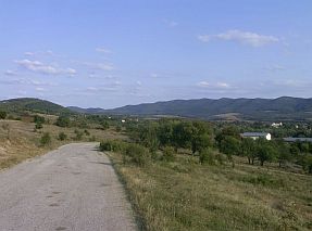
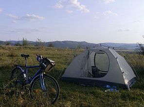
You will find the road toward Gorsko Novo Selo is with minimal traffic, pleasant and easy for pedaling. On the left is a nice spring of drinkable water. You can see my camping place just next to Gorsko Novo Selo. |
 |
 |
 |
 |
|
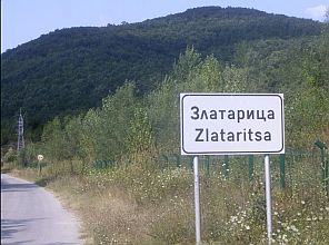
Zlataritsa is a little town, I am not sure if overnight accommodations are available in it. A little information is available here: |
||
 |
 |
 |
|
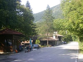
After Zlataritsa, toward Elena, the climbing starts. The hill is not steep. In the middle of the road between |
Zlataritsa and Elena there is a tourist complex. I remember there is a restaurant there, but I am not sure if overnight accommodations are available. |
 |
 |
 |
 |
 |
|
 |
Several kilometers before entering Elena there is a spring hot for drinking and cool for bathing . . . Several times I have used it to refresh, relax to it and wash equipment. The last time I was there, just after washing my equipment, I noticed there was a big bee garden and thousands of bees . . . Fortunately they were very busy with their busyness. They did not pay any attention on me. |
|
 |
 |
 |
|
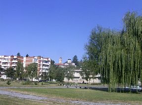
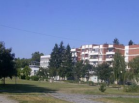
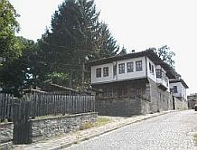
Elena is a touristy spot, architecture of XIX century is saved. There are overnight accommodations and nice restaurants in the town. |
Information of Elena can be seen here: https://bulgariatravel.org/en/town-of-elena/ Several photos from Elena: |
 |
 |
 |
 |
 |
 |
 |
 |
 |
 |
 |
 |
|
Traveling south from Elena you can use: -Tvardishki Pass: toward Nova Zagora; - Vratnik Pass: toward Yambol, |
(Look in) Chapter I. Passes in Balkan Sector I. B Points: 10. Tvardishki Pass 11. Vratnik Pass |
|
|
|
||
|
Again I will say that very detail information about available passes in Balkan south from Veloko Tarnovo |
and Elena can be seen in: Chapter I. Passes in Balkan Sector I. B |
|
|
|
| Chapter III. A. North - Central Region, Sector III. A - 3, Route c: From Svistov to Veliko Tarnovo; Sector III. A - 3. c I have given information for the route from Gorna Oryahovitsa to Arbanasi and Veliko Tarnovo, as well as | information and photos for them. I have shown how to reach Dryanovo and head toward Gabrovo and Shipka Pass, or toward Elena. It is not necessary to repeat all that here again. |
|
|
|
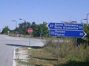
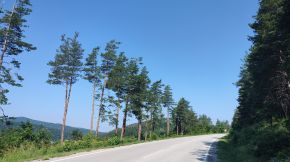
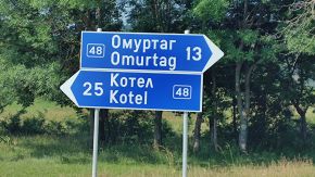
1. 2 From Ruse to: - Konstantin (Vratnik Pass, route a); - Ticha (Kotlenski Pass, route b); - Varbitsa (Varbishki Pass, route c); (Routes toward Sliven, Yambol and Burgas, Greece &Turkey borders)
The three routes shown on the map in left are appropriate for bicyclists crossing BG from north to south toward BG/Torkey borders checkpoints Lesovo & Malko Tarnovo. It is very important to avoid road E70, where the traffic can be quite heavy. - From Ruse to Sliven via Vratnik Pass: From Ruse to Opaka to Popovo to Omurtag to Kostantin (to Sliven to Yambol to Border Checkpoint Lesovo); - From Ruse to Yambol via Kotlenski Pass: Ruse to Opaka to Popovo to Omurtag to Ticha (to Kotel to Pentacle to Yambol to Border Checkpoint Lesovo); - From Ruse to Burgas via Varbishki Pass: Ruse to Opaka to Popovo to Omurtag to Varbitsa (to Sungurlare to Karnobat to Aytos to Burgas to Border Checkpoint Malko Tarnovo).
Next I will describe routes to Konstantin (route a), TIcha (route b) and Varbitsa (route c), where Vratnik Pass, Kotlenski Pass and Varbishki Pass are located respectively. A detailed description of passes can be seen in Chapter I Passes in Balkan Sector I. B (point 11. Vratnik Pass) Sector I. C (point 12. Kotlenski Pass; point 13. Varbishki Pass). |
|
For more detailed description I divide this route in 3 sectors:
Sector III. B - 6
From Ruse to Opaka
I am suggesting 2 routes:
- route a: From Ruse (roads 2 & 202) to Straklevo to Nisovo to Katselovo to Gorsko Ablanovo to Krepcha to Opaka.
- route b: From Ruse (501) to Basarbovo to Ivanovo to Dve Mogili (5001) to Pepelina to Ostritsa to Gorsko Ablanovo (202) to Krepcha to Opaka. |
|
Route a I can say, it is extremely pleasant route. There will be hardly any motor traffic, roads are in nice conditions, hills are short and not steep, the countryside - scenic.
|
|
I pedaled this route only one time - beginning of May '25 in the back direction toward Ruse, it is obvious from the next photos (showing my entering in Ruse). To leave Ruse |
toward Straklevo in this direction is easy, meaning to find the road, but pedaling - there is a 2,5 - 3 kilometers not steep hill until reach the plateau above the town. |
 |
 |
 |
 |
 |
|
 |
 |
|
|
On the Plateau just before the crossroad toward Straklevo there is a Motel. but my choice is the tent - I can not miss the beautiful sunset. |
||
 |
 |
 |
|
Straklevo is little town, next to it is Ruse Airport |
||
 |
 |
 |
|
The village of Nisovo is at distance of 28km from Ruse, it is placed in the not deep very picturesque canyon of Lom River. The terrain is very varied with hills and valleys. |
|
Some of the village houses are picturesque situated in the low places and others are on the hills. I did not find a food shop in it, but a little hotel was available. |
 |
 |
 |
 |
 |
 |
| From Nisovo toward Katselovo. Again there is not hard 15 km long ascending. | ||
 |
 |
 |
 |
 |
 |
 |
||
 |
 |
 |
| Toward Gorsko Ablanovo and Krepcha. Food shops are available in these villages. | ||
 |
 |
 |
|
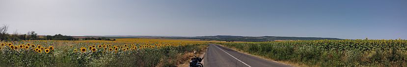
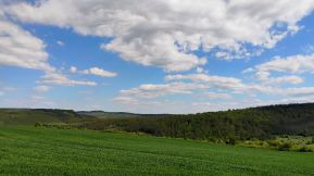
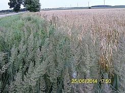
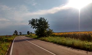
Easy for exploring area. Everything is fresh and green. Only 4 weeks later fields will getting yellow. |
||
 |
 |
 |
 |
 |
|
 |
 |
|
|
The next photos illustrate the same area from Katselovo toward Opaka, taken in the extremely raining June '21, when it was not easy to find a dry place |
to set up my tent except on the asphalt; and the next misty morning. Never mind, it was a pleasant tour. |
 |
 |
 |
||
 |
 |
 |
||
|
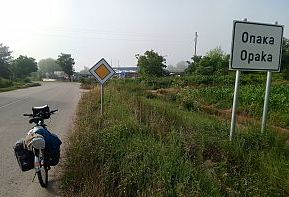
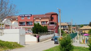
Very little information for Opaka can be seen here: https://en.wikipedia.org/wiki/Opaka Entering the little town, a memorable poster featuring the world famous football referee, Colina, inviting you to visit a building materials store . . . : )))))) Leaving Opaka you will see a hotel. The most famous fact about Opaka is that it is often mentioned in crossword puzzles in BG. |
|
|
 |
 |
|
 |
 |
|
|
Route b: From Ruse (501) to Basarbovo to Ivanovo to Dve Mogili (5001) to Pepelina to Ostritsa to Gorsko Ablanovo (202) to Krepcha to Opaka. |
||
 |
||
|
From Ruse to Dve Mogili I illustrate the route in the previous point of the same chapter, so next photos are photos from Dve Mogili to Opaka. |
The road is in very nice condition, because it has just been renovate. There will be hardly any motor traffic, making pedaling a real pleasure. Except in Pepelina, food and water are available in villages along the road. |
|
 |
 |
 |
 |
 |
 |
|
|
||
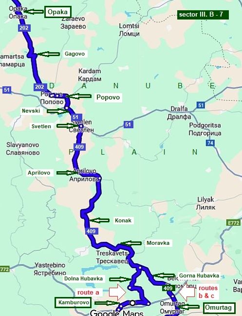
Sector III. B - 7 From Opaka to Omurtag
The route is: From Opaka (road 202) to Gagovo to Popovo to Nevski (road 21) to Svetlen (road 409) to Aprilovo to Konak to Moravka to Gorne Hubavka to Omurtag.
Again a nice countryside and route without traffic.
Accordin to your plans, you can head: to Konstantin (route a), or to Omurtag (route b & route c), details in the next paragraph.
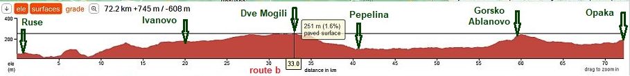
The road profile chart shows the easy part of the route from Opaka to Aprilovo. |
||
|
|
||
 |
 |
 |
 |
 |
 |
 |
||
|
Very little information for Popovo can be seen here: |
 |
 |
 |
 |
 |
|
 |
 |
|
Leaving Popovo you have to ride a short distance on road 51. As you enter Svetlen you have to turn right |
following the sign for Omurtag (road N 409). Here you will leave the main road. |
 |
 |
 |
| The first village next is Aprilovo food is available. | ||
 |
 |
 |
|
The countryside toward Omurtag. Very nice road, minimal traffic. I do not remember if there was food shops in the villages toward Omyrtag, probably yes. |
||
 |
 |
 |
 |
 |
|
 |
 |
|
| Toward Omurtag | ||
 |
 |
 |
|
Information for Omurtag (where there is an aviation museum): http://www.guide-bulgaria.com/NE/turgovishte |
Omurtag is named of the Khan Omurtag (the First Bulgarian Kingdom): https://en.wikipedia.org/wiki/Omurtag_of_Bulgaria Overnight accommodations are available in Omurtag as well. Several photos from Omurtag. |
 |
 |
 |
 |
 |
 |
|
Sector III. B - 8 From Opaka to Omurtag
|
| Accordin to your plans, you can head: to Konstantin (route a), TIcha (route b) and Varbitsa (route c), where Vratnik Pass, Kotlenski Pass and Varbishki Pass are located respectively. |
A detailed description of passes can be seen in Chapter I Passes in Balkan Sector I. B (point 11. Vratnik Pass) Sector I. C (point 12. Kotlenski Pass; point 13. Varbishki Pass). |
|
|
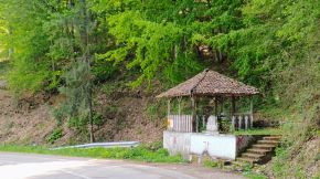
Route a: Pedalers decided to pedal this route can miss Omurta: From Dolna Hybavka to Kamburovo to Taymiste (road 408) to Glashatay to Dolen Krusholak to Starchiste to Maysko (road 53)
The road profile charts shows that this route is relatively hard - in the distance of 56 kilometers that altitude gain is almost a kilometer. The award is the very scenic area, nice roads, very little traffic. I am not sure if the road toward Dolna Hubavka and Kamburovo is signed well. |
||
 |
 |
 |
| Kamburovo is a bigger village, food shops and a restaurant is available in it. | ||
 |
 |
 |
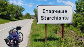
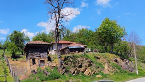
| The country side toward Stevrek, photos were taken in the beginning of April '25. I do not remember if in the villages toward Stevrek there was food shops. | ||
 |
 |
 |
 |
 |
 |
| Two water spring are available along this route, I am nit sure if in the hot summer days there will be water there. | ||
 |
 |
 |
 |
||
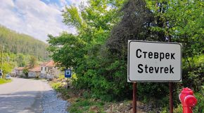
| Stevrek is a bigger village, food shop was available in it, I remember I got a cup of coffee in it. | ||
 |
 |
 |
| After Stevrek there is almost 10 kilometers climbing. No more food shops to Maysko. | ||
 |
 |
 |
 |
||
 |
 |
 |
 |
 |
 |
| The last road segment toward Maysko. The last photo is the crossroad: roads 408 and 53 - it is after Konstantin - the village can be seen in the middle photo below. | ||
 |
 |
 |
|
Route b: |
 |
||
|
Route b From Omurtag to Ticha. Reaching Omurtag you have to decide your next route: toward Kotlenski Pass, or Varbishki Pass. Have |
in mind that the road via Varbishki Pass from the south side of Balkan is in very poor conditions, but there is not any traffic. I prefer it in the back direction. |
|
 The country side between Omurtag and the Ticha: very nice mountain area, roads without traffic. |
||
 |
 |
 |
 |
 |
|
 |
 |
|
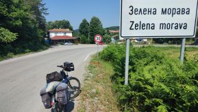
| At the crossroad toward Zelena Morava there is a restaurant. | ||
 |
 |
 |
 |
 |
 |
 |
 |
 |
| Information for Kotlenski pass van be seen in Chapter I Passes in Balkan Sector I. C, Point 12. Kotlenski Pass |
|
Route c The route is: From Omurtag to Dolno Novkovo to Ratlina to Plastina to Mangihevo to Varbitsa. |
||
|
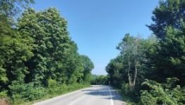
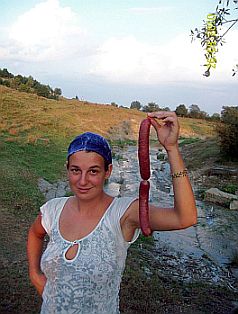
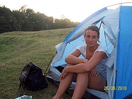
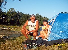
Next are 5 photos of the camp place next to Paliska River, just before Ratlina (next to Paliska River) I and my daughter Maya spent a night August '10. I remember the tasty sausages we bought in Ratlina. |
||
 |
 |
 |
 |
 |
|
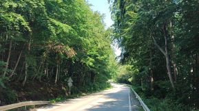
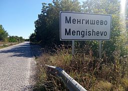
| The countryside from Mengishevo toward Varbitsa, August '20. A perfect road without any traffic. | ||
 |
 |
 |
 |
 |
 |
|
Some information for Varbitsa can be seen here: |
I am not sure if overnight accommodation is available in Varbitsa. Five kilometers up the mountain at Varbishki Pass there is a little resort, restaurant, hotel and thermal water. |
 |
 |
 |
| Information for Kotlenski Pass can be seen in Chapter I Passes in Balkan Sector I. C, Point 13. Varbishki pass | ||
|
|
||
|
1. 3 From Ruse to Provadia and Varna, Balchik and Durankulak
Sector III. B Giurgiu - Ruse |
||
|
The next routes are Intended for bicyclists intending to cross the low eastern part of the Balkan (heading toward |
|
Burgas), or visit the Black Sea while they are crossing Bulgaria (toward Durankulak, Balchik or Varna). |
 |
||
|
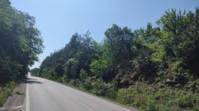
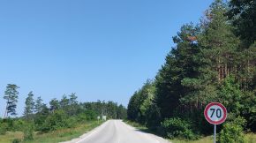
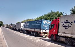
My long year experience has shown me, many peddlers are preferring main roads. Avoid road E70 from Ruse to Razgrad to Shumen because it has a lot of road traffic. |
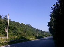
The next several photos illustrate the route along E 70 - I pedaled it several times many years ago, when the traffic was still not intensive. |
|
 |
|
 |
 |
 |
|
It would be much better to follow my next description. You will pedal nice roads without any |
traffic, the countryside is very nice, you will not add extra kilometers following my suggestion. |
|
|
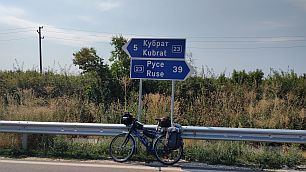
Sector III. B - 9 From Ruse to Kubrat
I suggest two routes, both of them are very nice to be explored: Route a |
||
|
The route is: From Ruse (road 2, road 23) to Cherna Voda to Novo Selo to Tetovo to Belovets to Kubrat. |
|
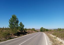
It is very pleasant area, typical for this part of Danube Plain, a flat area cut by dry river canyons. Compared with road 2 (E70), here there is very little traffic. |
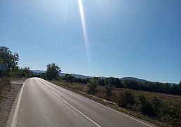
|
|
||
| Food and water are available in the villages along the road. | The next photos are the road toward Cherna Voda and our relax place in its garden. | |
|
|
|
|
 |
 |
 |
 |
 |
|
 |
 |
|
A typical one hour afternoon summer storm. Usually it happens June to the middle of July. August is usually a dry month in this area. |
||
 |
 |
 |
| Toward Kubrat. | ||
 |
 |
 |
 |
 |
 |
|
I am not sure if overnight accommodations are available in Kubrat. Somr information for it can be found here: |
The town is named of Bulgarian Khan Kubrat: https://en.wikipedia.org/wiki/Kubrat Photos from Kubrat and our coffee place. |
 |
 |
 |
|
Route b The route is: From Ruse (road 2, road 21) to Slivo Pole to Borisovo (road 2102) to Cheresovo to Seslav to Kubrat. |
Comparing with the route a, I think this route is easier although the distance is 5 km longer, and there can be more traffic traffic from Ruse to Slivo Pole. |
|
 |
||
| The next photos illustrate road 2 from Ruse toward Tutrakan and Silistra. | ||
|
|
|
|
| Leaving road 2, the next one is road 21 toward Slivo Pole. The next several photos illustrate the countryside toward Slivo Pole - a plane area. | ||
 |
 |
 |
|
No much information for Slivo Pole: http://www.guide-bulgaria.com/NC/rousse/slivo_pole/slivo_pole |
||
 |
 |
 |
| Toward Borisovo. Food shops are available in the villages along the road. | ||
 |
 |
 |
 |
 |
 |
|
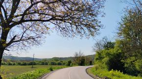
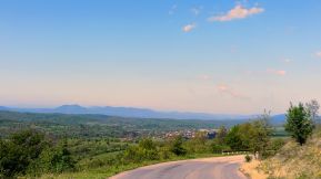
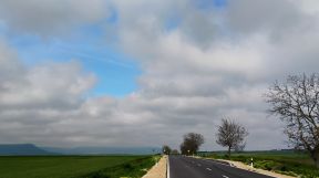
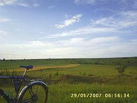
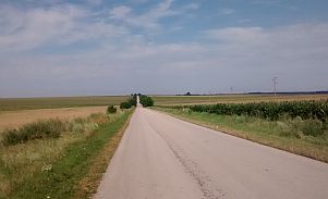
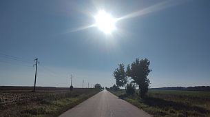
A typical view of Danube Plane. Flat area, perfect roads, no traffic. Middle of May, '25
|
||
 |
 |
 |
 |
 |
 |
 |
 |
 |
| The sane area: after Slivo Pole a FB friend (Armin) from Romania and I explored this area in the early August '22. Comparing with May, the colors are a little different. | ||
 |
 |
 |
 |
 |
 |
|
Sector III. B - 10 From Kubrat to Nikola Kozlevo
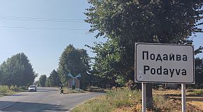
The route is: From Kubrat (road 23) to Medovene to Brestovene to Zavet to Malak Porovets to Dragomazh to Isperih (road 702) to Lavino to Kapinovtsi to Podayva to Belintsi to Duhovets to Pristoe to Doyrantsi to (road 7003) to Doyrantsi (road 701) to Valnari to Nikola Kozlezo.
|
|
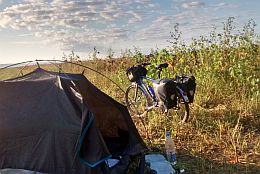
The route includes 79 kilometers pedaling in a nice plane area. There are a lot of villages along the road, so locating food and water in not a problem. Beautiful area to camp in the wilderness. |
 |
 |
 |
|
|
|
|
 |
 |
 |
|
|
|
|
|
Zavet is a little town. I am not sure if overnight accommodations are available here. A little information for Zavet: |
||
|
|
|
|
|
|
|
|
|
Toward Isperih |
||
 |
 |
 |
 |
 |
 |
 |
 |
 |
|
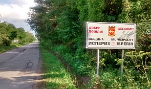
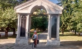
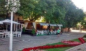
The next little town is Isperih, overnight accommodations are available in it. Some information on Isperih can be found: https://en.wikipedia.org/wiki/Isperih |
The town is named of Bulgarian Khan Asparuh: |
 |
 |
 |
 |
 |
 |
|
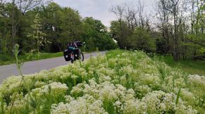
From Isperih toward Nikola Kozlevo - a calm countryside, very little traffic. |
||
 |
 |
 |
|
Photos were taken in the early August ' 22. My FB friend (Armin from Romania) and I pedaled this area. |
||
 |
 |
 |
 |
 |
|
 |
 |
|
 |
 |
 |
| In the Kaolinovo region mining is developed, there is a lot of Kaolin in the field. The little city is apart of the road. | ||
 |
 |
 |
|
Sector III. B - 11
Another very pleasant area for exploring. The roads are nice with very little traffic on the roads. I will suggest three routes to reach Provadiya: Route a: From Nikola Kozlevo (road 2073) to Radan Voyvoda to Stefan Karadzha (road 207) to Kaloyan to Dobrotich to Momchilovo to Sredno Selo to Vetrino (road 208) to Provadia.
Route b: From Nikola Kozlevo (road 701) to Stoyan Mihaylovski to Novi Pazar (road 2) to Vetrino (road 208) to Provadiya.
Route c: From Podayva (road 2005; 7) to Pchelina to Osenovets to Venets to Panayot Volovo (road 2) to Shumen to Kaspichan to Novi Pazar to Vetrino (road 208) to Provadia
All the three routes are very pleasant to be explored, maybe the traffic along the route c is a little bit more intensive, another two routes are with a minimal traffic. |
||
|
Route a The next photos illustrate the countryside toward Stefan Karadzha. |
||
 |
 |
 |
 |
 |
|
 |
 |
|
 |
 |
 |
 |
 |
 |
| A lot of villages are placed along the road, so supplying with food and water in not a problem. The next 26 kilometers from Kaloyan toward Provadia are extremely pleasant, down the hill. | ||
 |
 |
 |
 |
 |
 |
 |
 |
 |
|
Vetrino is a bigger settlement, in it can be find food, but overnight accommodation. |
||
 |
 |
 |
|
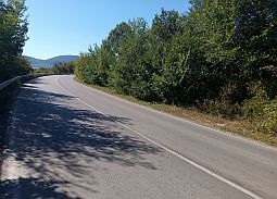
Down toward Provadia. A very pleasant road segment to pedal. Next photos are of the countryside Vetrino to Provadia. After Vetrino there is a nice spring. |
||
 |
 |
 |
 |
 |
 |
 |
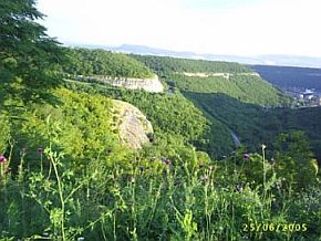
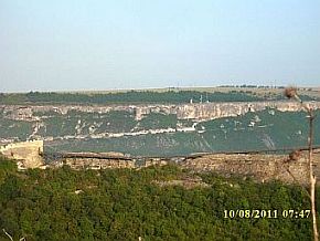
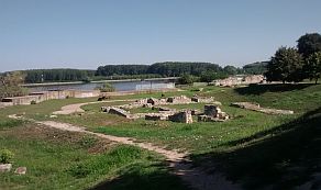
Provadia is a scenic place, it is placed in a not deep canyon along Provadiiska River. Overnight accommodation in Provadia is available, although in the touristy season some problems can appear. Information for Provadia and its fortress "Ovech" on the plateau over the town: https://en.wikipedia.org/wiki/Provadia http://trakia-tours.com/provadia-guide-94.html Next several photos of the plateau above Provadia and Ovech Fortres. |
|
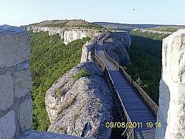 |
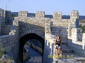 |
|
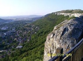 |
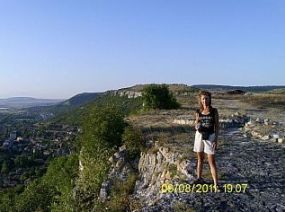 |
 |
| Several photos from Provadia. | ||
 |
 |
 |
 |
 |
 |
|
Bicyclists crossing the country north to south have to head toward Burgas and BG/Turkey border at Malko Tarnovo border checkpoint. |
For this purpose look into: - Chapter I. Passes in Balkan Sector I. C - Chapter III, D. South - East Region |
|
Route b: From Nikola Kozlevo (road 701) to Stoyan Mihaylovski to Novi Pazar (road 2) to Vetrino (road 208) to Provadiya.
I still did not pedaled this route, it is in my plans! Overnight accommodation in Novi Pazar is available - the last photo below - I am watching the strong spring storm from my hotel room. Very little information for Novi Pazar: |
 |
 |
 |
 |
 |
 |
|
Route c: From Podayva (road 2005; 7) to Zdravets to Pchelina toByinovitsa to Osenovets to Venets to Panayot Volovo (road 2) to Shumen to Kaspichan to Novi Pazar to Vetrino (road 208) to Provadia
Comparing with another two routes, here there is 100 meters more altitude gain - after Venets. The climbing is not hard. The countryside is beautiful. |
||
 |
 |
 |
 |
 |
 |
 |
||
 |
 |
 |
| Leaving Osenovets the road is joining with road 7 - the traffic here appears, although it is not intensive, the pedaling is safe. Venets is a bigger village, food shop is available. | ||
 |
 |
 |
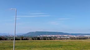
| My camp place on the high route point. Shumen City is in front of me with the typical plateau behind it. | ||
 |
 |
 |
 |
 |
 |
| Shumen City is in front of me with the typical plateau behind it. | ||
 |
 |
 |
|
Next links are the information about Shumen: https://en.wikipedia.org/wiki/Shumen |
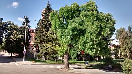
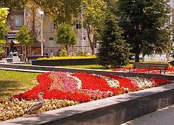
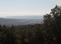
Several photos of the same area - approach to Shumen and the plateau (Shumen Fortress) next to it, the town and my afternoon relax place in the town garden. |
 |
 |
 |
|
Sector III. B - 12 From Shumen to Provadia and Varna
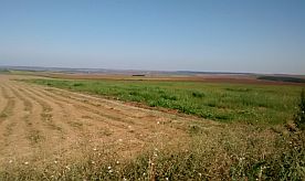
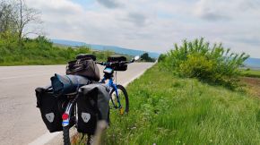
And the last road segment toward Varna is: From Shumen (road 2) to Kaspichan to Novi Pazar to Stan to Vetrino to Devnya to Varna. Nice road, minimal traffic. Next several photos are of the countryside from Shumen to Kaspichan to Novi Pazar, the middle of May, '25. |
 |
 |
 |
 |
 |
 |
 |
||
 |
 |
 |
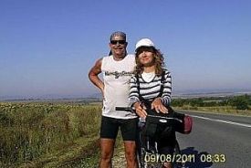
| The same area, August 2011. | ||
 |
 |
 |
|
|
The next two little towns are Kaspichan and Novi Pazar. Overnight accommodations are available in Kaspichan. Very little information for Kaspichan: https://en.wikipedia.org/wiki/Kaspichan
Very little information for Novi Pazar is available here: https://en.wikipedia.org/wiki/Novi_Pazar,_ If you research Google for information, have in mind that in Serbia there is Novi Pazar as well. Overnight accommodations are available in Novi Pazar. The last photo below - I am watching the strong spring storm from my hotel room. |
|
|
|
|
|
|
|
|
| Toward Vetrino. | ||
 |
 |
 |
 |
||
 |
 |
|
|
Vetrino is a bigger settlement, in it can be find food, but overnight accommodation. |
||
|
|
|
|
| The same area August '17 | ||
 |
 |
 |
 |
 |
 |
|
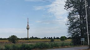
The route from Vetrino to Provadia can be seen in the previous Item. The next little town is Devnya - a n industrial center of chemistry industry. Information for Devnya and its interesting museum of mosaics: |
|
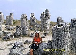
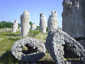
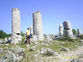
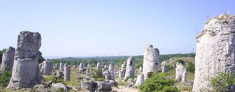
Between Devnya and Varna just next to the road is an interesting place, called "Stone forest". There are different theories concerning the rock formation. In fact it is a real little desert. It really is an impressive spot which is worth visiting:
|
 |
||
|
|
|
|
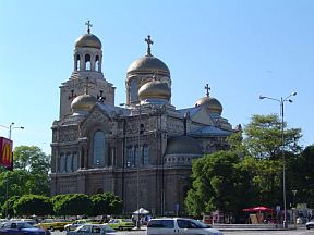
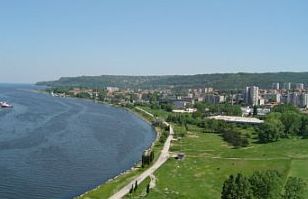
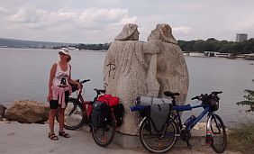
Varna is a big city, we call it the "Sea Capital” of Bulgaria.
Here are the three best sites I have found for information on Varna:
https://en.wikipedia.org/wiki/Varna https://www.britannica.com/place/Varna-Bulgaria http://www.bulgariatravel.org/article/details/205
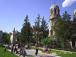
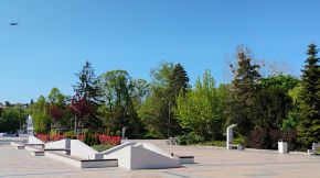
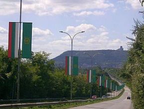
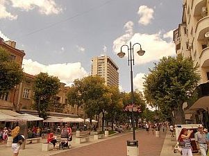
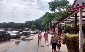
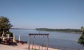
Below are several photos of Varna: the City, its walking zone, the Cathedral, the City Garden, and the city garden. |
 |
 |
 |
 |
 |
 |
 |
 |
 |
|
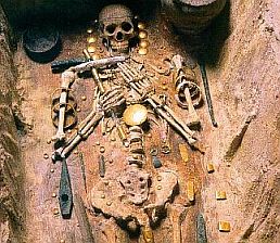
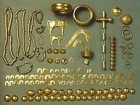
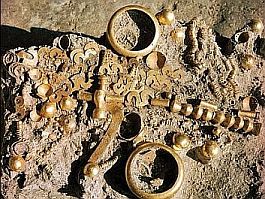
Several years ago on the region of Varna was found a burial, with some of the world's oldest gold jewellery, dating back to 4,600 - 4,200 BC:
|
The artifacts can be seen at the Varna Archeological Museum: http://archaeo.museumvarna.com/en/ https://en.wikipedia.org/wiki/Varna_Archaeological_Museum Obviously the question is for some very important person. |
 |
 |
 |
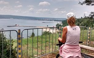
| Several photos of the Sea Garden in Varna. | ||
 |
 |
 |
 |
 |
|
 |
 |
| An opportunity is to visit Provadia and head toward Varna. next are several photos illustrating the countryside from Provadia towars Dobrina to Manastir to Devnya to Varna. | As it can be seen from the map above there is a road just next to the lake of Varna (road 2008). Have in mind it is an industrial zone and the traffic can be demanding. It would be better to avoid this road. |
|
|
 |
 |
 |
 |
 |
 |
|
|
|
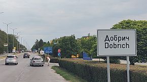
Sector III. B - 13 From Nikola Kozlevo to Dobrich
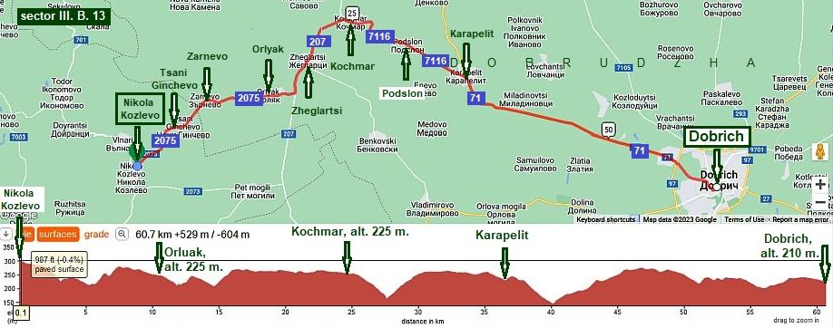
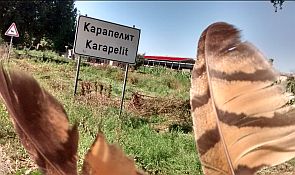
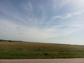
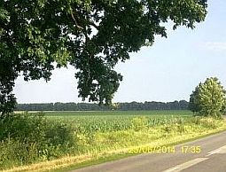
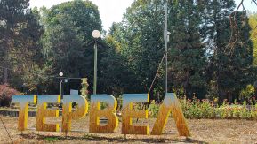
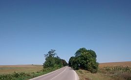
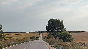
The route is: From Nikola Kozlevo (road 2075) to Tsani Ginchevo to Zarnevo to Orlyak to (road 207) Zheglartsi to Kochmar (road 7106) to Podslon to Geshanovo to Karapelit to (road 71) Dobrich Here you will explore an easy flat area, the countryside is beautiful. |
||
 |
 |
 |
 |
 |
|
 |
 |
Many times I have explored this area and often I move further from village to village researching the map, often I have used shortcuts – off-roads in the field between villages.
|
|
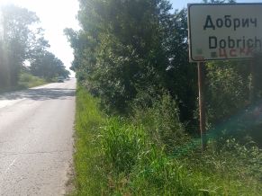
Dobrich is the main town of this district. Overnight accommodation in it is not a problem. |
Information for Dobrich: http://www.guide-bulgaria.com/NE/Dobrich/ http://www.guide-bulgaria.com/ne/dobrich/dobrich-city/dobrich |
 |
 |
 |
 |
 |
 |
|
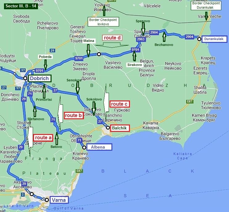
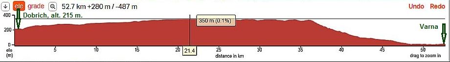
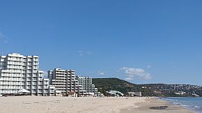
Sector III. B - 14 Routes from Dobrich to the seaside
There are fore opportunities: Route a: From Dobrich toward Varna (road 29).
|
| I have pedalled only the last 20 kilometers to Varna, but I do not believe I will do it again. The traffic here is quite intensive. If you intend to visit Varna, | use my description in the previous item. Next are the only 3 photos I have taken from this area, going down from Franga Plateau down toward Varna. |
 |
 |
 |
|
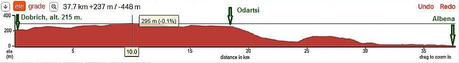
Route b: From Dobrich to Albena (road 71)
I pedaled this route only once in the extremely hot and dry May '07 . . . |
||
 |
 |
 |
|
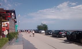
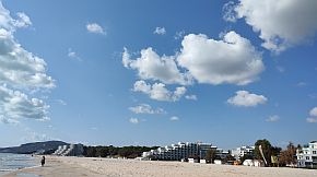
Albena resort is a beautiful place: https://en.wikipedia.org/wiki/Albena http://www.bulgariatravel.org/article/details/16 There is an endless beach (south towards Kranevo) and the beach sand maybe is the finest of all the beaches along BG Black Sea. |
|
There are fountains and showers on the beach. You can wash your equipment. Because of the lack of facilities my stays here are short and then I move on. Here, I love to walk along the beach. The entrance road into the Albena Resort has no exit. So, you will have to leave the resort the same way you came in. |
 |
 |
 |
 |
 |
 |
|
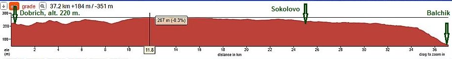
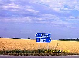
Route c: From Dobrich toward Balchik (road 27).
|
||
 |
 |
 |
|
|
|
|
 |
 |
 |
|
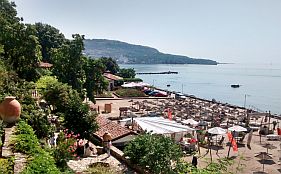
Balchik is a small city located in tiers above the sea. It is a touristy place. Rooms for the night are easily found, along with more luxury hotels. I love to stay |
here for a day or two. Information for Balchik: |
 |
 |
 |
 |
 |
 |
|
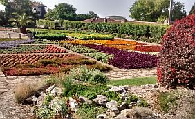
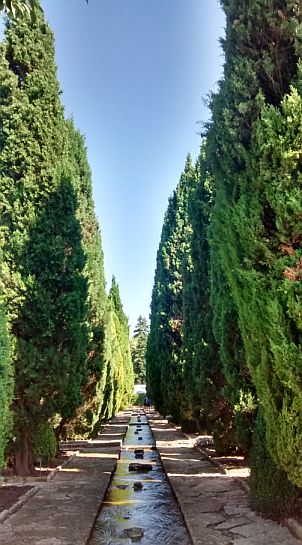
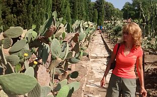
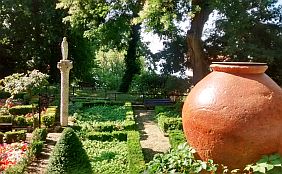
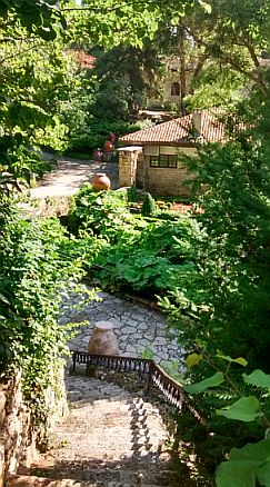
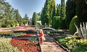
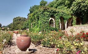
In the town there is a small residence of the Romanian queen with a lovely botanical garden. (This area was under Romanian control 1918 – 1938). |
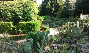
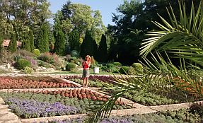
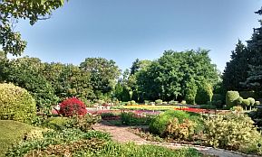
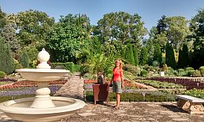
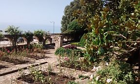
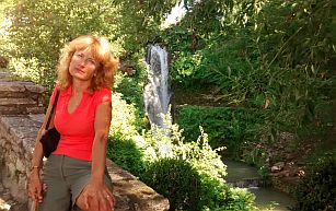
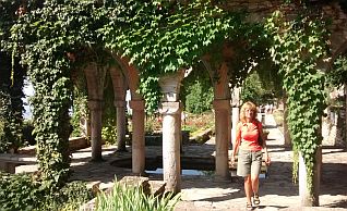
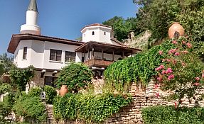
Information for this spot: http://visit.guide-bulgaria.com/a/14/balchik_botanical_garden.htm https://en.wikipedia.org/wiki/Balchik_Palace I like this garden and can not avoid to post more pictures :) |
 |
 |
 |
 |
 |
|
 |
 |
 |
 |
 |
 |
 |
|
 |
 |
 |
 |
 |
 |
 |
|
 |
 |
|
Route d: From Dobrich to Durankulak I recommend this route for bicyclists intending to explore the seaside.
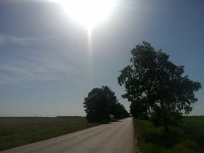
No problem finding food in villages along the road, the area is nice for camping in the wilderness. Photos of this beautiful plane area. |
||
 |
 |
 |
 |
 |
|
 |
 |
|
 |
 |
 |
 |
 |
 |
 |
 |
 |
|
A very detail information about the seaside, routes, cities, resorts you can see in the Chapter IV. Bicycling along Black sea side |
||
|
1. 4 Ruse - Silistra A detail description of this route can be seen in the Chapter V. Bicycling along Danube river 2. Oltenita - Tutrakan: ferry (still a project only) |
|
3. Calarashi – Silistra: ferry & Constanta – Silistra (border checkpoint Silistra)
|
|
Calarashi – Silistra: ferry. You can cross Danube by a ferry to/from Chiuciu (Calarasi) or come from Constanta (road 3) (RO). The more detail map above shows the disposition of both ferry and the border checkpoint. For the ferry schedule look here: https://www.spikaferry.com/en/
|
 |
Google map shows two ways to cross Danube River here. The first is the ferry I point below road 215; the second one - go to the border checkpoint Silistra - Ostrov, and after obviously in Romania there is an opportunity to cross Danube River to Chiuciu. I can not find information in Internet about it.
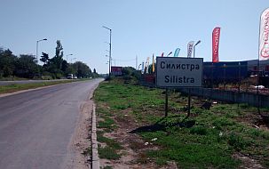
Information for Silistra: https://en.wikipedia.org/wiki/Silistra http://www.bulgaria-guide.com/guide/Silistra/203776/
|
 |
 |
 |
 |
 |
 |
 |
 |
 |
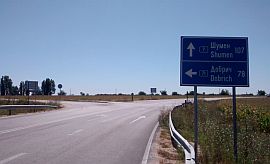
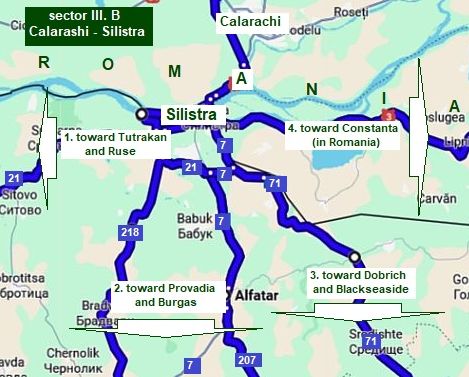 Pointed routes on the map from/to Silistra are:
3.1 To west: Toward Tutrakan and Ruse , road N 21 (I have mentioned several words about it in: Chapter V. Bicycling along Danube river
3. 2 To south (Provadia and BG/Turkey Border - Border Checkpoint Malko Tarnovo): Toward Povadia, roads N218, 7, 207; - route a: roads N218, 701, 2, 208 - route b: roads N7, 207, 208 I recommend both routes to bicyclists intending to pedal to Provadia.
3. 3 To Black sea side: Toward Dobrich (andBalchik): - route c: road N71.
On the maps below are shown these routes. |

Sector III. B Calarashi – Silistra
3. 2 From Silistra to Provadia (and BG/Turkey Border - Border Checkpoint Malko Tarnovo)
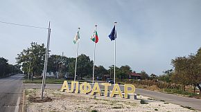
Toward Povadia: there are several opportunities to pedal toward Provadia, I would suggest two: - route a: From Silistra (road 218) to Dulovo (road 701) to Novi Pazar (road 2) to Vetrino (road 208) to Provadia; - route b: From Silistra (road 7) to Alfatar (road 207) to Vetrino (road 208) to Provadia (road 208). I recommend both routes to bicyclists intending to pedal to Provadia. Both rotes can be used by bicyclists intending to visit Varna. Have in mind that the road 29 from Dobrich to Varna is very busy.
- route c: From Silistra (road N71) toward Dobrich (and seaside - Varna and Balchik). |
|
Sector III. B - 1
Intending more detail description I will increase the scale.
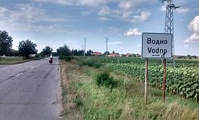
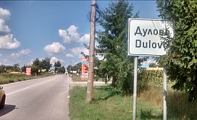
route a From Silistra (road 218) to Profesor Ishirkovo to Bradvari to Vodno to Dulovo (road 701) to (road 23, 7) to Grancharovo (road 701) to Seculovo
This part of the country is called Dobrudzha - the east most part of Danube Plane: https://en.wikipedia.org/wiki/Dobruja
As it can be seen from the road profile chart, the entire area is flat, it is very pleasant to be pedaled in the both directions. |
 |
 |
 |
 |
| Leaving Silistra toward Prof. Ishirkovo. The hardest hill here is after leaving Silistra, it is no longer than 2 kilometers. | ||
 |
 |
 |
 |
 |
 |
 |
 |
 |
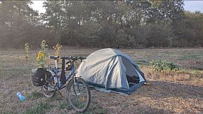
| The entire area is perfect to camp in the field. | ||
 |
 |
 |
|
The overnight accommodations are available in Dulovo. Very little information for Dulovo is available here: |
||
 |
 |
 |
 |
 |
 |
| I still did not pedalled the road segment from Grancharevo to Todor Ikonomovo, but it is in my plans. | ||
|
Sector III. B - 1
Intending more detail description I will increase the scale.
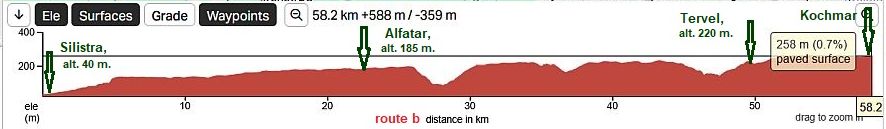
route b From Silistra (road 7) to Alfatar (road 207) to Alfatar to Alekovo to Chestimensko to Tervel to Kochmar
This part of the country is called Dobrudzha - the east most part of Danube Plane:
https://en.wikipedia.org/wiki/Dobruja
As it can be seen from the road profile chart, the entire area is flat, it is very pleasant to be pedaled in the both directions. |
 |
|
Route c - 2 Next photos illustrating route c - 2 are taken in the beginning of October '13 - the last time it was so hot was 1930. |
||
 |
 |
 |
 |
 |
 |
|
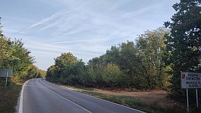
The elevation of Silistra is 26 m. and is surrounding by a higher plateau. If you are leaving Silistra in the southern direction (toward Alfatar) you have a climb for 5 – 6 kilometers. |
|
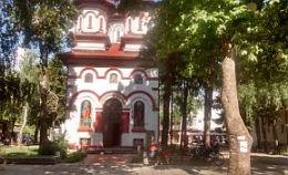
Some information for Alfatar: http://www.guide-bulgaria.com/NC/silistra/alfatar/alfatar
Overnight accommodation in Alfatar is not available. |
 |
 |
 |
 |
 |
|
 |
 |
|
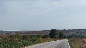
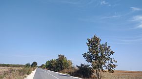
| Soon after Alfatar the route crosses the valley of so called "Dry River". | ||
 |
 |
 |
 |
 |
 |
|
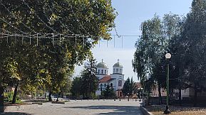
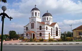
The next town Tervel is a little bit bigger. |
||
 |
 |
 |
 |
 |
 |
|
Sector III. B - 2
The next sector - again route a:
route a From Sekulovo (road 701) to Todor Ikonomovo to Doyeantsi to Valnari to Nikola Kozlevo to Harsovo to Zhilino to Stoyan Mihaylovski to Novi Pazar (road 2) to Vetrino (road 208) to Provadia
This part of the country is called Dobrudzha - the east most part of Danube Plane:
https://en.wikipedia.org/wiki/Dobruja
For a better resolution, I part the road profile chart in two: - from Sekulovo to Novi Pazar, and - from Novi Pazat to Provadia.
As it can be seen from the road profile chart, the entire area is flat, it is very pleasant to be pedaled in the both directions. |
 |
||
|
|
|
|
| I did not pedal the distance from Nikola Kozlevo, it is in my plan. | ||
|
|
The next two little towns are Kaspichan and Novi Pazar. Overnight accommodations are available in Kaspichan. Very little information for Kaspichan: https://en.wikipedia.org/wiki/Kaspichan
Very little information for Novi Pazar is available here: https://en.wikipedia.org/wiki/Novi_Pazar,_ If you research Google for information, have in mind that in Serbia there is Novi Pazar as well. Overnight accommodations are available in Novi Pazar. The last photo below - I am watching the strong spring storm from my hotel room. |
|
|
|
|
|
|
|
|
|
The road profile chart in two: from Novi Pazat to Provadia.
|
||
| Toward Vetrino. |
|
|
|
|
|
|
||
|
|
|
|
|
Vetrino is a bigger settlement, in it can be find food, but overnight accommodation. |
||
|
|
|
|
|
Down toward Provadia. A very pleasant road segment to pedal. Next photos are of the countryside Vetrino to Provadia. After Vetrino there is a nice spring. |
||
|
|
|
|
|
|
|
|
|
|
Provadia is a scenic place, it is placed in a not deep canyon along Provadiiska River. Overnight accommodation in Provadia is available, although in the touristy season some problems can appear. Information for Provadia and its fortress "Ovech" on the plateau over the town: https://en.wikipedia.org/wiki/Provadia http://trakia-tours.com/provadia-guide-94.html Next several photos of the plateau above Provadia and Ovech Fortres. |
|
|
|
|
|
|
|
|
|
| Several photos from Provadia. | ||
|
|
|
|
|
|
|
|
|
For the route from Provadia to Burgas, please look in the Chapter I. Passes in Balkan Sector I. C, Point 15. Aytoski Pass |
||
|
Sector III. B - 2
The next sector - again route b:
route b From Kochmar (road 207) to Zheglartsi to Redan Voyvoda to Stefan Karadzha to Kaloyan to Dobrotich to Momchikovo to Sredno Selo to Vetrino (road 208) to Provadia.
The route b is shorter than, the route a. As it can be seen from the road profile chart, the entire area is flat, but reavhimg Momchilovo, a long descending follows down to Provadia. This part of the route is not hard in the back direction - the route is very pleasant to be pedaled in the both directions at all. |
|
Comparing with the route a, this one is shorter and the climbing is a little bit less. Next are several photos illustrating the countryside from Stefan Kochmar toward Vetrino. |
 |
|
|
|
|
|
|
| A lot of villages are placed along the road, so supplying with food and water in not a problem. | ||
|
|
|
|
|
|
|
|
|
|
|
|
| For the distance from Vetrino to Provadia look above. | ||
|
For the route from Provadia to Burgas, please look in the: Chapter I. Passes in Balkan Sector I. C Point 15. Aytoski Pass. Bicyclists intending to visit Varna can use either the |
road east from Vetrino, or the not
named road east from Provadia - toward Manastir and Devnya. I will no
write again about it - the information for it is in the description for
the
Sector III. B - 12 From Shumen to Provadia and Varna |
|
 |
||
|
|
||
Sector III. B - 1
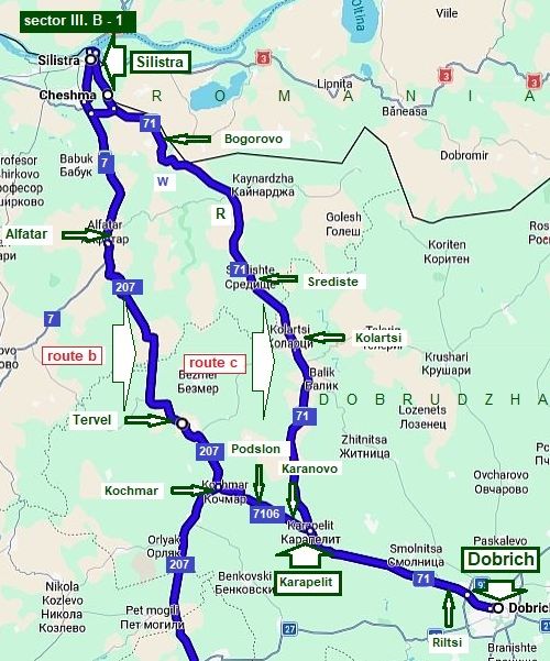
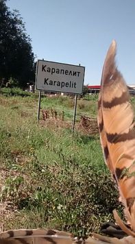
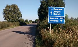
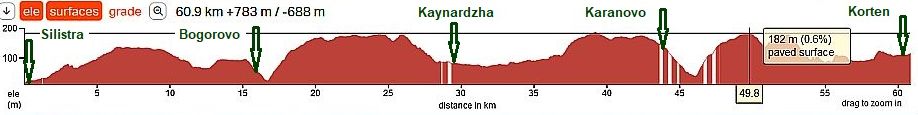
Bicyclists intending to head toward the seaside - Balchik or Durankulak I recommend pedaling toward Dobrich. A more detailed map concerning alternatives from Silistra to Karapelit: Here are possible 2 routes: Route b: From Silistra (road N7) to Alfatar (road N207) to Tervel to Kochmar (road N7106) to Podslon to Karanovo to Karapelit (road N71) to Riltsi to Dobrich). Route c : From Silistra (road N71) to Bogorovo to Srediste to Kolartsi to Hitovo to Karapelit to Riltsi to Dobrich.
|
|
Route b: easy for pedaling area.
What about route b, I post photos for it in the previous item. To join route c, a shortcut between Kochmar and Karapelit is available - the next several photos |
||
 |
 |
 |
| Comparing with the route c - 1, here there are more villages along the road, food and water are available in them. | ||
 |
 |
 |
|
Route c
As it can be seen from the road profile chart, when leaving Silistra there is 5 - 6 km hill. I point on the map above a spring of water at the lowest point after Bogorovo. |
 |
 |
 |
| Soon all this climbing appeared to be in vain - at Bogorovo you will be again in the altitude of Silistra. | ||
 |
 |
 |
 |
 |
|
 |
 |
|
| The hill after Bogorovo is very tedious, usually here is very hot in the summer time. Luckily 2 kilometers after it there is very nice restaurant, I was always | wondering - a restaurant in the middle of nothing, but it is a beautiful spot to refresh with a tonic, or beer. |
 |
 |
 |
|
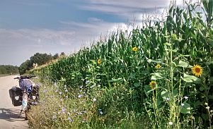
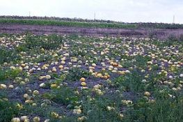
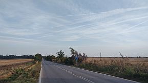
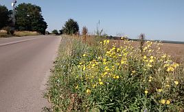
Further toward Karapelit pedalling is extremely pleasant. As I have mentioned, along the road between Silistra and Karapelit there are lot of apricot trees, |
which maces pedalling in this area very pleasant from the end of May to the middle of July. |
 |
 |
 |
 |
 |
|
 |
 |
|
Route c (from Karapelit to
Dobtich)
Nothing special to say about the distance from Karapelit to Dobrich. Almost flat area easy to be pedaled. Years ago near the road there were a lot of cherry trees, it seems they were cut because of drying. |
||
 |
 |
 |
 |
 |
 |
 |
 |
 |
|
Dobrich is the main town of this district. Overnight accommodation in it is not a problem. |
Information for Dobrich: http://www.guide-bulgaria.com/NE/Dobrich/ http://www.guide-bulgaria.com/ne/dobrich/dobrich-city/dobrich |
|
|
|
|
|
|
|
|
|
|
||
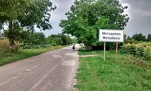
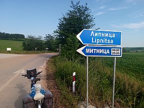
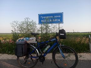
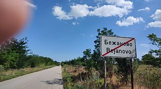
To complete this point, I will mention that in exploitation are two relatively new open Border checkpoints on the Bulgaria/Romanian border:
- Border Checkpoint Kaynardzha - Lipnitsa (open 2017, works between 8 am and 8 pm);
- Border Checkpoint Krushari - Dobromir (open 2018, having the same work time).
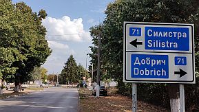
On the map in left I point this two new Border Checkpoints.
June '21 I explored this area and my information is very real. |
 |
|
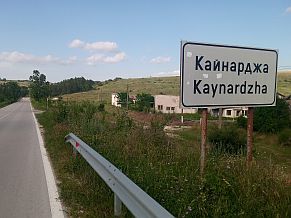
If you use Border Checkpoint Kaynardzha - Lipnitsa head west toward Kaynardzha and road 71. |
||
 |
 |
 |
|
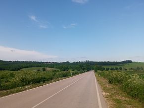
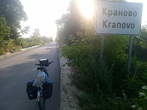
East toward Kranovo road is nice to this very small village. |
||
 |
 |
 |
 |
 |
|
|
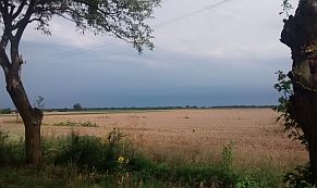
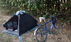
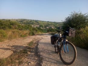
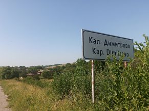
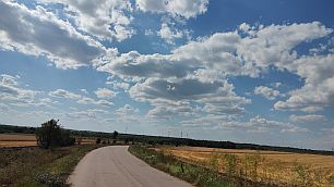
The road between Kranovo and Kapitan Dimitrovo has not been maintained is in very poor condition. Exploring just this road segment I had problems with my tires, I did not know both tires are very worn. But the fields were beautiful ! |
||
 |
 |
 |
|
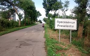
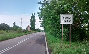
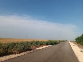
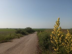
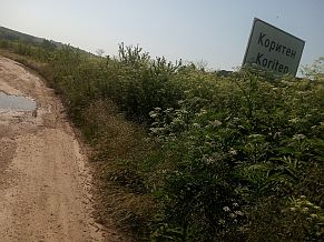
Toward Koriten, Krushari and Dobrich the road in nice. I did not take more photos, thinking only to reach Dobrich and replace my tires. |
||
 |
 |
 |
|
|
||
| The next map shows ways to reach the Black Sea: toward Durankulak, Balchik, Albena or Varna, | but I described all that in the previous item of the same chapter, and I will not repeat it again. |
|
|
|
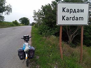
4. Border Checkpoint Iovkovo (Negru Voda – Kardam)
I am not sure, if somebody would use this Border checkpoints. Over the last few years the traffic here (from the border checkpoint to Dobrich) is really heavy in the tourist season. The roads here are in nice conditions. Towards Burgas and BG/Turkey Border I can suggest the following route:
Route A Includes crossing of Balkan Mountains along Aytoski Pass
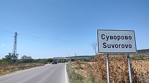
From Border Checkpoint (road 29) Iovkovo to Kardam to General Toshevo to Dobrich (road 2702) to Suvorovo to Vetrino (road 208) to Provadia to Dalgopol to Aytos (road 6) to Burgas (road 9, E87) to Malko Tarnovo to Border Checkpoint Malko Tarnovo.
I will not give here information for this route, Explores of my Home Page can find information about it in:
- Chapter I. Passes in Balkan Mountains, Sector I. C , Point 15. Aitoski Pass;
and
- Chapter III. Crossing Bulgaria from north to south (from Romania to Turkey & Greece): 3. From Burgas to Border Checkpoint Malko Tarnovo |
|
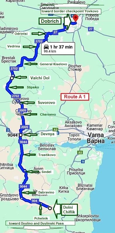
As a variant of Route A, I will give the next route A1 - Includes crossing of Balkan Mountains along Dyulinski Pass:
From Border Checkpoint (road 29) Iovkovo to Kardam to General Toshevo to Dobrich (road 2702) to Suvorovo (road 2009)to Devnya (road 9004&904) to Dolni Chiflik (road 906) to Dyulino to Burgas
As the information for Dulinski Pass (the route part from Burgas to Dolni Chuflik) is available in:
- Chapter I. Passes in Balkan Mountains, Sector I. C , Point 16. Dyulinski Pass,
Here I give information only for a part of this route:
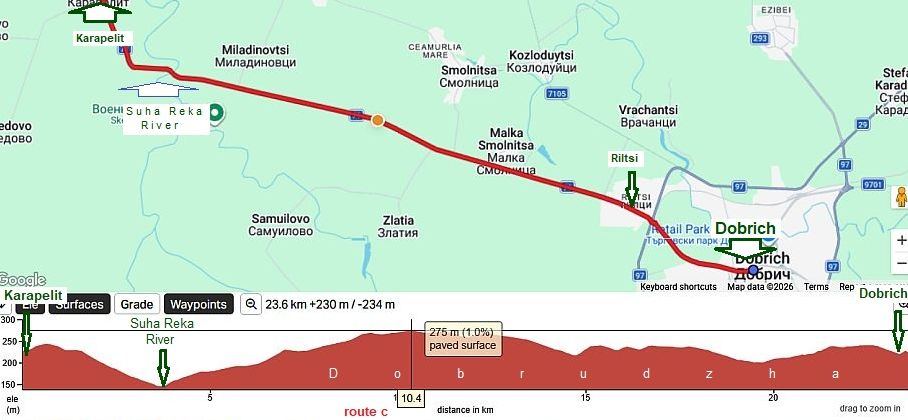
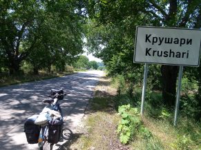
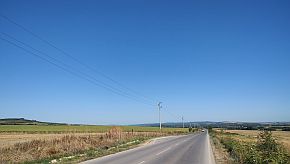
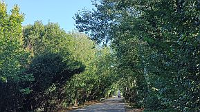
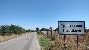
From Dolni Chiflik (road 904) to Pchelnik to Dabravino (road 2044) to Sindel to Trastikovo to Devnya (road 2009) to Chernevo to Suvorovo (road 2702) to Stipsko to Valchi Dol to General Kiselovo to Vedrina to Odrintsi (road 27) to Dobrich
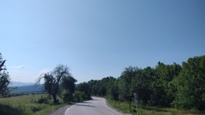
This part of the route is very pleasant to be explored - Roads are with very minimal traffic, food shops and water are available in the villages and towns along it.
The only one my suggestion is to avoid entering Sindel, it is not a pleasant place - the road surrounds it.
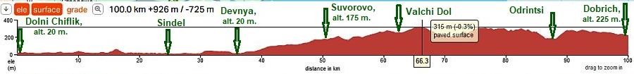
The road profile chart shows a long 30 km ascending starting from Devnya. in fact it is not hard - the altitude gain of almost 300 m is for 30 kilometers. |
||
 |
||
 |
 |
 |
 |
 |
 |
|
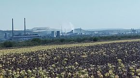
Devnya lies at the western shore of Lake Beloslav in the northeastern end of the Devnya Valley and along the southern slopes of the Dobruja Plateau, in the close proximity to the Black Sea. |
|
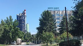
Because it is next to the sea port, there are several big plants here for cement and soda bicarbonate. Information for Devnya and its interesting museum mosaics: |
 |
 |
 |
| Toward Suvorovo and Valchi Dol |
 |
 |
 |
 |
 |
 |
|
A typical view of Dobrudzha - the east most part of Danube Plain. |
||
 |
||
 |
 |
 |
|
Suvorovo and Valchi Dol are the next little towns, no much to say for both little towns: http://www.guide-bulgaria.com/NE/varna/vulchi_dol/vulchi_dol |
||
 |
 |
 |
|
|
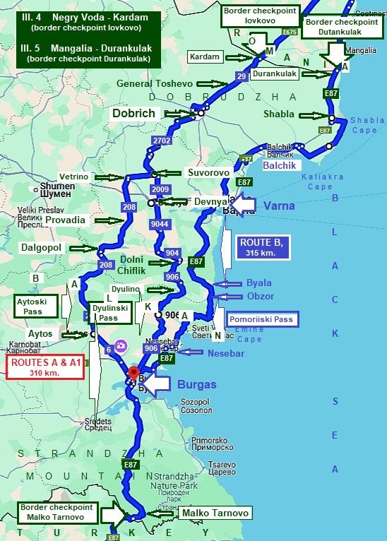
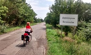
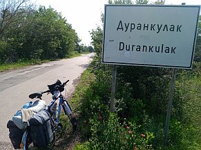
5. Border Checkpoint Durankulak (Mangalia – Durankulak)
Route B From border checkpoint Durankulak (road 9, E87) to Shabla to Kavarna to Balchik to Kavarna to Varna to Obzor to Nesebar to Burgas to Malko Tarnovo to Border Checkpoint Malko Tarnovo.
I realize that bicyclists entering in Bulgaria here would be glad to explore the seaside, so for detail information, please look in:
Chapter IV. Bicycling along Black sea side |
|
|
|
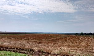
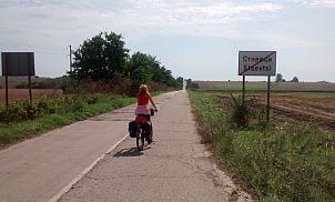
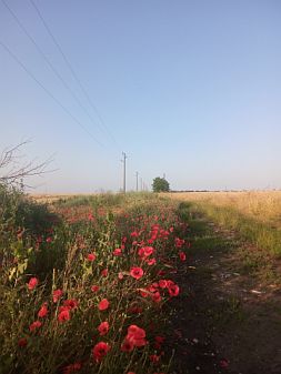
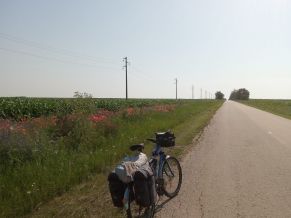
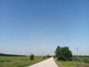
And finishing my description of this Chapter, I will give the last route: from border checkpoint Iovkovo to Durankulak - a road without any traffic. I love just this route and pedal it every time I have a possibility.
|
||
 |
 |
 |
 |
 |
|
 |
 |
 |
 |
 |
 |
|
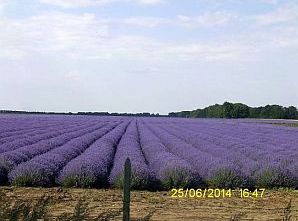
More photos from the same area I took in the early June '23. Having problems with my left elbow, I was not able to pedal so I walked from Kardam to Durankulak. |
 |
 |
 |
 |
 |
|
 |
 |
 |
 |
 |
 |
||
 |
||
 |
 |
 |
 |
 |
 |
|
|
||
.jpg)
.jpg)