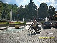
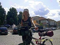
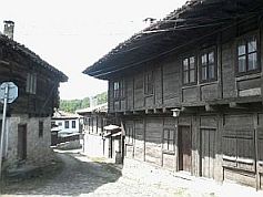
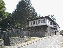
|
|
||
.jpg) |
|
|
|
|
||
|
|
||
|
|
|
|
|
|
||
|
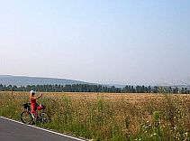
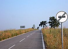
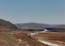
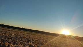
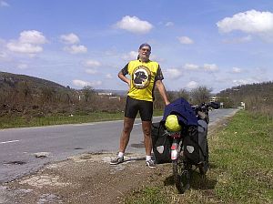
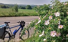
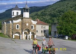
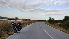
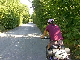
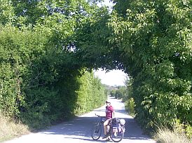
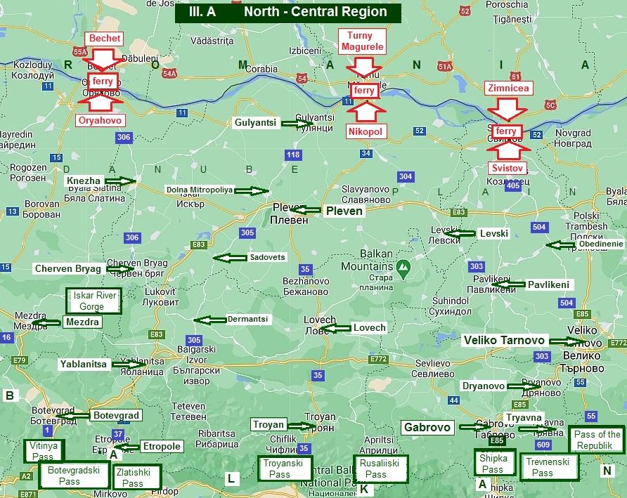
III. A North - Central Region |
|
|
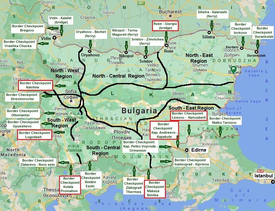
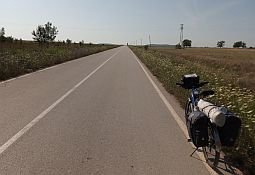
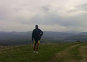
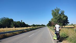
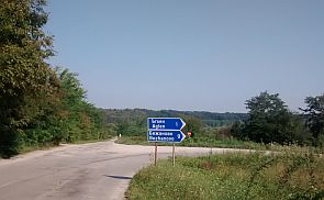
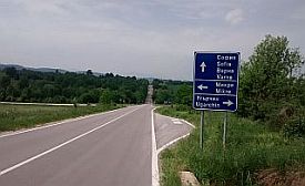
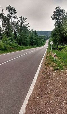
When planning a bicycle tour crossing Bulgaria from north to south, or from south to north, consider the following: - Define the point of entering in the country; |
- Define the point of leaving the country; - Choose the pass, where to cross Balkan: I have given detailed information about Balkan passes in the Chapter I. Passes in Balkan |
|
|
|
||
|
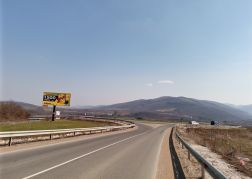
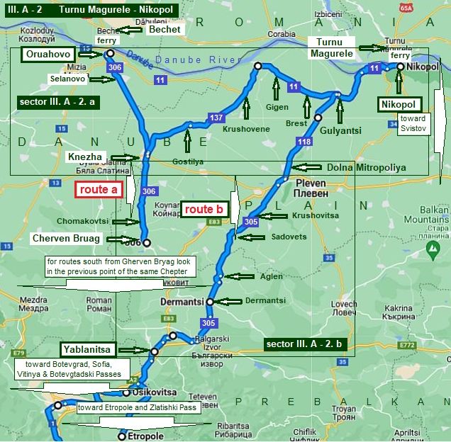
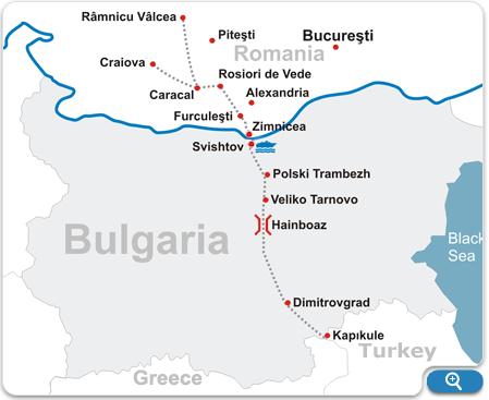
Below are a list of three places where you can cross the Romania – Bulgaria border: 1. Bechet – Oryahovo: ferry; 2. Turnu Magurele – Nikopol: ferry; 3. Zimnicea – Svistov: ferry. It will be the content of this Chapter. I will connect these points with the passes in Balkans along roads avoiding the traffic as much as possible; I will give here some opportunities as well. |
Bicyclists crossing the country from north to south toward Bulgaria - Greece Border have to look further in Chapters: II. Routes B. Routes in the South - West Region of the Country, III. Crossing Bulgaria from north to south (from Romania to Turkey & Greece): |
|
|
1. Bechet – Oryahovo: ferry |
||
|
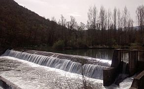
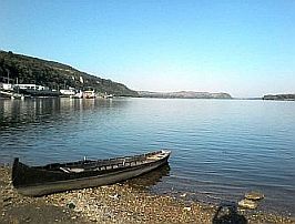
The Danube river can be crossed by ferry at Oryahovo: Bechet - Oryahovo: ferry crossing information can be found here: Unfortunately the site has no English language translation. The ferry operates 24 hours a day. Its schedule is: - From Oryahovo to Bechet, after 12:00 am, the ferry runs every other hour; |
- from Bechet to Oryahovo: each second hour starting from 13. No price for a bicycle, but a walker is charged by 1 EURO :) Oryahovo is a little town, overnight accommodation is available in it; information for Oryahovo: |
|
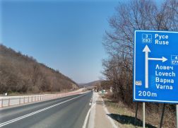
 IMPORTANT: Because of heavy traffic, including large trucks, try to avoid road N15 from Oryahovo to Vratsa (look the next map): From Oryahovo to Mizia to Borovan to Vratsa (road N15) to Mezdra to Botevgrad (E 79) to Sofia (A 2).
Bicyclists using the Bechet to Oryahovo ferry, have the next two possibilities (shortest routes) toward Bulgaria / Greece Border:
1. From Oryahovo to Sofia to Border Checkpoint Kulata/Promahon via:
- Iskar River Gorge; - Vitinya Pass; - Botevgradski Pass.
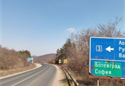
2. From Oryahovo to Knezha to Cherven Bryag to Yablanitsa to Etropole to Zlatishki Pass to Zlatitsa to Panagyuriste to Pazardzhik to Border Checkpoint Ilinden Exohi.
Next I will describe these two routes:
- route a: via Iskar River Gorge toward Sofia;
- route b: - via Vitinya Pass and Botevgradski Pass toward Sofia; - via Zlatishki Pass - responding to point two above.
For Balkan Passes look in the Chapter I. Passes in Balkan Sector I. A |
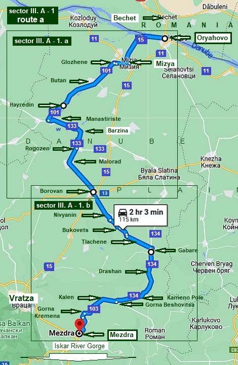
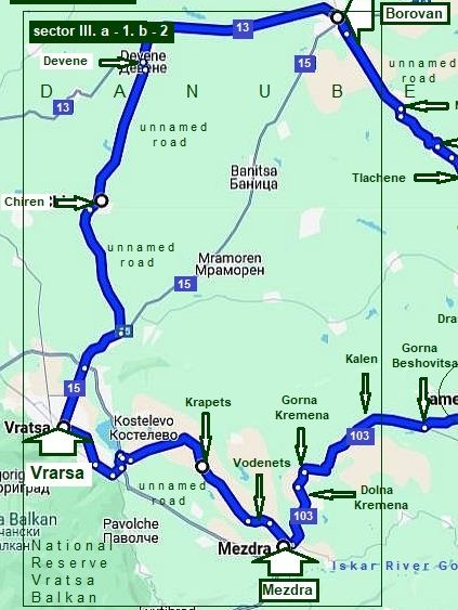
Sector III. A - 1
Route a Via Iskar River Gorge
The River Gorge is an extremely scenic route. The gorge is a really nice bicycle if going to the Bulgaria / Greece Border at border checkpoint Kulata - Promahon.
Here I will illustrate the route from Oruahovo to Mezdra only. Very detail information concerning Iskar River Gorge can be seen in:
Chapter I. Passes in Balkan Sector I. A Point 2. Iskar River Gorge - B. Mezdra to Cherven Bryag; - A. From Sofia to Mezdra,
and the route from Sofia to Border Checkpoint Kulata/Promahon can be seen in:
Chapter II. B. Routes in the South - West Region of the Country
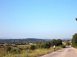
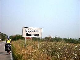
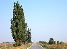
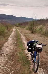
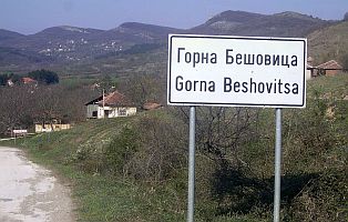
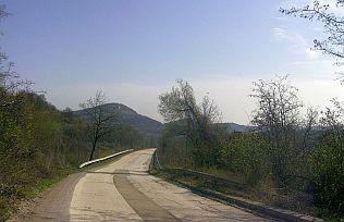
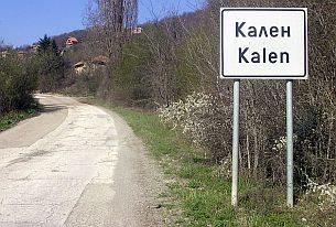
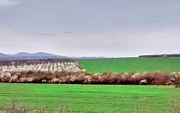
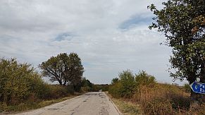
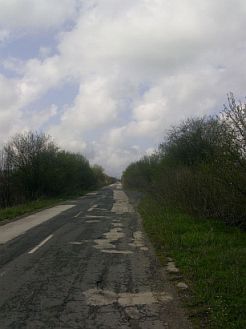
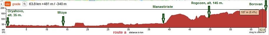
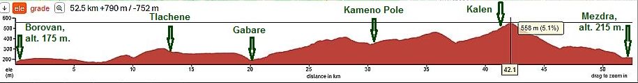
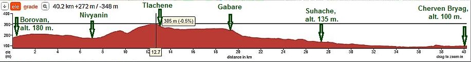
The route I describe here is: From Oryahovo (road 15) to Mizya (road 11) to Glozhene (road 101) to Butan to Kriva Bara to Hayredin to Manastiriste (road 133) to Rogozen (unnamed road) to Malorad to Borovan to Nivyanin to Bukovets to Tlachene tp Gabare (road 134) to Drashan to Kameno Pole to Gorna Beshovitsa (road 103) to Kalen to Gorna Ktemena to Mezdra. For more detail description I will part it into two sectors. |
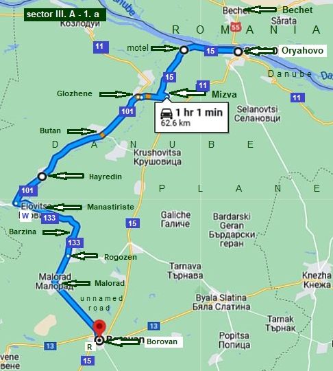
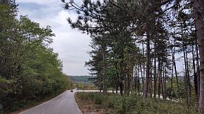
Sector III. A - 1. a In this sector is important to avoid road 11. The traffic along road 11 is not very bad. The route I give here is much safer, although is 15 kilometers longer. I think it is not a problem for bicyclists.
The route I suggest is: From Oryahovo (road 15) to Mizya (road 11) to Glozhene (road 101) to Kriva Bara to Hayredin to Manastiriste to Barzina to Rogozen to Malorad to Borovan.
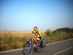
The pedaling in this road sector is pleasant, as can be seen from the road profile chart. The entire area is easy for pedaling as well as wild camping. |
|
|
|
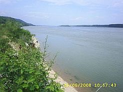
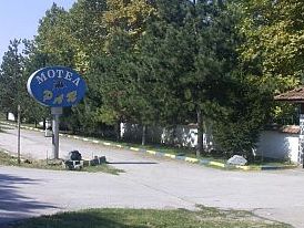
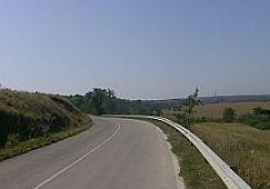
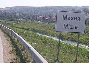
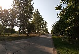
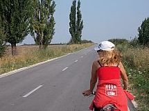
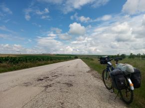
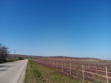
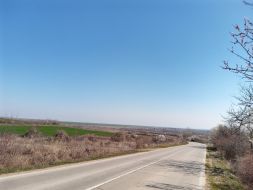
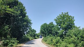
Toward Mizya: You have to pedal road 15, there can be periods of heavy traffic. You will see no more than 10 trucks to and from the ferry. The countryside is beautiful, the area is flat, I prefer |
road 15 rather than road 11. I am not sure if overnight accommodations are available in Mizia. But approximately half way to Mizia - Oryahovo a motel and restaurant are available. |
 |
 |
 |
|
Next little town is Mizia, a little information for it: |
||
 |
 |
 |
|
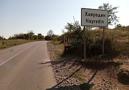
After Mizya you will leave road 15 and traffic will disappear. Bigger villages here are Glozgene and Hayredin, food shops are available there. |
A little information for Hayredin: |
|
|
|
|
 |
 |
 |
|
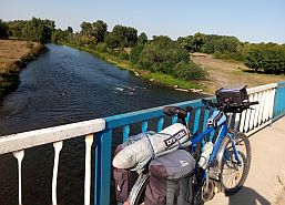
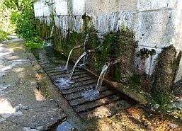
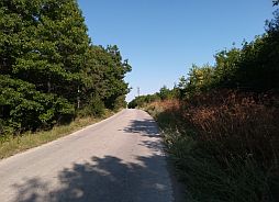
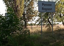
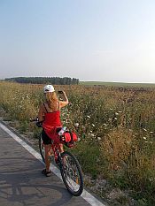
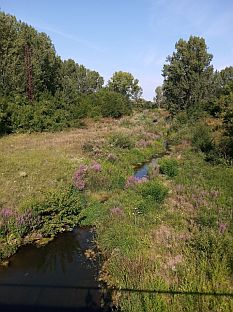
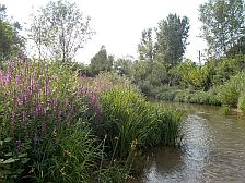
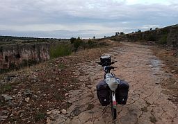
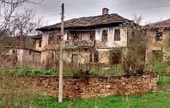
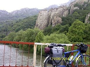
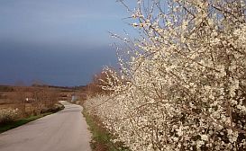
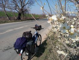
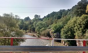
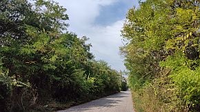
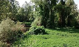
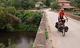
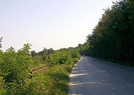
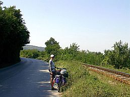
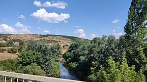
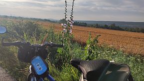
After Hayredin you have to take road 133 and cross Ogosta River. Crossing it (the first photo below), you will head toward Manastiriste. Next to the bridge there is a very |
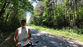
nice spring of cool water. Next photos illustrate the countryside toward Rogozen, it is my tour in the early July, 2020. |
 |
 |
 |
 |
 |
 |
|
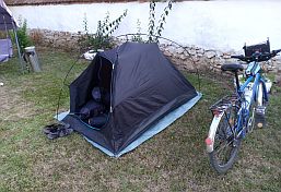
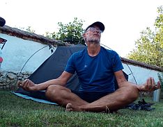
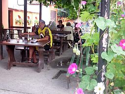
Overnight accommodation is possible in Rogozen, where a friend of mine, Ferdy, has a guest house (everyone in the village knows him): |
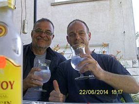
Wandering in this area I have never missed the chance to spend a night in his garden (appropriate for meditation), as well as sharing a bottle of gin with him. |
 |
 |
 |
|
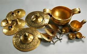
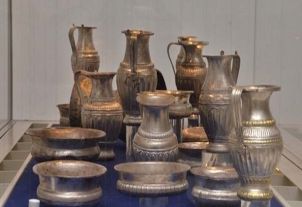
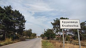
Rogozen is popular with the Thracian treasures found near it '80 last century: https://www.bulgaria-guide.com/guide/Rogozen_Treasure/200385/ |
||
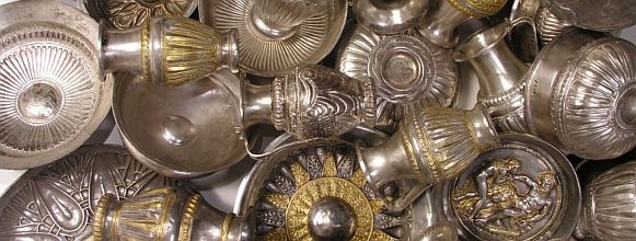 The Rogozen collection is the richest Thracian treasure found so far. Unearthed in the period 1985 - 1986, it consists of as many as 108 phialae, 54 small jugs and 3 cups. The objects are mostly made of silver with gilt coating. They were collected during a period exceeding a century - from the beginning of the 5th century to the mid-4th century BC. Part of it can be seen in the History Museums in Vratsa and Sofia. |
||
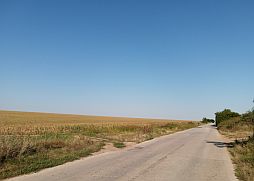
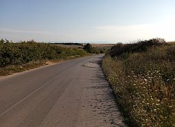
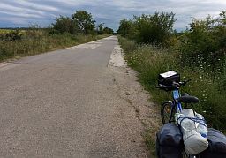
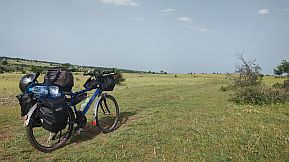
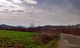
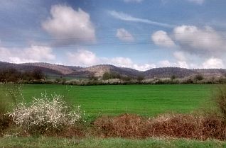
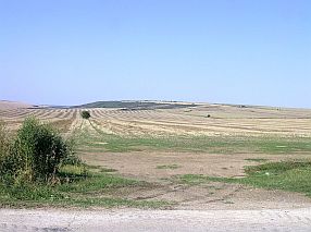
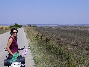
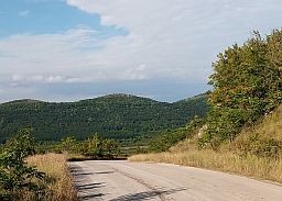
| The countryside toward Borovan. | ||
 |
 |
 |
 |
 |
 |
 |
 |
 |
|
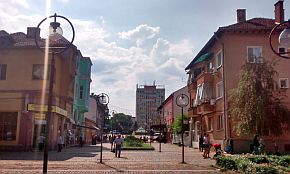
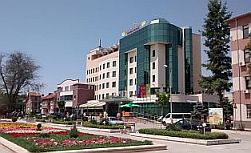
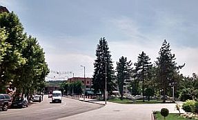
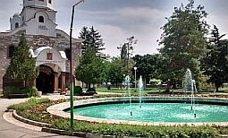
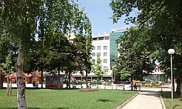
A little information for Borovan; http://www.guide-bulgaria.com/nw/vratsa/borovan/borovan |
||
|
Sector III. A - 1. b
|
|
As I have mentioned in the beginning of the section, this route connects Oryahovo and Sofia via Iskar River Gorge. So in this sector is shown how to reach the Gorge from Borovan. Entrance to the Gorge is Cherven Bryag. According to the time you have, you can choose to reach the Gorge at Cherven Bryag, Kunino, Roman or Mezdra. For bicyclists intending to visit Vratsa, in addition I will post here a route from Boroban to Vretsa (to Mezdra). Overnight accommodations are available in Cherven Bryag, Mezdra and Vratsa. All of this area is extremely nice to be explored by bicycle. There will be no traffic issues here. |
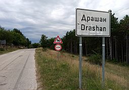
Detailed information concerning all this area including the route from from Cherven Bryag to Mezdra to Roman to Kunino (not pointed on the map above) can be found in the Chapter I. BALKAN PASSES, Sector I. A , point 2. Iskar River Gorge, Sector I. A - 2. e: From Mezdra to Roman to Kunino. The shortest route toward Sofia : From Borovan (unnamed road) to Nivyanin to Bukovets to Tlachene to Gabare (road 134) to Drashan to Kameno Pole to (road 103) Gorna Beshovitsa to Kalen to Gorna Kremena to Dolna Kremena to Mezdra. The next is the road profile chart of this route |
|
Starting from Borovan toward Tlachene the route is still in Danube Plain. |
||
 |
 |
 |
 |
 |
|
|
Nivyanin and our breakfast in it. We spent a night just at the bed of Skat River flowing through the village. |
||
 |
 |
 |
 |
 |
|
|
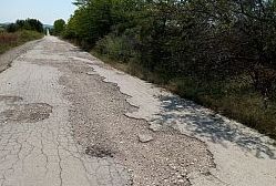
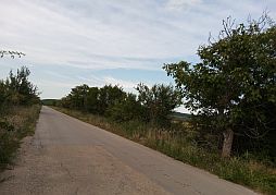
The road from Tlachene toward Gabare has not been maintained. Pedaling here can be a challenge. At least there is not any traffic. A food shop is available in Gabare. |
||
 |
 |
 |
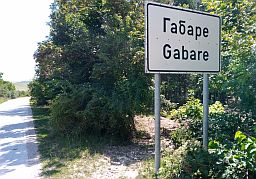
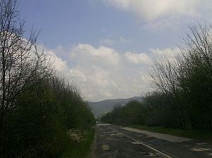
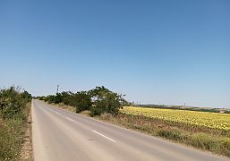
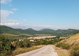
| Leaving Gabare, the road is in more hilly area, the Danube Plain is behind you. | ||
 |
 |
 |
 |
 |
 |
|
Sector III. a - 4. b - 1
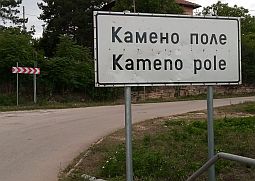
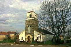
At one time, Kameno Pole was a big village, but now there is hardly anything left of the village. There are shops and food sources here. Find the church in the village, then turn left and leave the village.
Next to the village is a small river formed very scenic canyon. To visit it, find the church in the village, then turn left and leave the village.
A nice clip for the Rocky Field: |
||
|
|
|
|
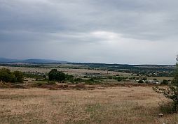
| Then you will be on the plateau next to the canyon. The area is called "the rocky field", it is easy to understand this name. | ||
 |
 |
 |
|
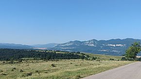
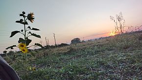
Pedaling along the thicker red line on the map above you will be next to the canyon. The view is amazing, photos below can not represent how impressive it is. |
||
|
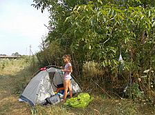
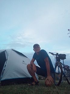
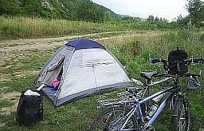
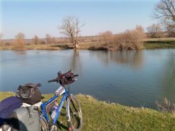
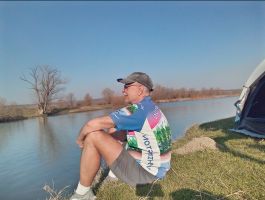
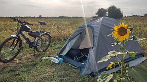
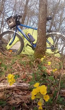
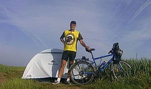
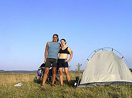
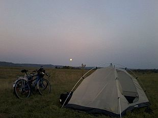
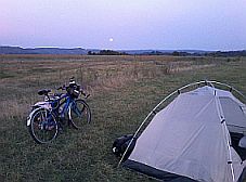
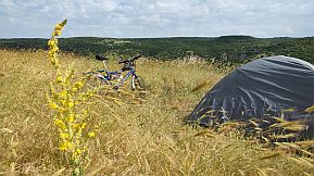
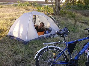
Always I am in this area I do not miss to spend a night in my tent. |
||
 |
 |
 |
 |
 |
 |
 |
 |
|
|
There are three groups of rock formations down the river, 2 - 3 kilometers further. There is a rocky track down the river as well. Unfortunately the two times I was |
there in the end of my day, I was tired, so I did not explored the entire area. I am sure, one day I'll be back there. |
 |
 |
 |
 |
 |
|
|
||
|
٭An opportunity. From Kameno Pole there is an asphalt road down toward Kunino (the only road I did not pedal in this area) and explore the Gorge starting from Kununo (toward Roman and Mezdra). |
Another opportunity is to head toward Dolna Beshovitsa along a rocky road (photos below), after to Roman - this road is nice and to start exploring the Gorge from Roman (toward Mezdra). | |
 |
 |
 |
 |
 |
 |
 |
 |
|
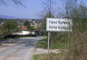
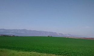
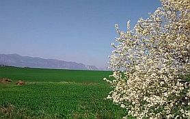
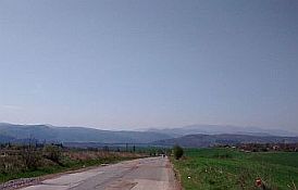
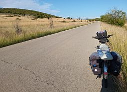
Next several photos illustrate the road from Kameno Pole to Mezdra. Again a road without any traffic. I remember that in Gorna Kremena there is a food shop. |
||
|
|
|
|
 |
 |
 |
 |
 |
 |
 |
 |
 |
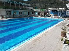 |
Soon you will be in Mezdra. Overnight accommodation can be found in Mezdra. Information for it: http://www.guide-bulgaria.com/nw/vratsa/mezdra/mezdra A kilometer after leaving Mezdra toward Sofia near road there is a hotel and swimming pool, see the photo in left. (unfortunately water in the pool is not thermal. But the hotel and area is nice). Mezdra is a train crossroad, trains toward Vidin, Sofia and Varna stop in Mezdra. |
|
 |
 |
 |
|
|
||
|
٭An opportunity If you wish to explore the Iskar River Gorge, consider Cherven Bryag as a starting point to exploring this beautiful area. And several words about the route toward Cherven Bryag: Wanderers exploring this route |
may be interested a shorter road from Gabare to Cherven Bryag. But the one I suggest here is much more easier with no additional climbing. From Borovan to Nivyanin to Bukovets to Tlachene to Gabare to Sushane to Cherven Bryag. |
|
|
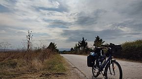
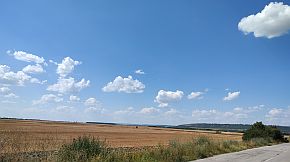
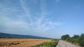
The only photo I took in this area - from Gabare toward Cherven Bryag - a typical view of Danube Plane in its west part.
Overnight accommodation is possible in Cherven Bryag: http://www.guide-bulgaria.com/nw/pleven/cherven_bryag/cherven_bryag |
||
 |
 |
 |
|
Again very detail information for the route from Cherven Bryag toward Roman and Mezdra can be seen in: Chapter I: Balkan Passes, Sector I. A , Point 2. Iskar River Gorge, Sector I. A - 2. e: from Mezdra to Roman to Kunino. Further, to reach Sofia, you have to pedal along Iskar River Gorge from Mezdra to Sofia (road 16). For information and details concerning Iskar River Gorge look again in the Chapter I. Passes in Balkan, Sector I. A , Point 2. Iskar River Gorge, Sectors I. A - 2,a; 2,b; 2c; 2d. |
For bicyclists entering Bulgaria through its North-West corner and intending to pedal to east to Black Sea (Varna), missing Sofia, please look in:
Chapter VI. Routes: B. From Sofia to Varna |
|
|
 ٭An opportunity
Sector III. a - 4. b - 2
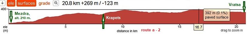
For bicyclists intending to visit Vratsa, in addition I will post here a route from Boroban to Vretsa (to Mezdra). Here is important to avoid the road 16 - it is a busy road. The route is: From Borovan to Devene to Chiren to Vratsa.
Chiren is a bigger village, food shop is available in it. Chiren is known with a very important and big underground gas storage located north from it and purposed to balance our annual gas consumption. https://www.bulgartransgaz.bg/en/pages/chirenobshta-107.html
The road profile chart shows the route is very easy and pleasant to be pedaled in both directions. Be careful several kilometers along road 15 - the traffic is a little more intensive, I would not say it is dangerous.
|
 |
||
|
The next photos are the countryside from Vratsa toward Borovan, photos were taken June '24, I and my FB friend Armin explored this area. |
||
 |
 |
 |
 |
 |
 |
|
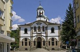
Information about Vratsa can be seen here: https://en.wikipedia.org/wiki/Vratsa https://www.visitbulgaria.net/en/vratsa/vratsa.html |
||
 |
 |
 |
 |
 |
 |
|
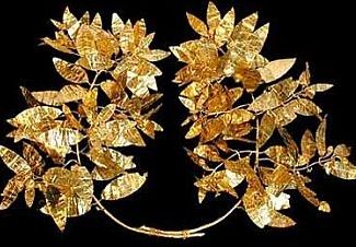
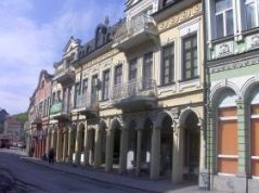
The town is placed just below the Balkans, is a scenic place, the History Museum in the town is worth seeing, and overnight accommodation in the town is easy to find. Information on the History Museum in the town can be found here: |
http://www.vratsamuseum.com/index.php?lang=en There are a lot of Thracian gold treasures in it: Valchedram Gold treasure: Especially impressive is the gold crown shown in the last photo - one of the most impressive things I have ever seen in my life. |
 |
 |
 |
| and more than 200 peaces of Rogosen gold - silver treasure: | ||
 |
 |
 |
|
Intending mote detail information for routes from Vratsa to Mezdra, I will increase the scale a little
Route a - 1 From Mezdra to Vratsa
Although the road 1 is very busy, I think pedalling here is not dangerous, it is 2 strips in each direction. Never mind, pedalling here is not pleasant, especially from, Mezdra toward Vratsa. In the back direction, descending allows a high speed, so the time for this distance is very short. I have not photos from this area.
As it can be seen from the road profile charts, the climbing of the route a is the least comparing with routes I will give next. |
 |
|
As an alternative of the busy
road, I would suggest Route a - 2 From Mezdra to Vratsa
The distance is longer comparing with the route a - 1, but here definitely there is not any traffic. Next photos illustrate this beautiful countryside, revealing a nice view toward Vratsa Balkan.
|
||
 |
 |
 |
|
Mezdra is a small town where overnight accommodation is possible. http://www.guide-bulgaria.com/nw/vratsa/mezdra/mezdra
Here you will enter in Iskar River Gorge, a detail description for it you can find in the Chapter I. BALKAN PASSES, Sector I. A , Point 2. Iskar River Gorge About 2 km after Mezdra, on the road segment from Vratsa to Mezdra, you will find a nice hotel, near road E 79, and swimming pool, unfortunately the pool water is not thermal. The restaurant in the hotel is relatively expensive. Be aware there are 2 - 3 very unpleasant kilometers between Mezdra and Rebarkovo. |
||
|
|
|
|
|
Route b: the last opportunity to avoid traffic and miss Mezdra, you can pedal:From Vratsa to Pavolche to Chelopek to Lyutibrod. I do recommend it!
And as it can be seen, here a climbing is available, but it is easy from Vratsa toward Chelopek. And three photos from this area. |
 |
 |
 |
|
|
|
Sector III. A - 1 Route b
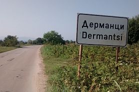
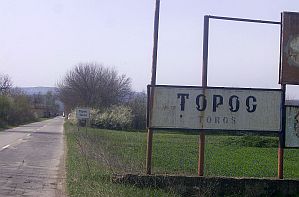
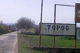
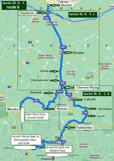
This route I would recommend to bicyclists loving to explore mountain areas as well as to avoiding Sofia heading to Border Checkpoint Ilinden - Exohi (BG / Greece Border: From Oryahovo (road 306) to Selanovtsi to Knezha to Enitsa to Chomakovtsi to Cherven Bryag to Lukovit to Dermantsi to Toros to Yablanitsa.
For the route from Yablanitsa to Zlatitsa (Zlatishki Pass) look in: Chapter I. Passes in Balkan Sector I. A Point 4. Zlatishki Pass
For the route from Zlatitsa to Panaguyriste to Pazardzhik look in: Chapter I. Passes in Balkan Sector I. D - Sector I. D - 18. From Zlatitsa to Panagyuriste to Pazardzhik; - Sector I. D - 19. From Zlatitsa to Koprivstitsa to Strelcha to Pazardzhik
In the Chapter III. Crossing Bulgaria from north to south (from Romania to Turkey & Greece): can be seen the route toward Border Checkpoint Ilinden - Exohi. The route can be used to reach Sofia as well either via Vitinia Pass or Botevgradski Pass - for these passe again look in Chapter I. Passes in Balkan Sector I. A |
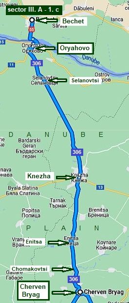 For more detail information I will part the Sector III. A - 1 in two: Sector III. A - 1. c
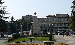
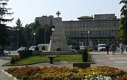
The route from Oryahovo to Knezha I traveled only by a car, it is a nice road without any traffic. Information for Knezha and a photo of the city center: http://www.guide-bulgaria.com/nw/pleven/kneja/kneja
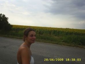
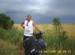
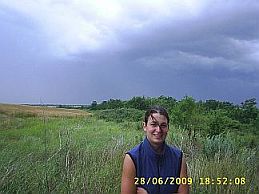
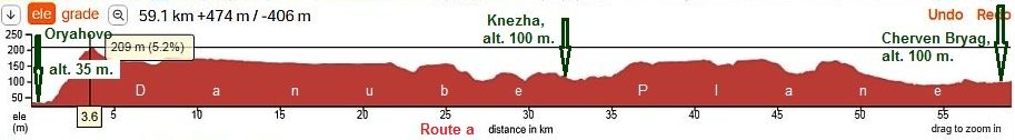
And the only 3 photos (in right) illustrating the area between Knezha and Cherven Bryag, I took in the extremely raining June 2009 when I and my daughter Maya explored this area. The next road profile chart is for the distance from Oryahovo to Cherven Bryag. Except the steep hill just next to Oryahovo, all the other route is in the flat Danube Plane. |
 |
 |
|
 |
|
 |
|

Sector III. A - 1. d
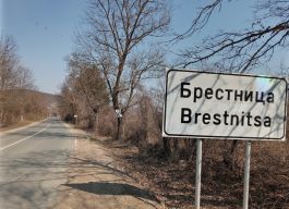
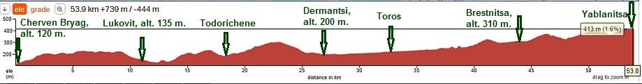
The route here is: From Cherven Bryag (road 306) to Lukovit to Dermantsi (road 305) to Toros (roads 4 & 3) to Brestnitsa Yablanitsa, although I show a little expanded map in left. As can be seen that there is a shortcut from Todorichene to Brestovitsa, but this route is more hilly than the one I suggest.
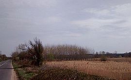
This region is interesting, offering several nice opportunities, I will write about it in the next item. Leaving Cherven Bryag already we are in more hilly area called Pre Balkan - a hilly area north from Balkan. |
||
|
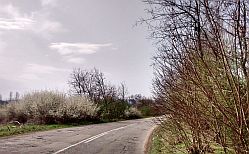
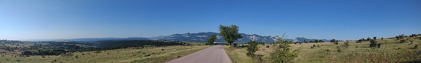
The countryside from Cherven Bryag toward Lukovit. No any traffic along this route |
||
.jpg) |
.jpg) |
.jpg) |
.jpg) |
.jpg) |
.jpg) |
 |
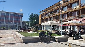
Lukovit is a little prosperity town, down the main road E83. Overnight accommodation is available in it. Information for it: http://www.guide-bulgaria.com/nw/lovech/lukovit/lukovit
|
|
 |
 |
 |
|
Next three photos are taken in the best early April '18 in the area from Todorishene to Dermantsi. Todorichene is a bigger village, food is available in it. Photos of this area: |
||
 |
 |
 |
|
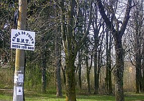
Dermantsi is a bigger village, in its center there is a restaurant. If you need overnight accommodation, after seeing the village square turn right (to south - toward Teteven). When you almost leave Dermantsi, you will see a sign (the third pic below) for a guest house, unfortunately |
written in Cyrillic:"къща за гости" and a cell tel. number. I do not believe they understand English, but I am sure, you will have not a problem to stay there for a night. I know peddlers finding this guest house consulting with my Home Page. |
 |
 |
 |
|
|
||
|
٭An opportunity An opportunity here is to visit Aglen (road 305), if you need a hotel for a night - north from Dermantsy - the village in red in the map above: there is a nice spot |
|
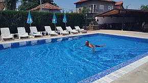
for relax in the hot summer afternoons: Hotel complex "Iglen": a food shop, restaurant, swimming pool.
|
 |
 |
 |
|
|
||
| More photos of this beautiful area. | ||
 |
 |
 |
 |
 |
 |
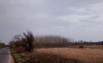
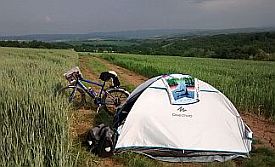
| The camp place next to Toros near Vit River. I love this area, I camped here several times. | ||
 |
 |
 |
 |
 |
 |
|
Toward Yablanitsa you have to pedal several kilometers along the main road E 772. There is not traffic on this road as the new highway is now open and used. |
||
 |
 |
 |
 |
 |
 |
|
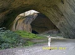
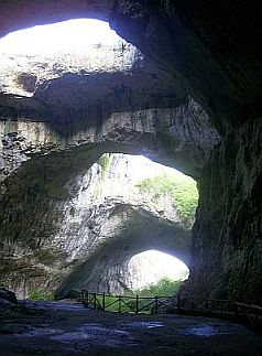
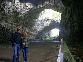
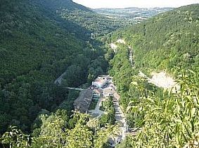
Food can be found in Brestnica.Two km south of Brestmoca is located an interesting cave, Saeva Dupkla. The cave was formed more than 1 million years ago from tectonic limestone. Its five halls and 400 metres of |
corridors offer some of the most beautiful caveformations in the Bulgaria. The calcium carbonate content in the rocks contributed the formation of the various natural shapes in different colors. |
 |
 |
 |
 |
 |
 |
|
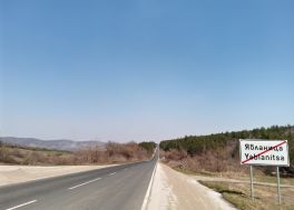
Yablanitsa is little town. Personally, I do not like it, I am not sure if overnight accommodation is available in it. Google shows that in the region there are accommodations. Very little information for it is available here: http://www.guide-bulgaria.com/nw/lovech/yablanitsa/yablanitsa |
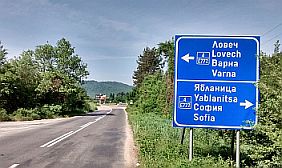
After Yablanitsa you can decide to head toward Botevgrad and Sofia (Botevgradski Pass or Vitinya Pass, or Etropole an Zlatishki Pass. Look in: Chapter I. Passes in Balkan Sector I. A , Points: 3. Vitinia Pass (and Botevgradski Pass), 4. Zlatishki Pass. |
|
|
|
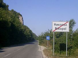
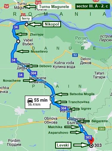
Please read the next 2 points together - I will combine descriptions about routes from Nikopol & Svistov toward BG/GR & BG/TU borders, I will avoid some repetitions. 2. Turnu Magurele – Nikopol: ferry
|
|
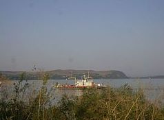
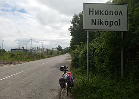
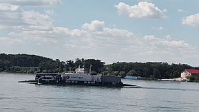
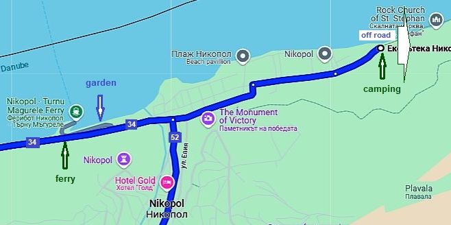
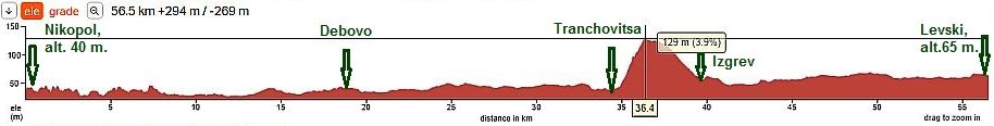
The next point to possibly cross the Danube is at Nikopol: Turnu Magurele - Nikopol. The ferry is located just after the city label. Ferry schedule and prices are available on the link: |
|||||||||||||||||||||||||||||||||||||||||||||||||||||||||
|
Ферибот „БДИН“ - ЗА ПЕРИОДИТЕ:
Ferry
"BDIN" - for periods
Ferry
"EVROPA" - for periods
|
|||||||||||||||||||||||||||||||||||||||||||||||||||||||||
 |
 |
Hmmmmmmm … no price for bicyclists … hhahh ... !!!
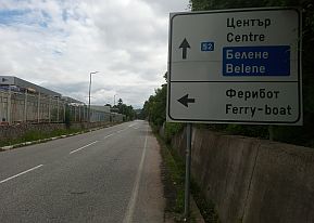
The approach toward the ferry is signed well. |
 |
 |
 |
|
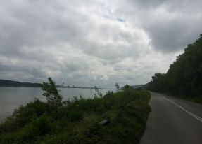
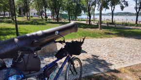
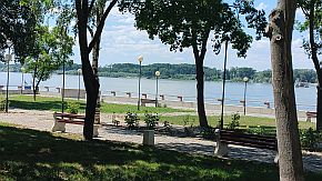
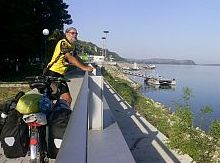
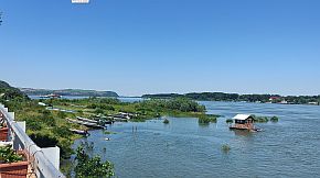
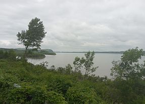
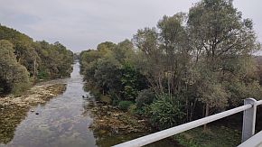
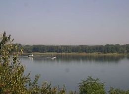
Entering Nikopol just after the ferry port there is a little lovely garden having a nice view toward Danube and Romanian shore. |
 |
 |
 |
 |
||
|
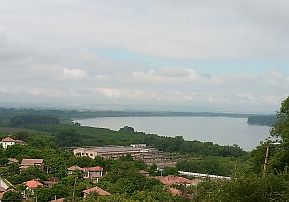
Overnight accommodations are available in the town. And some information for Nikopol: https://en.wikipedia.org/wiki/Nikopol,_Bulgaria http://www.guide-bulgaria.com/nw/pleven/nikopol/nikopol |
 |
 |
 |
 |
 |
 |
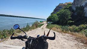
| Heading to east along Danube river, leaving the town you will see a camping place. (in the town there are sighs pointing it) June '24 it was not at work. | A rocky off road is in front of you. the natives told me it can lead you to Belene, I would not attempt to pedal to it. Anyway, the place is very scenic with the higher rocks. |
 |
 |
 |
|
2. Turnu Magurele – Nikopol: ferry routes a & b
Well, it is not easy for me to recognize, where would like to go a bicyclists entering in BG by this ferry, so I will recommend several routes to reach BG/GR border, beginning from west to east
Again, the first two routes a & b as in the previous item, are:
- toward Knezha, Cherven Bryag, Sofia via Iskar River Gorge, Vitinya Pass or Botevfradski Pass - for bicyclists heading toward Border Checkpoint Kulata - Promahon (BG/Greece border)
- toward Etropole, Zlatitsa and Pazardzhik via Zlatishki Pass - for bicyclists heading toward Border Vheckpoint Ilinden - Exohi (BG/Greece border).
Because a lot of the information here is overlapped with the one in the previous item, I will give only the differences. |
|
|
|
|
|
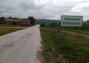
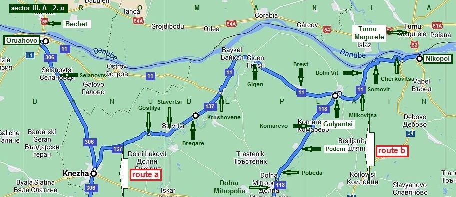
Sector III. A - 2. a Route a From Nikopol to Sofia (via Iskar River Gorge) |
||
|
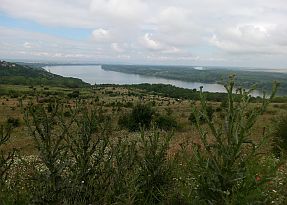
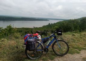
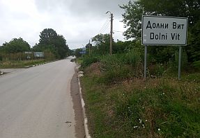
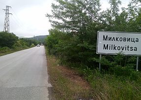
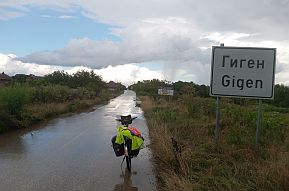
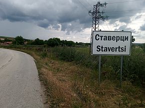
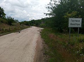
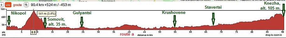
The route is: From Nikopol (road 11) to Cherkovitsa to Somovit to Dolni Vit to Milkiovitsa to Gulyantsi to Brest to Gigen to Krushovene (road 137) to Bregare to Knezha to Stavertsi tp Gostulya to Knezha (to Cherben Bryag to Mezdra to Svoge to Sofia). As I have mention, this route would be appropriate, if you decide to pedal toward Greece living Bulgaria at |
border checkpoint Kulata - Promahon. The route from Nikopol to Knezha is very pleasant for pedalling (as it can be seen from the road profile chart), there is not any traffic along the route. And yes, there is one not so pleasant hill between Nikopoi and Somovit, nobody expects such a hill just next to Danube here, al least I was surprised very much I explored this area for the first time. | |
|
|
||
|
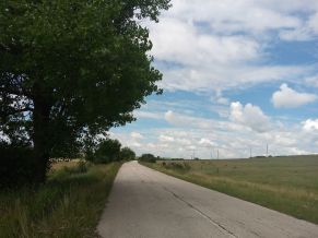
Next pictures illustrate the countryside between Nikopol and Gulyantsi. There are a lot of villages along the road here, so water and food supply is not problem. |
Overnight accommodation is available in Knezha, I am not sure if in Gulyantsi it can be found out. | |
 |
 |
|
 |
 |
 |
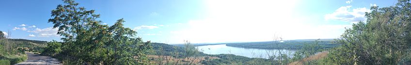
| The hill between Nikopol and Somovit. A nice view toward Danube River is revealed here. | ||
 |
 |
 |
 |
||
 |
 |
 |
|
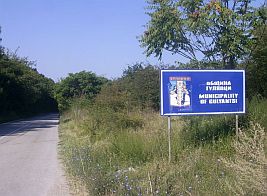
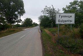
A bigger settlement here is Gulyantsi, I do not believe there is an overnight accommodation in it. A little information for Gulyantsi Municipality and Gulyantsi. |
|
http://www.guide-bulgaria.com/nw/pleven/gulyantsi http://www.guide-bulgaria.com/nw/pleven/gulyantsi/gulyantsi Toward Gigen and Krushovene. A food shop is available in the villages. |
 |
 |
 |
| June 24' - I and my FB friend Armin from RO camped next to Gulyuantsi. | ||
 |
 |
 |
| Toward Gigen and Krushovene. A food shop is available in the villages. | ||
 |
 |
 |
 |
 |
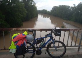 |
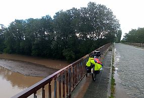
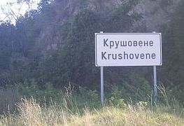
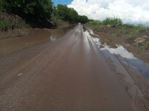
| Krushovene is in the valley of Iskar River - already a low place. Food is available in it. The next photos are | taken in the raining June '21, when several road sectors were covered by water and mud. |
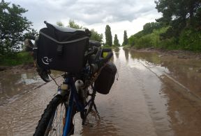 |
 |
 |
| The road from Krushovene to Knezha road without traffic. I travelled this road in the extremely raining June | '21, when parts of the road were covered by sediments from the field. |
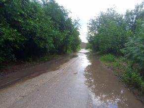 |
 |
 |
 |
 |
 |
 |
In the left is the only photo I took in Knezha. Information for it: http://www.guide-bulgaria.com/nw/pleven/kneja/kneja
I will not write here about the route from Knezha to Cnerven Bryag - it is available in the previous item. information for Iskar River Gorge can be seen in: Chapter I. Passes in Balkan Sector I. A - Point 2. Iskar River Gorge, A. Sofia - Mezdra; - Point 2. Iskar River Gorge, B. Mezdra - Cherven Bryag |
|
|
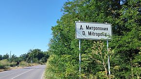
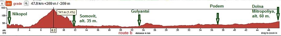
Sector III. A - 2. a Route b From Nikopol to Dolna Mitropoliya
|
||
|
From Nikopol (road 11) to Cherkovitsa to Somovit to Dolni Vit to Milkiovitsa to Gulyantsi (road 118) to Komatevo to Podem to Pobeda to Dolna Mitropoliya. |
After Gylyantsi the road is up the stream of Lom River, the area is almost flat, the traffic - minimal. Food shops and water are available along the road. |
|
|
|
||
 |
 |
 |
 |
 |
 |
|
A little information for Dolna Mitropoliya: http://www.guide-bulgaria.com/nw/ pleven/dolna_mitropolia/dolna_mitropolia Overnight accommodation is available in Dolna Mitopoliya, but my suggestion is to visit Pleven; it would be not bad if you explore this area. |
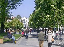
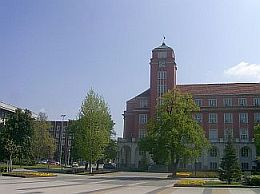
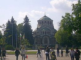
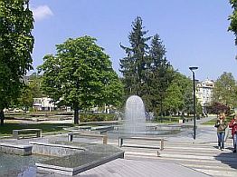
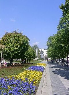
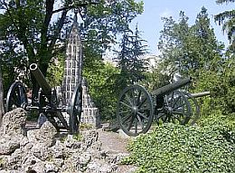
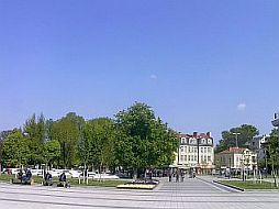
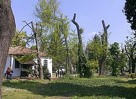
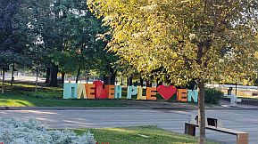
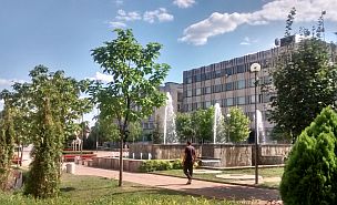
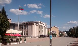
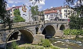
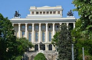
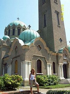
Pleven is known with a heavy battles between Russian and Turk armies 1877/78. A lot of information about the town is here: https://en.wikipedia.org/wiki/Pleven http://www.guide-bulgaria.com/nw/pleven/pleven/pleven https://bulgariatravel.org/en/town-of-pleven/ Several photos from Pleven. |
 |
 |
 |
 |
 |
 |
 |
 |
|
|
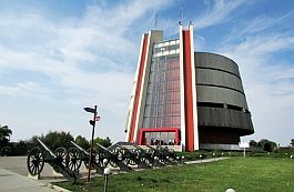
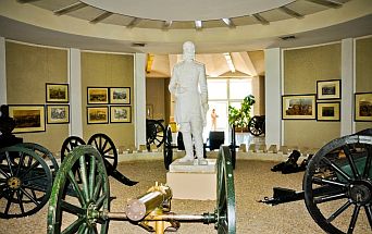
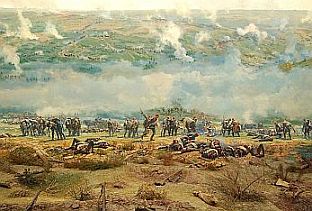
It is worth to visit Pleven Epopee Panorama: https://bulgariatravel.org/en/pleven-epopee-1877-panorama-pleven/ |
||
 |
 |
 |

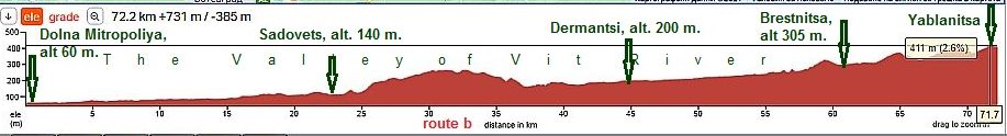
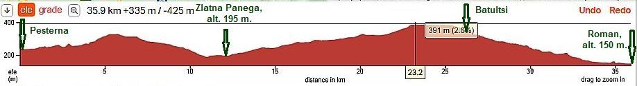
Sector III. A - 2. b Route b
This is really one of my favourite routes in Bulgaria:
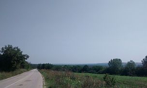
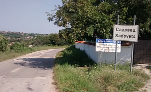
From Dolna Mitropoliya to Krushovitsa to Sadovets to Aglen to Toros to Brestovitsa toYablanitsa.
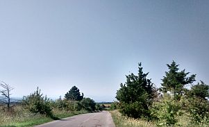
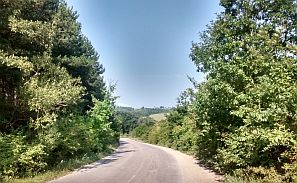
The road 305 is up stream of Vit River. There is very little traffic here, except a kilometer or two just after Dolna Mitropoliya and just before Yablanitsa, where the route includes E 83. Two kilometers along (road 4 (E772) between Toros and Brestnitsa) can have a lot of traffic. Soon it will be redirected after finishing of the motor road A2. Food and water is available in the villages along the road. The entire area is perfect for camp in the wilderness.
As it is obvious from the road profile chart, it is an extremely pleasant route to be pedalled in the either direction. |
||
 |
||
| Photos of this really very nice area, one of my favourite road segment. There is not any traffic here. | ||
 |
 |
 |
 |
 |
 |
 |
 |
 |
|
The road surround Aglen, but in the village there is a nice spot for relax in the hot summer afternoons: Hotel complex "Iglen": a food shop, restaurant, swimming pool. https://vila.bg/hotel-iglen-5337.html |
||
|
|
|
|
|
Dermantsi is a bigger village, in its center there is a restaurant. If you need overnight accommodation, after seeing the village square turn right (to south - toward Teteven). When you almost leave Dermantsi, you will see a sign (the third pic below) for a guest house, |
unfortunately written in Cyrillic:"къща за гости" and a cell tel. number. I do not believe they understand English, but I am sure, you will have not a problem to stay there for a night. I know peddlers finding this guest house consulting with my Home Page. |
|
|
|
|
| More photos of this beautiful countryside I took in the extremely nice end of September '23. | ||
 |
 |
 |
 |
 |
 |
 |
 |
 |
| the same area area, beginning of April ' 17 | ||
 |
 |
 |
 |
 |
 |
| Our camp place next to Toros near Vit River. I love this area, I camped here several times. | ||
|
|
|
|
| End of March ' 22 | ||
|
|
|
|
 |
 |
Leaving road 305 after Toros, there are two kilometers pedalling along road 4 (E772) with more intensive traffic, soon it will be redirected after finishing of the motor road A2. |
|
|
|
|
|
|
|
|
|
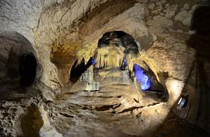
Food can be found out in Brestnica, next to it is located an interesting cave Saeva Dupka - 2km south of it. The cave was formed more than 1 million years ago from tectonic limestone. Its five halls and 400 metres of corridors offer some of the most beautiful cave |
formations in the Bulgaria. The calcium carbonate content in the rocks had contributed the formation of the various natural shapes in different colours.
|
|
|
|
|
|
|
|
|
|
Yablanitsa is little town , I do not like it, I am not sure if overnight accommodation is available in it, but Google shows that in the region there are places for it. Very little information for it is available here: http://www.guide-bulgaria.com/nw/lovech/yablanitsa/yablanitsa |
After Yablanitsa you can decide to head toward Botevgrad and Sofia (Botevgradski Pass or Vitinya Pass) , or Etropole an Zlatishki Pass - for these passes again look in: Chapter I. Passes in Balkan Sector I. A , Points: 3. Vitinia Pass (and Botevgradski Pass), 4. Zlatishki Pass. |
|
٭Opportunities in this sector.
If you decide to explore Iskar River Gorge, on the map above I show two opportunities to do it:
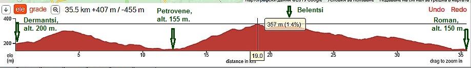
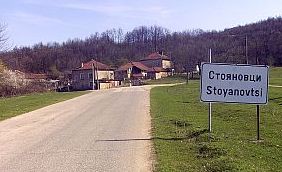
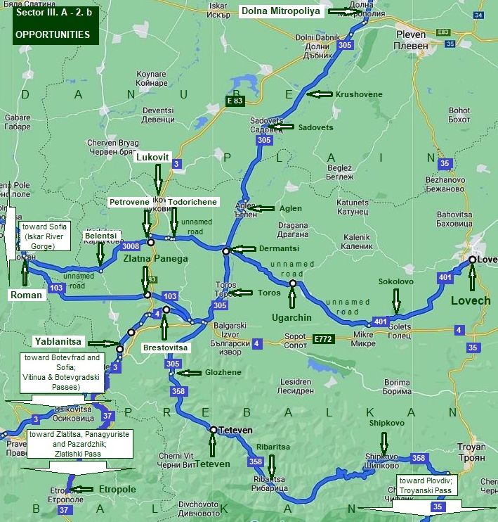
٭A. From Dermantsi to Todorichene to Petrovene (road 3008) to Belentsi to Stoyanovtsi to Roman.
Unfortunately this road is unnamed on the map, but the road, directions, villages are signed very well; the road is in very nice conditions, no any traffic here. |
 |
||
|
Next several photos are taken in the best early April '18 in the area from Dermantsi to Roman. Unfortunately I do not remember is food shops were available in Belentsi; |
Petrovene is a bigger village, food is available in it. Photos of this area: | |
|
|
 |
 |
|
|
 |
|
|
|
 |
|
|
|
There are no overnight accommodations in Roman. There will be accommodations in Lukovit, a little prosperity town, down the main road E83. Information for it:
|
|
|
|
|
|
|
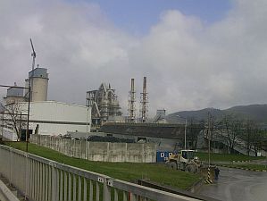
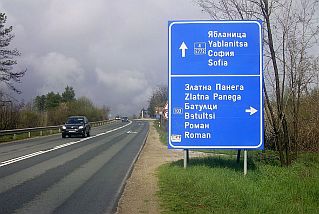
٭B. Road 103 toward to Zlatna Panega to Batultsi to Roman.
|
||
|
|
Leaving road 305 and pedalling a kilometer or two along road E 772, you have to take road 103 toward Roman, the crossroad is signed well - the photo in left.
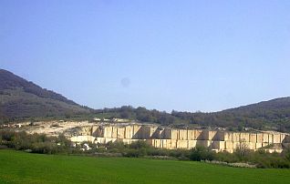
The entire area is great for exploring. The next several photos are the area from Zlatna Panega to Roman with its huge cement plant. The place is known with its Karsts springs: |
|
 |
 |
 |
 |
 |
|
|
|
||
|
The next two routes (C & D) are intended for bicyclists intended to climb Troyanski Pass heading toward Plovdiv. Both routes are extremely exciting. ٭C. Toward Teteven (to Troyan to Troyanski Pass). |
|
Teteven is very scenic place, a lot of information for this beautiful little town I have shown in the:
Chapter VI. B. From Sofia to Varna, Sector VI. 2 - B From Etropole to Teteven, I will not repeat it here. |
|
|
||
|
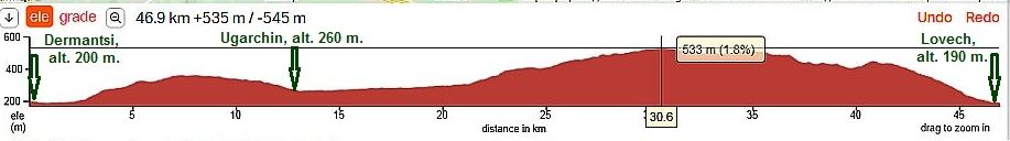
٭D. Toward Lovech (to Troyan to Troyanski Pass). If you suddenly decide to change your plan for the Balkan Pass where to cross Balkan, next route is toward |
Lovech, south from it is the hard for pedaling Troyanski Pass. From Dermantsi (unnamed road) to Ugarchin to Skolovo (road 401) to Izvorche to Lovech. |
|
|
If my memory serves, food is available only in Ugarchin along this road. Next several photos are the area from Dermantsi to Ugarchin. |
||
 |
 |
 |
 |
 |
|
 |
 |
|
|
Ugarchin is a little town away from main roads. A little information for it and 3 photos: |
||
 |
 |
 |
|
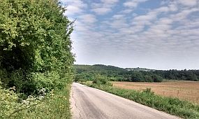
The road towards Lovech is in very nice conditions, no any traffic there. No food in the villages along the road here. |
||
 |
 |
 |
 |
 |
|
 |
 |
|
|
Information about Lovech - in the same point for
Route C: From Nikopol to Plovdiv (via Troyanski Pass) |
||
|
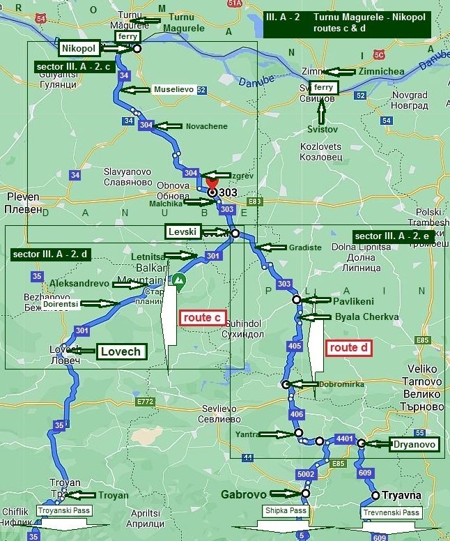
2. Turnu Magurele – Nikopol: ferry Routes c & d
Another two routes from Nikopol to south I will mention here are:
Route c From Nikopol to Levski to Lovech to Troyan to Plovdiv (via Troyanski Pass). This route I recommend to bicyclists loving long climbing up the mountain (Troyanski Pass);
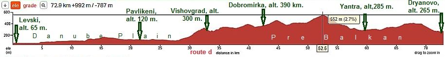
Route d From Nikopol to Levski to Pavlikeni to: - Gabrovo to Kazanlak to Haskovo (via Shipka Pass) or, - to Tryavna to Stara Zagora to Haskovo (via Trevnenski Pass).
You know, very detail information for Balkan Passes can be seen in:
Chapter I. Passes in Balkan Sector I. A Point 5. Troyanski Pass (Beklemeto), Point 7. Shipka Pass, Point 8. Trevnenski Pass.
Again, my goal is to recommend routes with minimum of traffic. A special attention I will give for tourists wanting to visit Veliko Tarnovo as well, I know it is popular as a tourist destination. |
|
|
 |
Sector III. A - 2. c
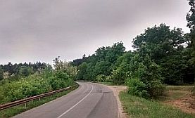
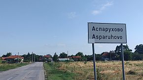
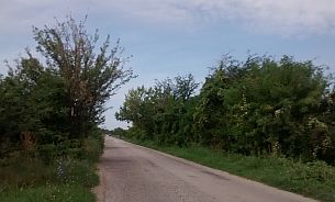
The common part of the both routes here is: From Nikopol to Zhernov to Muselievo to Debovo to Novachene to Batsova Mahala to Tranchovitsa to Izgrev to Balgarene to Malchika to Asparuhovo to Levski.
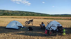
I still did not explore the road segment from Nikopol to Izgrev. The next photo I took just before Malchika where I and my daughter spent a night in the field beneath the fool moon.
The road segment I would suggest to you is the one having the least climbing. It is obvious from the next road profile chart. All the distance is up the stream of Osam River. |
|
|
|
|
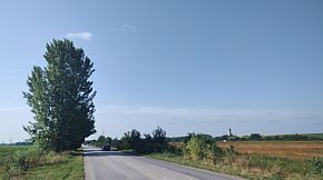
The next several photos are the countryside from Balgarene to Levski. (June '24).
|
||||
 |
 |
 |
||
 |
 |
 |
||
|
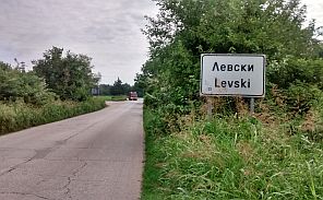
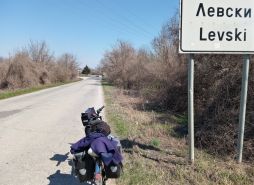
Toward Levski (overnight accommodation in it is available). Again the road is without any traffic. |
Information for Municipality of Levski and Levski: |
 |
 |
 |
 |
 |
 |
|
|
|
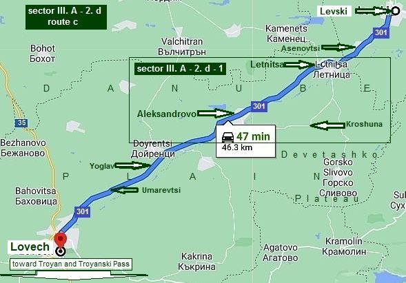 |
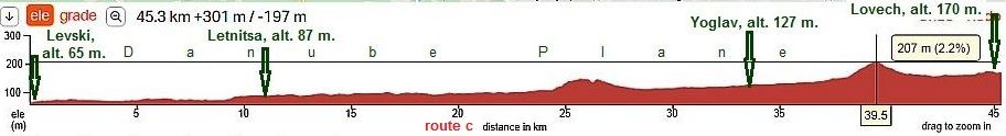
Sector III. A - 2. d Route c
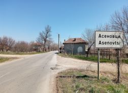
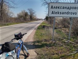
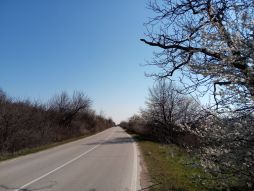
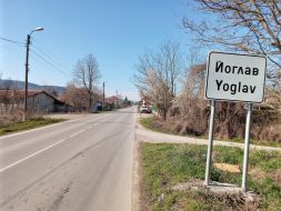
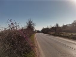
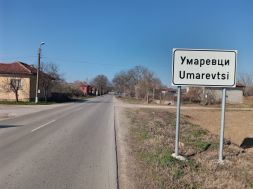
From Levski to Asenovtsi to Letnitsa to Aleksandrovo to Yoglav to Umarevtsi to Lovech. It is a typical Danube Plain area, easy and pleasant for pedalling in either direction. The road is in a very nice conditions and the traffic is minimal. Again the road is upstream of Osam River. In the villages along the road there are food shops, so supplying with food and water is not a problem.
|
 |
|
|
All the next photos were taken in the end of the beautiful end of March '22m I had the best chance to tour 9 - 10 sunny days. |
||
 |
 |
 |
|
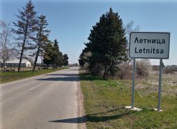
Letlnitsa is relatively bigger settlement, overnight accommodation is available in it. Information for Letnitsa |
municipality and Letnitsa: |
 |
 |
 |
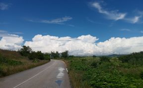
| The countryside toward Alexandrovo and Lovech. | ||
 |
 |
 |
 |
 |
 |
 |
 |
|
 |
 |
 |
 |
 |
 |
|
|
|
|
||
|
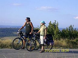
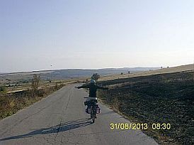
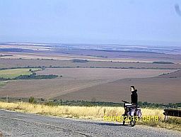
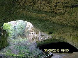
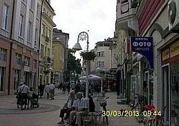
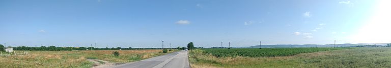
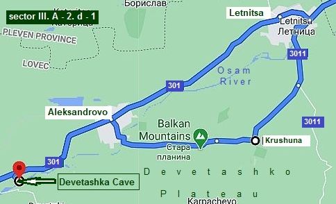
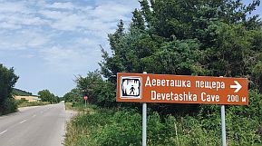
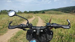
٭Opportunities in this sector Sector III. A - 2. d - 1 Now I will increase the scale in the road segment from Letnitsa to Alexandrovo. It is worth the effort to increase a little your mileage here and visit Krushuna and see waterfalls next to the village. Further along the road is Devetashka Cave – I have pointed its location on the map, along the road N301, and you should see the sign for the cave. Overnight accommodation is available in Letnitsa as well as in Kroshuna. The next 3 photos are on so called Devetashko Plateau I and Maya bicycled in the late August 2013. The last one is just over Devetashka Cave, a view to Danube Plane is great from this place. |
||
 |
 |
 |
|
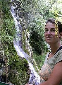
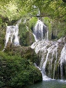
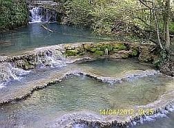
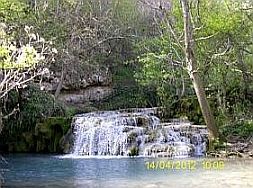
٭A. Kroshuna Waterfalls And several photos for the waterfalls next to Krushuna. |
Information about Falls and many photos of this amazing place can be seen here: |
 |
 |
 |
 |
 |
 |
|
|
||
|
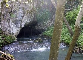
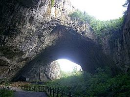
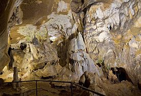
٭B. Devetashka Cave Is a magnificent one and the photos can not suggest its impressive effect as well. Scenes of some |
Hollywood movie were made in it several years ago. |
|
 |
 |
 |
 |
 |
|
Toward Lovech and my camping place near Devetashka Cave. |
||
|
|
|
|
|
|
|
|
|
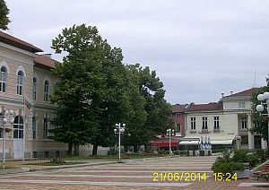
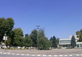
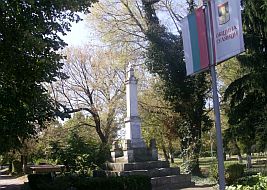
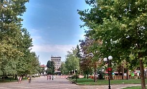
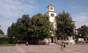
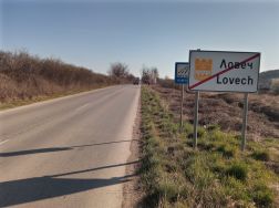
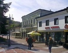
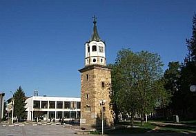
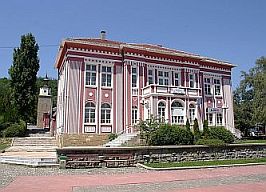
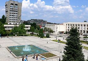
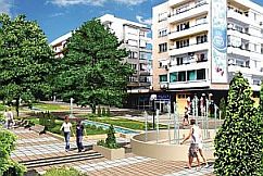
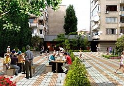
Photos from Lovech and information about it: https://en.wikipedia.org/wiki/Lovech http://www.guide-bulgaria.com/nw/lovech/lovech/lovech |
||
 |
 |
 |
|
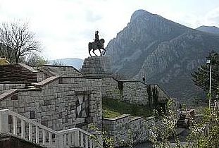
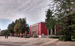
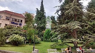
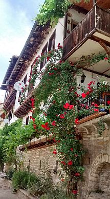
A walk to the old town "Varosha" and the mediaeval fortress remains is worth. |
||
 |
 |
 |
 |
 |
|
|
|
||
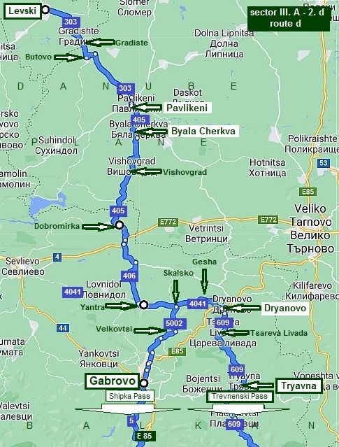
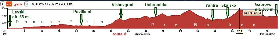
Sector III. A - 2. d
It is the route:
From Levski to Gradiste to Butovo to Pavikeni to Byala Chrkva to Vishovgrad to Dobromirka to Yantra to Skalsko: - to Gesha to Dryanovo to tryavna snd Trevnenski Pass; - to Velkovtsi to Gabrovo and Shipka Pass.
My suggestion is to choose Trevnenski Pass, as the traffic via Sipka Pass is relatively intensive although I think it is not dangerous. Thervnenski Pass is absolutely free from traffic.
A detail Information for both Passes is available in: Chapter I. Passes in Balkan - Point 7 for Shipka Pass starting from Gabrovo, and - Point 8 for Thervnenski Pass starting from Dryanovo.
|
||
|
The road profile chart from Levski to Dryanovo
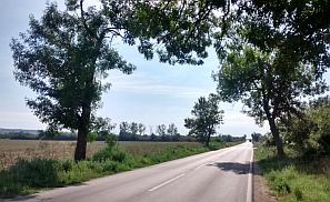
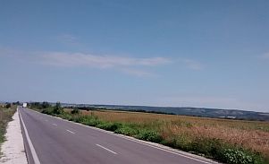
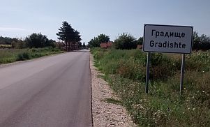
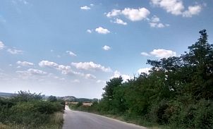
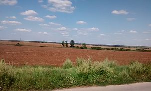
The road profile chart from Levski to Gabrovo. The next several photos illustrate the countryside from Levski to Pavlikeni - the easy part of the route in Danube Plain. |
||
 |
 |
 |
 |
 |
 |
|
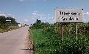
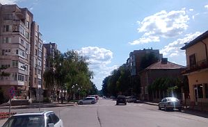
Overnight accommodation is available in Pavlikeni. Here is information for it: https://en.wikipedia.org/wiki/Pavlikeni http://www.visitbulgaria.net/en/pavlikeni/pavlikeni.html |
||
 |
 |
 |
 |
The next little town is Byala Cherkva. Very little information for it is here: http://www.guide-bulgaria.com/NC/veliko_turnovo/pavlikeni/byala_cherkva The last time I pedalled the route from Byala Cherkva to Dobromirka maybe 15 years ago, so I do not remember if food shops were available in villages there. Unfortunately I can not find photos from this area. Next several photos are taken in the area between Yantra and Dryanovo - a scenic and hilly area. |
 |
 |
 |
 |
 |
|
 |
 |
|
 |
 |
|
|
Information for Dryanovo and several photos: |
||
 |
 |
 |
 |
 |
 |
|
|
||
|
|
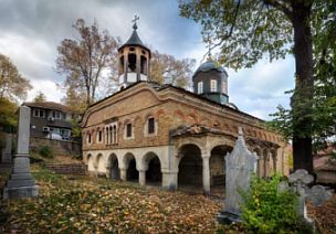
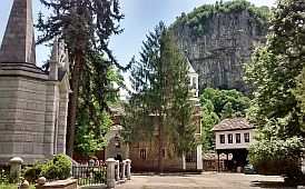
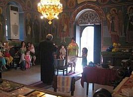
٭Opportunities in this sector. Dryanovski Monastery
A remarkable place to visit is Dryanovski Monastery and the area near the monastery. The monastery is located in Karst Valley, where 2 rivers meet. The area has different opportunities for overnight accommodations - camping ground, tourist hut, hotels. There are both restaurants & hotels near the monastery. Information for the Monastery: https://www.youtube.com/watch?v=fsZ_F5AqlcY https://bulgariatravel.org/en/dryanovo-monastery-st-archangel-michael/ https://en.wikipedia.org/wiki/Dryanovo_Monastery
|
|
 |
 |
|
 |
 |
 |
|
The rocks of the Karsts chains over the monastery are very impressive; there is a labelled track from the monastery to the hills above it (just behind the tower on the second photo above). |
||
 |
 |
 |
 |
||
|
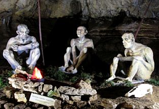
Here is an interesting cave "Bacho Kiro"- just behind my partner above: |
||
 |
 |
 |
|
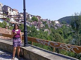
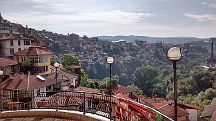
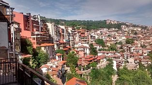
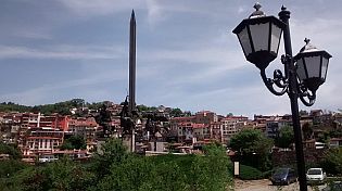
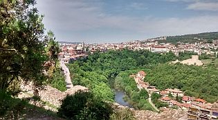
Close to Dryanovo is located Veliko Tarnovo. As a Capital of the Second Bulgarian Kingdom, it is interesting to visit it. A little history information for the Second Bulgarian Kingdom: https://en.wikipedia.org/wiki/Second_Bulgarian_Empire This touristy place is advertised in the guiding books, so I know that foreigners would like to visit it. Have in mind, this town is a cross road, so the traffic around it is quite intensive especially after Debelets, where roads N5 (E85) and road N55 are joining. Be careful if you bicycle there. It is really very dangerous road segment. Road N4 (E772) also must be avoided - it is the road between Sofia and Varna town, the traffic on it is terrible as well. |
So, if you intend to visit Veliko Tarnovo, my suggestion is to stay for overnight accommodation in Dryanovo (it is not a problem) and visit Veliko Tarnovo using a taxi. For taxi you can ask in the hotel. More information and photos for Veliko Tarnovo I will show a little further in the next item (from Nikopol to Veliko Tarnovo).
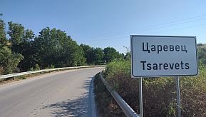
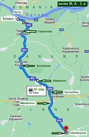
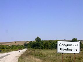
To reach it from Nikopol, it is better to pedal of first to Svistov, the route further is: From (Nikopol) Svistov to Tsarevets to Kozlovets to Alekovo to Varzulitsa to Maslarevo to Obedinenie to Resen to Samovodene to Veliko Tarnovo. Again I will say - look the next item. |
|
|
|
||
|
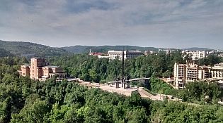
And several words for Gabrovo for bicyclists deciding to climb Shipka Pass: Gabrovo is a bigger city, it is a regional center. Overnight accommodation is not a |
problem in it. For information about Gabrovo: |
 |
 |
 |
 |
 |
 |
 |
 |
 |
|
3. Zimnicea – Svistov: ferry
|
|
Good information about this ferry can be found here: Conveniently, the map posted in the ferry site, shows the route used by the transit traffic between Romania and Turkey, meaning it is exactly the route bicyclists MUST avoid !!! (be aware the section of the route between Hainboaz and Dimitrovdrad on the site map is not correct). There is an added traffic from Polski Trambesh to the bridge near the town of Ruse. So, always avoid pedaling here, especially from Polski Trambesh to Veliko Tarnovo to Hainboaz (or Pass of the Republic - road E85) !!!
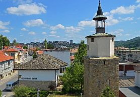
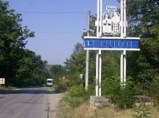
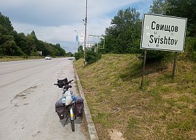
Information and photos for Svistov: https://en.wikipedia.org/wiki/Svishtov http://www.guide-bulgaria.com/NC/veliko_turnovo/svishtov/svishtov |
 |
 |
 |
 |
 |
|
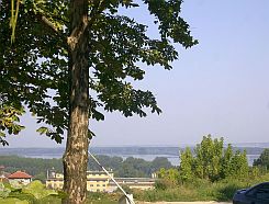
Leaving Svistov to east, of first you will see remains of the ancient Roman town NOVAE, at your right: |
|
 |
 |
 |
|
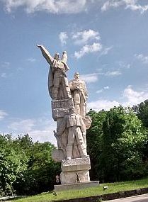
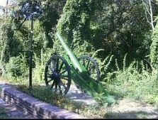
Further, at your left, is the memorial on the place Russian Army crossed Danube 1877, beginning the war |
against Ottoman Empire resulting in the establishment of the Third Bulgarian Kingdom. |
 |
 |
 |
|
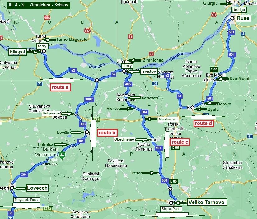
Sector III. A - 3
The first before all here is: AVOID E85 !!! So, the logic of my next description further will be as follows: |
|
Route a If you turn west to Nikopol, you can use all the routes I described in the previous point of this chapter; For the route from Svistov to Nikopol a very detail description I have shown in Chapter V. Bicycling along Danube river Sector V. E:The route from Nikopol to Svistov;
Route b It will be a new route to Lovech, for bicyclists loving hard climbing, intending to cross Balkan via Troyanski Pass; |
Route c It is a route toward Veliko Tarnovo, tourists entering in Bulgaria by the ferry Turnu Magurele - Nikopol can use it as well; (In the next point of this chapter I will give one more nice route toward Veliko Tarnovo: from Byala to Veliko Tarnovo); Route d It is a route toward Ruse, I will not write here about it, a very detail description concerning this route I have shown in: Chapter V. Bicycling along Danube river Sector V. F: The route from Svistov to Ruse. |
|
|
|
||
|
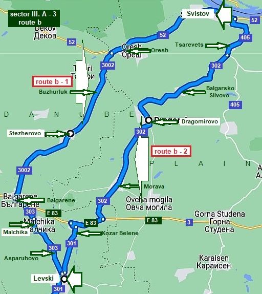
Sector III. A - 3 Route b
Here I would suggest 2 possible routes:
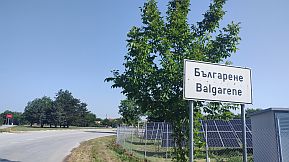
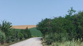
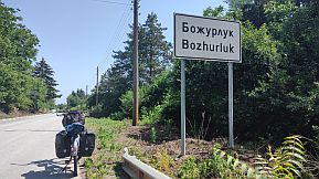
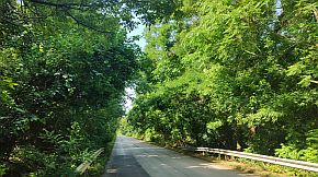
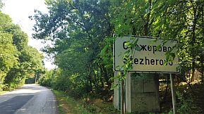
route b - 1: From Svistov (road 52) to Oresh to Bozhurluk (road 3002) to Stezherovo to Balgarene (road 303) to Malchika to Asparuhovo to Levski .
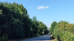
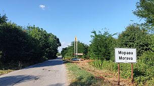
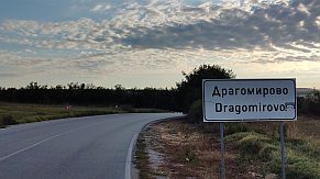
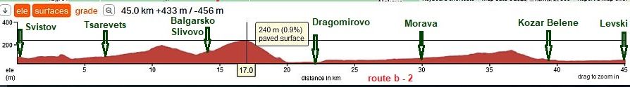
route b - 2: From Svistov (road 52 & 405) to Tsarevets to (road 302) to Dragomirovo to morava to Kozar Belene (road 301) to Levski. |
|
Route b - 1 The road from Svistov to Levski is very nice countryside, area is easy for pedaling in the both directions. No any traffic here. |
 |
 |
 |
 |
|
On the map above I point Oresh: next to the road is a Line Station - a nice place to relax; there is a water tap, very nice option for the hot summer days. |
||
 |
 |
 |
| Leaving Danube, almost 12 kilometers not hard climbing. Food shops are available in villages along the road toward Buzhurluk. | ||
 |
 |
 |
 |
 |
 |
|
Next three photos illustrate the area near Balgarene, a place I and my daughter Maya spent a nice night beneath the fool moon years ago. |
||
 |
 |
 |
|
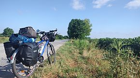
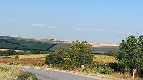
The next several photos are the countryside from Balgarene to Levski. (June '24).
|
||||
|
|
|
|
||
|
|
|
|
||
| Route b - 2 | ||
|
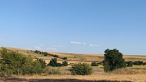
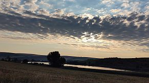
Comparing with the route b - 1, this one is in a more hilly area. I pedalled it early august '22, I can say, it was a pleasant experience. Food is available in all the villages along the road. |
A little disadvantage would be a pedalling no more than kilometers on the road E 83 next to Kozar Belene, but in this direction it is only a minute on this road. There is a train from Svistov to Levski as well. |
|
|
Photos from this area - I put in order from Levski to Svistov. |
||
 |
 |
 |
 |
 |
 |
 |
 |
 |
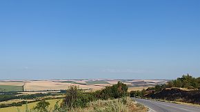
| The next photo in the middle is a typical view from Danube Plain. | ||
 |
 |
 |
|
The route from Levsti toward Lovech is given in the previous item. |
 |
Sector III. A - 3
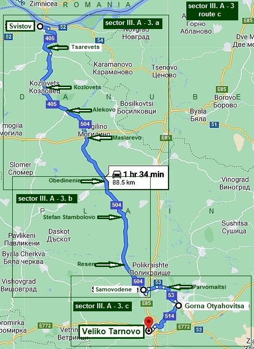
Route c From Svistov to Veliko Tarnovo
I know that many tourist wish to visit Veliko Tarnovo. So, the next description is devoted to Veliko Tarnovo. Another route toward Veloko Tarnovo I will give in the next point of this chapter as well (from Ruse).
As a Capital of the second Bulgarian Kingdom, Veliko Tarnovo is a touristy destination. Veliko Tarnovo is a popular destination among the tourists visiting Bulgaria.
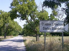
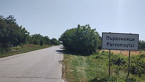
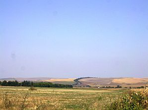
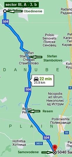
The route is: From Svistov to Tsarevets to Kozlovets to Alekovo to Maslarevo to Obedinenie to stefan Stambolovo to Resen to Samovodene to Parvomaitsi to Gorna Oryahoviysa to Veliko Tarnovo.
This road segment is entirely on the Danube Plane. The area consists of rolling hills covered with sunflowers and wheat. There are a lot of villages in the area where food and water can be found out. Hills are not steep and about 2 - 3 kilometers long. August 2015 I pedaled this route together with my daughter in the reverse direction, we had a great time together.
For better and more detail description I will split this road segment in three sections. |
|
Sector III. A - 3. a From Svistov to Obedinenie |
|
|
|
|
|
|
|
|
|
|
|
|
|
|
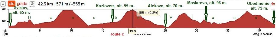
The road profile chart shows the typical lay of the Danube Plane. |
||
 |
||
|
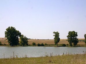
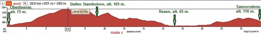
Sector III. A - 3. b
From Obedinenie to Samovodene
Here are the next 40 beautiful kilometers toward Veliko Tarnovo. The road conditions are not the best. There was minimal traffic and pedaling is a real pleasure.
Photos are from the end of August 2015. My daughter and I spent several very nice days exploring this area.
The road profile chart shows again the typical lay of the Danube Plane. |
 |
 |
|
 |
|
More photos of this beautiful countryside. |
||
|
|
 |
 |
 |
 |
|
|
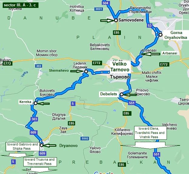
Sector III. A - 3. c
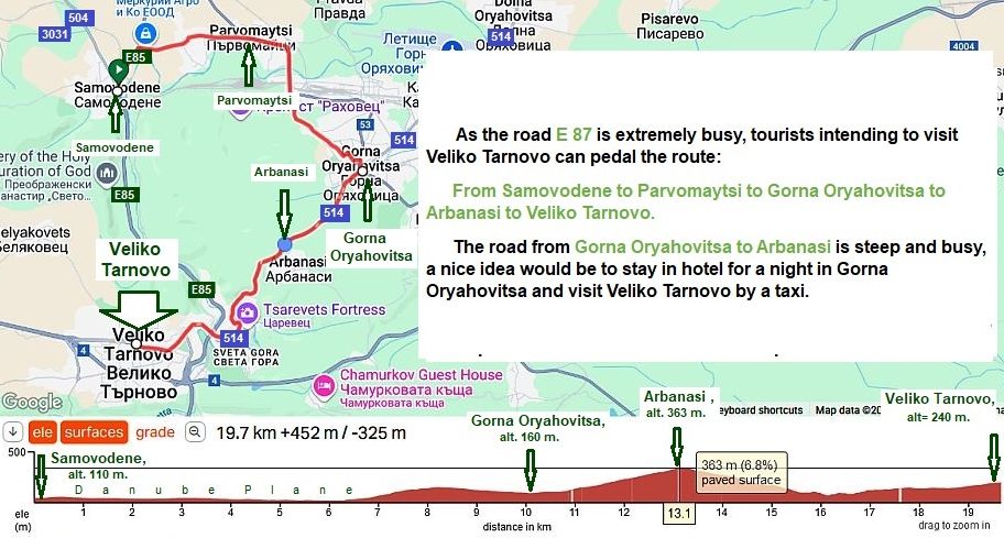
This Map is important. Here is shown a way to avoid one of the most dangerous roads in BG E 85 and E 772. In Samovodene, turn a little back (E85) and find the road toward Gorna Oryahovitsa and Arbanasi.
The next map shows better the same area.
|
||
|
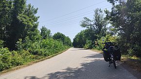
Toward Parvomaytsi and Gorna Oryahovitsa. |
 |
 |
 |
|
Gorna Oryahovitsa is a big railway center. The lines crosses Bulgaria from east to east and from north to south. Overnight accommodation is available here. Information is here: http://www.guide-bulgaria.com/NC/veliko_turnovo/gorna_oryahovitsa/gorna_oryahovitsa |
||
 |
 |
 |
|
I climbed the mountain toward Arbanasi, but I can not find photos from this area. Arbanasi (5-6 kilometers north from Veliko Tarnovo) is also a touristy area, it is connected with Bulgarian history. https://en.wikipedia.org/wiki/Arbanasi,_Bulgaria https://bulgariatravel.org/en/the-arbanasi-archeological-reserve/ |
When you are in Arbanasi, a great view toward Veliko Tarnovo and the Balkans will reveal in front of you. Several photos of Arbanasi. A great view is available from Arbanasi toward Veliko Tarnovo and Balkan. |
 |
 |
 |
|
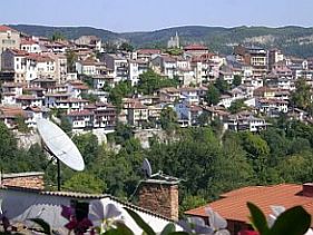
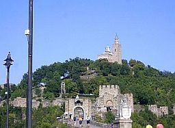
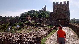
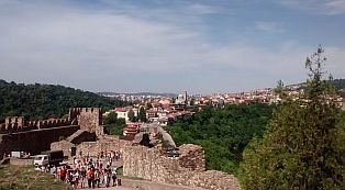
As a Capital of the Second Bulgarian Kingdom, Veliko Tarnovo is very popular destination among tourists. A lot of information, including overnight accommodation about Veliko Tarnovo can be found here: https://en.wikipedia.org/wiki/Veliko_Tarnovo http://www.velikoturnovo.info/en/ https://bulgariatravel.org/en/veliko-tarnovo/
Information about the second Bulgarian Kingdom can be found here: https://en.wikipedia.org/wiki/Second_Bulgarian_Empire There are a lot of monasteries in the region near Veliko Tarnovo. Here are several links supplying information about them: http://www.bulgarianmonastery.com/en/region/veliko_tarnovo_monasteries.html |
||
 |
 |
 |
 |
||
 |
 |
 |
 |
 |
 |
 |
 |
 |
 |
 |
 |
 |
 |
 |
 |
 |
 |
 |
||
 |
|
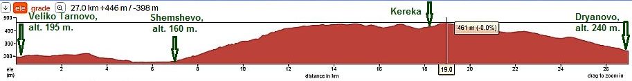
If you choose to cross Balkan Mountains via Shipka Pass or Trevnenski Pass, follow the road toward Dryanovo: From Veliko Tarnovo to Shemshevo to Kereka to Dryanovo.
I have not photos to illustrate this route. For information about the route from Dryanovo to Gabrovo, look back - Sector III. A - 2. d of the same chapter. |
|
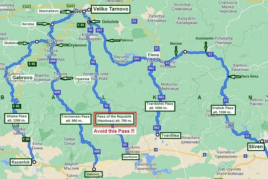
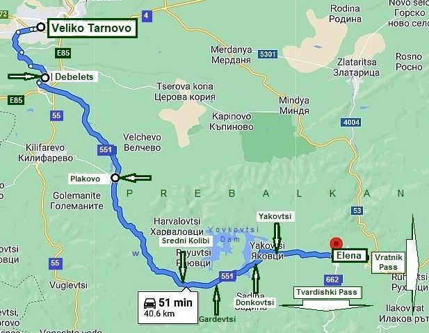
The next map shows ways to cross Balkan starting from Veliko Tarnovo: - Shipka Pass (alt. 1200 m.): follow the toad I trace on the map above to avoid as much as possible road E 85; - Trevnenski Pass (alt. 960 m.), road 609: I do recommend it, very pleasant and scenic route; |
- Pass of the Republik (Hainboaz - road 55): definitely avoid it, extremely dangerous road; - Tvardishki Pass (alt. 1050 m.), roads 551 and 662, I do recommend it, very pleasant and scenic route; - Vratnik Pass (alt. 1100 m.), roads 551 and 53, I do recommend it, very pleasant and scenic route; |
 |
|
|
The route from Veliko Tarnovo to Elena (road 551)
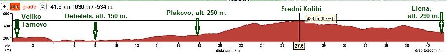
I will finish this Chapter with the route from: From Veliko Tarnovo to Debelets to Plakovo to Sredni Kolibi to Gardevtsi to Donkovtsi to Yakovtsi to Elena (road 551). I do recommend this route; the road is in very nice condition. You will not find much traffic here. CONSIDER AVOIDING ROAD E85 because it is a very busy road !!!
|
|
|
|
It is a extreme beautiful area. The road is only one lane. But the pedaling here is safe because there is hardly any traffic. |
I did not pedaled the road segment from Debelets to Plakovo; the first three photos below are from Kilifarevo to Plakovo. |
.jpg) |
.jpg) |
.jpg) |
|
Food is available in Plakovo. Supply with water here, the next water spring is not so close, and almost 10 km up the hill are to it. |
Avoid drinking the water from the spring. It doesn't taste good at all. Fortunately, all the distance up the mountain is wooded. You will pedal in the shade. |
|
|
|
|
.jpg) |
.JPG) |
.JPG) |
|
On the highest point of the route is located Sredni Kolibi. I do not remember if food and coffee places are available in Sredni Kolibi, or in the next villages along the |
road. If my memory serves, a guest house was available somewhere in the region too. |
.jpg) |
.jpg) |
.jpg) |
|
Plan a stop near Iovkovtsi Dam. There is easy access to it (just before Yakovtsi). Summer time the water is perfect |
to refresh. The place is perfect for camp in the wilderness. Next to Yakovtsi there is a little hotel & restaurant. |
.jpg) |
.jpg) |
.jpg) |
.jpg) |
.jpg) |
.jpg) |
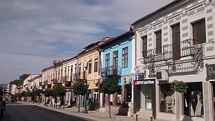
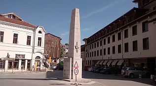
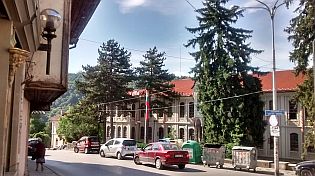
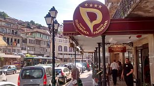
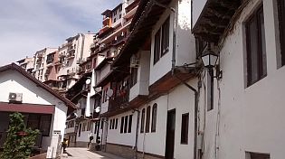
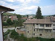
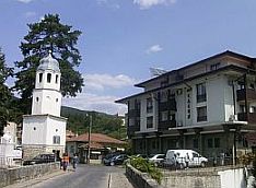
| Elena is a touristy spot, architecture of XIX century is saved. There are overnight accommodation and nice restaurants in the town. |
Information of Elena can be seen here: https://www.visitbulgaria.net/en/elena/elena.html https://bulgariatravel.org/en/town-of-elena/ Several photos from Elena: |
 |
 |
 |
 |
 |
 |
 |
 |
 |
 |
 |
 |
|
|


.jpg)
.jpg)
.jpg)