I. BALKAN PASSES

Sector I. A


Sector I. A

The routes in the sector I. A  are as follows:

      1. Petrohan Pass:

      2. Iskar River Gorge:

      3. Vitinia Pass (and 3.A Botevgradski Pass):

      4. Zlatishki Pass:

      5. Troyanski Pass (Beklemeto):

From Montana to Berkovitsa to Kostinbrod to Sofia (Road 81);

From Sofia to Svoge to Mezdra to Roman to Cherven Bryag (Road 16);

From Yablanitsa (and Roman) to Botevgrad to Sofia (Road 1); 

From Yablantsa (from Roman) to Etropole to Zlatitsa (Road 37);

From Lovech to Troyan to Karnare (Road 35).


1. Petrohan Pass

(road 81)


      Petrohan Pass is the west most pass in the Balkan mountains. Here is the road connecting Montana (alt. 150 m.) and Sofia (alt. 550 m.), it is approx. 110 km. The road is marked on the map as the N81, in the moment it is in very nice condition.


      Petrohan Pass is one of the highest Balkan passes. The highest pass point has an altitude of 1410 meters and it is approximately in the middle of the road from Sofia to Montana (45 km south from Montana). The water found in the springs of this mountain region is drinkable.


       Except the late Friday's & Sunday's afternoons when people leave Sofia for the weekend and go back in Sofia after their weekend traffic will not be an issue.

      Petrohan Pass MUST BE AVOIDED winter time. A nice time to explore  this area is May through the middle of October. I suggest you always check the weather forecast before exploring this area. It would be nice to have a winter equipment crossing the Mountain here as well.


      In the winter months Petrohan Pass MUST BE AVOIDED. A nice time to explore  this area is May through the middle of October. I suggest you always check the weather forecast before exploring this area. As a precaution, always be prepared for foul weather.


      Trust me, the route is much easier pedalling  south to north (from Sofia to Montana). Many times I have pedalled this Pass.  It takes me 6 hours  to pedal from Sofia to Montana and 10 - 12 hours  to pedal from Montana to Sofia.


      Look also the chapter:

      X.  How to enter/leave Sofia by bicycle


A. From Montana to Berkovitsa to Barzia and the top of the Pass:

Overnight accommodation in Montana is not a problem; information for Montana and several photos:

http://www.visitbulgaria.net/en/montana/montana.html                    https://en.wikipedia.org/wiki/Montana,_Bulgaria

       The next several photos illustrate the road from Montana toward Berkovitsa. The road is pleasant for   pedalling at all, the road slope toward Berkovitsa is not steep - the altitude gain is almost 100 m. per each 10 km.


Sector I. A - 1.a

Route a


Starting from Montana (altitude 150 meters) to the south it follows Berkovitsa and Barzia.


      Just after Barzia the actual ascent of the Pass begins. The distance Barzia to the highest Pass point (where a little restaurant can be found) is approximately 18 km. The slope is a constant  6 - 7% as seen in the photos below. There are fountains with nice cool mountain water along the road. Seven to eight kilometers after Barzia there is a spring of water and little restaurant.

Never mind the nice beech forest and shade between Barzia and the Pass top, the climbing from north to south is relatively hard – the vertical displacement (beginning from Montana town) is almost 1300 meters (to this climbing it must be added an additional climbing in the south Pass side as it can be seen from the south side path profile picture - the map below (sector I. A - 1. b). The road here is wide enough and comfortable for bicycling.

      Only strong and fit bicyclists, who love to climb long distances, should attempt to climbing this Pass from north to south. The north side of the Pass (in the mountain after Barzia to the top of the pass) is not convenient for wild camping. But, the ride is very picturesque with its cool old beech forest.

      Overnight accommodation in Berkovitsa is possible, entering in it you will see a lot of signs pointing small


hotels and guest houses; information for Berkovitsa and several photos:

 http://www.visitbulgaria.net/en/berkovitsa/berkovitsa.html

      You can miss Berkovitsa, pedalling up toward Barzia and the Pass. Two - three kilometers to Barzia the road   is already steep; the slope is 7 - 8 % and it is permanent to the Pass.

      Seven - eight kilometers after Barzia there is a spring of water and little restaurant.

  The next photos are the road toward the top off the Pass.

      On the top you will see a little reservoir - equalizer collecting water driving 3 water power plants down to north; there is very nice little restaurant offering very


tasty meals as well. A hotel on the Pass is available, there is a sign toward it (next I will point its location on the map: Sector I. A - 1.b, Route b).

Sector I. A - 1. a

Route b

      To avoid the traffic follow route b, from Berkovitsa toward huts in Balkan just below Kom Pick.


Several words concerning this place can be seen here:

https://en.wikipedia.org/wiki/Kom_Peak

      There are 2 huts - and old and a new one. In the early April 2017 I tried to explore this route in the back direction.

        Just on the Pass and a little further the road is signed well.

      Unfortunately further the road is not signed, so I lost it and after several hours walking down the mountain tightening bike brakes along very broken and steep off road used by wood cutters and spending a night in my tent in the mountain, next morning I  was down in Barzia.


      The bike was with a flat tire and 2 broken spokes. Never mind, I spent very nice time in the mountain. My intension is to repeat this attempt, let we see when it will happen.

      I believe in the back direction there will be not any problem to be on the right road.


       ٭An opportunity


      Here I will mention an opportunity for bicyclists having time; they can visit the Klisyrski Monastery the road (812) toward it either from Berkovitsa or Barzia is signed well), overnight  accommodation is possible there, there is a restaurant as well.

http://www.bulgariamonasteries.

com/en/klisura_monastery.html


Sector I. A - 1. b


B. From Sofia (Kostinbrod) toward

Gintsi and the Pass top:


      Climbing of the mountain from its south side begins immediately after Kostinbrod. There are several narrow road segments as well as 2 - 3 very short road segments having a slope of 12%, but climbing the Pass from Sofia (alt. 550 m.) is relatively easy. The south mountain side exposes excellent views of the Sofia field and Vitosha Mountain.

      As a conclusion I would say that bicyclists loving mountain bicycling will be satisfied exploring this area. There are nice place to camp in the wilderness from this side of the Pass. There are springs of fresh water as well.


      On the road profile chart below I have shown the altitudes of some specific points showing the road profile.


      (The South Pass side has more complicated road profile which makes it harder Pass pedaling in the direction Montana - Sofia).


      To avoid the traffic several kilometers, in the end of this point I will add 2 opportunities - it is especially comfortable when you are climbing the Pass.

      The several next photos are taken from the south side of Petrohan Pass, from Sofia toward Kostinbrod.

        Leaving Sofia, the road toward Kostinbrod is wide in the flat area of Sofia Field.

       The ascending stars immediately after Kostinbrod. Looking back you will see very nice view toward the fields of Sofia and Vitosha Mountain.


      The view is especially impressive in the spring, when Vitosha Mountain is still covered with snow.

      Restaurants can be found in Kostinbrod, Buchin Pass (the crossroad toward Godech - road 164), Gintsi, and on the top of the Pass.

      Wonderful opportunities in this area are both routes: 

- from Buchin Pass to Iskrets to Svidnya to Svoge, down


 to Iskar River Gorge (to right on the map - road 164);

      - from Buchin Pass to Godech to Dragoman to Sofia (to left) on the map above - road 813).

      The next several pictures are in the region of Buchin Pass.

Toward Gintsi

Food and overnight in Gintsi can be found.

      The road after Gintsi to the highest point of the Pass (9 - 10 km) is a little bit steeper.


or . . . maybe not . . . maybe simply I am already tired . . .

                         :)))))))))))))))))))))))))))))))


 ٭Opportunities


    Sector I. A - 1.b - 1


      To avoid the traffic several kilometers, at Beledie Han is possible to leave road 81 and climb several kilometers along the old road. It is not signed as well as it is a little hard to recognise it, here GPS device would work.

       Up the mountain this opportunity is nice, especially in hot afternoons - road 81 is very sunny place just here.


      On the Map in left I see a hut, I do not know anything about it.


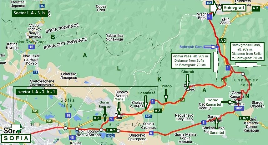
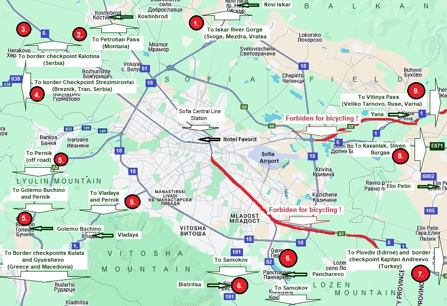
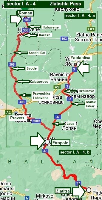
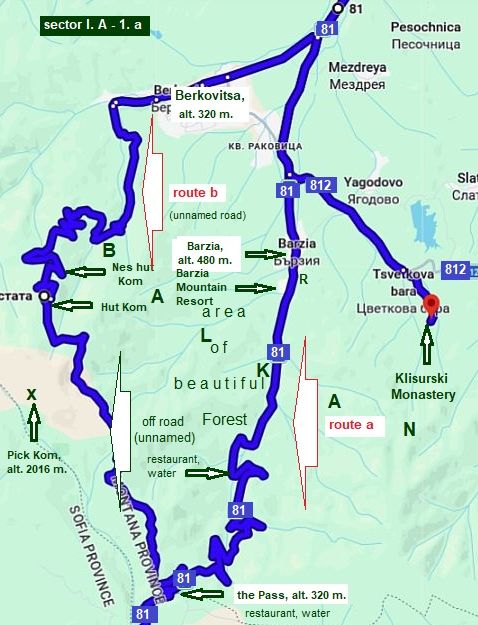
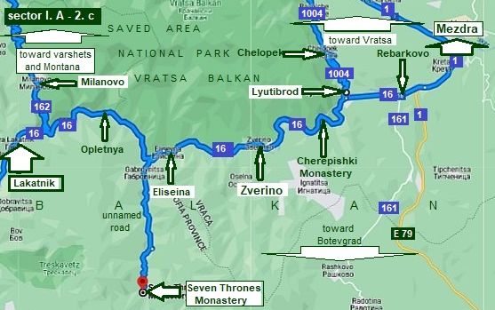
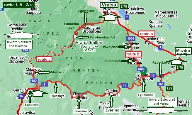
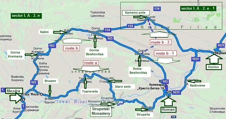
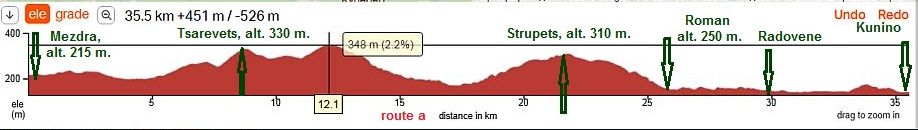
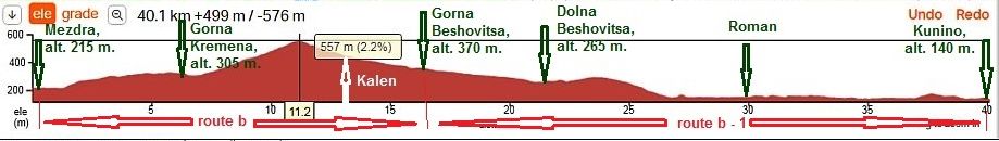
Sector I. A - 1. b - 2       


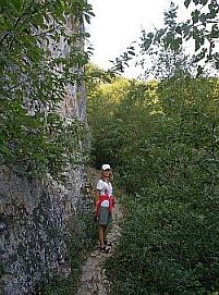
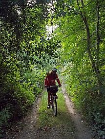
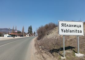
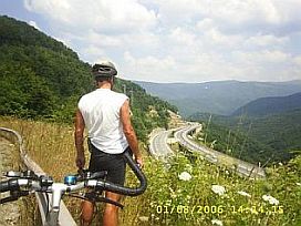
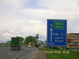
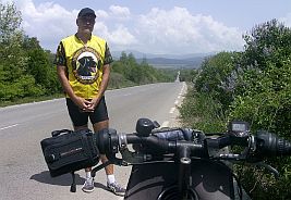
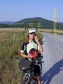
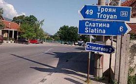
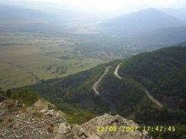
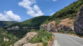
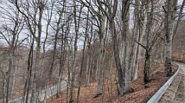
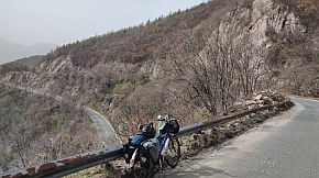
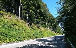
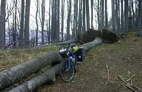
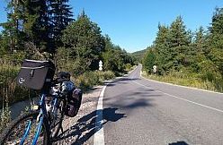
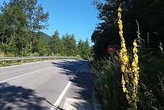
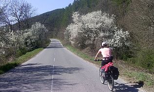
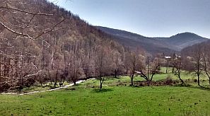
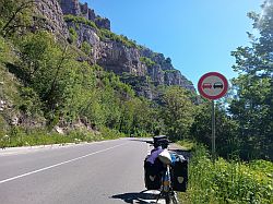
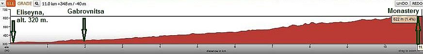
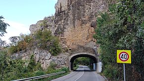
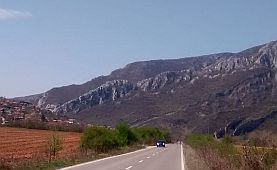
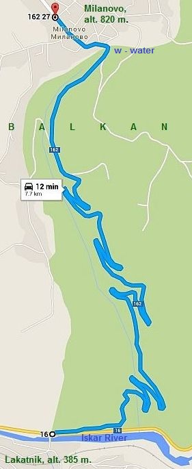
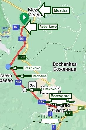
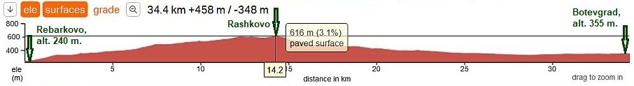
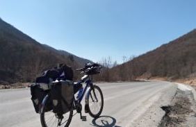
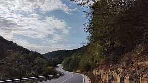
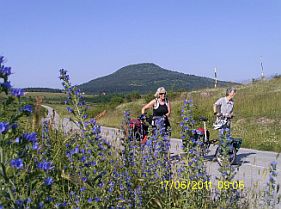
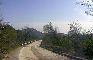
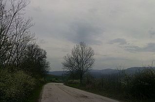
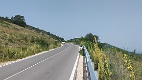
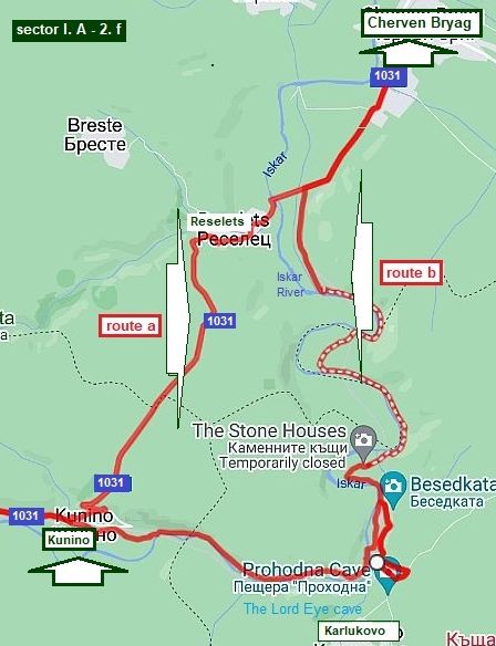
      Bicyclists climbing the Pass from Sofia to north who wish to avoid the traffic and love off road bicycling, I recommend route b, along so called "History Road".


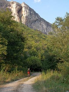
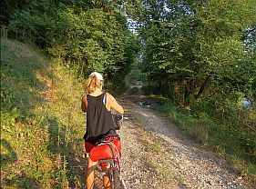
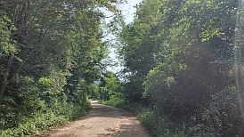
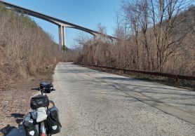
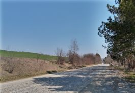
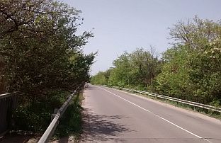
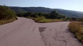
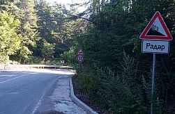
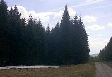
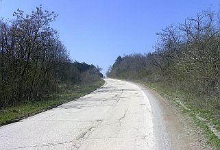
      Be aware, over the first 2 - 3 km, pedalling is not possible. The road is steeper and rocky.


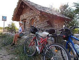
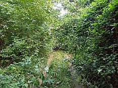
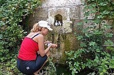
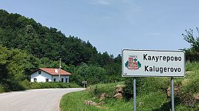
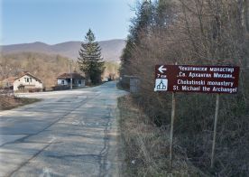
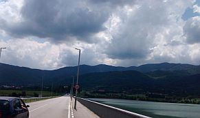
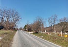
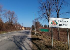
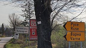
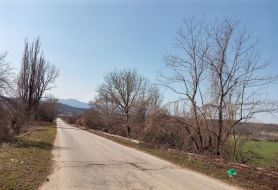
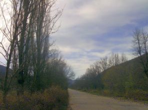
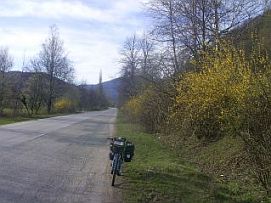
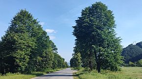
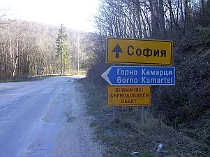
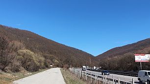
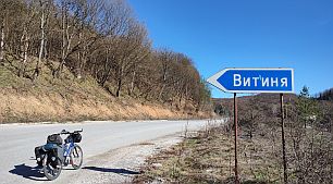
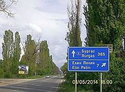
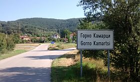
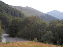
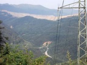
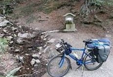
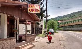
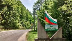
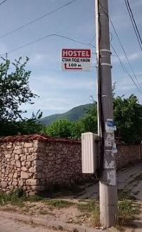
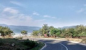
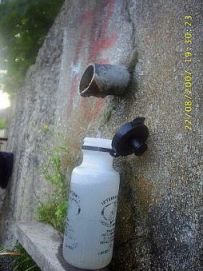
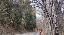
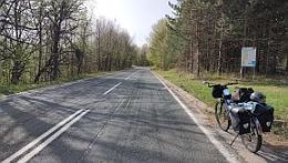
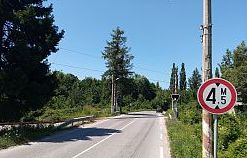
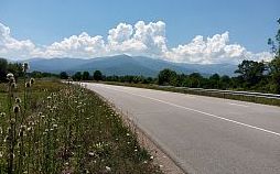
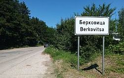
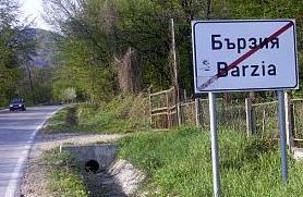
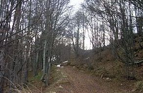
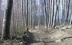
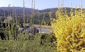
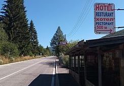
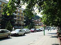
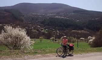
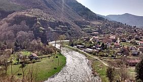
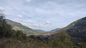
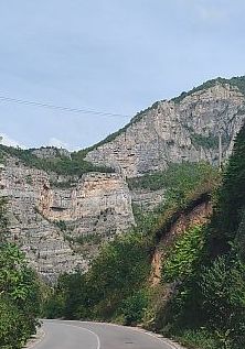
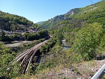
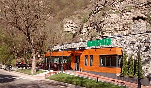
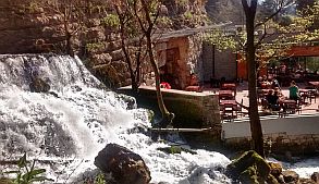
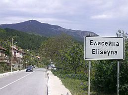
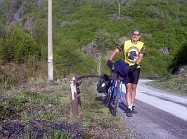
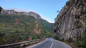
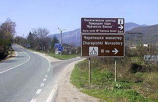
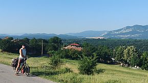
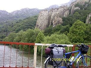
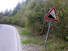
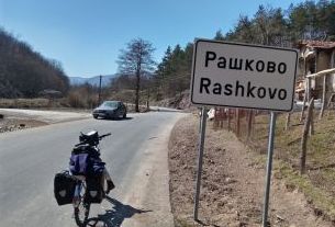
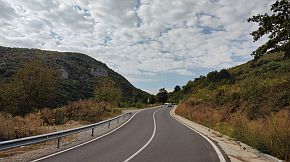
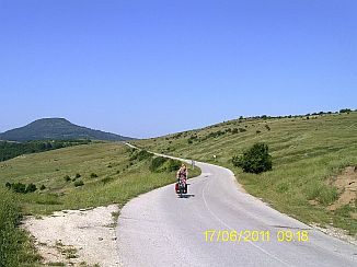
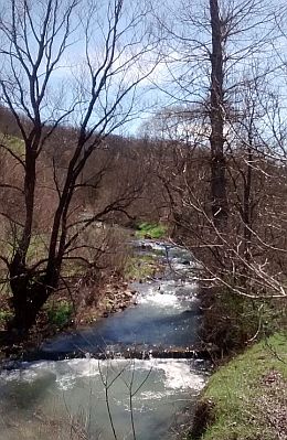
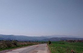
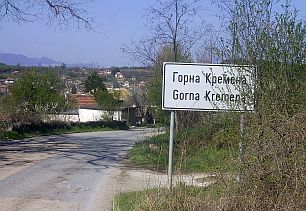
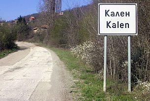
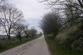
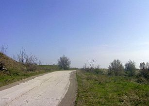
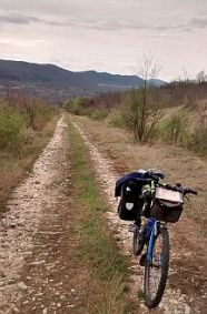
     Taking the road toward Brakyovtsi, on your left you will see a nice spring of fresh 
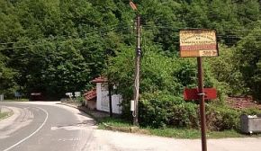
water, just after it take the road in left. It is pointed by a brown sign. 
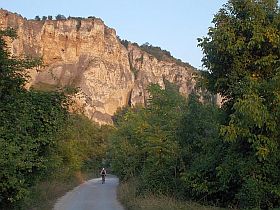
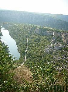
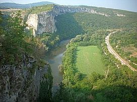
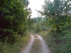
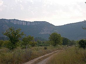
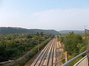
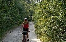
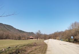
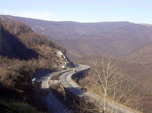
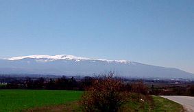
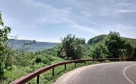
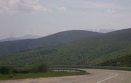
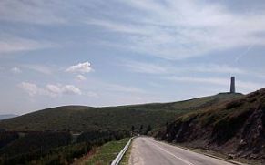
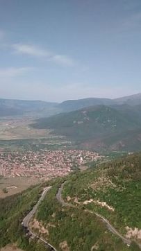
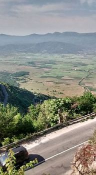
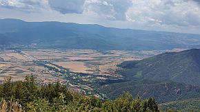
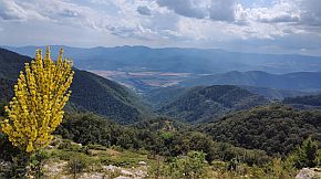
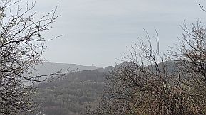
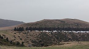
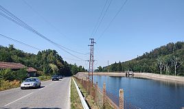
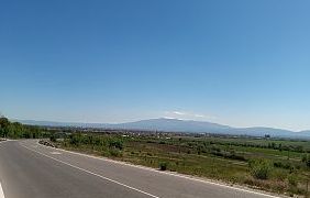
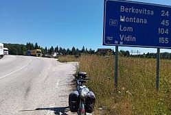
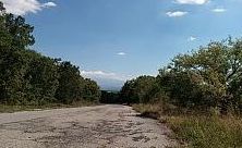
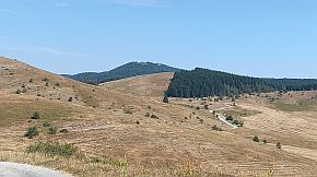
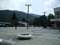
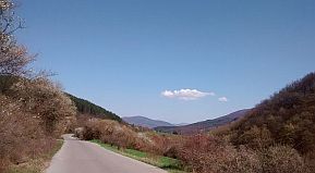
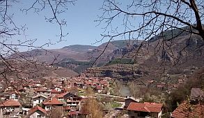
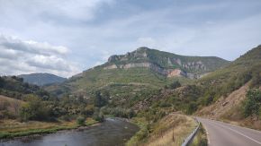
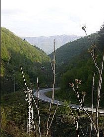
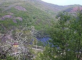
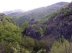
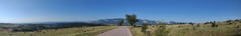
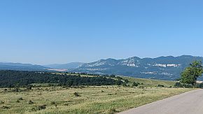
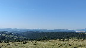
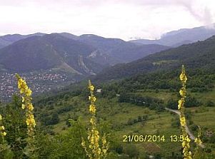
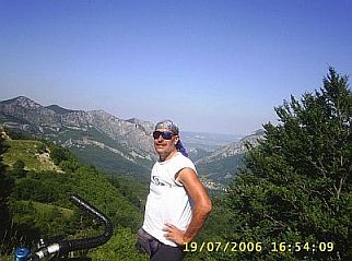
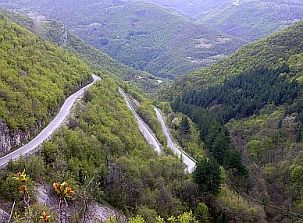
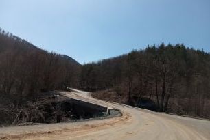
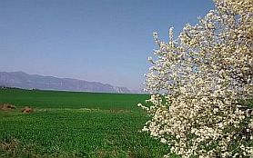
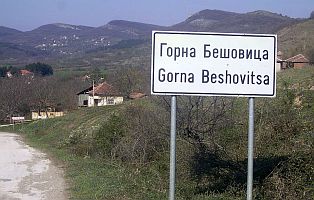
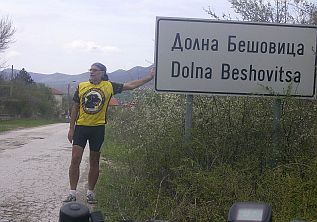
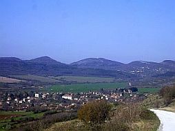
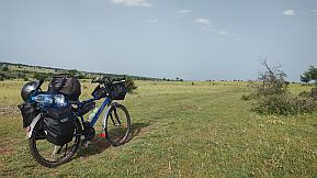
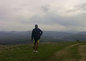
After you can not be wrong. The road will take you on the highest 
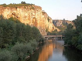
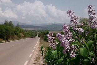
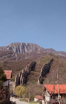
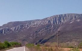
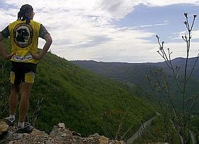
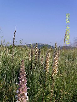
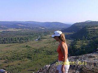
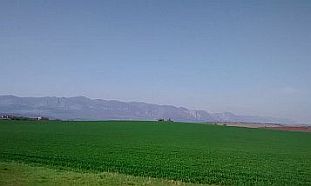
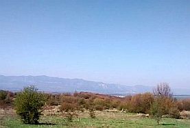
point of the Pass. Once reaching the open area high in the mountain, you will enjoy of a beautiful view in each direction.


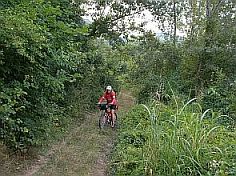
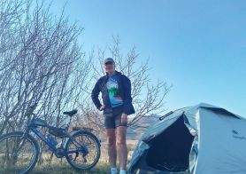
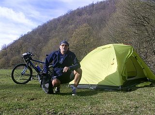
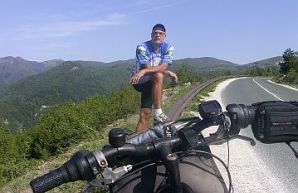
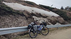
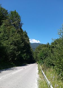
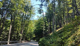
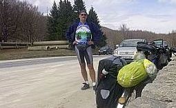
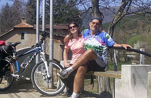
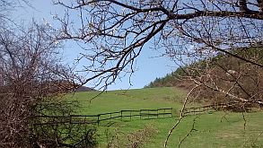
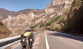
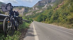
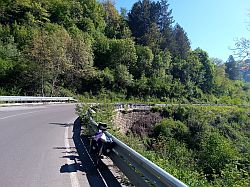
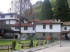
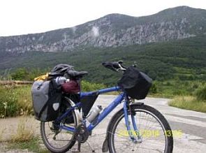
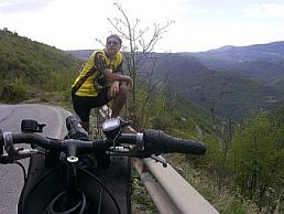
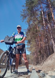
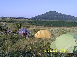
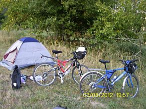
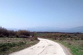
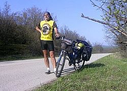
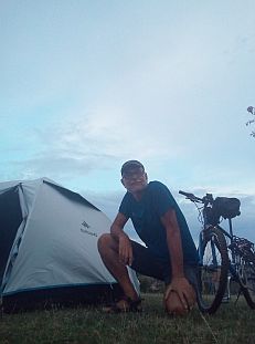
      Be careful of stray dogs in this area. Have a spray against dogs. The next photos are taken in the middle of
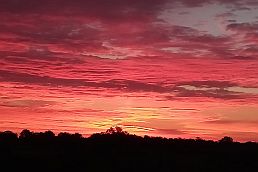
 April 2017.


2. Iskar River Gorge

(road 16)

      The Iskar River Gorge is one of my favorite destinations for bicycling I love to pedal it at least once a summer. On the map the road connecting Sofia and Mezdra is signed as the N16 (it is just after renovation, it is in very nice condition).

      I will expand my description from Mezdra to Cherven Bryag, where the river is leaving Balkan and its canyon is not so deep, but this area is very scenic, there are a lot of places worth seeing as well.

      The Iskar River Gorge is a marvellous place and is easy bicycling in both directions; the hills here are not


long and not hard to climb, sightseeing are excellent. Any time the opportunity exists, always explore Iskar River Gorge. You definitely will not be disappointed. Again, along the road there is a train line, if a reason appears, you can use it to move further.

       Iskar River is the longest river in Bulgaria. A lot of information about the Iskar River Gorge is available in the Net:

https://en.wikipedia.org/wiki/Iskar_(river)

https://www.bg-guide.org/en/destinations/the-gorge-of-the-river-iskar

https://bulguides.com/iskar-gorge/

For a better convenience I will part the Gorge into six sectors:

- sector I. A - 2. a:   From Sofia to Svoge;

- sector I. A - 2. b:   From Svoge to Lakatnik;

- sector I. A - 2. c:   From Lakatnik to Mezdra;


- sector I. A - 2. d:   From Vratsa to Lyutibrod (as well as from Vratsa to

                                   Lakatnik - crossing the Saved Area Vratsa Balkan);

- sector I. A - 2. e:    From Mezdra to Roman to Kunino;

- sector I. A - 2. f:     From Kunino to Cherven Bryag;


Sector I. A - 2. a

From Sofia to Svoge

(road 16)


      The distance between Sofia and Svoge is approx 40 kilometers.


      The leaving / entering in Sofia is a tedious work, for detail information please look into:

       Chapter X.    

        How to enter/leave Sofia by bicycle


      As it can be seen from the road profile chart the area is not hard for pedalling in both direction.


      Have in mind that the traffic here can be more intensive in the weekend ends when people are going back to Sofia, I would not say it is dangerous, the road here is with many sharp turns and car's velocity is not high.


      Never mind that I even do not know how many times I pedalled this distance, I have not photos of this road segment ... AMAZING ... I hope I will correct it very soon.


      Leaving Novi Iskar, you will enter in the Gorge. All the distance from Sofia to Svoge is not nice for camp on the wilderness.

      There are a lot of small villages along the river, with small food shops, and restaurants. Hotels are available in 


Svoge. Information for Svoge and 3 photos from the town: http://www.guide-bulgaria.com/SW/sofia/svoge


      On the map above I have shown a route from Rebrovo to Batulia . . . toward Botevgrad. More information for this opportunity can be seen in the


Chapter VI. Crossing Bulgaria from west to east. Routes:

B. From Sofia to Varna , Route c - crossing Balkan,  Sector VI. 2 - A. 3 and Sector VI. 2 - A. 3. a;


 ٭An opportunitiy

The next several photos are taken between Svoge and Buchin Pass.

Information and photos for the distance from Buchin Pass to Kostinbrod to Sofia can be seen in the same chapter, Point 1. Petrohan Pass,  B. From Sofia (Kostinbrod)


Sector I. A - 2. b

From Svoge to Lakatnik

      According to me it is the most scenic road segment. The distance here is almost 20 kilometers, after Svoge there is almost no any traffic. The canyon here is getting narrow and deep. Approaching Tserovo, you will enjoy of the first magic sightseeing, unfortunately abilities of both my camera and me can not represents it. Here can be found nice places to set up a tent near the river.

Especially impressive are rocks near Lakatnik:     

https://pateshestvia.net/en/lakatnik-rocks-climbers-bulgaria/

More pictures of this beautiful area in different seasons.

Approaching Lakatnik, next to the road just below the rocks you will see a nice little renovated restaurant next to a river coming from a cave above the restaurant - a perfect place for relax.


Sector I. A - 2. c


From Lakatnik to Mezdra


      Again, it is very impressive road segment. Have only in mind that  the road segment between Mezdra and Rebarkovo: two - three kilometers - the crossroad of road 16 with 1 (E79) has very intensive traffic.  Be careful riding in this area. The road here is in a renovation and soon pedaling here will be save.


      Next several photos are area from Lakatnik to Eliseyna.

Just before Eliseina is the first tunnel you will see. The tunnel is not dangerous, it is bright and not long.


     ٭An opportunity here is to visit a Monastery "Sedemte Prestola" ("The  Seven  Altars" is an ancient monastery from X - XI century) - approx 11 km. from Eliseyna,


the road is well signed (the entire area is very scenic, the pedaling up to the Monastery is not hard):


https://en.wikipedia.org/wiki/Seven_Altars_Monastery

Road toward the Monastery

      Overnight accommodation for unpretentious bicyclists is available in the Monastery "Sedemte Prestola", but you must bring food with you.

  Restaurant and shop are not available there.  You may supply food in Eliseyna, if you decide to stay there for a night.


OK, we go further. Next several photos are area between Eliseina and Zverino.

      Very little information for Zverino is available here:

http://www.guide-bulgaria.com/nw/vratsa/mezdra/zverino

      Next to the road there is a little hotel; in the village there is a big vacancy complex (a camping is available there as well):

https://www.facebook.com/OasisZverino/

      I think it is at work from the middle of June to the


beginning of September.

      Next several kilometers are the next amazing place in Iskar River Gorge: Cherepishki Monastery and rocks near it. Information for the monastery:

http://www.bulgariamonasteries.com/en/cherepish_monastery.html

      The Monastery is not visible from the road, but the place is labeled very well.

      Soon you will enter in the zone of the Cherepish Rocks. There are 3 or 4 short tunnels, it is not dangerous to pedal in it. The place is magical.

https://www.youtube.com/watch?v=R3Q548xYuuI

Interesting rock formation are available above Lyutibrod as well.

https://bulgariatravel.org/en/ritlite-natural-landmark/

      As I have pointed on the map above, at Rebarkovo you will be on the main road E79. If you pedal toward Vratsa, you can avoid it heading toward Chelopek (more details - in the next point).


      Just before enter in Mezdra near road there is a hotel & swimming pool - it is pointed in the next map (unfortunately the water in it is not thermal, never mind, the place is nice).

      Soon you will be in Mezdra. Overnight accommodation is available in it. Information for it:

http://www.guide-bulgaria.com/nw/vratsa/mezdra/mezdra


Sector I. A - 2. d:


From Lyutibrod to Vratsa  (as well as from Lakatnik and Mezdra to Vratsa)


      Here are shown the three approaches to Vratsa in this sector:

- route a:

From Mezdra to Vratsa;


- route b:

From Lyuti Brod to Chelopeck to Pavolche to Vratsa;


- route c:

From Lakatnik to Milanovo to Parshevitsa Hut to Zgorigrad to Vratsa.


Route a

From Mezdra to Vratsa


      Although the road 1 is very busy, I think pedalling here is not dangerous, it is 2 strips in each direction. Never mind, pedalling here is not pleasant, especially from, Mezdra toward Vratsa. In the back direction, descending allows a high speed, so the time for this distance is very short.

        I have not photos from this area.


      As it can be seen from the road profile charts, the climbing of the route a is the least comparing with routes I will give next.

Route b

      As I have mentioned above, the road segment from Mezdra to Rebarkovo (to the crossroad of roads E79  & road N16 - almost 3 km) is narrow and very dangerous with intensive traffic, it would be much better to avoid it ! Here is a good alternative route:


      From Lyutibrod to Chelopek to Pavolche to Vratsa (road 1004).

      The climb is a little more, but the road is without any traffic and the scenery is beautiful as it can be seen from the 3 photos below the road profile chart.

Route c


      As a last opportunity intended for fans of mountain & off-road bicycling, I would recommend:

      From Lakatnik to Milanovo to Parshevitsa Hut to Zgorigrad to Vratsa.

      The route is in an area of the National Reserve:

https://bulgariatravel.org/the-vratsa-balkan-

nature-reserve/


      Road 162 can be used to reach Varshets abd Montana, roe that please look in:

Chapter II. Routes:

A. Routes in the North - West Region of the Country

      The most scenic place here is the gorge named "Vratsata" (the first pics below) between Vratsa and Zgorigrad:

http://www.visitbulgaria.net/en/vratsata_gorge/vratsata_gorge.html 


      I remember that beginning from Zgorigrad arter 1,5 - 2 hours of climbing there was a spring of water.


      Overnight accommodation is possible in  Zgorigrad - the photo in the middle below,

http://www.guide-bulgaria.com/nw/vratsa/vratsa/zgorigrad

      It is possible as well near Ledenika Cave, Parshevitsa Hut. Little information for Parshevitsa Hut:

http://vr-balkan.net/en/huts/

http://www.visitbulgaria.net/en/parshevitsa/parshevitsa.html

     In the mountain the off road section is not signed, but I believe it is easy to maintain your orientation in the area as it is an open area; no forest, the visibility is nice in each direction (the last two photos below show the


highest place in the mountain, faraway). 

      On the highest point you can find Parshevitsa Hut, information for it:

https://www.visitbulgaria.net/en/parshevitsa/parshevitsa.html

      Approx 15 km after Zgorigrad there is a remarkable cave "Ledenika", maybe the most popular cave


destination in Bulgaria, it is worth to be visited.                  

http://vr-balkan.net/en/ledenika-cave/

      Overnight accommodation is possible in Vratsa, Zgorigrad, near Ledenika Cave, Parshevitsa Hut.

        An especially  scenic area is the road segment


between Milanovo and Lakatnik (Iskar River Gorge). While bicycling down the mountain, from Milanovo down to Iskar River Gorge, 9 kilometers you will enjoy a great view.

       Vratza is a regional center. Information about Vratsa can be seen here:


https://en.wikipedia.org/wiki/Vratsa

https://www.visitbulgaria.net/en/vratsa/vratsa.html

      The town is placed just below the Balkans, is a scenic place, the History Museum in the town is worth seeing, and overnight accommodation in the town is easy to find. Information on the History Museum in the 


town can be found here:

http://www.vratsamuseum.com/index.php?lang=en

https://bulgariatravel.org/en/vratsa-regional-history-museum/

      There are a lot of Thracian gold treasures in it: Valchedram Gold treasure:

and more than 200 peaces of Rogosen gold - silver treasure:


٭An opportunity


      As an opportunity here I would suggest a route connecting Iskar River Gorge and Vitinya Pass (The next point in the same chapter):

      From Rebarkovo to Rashkovo to Radotina to Litakovo to Botevgrad.


      The route is in a very nice and easy for pedaling area, away from the traffic, the road was after renovation. I pedaled is on the 23th of March 2022, touring toward Veliko Tarnovo town. It was extremely nice early tour in the warm last 10 days of March.

      Unfortunately I do not remember if food shops were available in the villages along the road. Maybe.


      Information for the routes east from Botevgrad can be seen in the Chapter:

VI. Crossing Bulgaria from west to east. Routes:  

B. From Sofia to Varna

Starting from Rebarkovo, you will climb almost 15 kilometers up to Rashkovo. The hill is not steep.
The next photos illustrate the countryside from Rashkovo to Botevgrad.
The same route, in the late September '23, the road renovation was over.


Sector I. A - 2. e

From Mezdra to Roman to Kunino

      Depending of your route direction, Mezdra can be regarded as an initial or final point of the Iskar River Gorge.  But, I would expand a little my description further of the area along Iskar River. The ride from Mezdra to Cherven Bryag follows inside an incredibly scenic canyon.

      All that area is a rocky place away from main roads, so it is almost unknown among Bulgarian. Roads here are not maintained very well, so needles to say there is not any traffic.


      I believe bicyclists, planning routes in Bulgaria, can use this information to plan a route in this wild area. To give more detail information, I will part the distance from Mezdra to Cherven Bryag in two sectors:

      - from Mezdra to Roman to Kunino;

      - from Kunino to Cherven Bryag,

and especially for the first one I will give more opportunities. I like this area and visit it each summer.

      Have in mind that overnight accommodation in all this region is available only in Mezdra.


      On the next map I have shown several routes between Mazdra and Kunino. All these routes are beautiful, I pedalled all them many times.


      I am not sure which one is the best, maybe the one including Kameno pole: the route b - 2

Map of Mezdra: It is not a big town. Be aware, the roads toward Dolna Kremena and Brusen are not signed well.

Route a

      There is not a road along Iskar River between Mezdra and Roman. The shortest distance between Mezdra and Kunino (approx 35 km) is:


      From Mezdra to Brusen to Tsarevets to Staro selo to Strupets to Roman to Radovene to Kunino.

      Once leaving Mezdra, you will not see any cars on the road. The road toward Brusen, Tsarevets and Staro selo is in very nice condition. You have to climb not high hills here.


      Going up the hills you will see a scenic view toward Iskar River Gorge. I am not sure if food is available in villages between Mezdra and Roman except Strupets.

      The countryside from Strupets toward Roman. The area is perfect for camping, The best period to visit this


area is to 15 - 20 of June. After the sun dries everything and the landscape is yellow or even colorless.

      There are beautiful views near Iskar River, Strupets, just before enter Roman.

      Crossing Iskar River between Staro selo and Strupets (the middle photo above) you will see a sign toward Strupetski Monastery:


http://www.bulgarianmonastery.com/en/

monastery/tarzhishki_monastery.html

     Overnight accommodation is possible in it, but you have to bring food with you. The last 5-600 meters of the road toward the Monastery is a dirty one.

      Several photos of the area between the crossroad toward Strupetski Monastery and Roman taken in the


beginning of August '19, just before a strong storm came over me, fortunately I found a shelter in Strupets.

      Roman is one of the little cities in Bulgaria I have nothing to say, well, the area near Roman is beautiful to be explored by bicycle. Information for Roman:

http://www.guide-bulgaria.com/nw/vratsa/roman/roman

      Have a cup of coffee in it and go ahead.

        Next several photos are after the heavy storm and hail. Sometimes the hail summertime is dangerous so I have always been careful seeing clouds bringing it. Fortunately such clouds can be recognized easily. And the best is that half an hour later as if there was nothing . . .

Kunino, it is located just below an huge rock, you will see it leaving Roman. There is very nice spring of cool water in Kunino.

      The next route again finishes in Kunino, but is it a little longer.

Route b & Route b - 1 (road 103)

      From Mezdra to Gorna Kremena to Kalen to Gorna Beshovitsa to Dolna Beshovitsa to Roman.


      As if the climbing here is a little more, but in fact it is not. There is only one hill here, it seems it is a hill of marble - you will see several marble quarries.


Climbing from Mezdra toward Gorna Kremena, a beautiful view is revealed toward Vratsa Balkan, which is a National Reserve.

      And the last route finishing in Kunino, including Kameno Pole I like to explore.


Route b & Route b - 2 (roads 103 and 134)

      But exploring this route, it would be better to visit a


village called Kameno pole and area near it. Next several

photos are the area between Gorna Beshovitsa and Kameno pole.

      From Mezdra to Gorna Kremena to Kalen to Gorna Beshovitsa to Kameno pole to Kunino.


      Next several photos are the area between Gorna Beshovitsa and Kameno pole. Kameno pole was a big


village, but now it is almost leaved. Never mind, there is shops and food there.


      Kameno pole was a big village, but now it is almost left. Never mind, there is shops and food there. Next to it is a small river formed very scenic canyon.


      Find the church in the village, then turn left and leave the village.


      A nice clip for the Rocky Field:

https://www.youtube.com/watch?

v=dcDdWVNrmpA

Then you will be on the plateau next to the canyon. The area is called "the rocky field", it is easy to understand this name.
Pedaling along the blue dashed line on the map above you will be next to the canyon. The view is amazing, photos below can not represent how impressive it is.
      There are three groups of rock formations down the river, 2 - 3 kilometers further. There is a rocky track down the river as well. Unfortunately I was there in the     end of my day, I was tired, so I did not explored the entire area. I am sure, one day I'll be back there . . . well I was there again, again was tired and did not explore the canyon.

      From Kameno pole there is an asphalt road toward Kunino (I did not pedal it) as well as a rocky off road


toward Dolna Beshovitsa. As a fun of the wilderness, I used the second variant - next photos.

     Again I will say that this area is nice to be visited no later than 10th of June, after there will be not any green   spot here, only rocks, just like in a desert. Maybe it is because I like this area - it is not typical for Bulgaria.


Sector I. A - 2. f

 From Kunino to Cherven Bryag


      It is one of my favourite areas in Bulgaria.


      From Kunino Toward Cherven Bryag here two routes are possible:

Route a:

      If you do not want to pedal dirt roads:

      From Kunino to Reselets to Cherven Bryag (road N 1031)


      Several photos of the road from Kunino to Reselets. Leaving Kunino, the road is very broken, but once you are on the plateau it will be much better.


      Just after Kunino there is a hill you have to climb - soon you will be on the rock hanging over Kunino, where an exciting view is revealed in each direction. What about Reselets, I do not remember if food was available there.

The typical rock above Kunino.

Route b   

      From Roman to Kunino to Karlukovo Rail Station to Cherven Bryag.

      I recommend this route only to cyclists loving off road bicycling. After Kunino, the ride along route b turns to “off road” conditions with very rocky sections, some sections are over the old rail way, and some sections contain big dirty puddles. Mosquitoes and flies can be a problem in this area. Because of the road conditions, you can not


pedal fast enough to escape their bite. In August '16 my partner and I explored this road, she was not so happy at all at the end of this section.

      Heavy loaded bikers and recumbent should avoid this section. In the raining season it is better to avoid this area as well.

      But ... the reward, if you follow the dirt road, is experienced at a place near Karlukovo: The Lord Eyes Cave, you will truly enjoy a visit to this remarkable place.


Kunino:

      Be careful in Kunino to find the road, it is not so easy, if GPS device does not help, ask for "Karlukovo" if necessary.

      Near a school further and dogs in his yard. They are not dangerous, but they are very noisy and love to attack bicyclists. In such cases, I have never hesitated to use my spray against dogs. It works perfectly!

      I know someone who uses a portable klaxon horn on dogs. He prefers short blasts from the klaxton, aimed at the dog/s, and verifies that it really works at 'frightening' dogs.

     Next several photos are taken from  Kunino to Karlukovo Rail Station. As I have mentioned above, it is rocky, there are a lot of pool, mosquitoes and flies will bite you, having in mind the dogs I have mentioned above, I think this route is only for experienced vagabonds. I remember my partner was not so lucky to pedal just here.


 ٭An opportunity

      Approximately 18 km. past Kunino, on the rocks (your right) you will see a building (see picture). It is a hotel. The road toward the Hotel is not signed well, but I think the next scheme works, over more it is visible form the gorge.


      If you have the time, stay there for a night and walk in the region. The scenery is the best, a cave (named the Lord Eyes, or "Prohodna Cave") is a 20 minute walk from the hotel - there is a signed track to  the cave entrance (the 4th photo below).

      Below are several photos of this area; photos and information about the cave can be seen in the link:

https://en.wikipedia.org/wiki/Prohodna


      When I pedalled this region in August '16, I wandered in this area on a very hot and strenuous day of pedalling. I chose to stay at the hotel that evening.  At the hotel balcony, I enjoyed having a gin and tonic and ice and lemon before me ...  Maybe it will be not repeated, but who knows.


Next several photos are the off road from Karlukovo Rail Station to Cherven Bryag.

      To find this road in the opposite direction would be not easy - no any signs; after crossing the rail, turn left before crossing Iskar River and follow the off road.


      Overnight accommodation is possible in  Cherven Bryag:

http://www.guide-bulgaria.com/nw/pleven/

cherven_bryag/cherven_bryag


3. Vitinya Pass (road 1)

&

3. A.  Botevgradski Pass (known as well as Arabakonak Pass)


3. Vitinya Pass connects Botevgrad and Sofia

(64 km)

      The road is marked on the map as N1. As it can be seen from the map, it follows the motorway A2 from Sofia to the top of Pass. The old road (N1) parallel to the motor road (A2), is the designated bicycle road.

      Please, have in mind that sometimes in cases of accidents in A2 the traffic is directed on the old road 1 - Vitinya Pass.


3. A. Botevgradski Pass connects Botevgrad and Sofia

(70 km)


      This Pass is better route for bicyclists crossing Bulgaria from north to south who would like to miss Sofia, heading to east (road 6). Road 6 is a busy one, never mind, I think it is not dangerous.


      The altitudes of the both passes is almost the same.


Sector I. A - 3. a


      Here I will expand my description elongating the routes:


     A. From Roman to Botevgrad (toSofia)

and

      B. From Yablanitsa to Botevgrad (to Sofia).


      It will be more comfortable for bicyclists crossing Bulgaria from north to south (or back), and Roman and Yablanitsa are connected with ferries at Danube River:


Chapter III. Crossing Bulgaria from north to south (from Romania to Turkey & Greece):

A. North - Central Region

A. From Roman to Botevgrad

       One of the very nice routes in this part of the country is from Roman to Botevgrad:

      From Roman to Hubavene to Karash to Sredni Rat to Kalugerovo to Praveshka Lakavitsa to Svode to Razliv to Trudovets to Botevgrad.


      No any traffic here; there is 5 – 6 kilometer off road segment, and never mind I have toured this route many times, unfortunately I can not remember if it was between Sredni Rat and Svode,  or Karash and Sredni Rat.

Several photos of this beautiful area - from Roman to Kalugerovo (road 308).


      ٭An opportunity:

      Next to Kalugerovo is placed Chekotinski Monastery "St. Archangel Mihail".  I want to mention this place - here is maybe the only appropriate place for overnight accommodation between Roman and Pravets; there is a nice hotel in the monastery. Unfortunately I do not remember if food was available in the monastery.


      Information for the Monastery and several photos from this spot:

http://www.bulgarianmonastery.com/en/

monastery/chekotin_monastery.htm


      The road toward Kalugerov, Praveshka Lakavitsa, Pravets, Razliv and Botevgrad is easy for pealing. Food is available in the villages along the road.


      Next several photos are the road toward Pravets and the lake near Pravets.

Information for Pravets:

http://www.guide-bulgaria.com/SW/sofia/pravets/pravets


      Next several photos are the lake near Pravets; there is a hotel there, it is nice for bicyclist loving more luxury places.

Overnight accommodation is available in Botevgrad. Information and photos for Botevgrad: 

http://www.visitbulgaria.net/en/botevgrad/botevgrad.html    

B. From Yablanitsa to Botevgrad (to Sofia).

The approach from Yablanica to Botevgrad include more hilly area, as it is obvious from the road profile chart below:

      The route is:

      From Yablanitsa to Dzhurovo to Osikovitsa to Osikovska Lakavitsa to Razliv to Trudovets to Botevgrad

      As the road is parallel to the motor road A2, here there is not any traffic. Food can be found in the


villages along the road. The next photos are taken on the 24th March 2022 - my nice 10 days trip.


A little information for Yablanitsa:

http://www.guide-bulgaria.com/nw/lovech/yablanitsa/yablanitsa

Early in the morning the temperature was 2 deg below freezing, fortunately the sun increased it rapidly.

Sector I. A - 3. b

Vitinya Pass (road 1)

From Botevgrad

The climbing of Vitinya Pass starting from Botevgrad is harder, here the slope of the road is bigger.

Most of the next photos posted here I took in the beautiful 3rd April '18. Beginning from Borevgrad, climbing toward Bebresh Dam is not hard.

      There are convenient places for camp in the wilderness. Have only in mind in the region there are a lot of caws and water buffalos graze free across the valley in the bright part of the day, so, no later than 7.30 am it would be better if you be off the place.


Bebresh Dam

Just after the Dam, the hard climbing to the top of Pass is beginning - you will see the viaducts of the motor road.

      On the Pass there was fuel station, water, a little restaurant, unfortunately everything here is left now, but in the moment there is a tourist hut (just behind the leaved fuel station), it is a little primitive, but in some situation you can use it - there is a roof and bed in it.


      Have in mind, from Botevgrad to the top there is not food and water. Just there you will see a sign toward Sofia and Gorno Kamartsi, follow the road toward Sofia, although you will be not wrong if follow the other road as well.


From Sofia


      The climb from Sofia to the mountain is longer, but a much easier. Camping places are available here, but the motorway is very close and the noise level can be high due to the intensive of the traffic.

     To leave Sofia, you have to follow Boul. "Botevgradsko Shose".  Never mind the traffic here is   intensive, the boulevard is not dangerous for pedalling, I do recommend to leave/enter Sofia just here in the east direction.

      Leaving Sofia, (for detail information please look also Chepter X: How to enter/leave Sofia by bicycle just after the ring around Sofia take the road toward Dolni Bogrov to Gorni Bogrov to Yana (road 1).  


      Be careful for the sign toward "ßíà" (Yana), otherwise you will jump on the motor road. Very nice view is if you look back toward the Field of Sofia and Vitosha Mountain.

Entering in the mountain, you will find 3 - 4 kms road of very poor condition, fortunately there will be not any traffic here.

      Up the mountain three small villages are available: Eleshnitsa, Potop and Churek; food you can find in Churek, just before it there is a spring of fresh water as


well (it is the only spring along this road segment), but I am not sure if in the hot summer days there will be water there.


3. A.  Botevgradski Pass

(known as well as Arabakonak Pass)

      HAVE IN MIND THE NEXT: Very often the motor road A2 is in a reconstruction (They permanently renovate bridges and tunnels) and the traffic is directed along the old road crossing Vitinya (road N1). It happen also when there is a heavy accident as well. It is because here I show an alternative from Sofia to Botevgrad via Botevgradski Pass, known as well as Arabakonak Pass (Please look again the map above):

      From Sofia to Dolni Bogrov to Sarantsi to Gorno Kamartsi to Botevgrad.


      Never mind that this road is not maintained well between Gorno Kamartsi and Bebresh Dam, it is perfect for pedaling in the both direction as well as here there is not any traffic.

      I would recommend this route to bicyclists deciding to avoid Sofia when crossing Bulgaria from north to south, or from south to north.

      The road profile chart shows that this Pass is little higher than Vitinya Pass. The climbing from Botevgrad is shorter but steeper.

      To leave Sofia, you have to follow Boul. "Botevgradsko Shose" (he next three photos).

      Never mind the traffic along it is intensive, the


boulevard is not dangerous for pedaling, I do recommend to leave Sofia just here in east direction.


      Once leaving Sofia (after Sofia Ring) you have only to follow signs toward Burgas (road 6), the road is signed very well. And here is maybe the most tedious road segment - you are in the Field of Sofia - flat & straight.


      Several photos of this area:

      After the crossroad toward Gorna Malina you will enter in the mountain area. There are 2 hills 


 (no longer than 1 - 2 kilometers each) having slopes of 10%, although the last time I explored this area the signs were not available.

      Soon after the second hill you will see the sign toward Gorno Kamartsi and Botevgrad. Just taking 


this local road, I spend a night setting up my tend in the field.

      The road toward Botevgrad in Gorno Kamartsi is signed well, but the next crossroad, is not. Turn left. The right road is toward Stargel. Bring water with you,   because up the mountain there are not taps of drinkable water in both direction. The next climbing up the mountain is not hard.

Once reaching the top, there will be very pleasant descending to Botevgrad ... but in the back direction is a little hard climbing.

      Unfortunately from the other side (from Botevgrad, just after Bebresh Dam), the road is not signed - the lettering toward Gorno Kamartsi or Sarantsi is painted in yellow, but the crossroad toward Botevgradski Pass is just after the huge bridge.


4. Zlatishki Pass

(road 37)


      Do not be surprised, if Google Maps refuse to trace this route. The road segment between Etropole and Zlatitsa is out of maintenance and it is forbidden for cars. Just this makes Zlatishki Pass so nice to be explored by bicycles, I did it several times.


      The Pass itself is from Etropole to Zlatitsa, again, I will elongate a little routes here, giving routes connecting Etropole with Roman and Yablanica, it will be easier for bicyclists designing routes crossing Bulgaria from north to south and back.


      Information for this route can be seen in the previous item, as well as in the

Chapter VI. Crossing Bulgaria from west to east. Routes:

B. From Sofia to Varna

Route B.  Sovia - Varna, Sector VI. 2 - A,  from Sofia to Etropole


      Never mind, Here I will repeat this information, for this purpose I will split the map in two sectors.


Sector I. A - 4. a


      Here I will expand my description elongating the routes:


      A. From Roman to Etropole

      From Roman (road 103) to Hubavene (road 308) to Karash to Sredni Rat to Svode to Kalugerovo to Praveshka Lakavitsa to Pravets (road 3009) to Etropole.

and


      B. From Yablanitsa to Botevgrad Etropole.

 From Yablanitsa (road 3) to Dzhurovo (road 37) to Laga to Etropole.


      It will be more comfortable for bicyclists crossing Bulgaria from north to south (or back), and Roman and Yablanitsa are connected with ferries at Danube River:


Chapter III. Crossing Bulgaria from north to south

(from Romania to Turkey & Greece):

A. North - Central Region

A. From Roman to Etropole

      Starting from Roman, this route segment is exceptionally scenery area and the pedalling here is a great pleasure.

      As it can be seen on the road profile chart, elevation


of the road is less than 100 meters for all the distance of almost 25 km from Roman to Kalugerovo. Here you will see no more than 3 – 4 cars.

Somewhere here there is 5 – 6 kilometer off road segment, and never mind I have toured this route many times, unfortunately I can not remember if it was between   Sredni Rat and Svode, or between Karash and Sredni Rat. The off road is rocky, it can be pedalled in a raining days as well. The first two photos below  illustrate this off road segment.


  ٭An opportunity:


      Next to Kalugerovo is placed Chekotinski Monastery "St. Archangel Mihail".  I want to mention this place - here is maybe the only appropriate place for overnight accommodation between Roman and Etropole; there is a nice hotel in the monastery.

      Unfortunately I do not remember if food was available in the monastery. 


      Information for the Monastery and several photos from this spot:


http://www.bulgarianmonastery.com/en/

monastery/chekotin_monastery.html


Toward Pravets

Information for Pravets:

http://www.guide-bulgaria.com/SW/sofia/pravets/pravets


      Next several photos show the lake near Pravets; there is a hotel there, it is nice for bicyclist loving more luxury places.

      As it is obvious from the road profile chart, between Pravets and Etropole there is a hill, I would not say it is

  hard for pedalling. Two or three kilometers after Pravets there is a restaurant near the road.

B. From Yablanitsa to Botevgrad Etropole

The route from Yablanitsa to Etropole is:

From Yablanitsa (road 3) to Dzhurovo (road 37) to Laga to Etropole.

 The next three photos are the area from Yablanitsa toward Dzhurovo.


      And the only my photo next to Laga - toward Etropole.

      Etrople is a small town, a great place to relax for a night before climbing the Pass. Overnight accommodations at the hotel is not a problem.  There is a small museum in Etrople, as well as a few restaurants.

https://en.wikipedia.org/wiki/Etropole


http://www.guide-bulgaria.com/SW/sofia/etropole/etropole


٭An opportunity:


      East from Etropole is a monastery, with a scenic waterfall just behind it:


http://www.bulgariamonasteries.com/en/etropole

_monastery.html   


https://en.wikipedia.org/wiki/Etropole_Monastery


Sector I. A - 4. b

      Zlatishki Pass connects Etropole (alt. 536 m.) and Zlatitsa (alt. 690 m), the distance is 28 km. It is marked on the map as N37. The pass altitude is 1381 meters, it is 17 km from Etropole and 11 km from Zlatitsa. 

      I will say again, that the Pass is closed for cars because of the very bad road conditions, so Google map does not permit to trace the route.

      According to me,  it is one of the best routes to cross the Balkans.

     The road profile chart shows that climbing from Etropole is a little bit easier comparing with the climbing from the opposite direction.


      There are nice places for wild camping. Winter time the Pass is closed.


      A little history:

https://en.wikipedia.org/wiki/Battle_of_Zlatitsa

      Beginning from Etropole to south, climbing is permanent and long - 17 km. Have in mind that there is not any taps of drinkable water up to the highest Pass point.

      Leaving the town, you will see a sign that the pass is closed. If a police patrol is present you will enjoy of very pleasant climb because there will not be any traffic up the 


mountain. But if you do not see the police presence, drivers usually ignore the sign and use the road. Because the road is in very poor conditions, in the dry season/s the road can be very dusty (as can be seen in the last photo below), and I would not recommend to climb the Pass from this side.


      Except a little monument, there is nothing else on highest point of the pass.        In the North direction, the Cupper Metal open mine can be seen.

      The climbing from Zlatitsa to north is pleasant and relatively easy. Food, coffee, overnight accommodations is available in Zlatitsa. Information for Zlatitsa can be seen here:

http://www.visitbulgaria.net/en/zlatitsa/zlatitsa.html

The scenery here is much better than the North Pass side. Higher in the mountain there are nice places for


camp in the wilderness (overnight accommodation in Zlatitsa and Pirdop is available too, both little towns are appropriate to relax in before Pass climbing).


      Leaving Zlatitsa again you will see a lot of signs pointing that the road is closed for cars; just after the train line a little hostel & restaurant is available.

      A little hotel is available in Tsarkviste, it can be seen from the road just before entering  the mountain. The first several kilometers of the road are paved and nice.  Higher in the mountain you are pedaling on “off road” conditions. There is a nice little river along first 5-6 km


of the road. 

Here there are 2 springs of nice drinkable water: 3 - 4 km. after Tsarkviste and a kilometer or two before the Pass peak (the last picture below). Better places for camping are available higher in the mountain.

      Zlatitsa is located on the road E 871 To the West you can pedal toward Sofia, to East - Burgas.  

Very little information for Zlatitsa is here:

https://en.wikipedia.org/wiki/Zlatitsa

http://www.guide-bulgaria.com/SW/sofia/zlatitsa/zlatitsa

     Routes in the the region:

      - East from Etropole: toward Yamna to Teteven  . . . to Varna;

      - West from Etropole: from Pravets to Botevgrad to Vitinia Pass to Sofia;

      - North from Etropole: from Laga to Djurovo to Vidrare (along Malak Iskar River) to Kalugerovo to Svode  . . . to Roman it is one of the best routes to pedal in BG, I recommend it.

      In Chapter VI. Crossing Bulgaria from west to east. Routes: B. From Sofia to Varna,  Sector VI - 2 - A: from


Sofia to Etropole, Variant 2. there are more details concerning these routes.

     Zlatitsa is located on the road E 871 To the West you can pedal toward Sofia, to East - Burgas.

     Information concerning this route can be seen in the Chapter VI. Crossing Bulgaria from west to east. Routes:

C. From Plovdiv to Burgas.

      There are 2 opportunities in the South Direction toward Pazardzhik, look further in the same

Chapter I.  Passes in Balkan , Sector I. D


5. Troyanski Pass (Beklemeto)

(road 35)

5. Troyanski Pass (Beklemeto)

(road 35)


https://en.wikipedia.org/wiki/Beklemeto_Pass


      Troyanski Pass, (or Beklemeto), is one of the highest passes in the Balkans. The road connects Troyan and Karnare. It is marked on the map as N35. I would recommend this Pass only to stronger bicyclists loving to climb long distances. The highest of the Pass point has altitude 1526 meters, although other maps show it is 1560 m. I have climbed it three times from south to the north. The first time was 2007, the last - 2022. The time I climbed it always was 4 hours.


      The road is in very nice conditions. I would say the traffic is not intensive. Because of the turns and slope (it is 5 - 6 %), car speed is not high, drivers are careful as well as the heavy trucks definitely avoid the Pass.


      In the winter time this Pass is closed. A nice period to bicycle there is May through the middle of October.


      The Pass is between Troyan and Karnare, here I will expand a little my description and give a little more information including the road segment from Lovech to Troyan.


Climbing the Pass from Lovech

Photos from Lovech and information about it:

https://en.wikipedia.org/wiki/Lovech              http://www.guide-bulgaria.com/nw/lovech/lovech/lovech

A walk to the old town "Varosha" and the mediaeval fortress remains is worth.

https://bulgariatravel.org/en/hisarya-fortress-lovech/


Sector I. A - 5. a

     The road segment Lovech to Troyan is easy and pleasant for pedalling, although the traffic here is relatively intensive. I would not say it is dangerous.        The two villages Slivek and Kazachevo are apart from the road, food and water are available in both villages, next to the second of them I camped near Osam River.
 A train is available from (Levski to) Lovech to Troyan. In the crossroad with the main road 4 (E772) there is a restaurant.

      Going further toward Troyan, after Leshnitsa just near the road are the ancient remains of the Roman fortress "Sostra".

      Remains of some of Roman "diagonals" road can be seen as well, I would not say their roads were so nice to pedal on them.


      Maybe here is the only convenient spot for camping in the wilderness.

      Next three photos are the road toward Troyan.

Overnight accommodation is available in Troyan, information about it can be seen here:

https://en.wikipedia.org/wiki/Troyan            http://www.guide-bulgaria.com/nw/lovech/troyan/troyan

Several photos from Troyan.


٭An opportunity:


      Several kilometers east from Troyan is placed Troyanski Monastery. It is a touristy place, there is hotel next to Monastary as well as in Oreshak - just to the Monastery.

      I think overnight accommodation is better in Oreshak:

http://www.guide-bulgaria.com/nw/lovech/troyan/oreshak


Information for the monastery and several photos:

http://www.bulgariamonasteries.com/en/troyan_monastery.html


Sector I. A - 5. b


      Beginning from Troyan to the south the climb is long and permanent, although there are no slopes steeper than 6 - 7%. The area is attractive and woody.

       As it can be seen from the road profile chart, the first 10 kilometers (up Balkan) the slope is not so steep.


      Beli Osam is not placed just on this road, but at the crossroad toward Shipkovo and Teteven (to right) food and water are available.

      The last little village up the Balkan is Balkanets. Next to the road there is a coffee places and restaurant,  the last place for relax and maybe a beer before begin climbing the mountain.


      Overnight accommodation is available in it as well, sigh for guest house is placed near the road, (the last photo below) unfortunately it is not written in Latin.

      I have never climbed Troyan Pass from this side, but I think it is not so hard. The slope is not steeper than 8-9%, more of the road is in a forest, so even in the hot days you


will pedal along a shaded road. Next several photos are from this area. Approximately 7 km. after Balkanets there is a spring of a nice fresh water.

      Approximately 26 km from Troyan is placed a nice hotel-restaurant (6 km to the divide). It is very nice place to relax, wifi is available as well (the pass word May, 2018


was "panorama":). A kilometer and half further there is a sign toward a guest house ("Áîðîâåòå", again this sign is not written in Latin), I did not visited this place.

      Already you are in the higher part of the mountain, soon you will see the monument, and after several turns divide will be next to you.


     And the best is still yet to come! Soon you will pedal down the mountain - 22 km to Karnare enjoying of a great view!


B. From Karnare

Sector I. A - 5. c

      Beginning from Karnare the southern side of the Pass is long and steep (It is permanent and less than 10%). After the serpentines the slope is not so steep and climbing is a little bit easier.


      To climb the Pass in the sunny summer afternoons is not a good idea (do it only early in the morning); no shade and no drinkable water (the first water fountain is 2 - 3 kilometers to the pick - I pointed it on the map).

      As a compensation of the hard bicycling, the perfect view to the south must be taken into account. When you see the monument on the divide, it means your suffering soon will be over.

      Nice places to camp in the wilderness are available on this side of the Pass.

      There is a restaurant in Karnare, in the village you can supply with food and water. Overnight accommodation is available in it as well, on a pole you can see a sign "Hostel".

      The road profile chart show the permanent not steep ascending, I think the slope is 5 - 6 %. I climbed the Pass 3 times: August 2007, early May 2018 and early


August 2022. Except the first time, I was very careful with my preparation and training, so all the climbing here was approx 4 hours.

    Next several photos are from the south side of the Balkan. As I have mentioned, the scenery here is perfect, it is because I love to climb the mountain from this side. (May' 18)


     The south side of the Pass is a sunny place, there is not any shade. So my suggestion is to avoid climbing it in the hot summer afternoons. I really did not feel very comfortable climbing the Pass in the extremely hot August summer '07. Starting at 4 pm from Karnare, I was not able to reach the divide and spent a thirsty night 8 km before the top of the Pass. It is not easy for me to forget this climbing, although I love the hot summer days. The three photos in left are my memories of this tough hot afternoon.

      My suggestion is always when you pedal Balkan to bring with you winter equipment never mind of the season as well as to inform about the weather forecast. The weather high in the mountain is changer very fast, if you are not equipped properly, you really can have a great troubles.


Next photos were taken 21st April 2017. Several minutes after I was on the top of the Pass there was a snow storm in the mountain.


August '22. Again the south side of the Pass


back to Chapter I. Balkan Passes