|
|
||
|
|
|
|
|
|
||
|
|
||
|
|
|
|
|
|
||
|
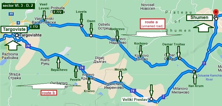
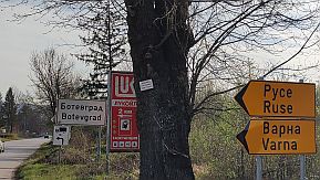
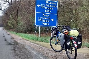
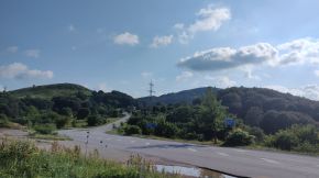
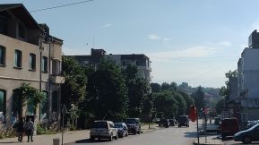
VI. Crossing Bulgaria from west to east. Routes: B. From Sofia to Varna |
|
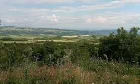
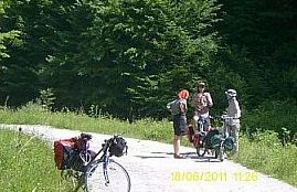
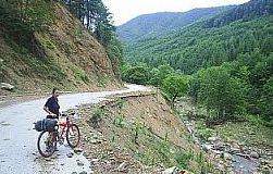
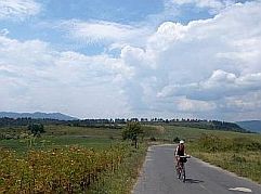
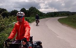
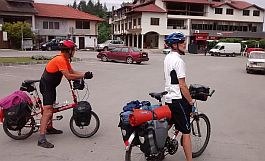
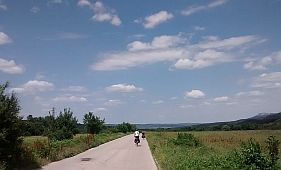
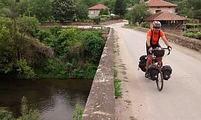
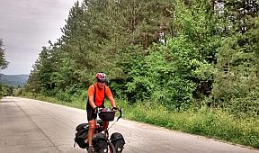
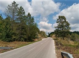
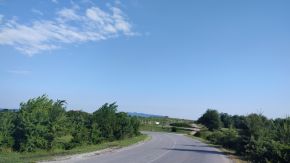
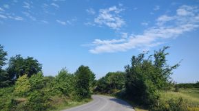
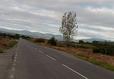
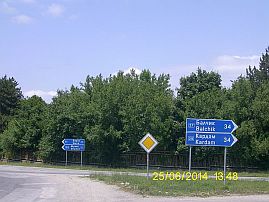
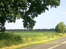
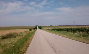
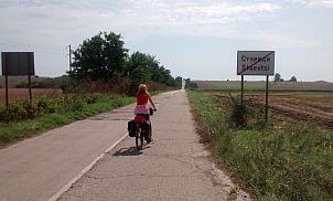
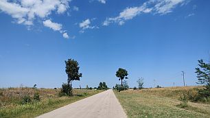
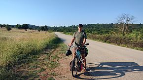
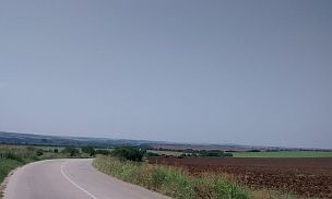
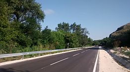
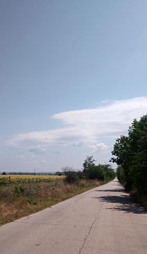
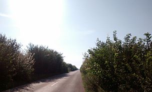
A bicycle route, starting in Sofia, ending in Varna is appropriate for bicyclists. Depending on how much time is available, choose one of the routes suggested here: Route 1 It is the route along the south side of Balkans, a route between the Balkans and the Sredna Gora mountains. From Sofia to Kazanlak to Aytos to Varna. This route would be nice for those with limited timе. Route 2 It is a longer route along the north side of Balkan: From Sofia to Sevlievo to Shumen to Varna Route 3 It is also a longer the route along Danube Plain. From Sofia to Pleven to Shumen to Varna |
||
|
|
||
|
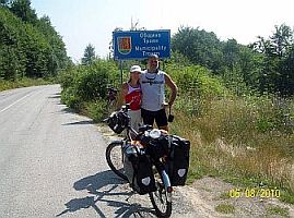
Of course, other routes are possible as well. For example, if bicyclists entering Bulgaria via border checkpoint Bregovo, or border checkpoint Vrashka |
Chuka (Bulgaria/Serbia border), can pedal along Danube River to the seaside (missing Sofia). |
|
|
|
||
|
Route 1 From Sofia to Varna The route between Balkan and Sredna Gora Mountain |
||
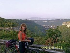
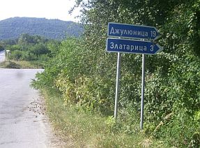
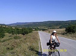
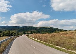
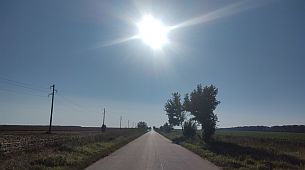
| The shortest route between Sofia and Varna (475 km.) is the one between Balkans and Sredna Gora Mountain to | Sliven, where the lower eastern part of the Balkans can be crossed to northeast direction heading towards Varna. | |
|
|
||
|
A very detail description of the road segment from Sofia to Aytos can be seen in the:
Chapter VI. Crossing Bulgaria from west to east. Routes: A. From Sofia to Burgas : Route 1 |
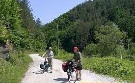
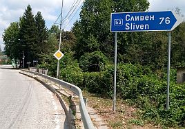
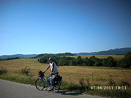
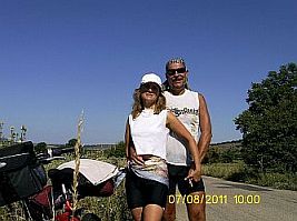
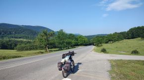
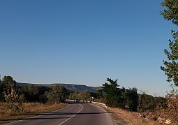
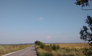
Here I will mention again, it is an easy to pedal and an extremely scenic route, as well as it is the shortest distance between Sofia and Varna: From Sofia (road E871) to Pirdop to Karlovo to Kazanlak to Sliven to Aytos (road 208) to Dalgopol to Provadia (road 2) to Varna. |
|
|
|
|
More detail description now I will give to the last part of the route shown in: Sector VI. 1 From Aytos to Varna (and Obzor)
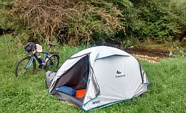
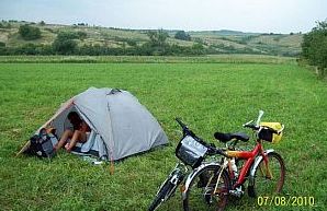
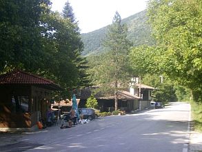
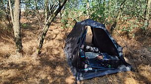
The entire area is not heavy travelled, the countryside is beautiful, and camp in the wilderness are perfect. If wanted, there is a train line from Karnobat to Dalgopol Varna, you can use. I truly enjoy bicycling in this area. Food and water can be found anywhere in this area. Next, I will extend my description, giving a route to Obzor .
|
|
|
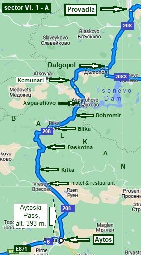 |
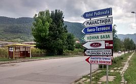
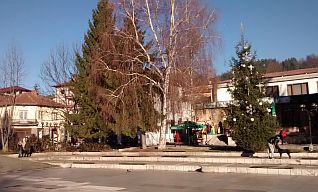
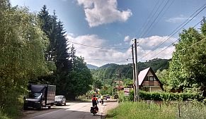
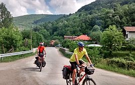
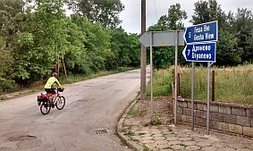
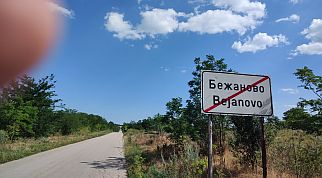
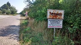
Sector VI. 1 - A From Aytos to Provadia
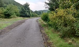
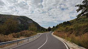
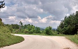
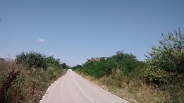
The route (road 208) is: From Aytos to Kitka to Daskotna to Bilka to Dobromir to Asparuhovo to Komunari to Dalgopol to Provadia. A very pleasant route pedaling in either directions. |
|
|
|
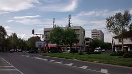
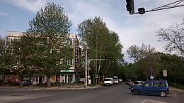
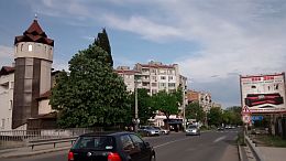
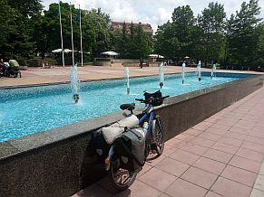
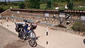
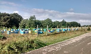
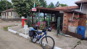
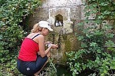
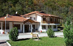
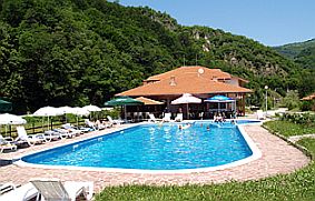
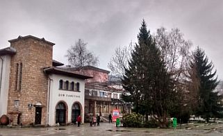
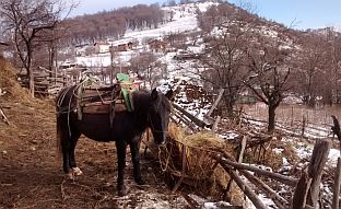
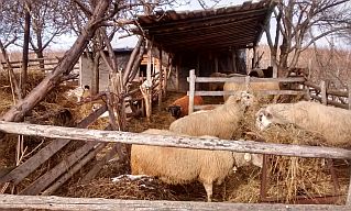
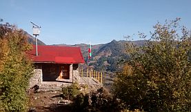
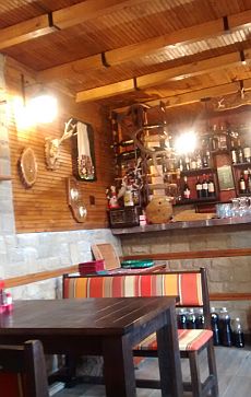
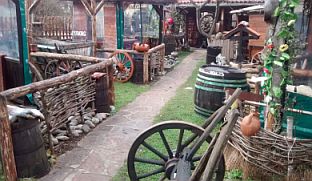
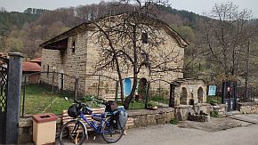
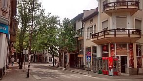
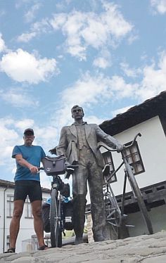
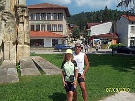
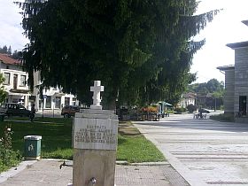
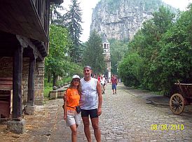
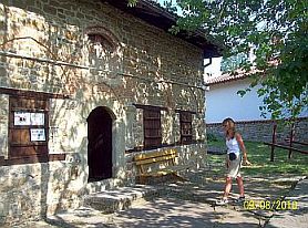
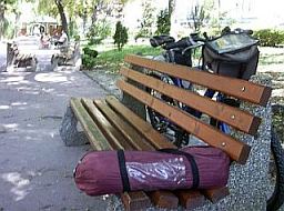
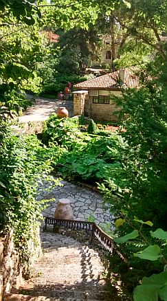
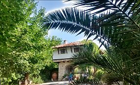
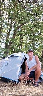
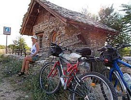
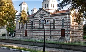
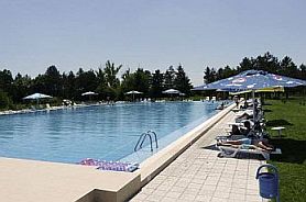
For overnight accommodations in Aytos, I recommend the Hotel Genger:
https://hotelkamynite.com/en/entertainments /ethnographic-complex-genger-aytos
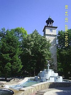
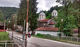
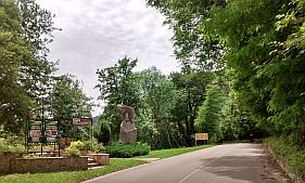
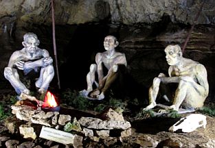
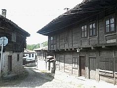
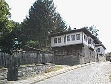
Look for a spot named Genger as you begin climbing Aytoski pass, road N 208. It is in a park area, like a mini ethno - village. There is a trail up to the ethno-village, to a restaurant and pool. Information and several photos from Aytos. |
|
 |
 |
 |
 |
 |
 |
 |
||
|
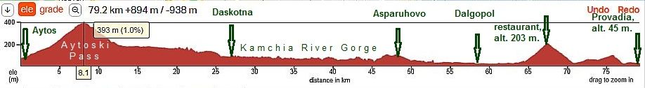
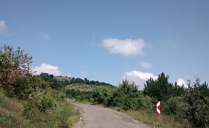
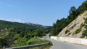
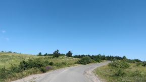
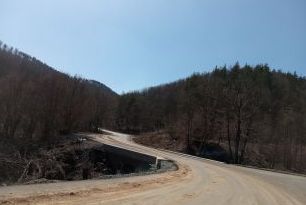
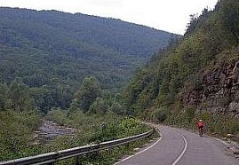
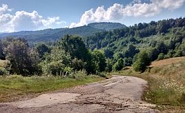
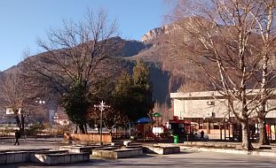
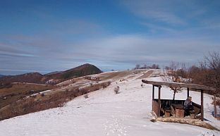
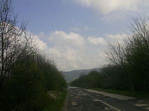
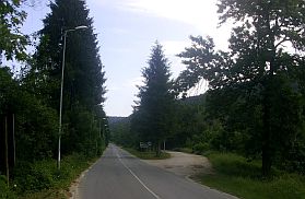
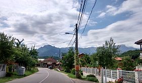
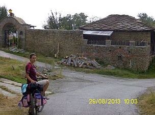
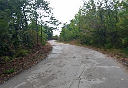
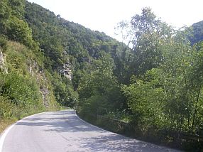
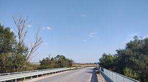
Eight kilometers of ascending, after leaving Aytos, you will arrive at the top of Aytoski Pass. It is the hardest climb on route. Once reaching the top, you will enjoy an easy downhill. |
 |
 |
 |
 |
 |
 |
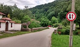
| Four kilometers after the crossroad toward Ruen there will be a motel and restaurant. (August '24 it was not at work) | ||
 |
 |
 |
 |
 |
 |
|
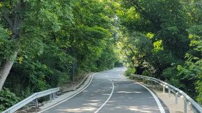
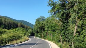
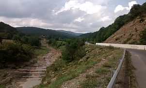
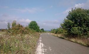
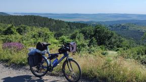
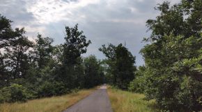
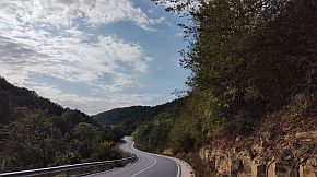
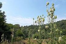
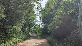
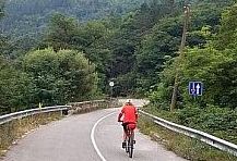
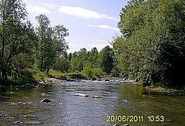
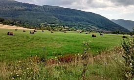
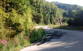
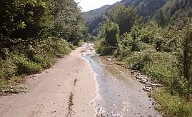
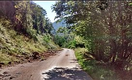
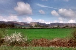
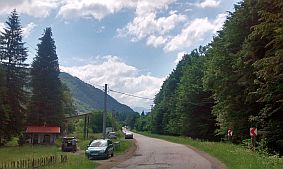
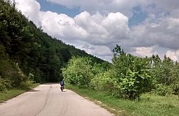
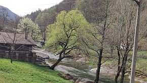
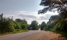
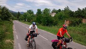
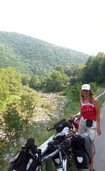
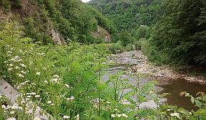
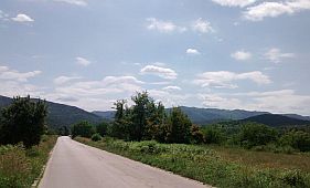
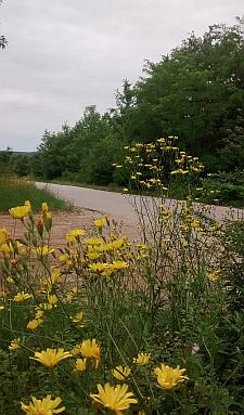
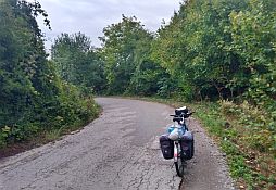
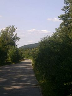
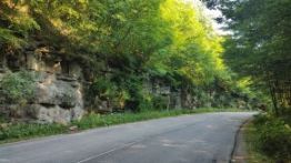
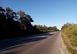
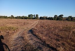
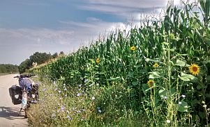
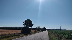
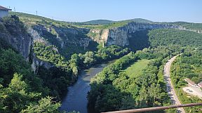
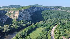
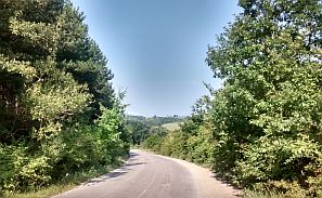
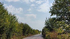
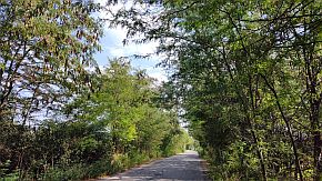
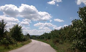
The next several kilometers to Daskotna are along Kamchia River Gorge. Pedaling along this gorge is really enjoyable. |
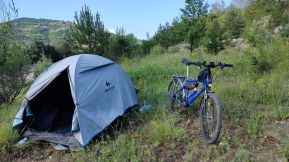
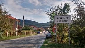
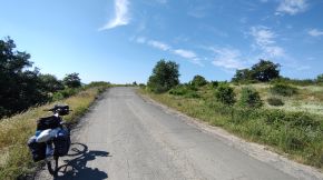
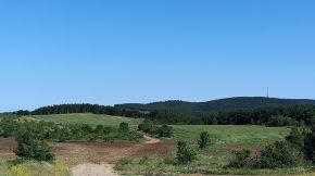
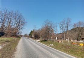
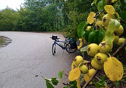
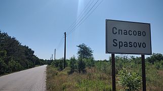
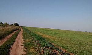
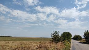
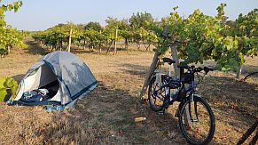
Daskotna, Dobromir and Asparuhovo are bigger villages, Food and coffee is available there. There are nice places (not so many) to camp in the wilderness too. |
 |
 |
 |
 |
 |
 |
 |
 |
 |
|
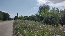
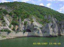
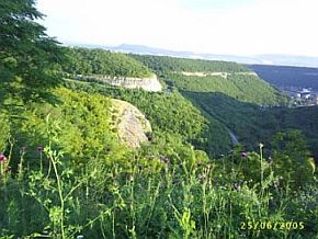
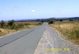
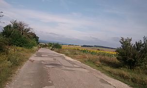
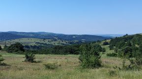
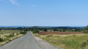
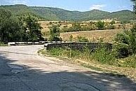
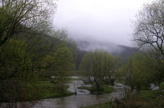
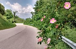
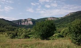
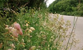
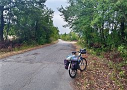
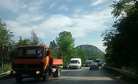
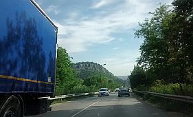
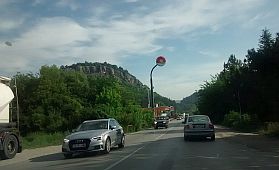
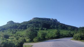
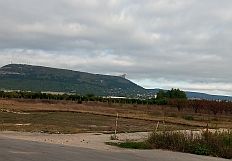
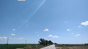
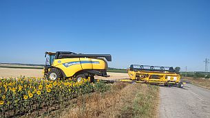
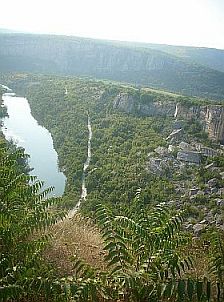
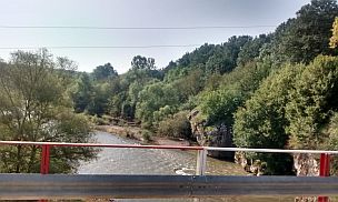
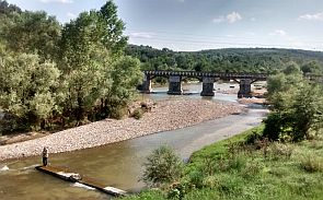
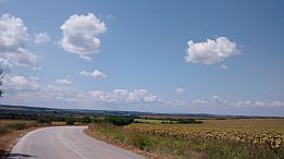
The next road segment (from Dobromir to Asparuhovo) may be the most scenic one. Crossing Tsonevo Dam you will see a very pretty place: “The Wonderful Rocks”. The Wonderful Rocks is a massif consisting of about ten beautiful rock needles, 40-50 meters high, shaped like castle towers. They were formed by the effect of water and wind on limestone. The rocks had formed directly by the |
banks of Tsonevo dam, where they are steepest and vertical. The phenomenon consists of three massifs. Three tunnels are dug through along their entire length, where an automobile road made of crushed stones passes. Since they can be seen from the main road, the rocks often attract travelers, which come by to enjoy the view |
 |
 |
 |
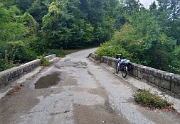
| Last years the water level in the dam is too low, so an ancient roman bridge can be seen in it. | ||
 |
 |
 |
|
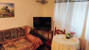
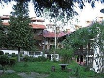
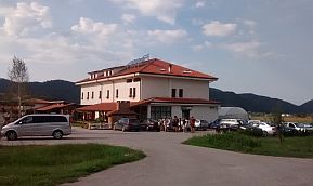
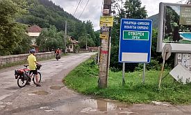
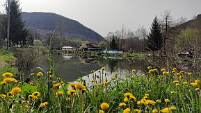
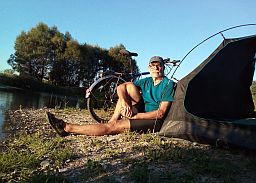
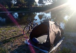
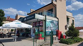
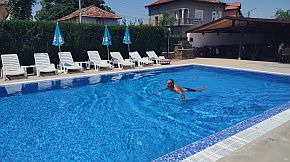
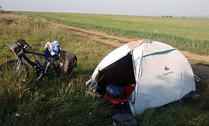
Asparuhovo is placed near Tsonevo Dam, in it there are several hotels and guest houses - fishers use it as a base for their weekends. The next photos are guest house "Vega" I spent a raining night May '25. |
Information for Tsonevo Dam and Asparuhovo can be seen here: |
 |
 |
 |
|
| Leaving Asparuhovo near the road there is one more hotel. | |||
 |
 |
 |
|
| Toward Dalgopol | |||
 |
 |
 |
|
|
|||
 |
 |
 |
|
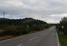
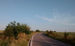
The road toward Provadia crosses a hilly area. Nine to ten kilometers after Dalgopol there is a hill with a little |
restaurant right on top of the hill. A nice view back toward Tsonevo Dam can be seen from this restaurant. |
 |
 |
 |
 |
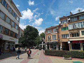
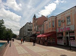
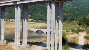
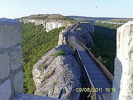
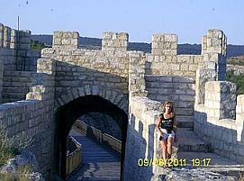
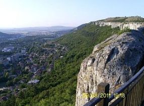
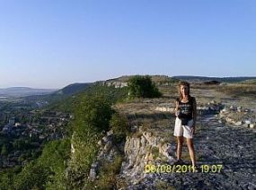
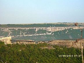
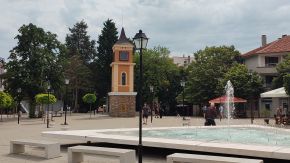
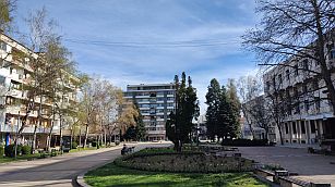
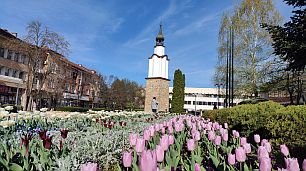
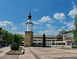
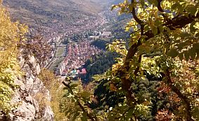
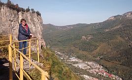
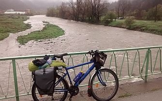
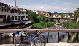
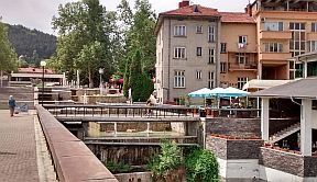
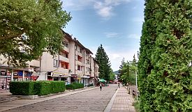
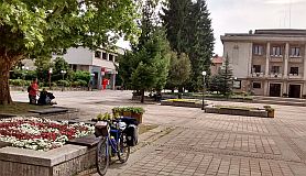
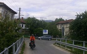
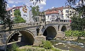
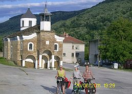
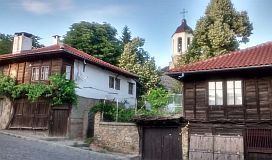
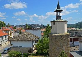
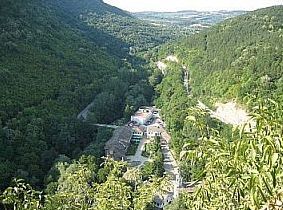
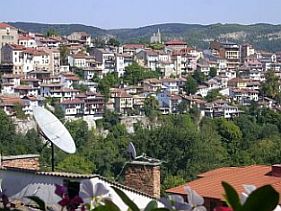
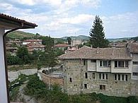
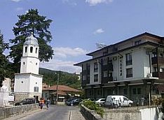
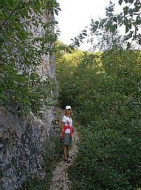
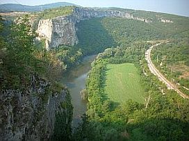
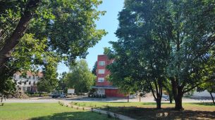
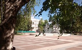
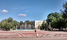
Provadia is a scenic place, it is placed in a not deep canyon along Provadiiska River. Overnight accommodation in Provadia is available, although in the touristy season some problems can appear. Information for Provadia and its fortress "Ovech" on the plateau over the town: https://en.wikipedia.org/wiki/Provadia http://trakia-tours.com/provadia-guide-94.html Next several photos of the plateau above Provadia and Ovech Fortres. |
|
 |
 |
|
 |
 |
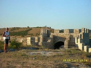 |
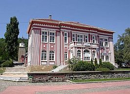
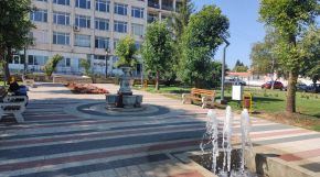
| Several photos from Provadia. | ||
 |
 |
 |
 |
 |
 |
|
Sector VI. 1 - B From Provadia to Varna The last road segment toward Varna is: From Provadia to Dobrina to Manastir to Devnya to Varna.
|
|
As it can be seen from the map above there is a road just next to the Lake of Varna (road 2008). This is an industrial zone and the traffic there is a problem. It would be better to avoid this area. Devnya is an industry center, information for Devnya: |
There is an interesting museum of Roman mosaics: https://en.wikipedia.org/wiki/Museum_of_Mosaics,_Devnya Devnya is located in a Karst area, the next link is an interesting place with huge Carst springs: https://bulgariatravel.org/devnya-springs/ Next several photos are taken along the road just east above Provadia toward Dobrina, Manastir and Varna. |
 |
 |
 |
 |
 |
 |
|
Between Devnya and Varna just next to the road is the"Stone forest", an impressive spot which is worth visiting. https://bulgariatravel.org/dikilitash-pobiti-kamani-upright-stones/ |
 |
||
|
|
|
|
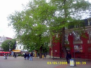
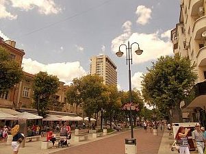
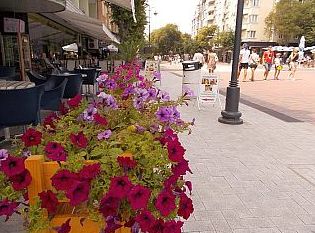
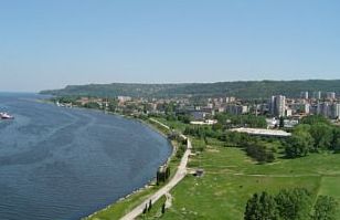
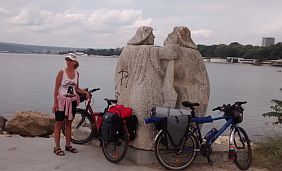
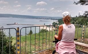
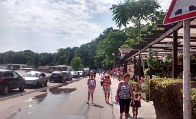
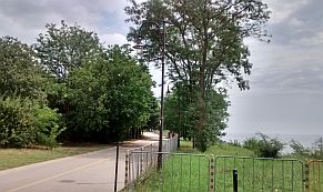
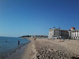
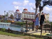
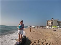
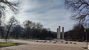
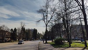
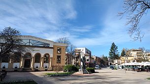
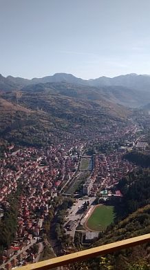
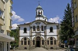
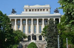
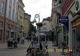
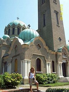
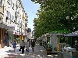
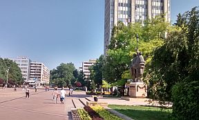
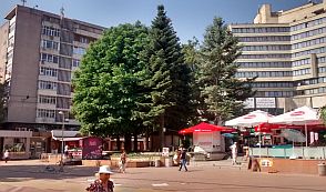
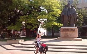
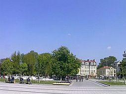
Varna is a nice town, we call it “the Sea Capital” of Bulgaria. Below are several photos of Varna: the City, its walking zone, the Cathedral, the City Garden, and the city garden.
There is a lot of information for Varna on the internet. Here are the 2 best sites I like:
https://www.britannica.com/place/Varna-Bulgaria
https://bulgariatravel.org/city-of-varna/
|
 |
 |
 |
 |
 |
 |
 |
 |
 |
|
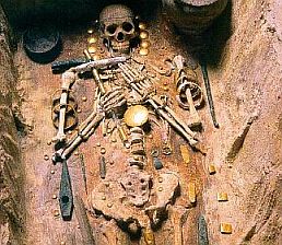
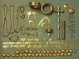
Several years ago, on the region of Varna, was found a burial site, with some of the world's oldest gold jewellery, dating back to 4,600 - 4,200 BC. https://en.wikipedia.org/wiki/Varna_Necropolis http://www.smithsonianmag.com/travel/varna-bulgaria-gold- |
The artefacts can be seen at the Varna Archaeological Museum.
https://en.wikipedia.org/wiki/Varna_Archaeological_Museum
|
 |
 |
 |
|
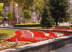
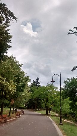
Several photos of the Sea Garden in Varna. |
||
 |
 |
 |
 |
 |
|
 |
 |
|
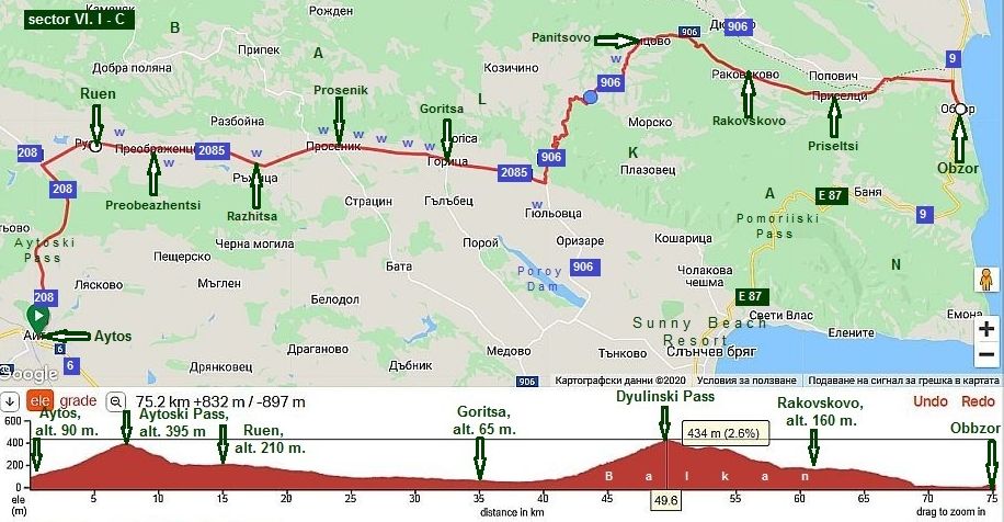
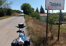
Sector VI. 1 - D From Aytos to Obzor |
||
|
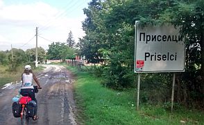
Bicyclists hating areas overcrowded by tourists can avoid Varna and visit Obzor: |
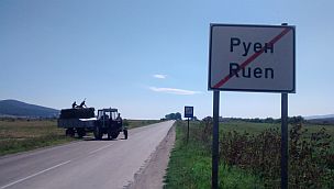
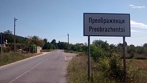
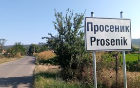
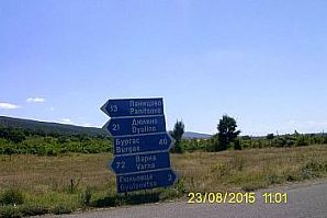
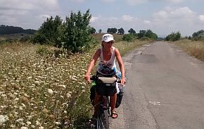
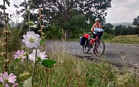
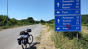
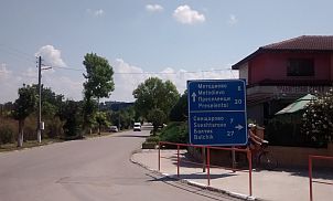
From Aytos (road 208) to Ruen (road 2085) to Preobrazhentsi to Prosenik to Goritsa (road 906) to Dyulinski Pass to Panitsovo to Rakovskovo to Priseltsi to Obzor. |
|
 |
||
|
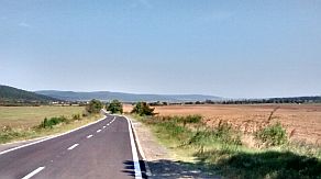
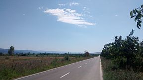
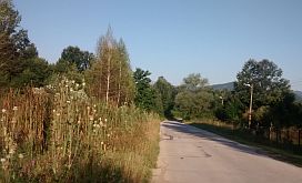
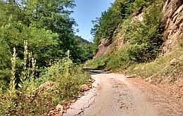
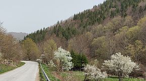
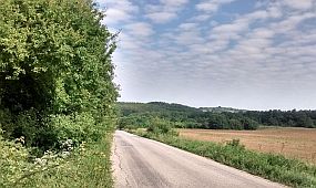
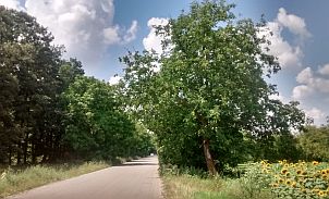
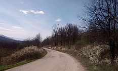
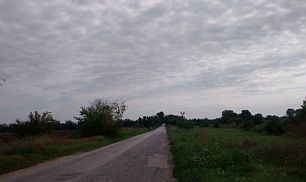
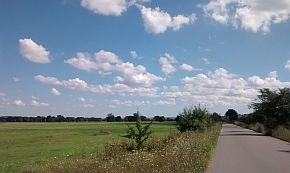
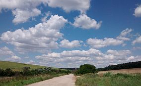
The road from Ruen to Goritsa is extremely pleasant. There are water springs along the road, although the water doesn't taste nice at all. |
In this area, bring your own water in the summer months. There isn't a food shop in Goritsa. The next several photos are of the countryside from Ruen to Goritsa. |
|
 |
 |
 |
 |
 |
|
 |
 |
|
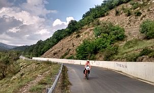
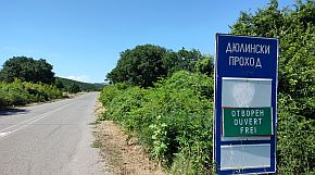
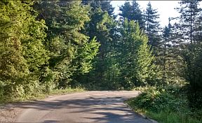
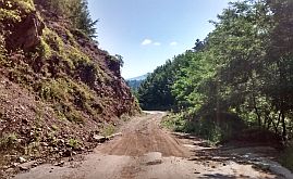
Climbing of Dyulinski Pass to the top is a little bit harder. It would be an unpleasant ride in summer afternoons. If you can, start the climb in the mornings, or in the late afternoon, after 6 pm. Remember, bring water with you. |
 |
 |
 |
 |
 |
 |
|
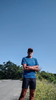
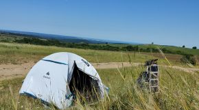
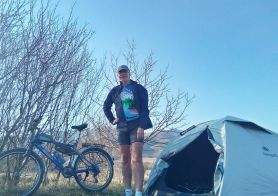
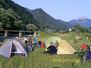
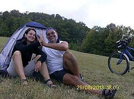
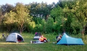
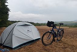
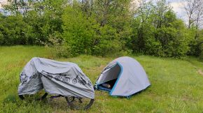
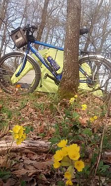
The mountain divide is a wide open area, several times I camped there. |
||
 |
 |
 |
|
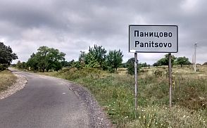
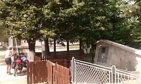
Toward Panitsovo you will see a spring of water. There is a food shop in the village. |
 |
 |
 |
 |
 |
 |
|
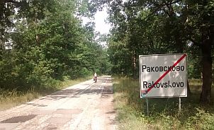
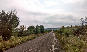
Just after Panitsovo you can go down toward Dyulino. But, I suggest a right turn toward Rakovskovo, although you can see a sign pointing that the road is closed. IT IS NOT ! The decent here is not steep. |
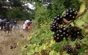
In Rakovskovo is available a hotel and restaurant. Next several photos are from this area. A lot of black berry are available here July and August. |
 |
 |
 |
 |
 |
 |
 |
 |
 |
| Photos of Dyulinski Pass. | ||
 |
 |
 |
 |
 |
|
 |
 |
|
 |
 |
 |
 |
 |
 |
|
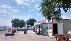
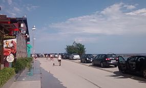
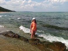
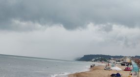
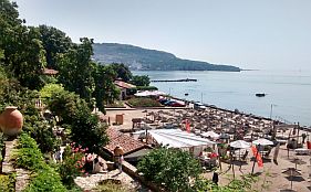
Soon you will be in Obzor. I like this place and each year stay lazy there for 10 days enjoying of its best beach. And some information & several photos from Obzor: http://www.beachbulgaria.com/obzor/ https://bulgariatravel.org/obzor/ |
 |
 |
 |
 |
 |
|
 |
 |
 |
|
|
 |
 |
 |
 |
 |
 |
 |
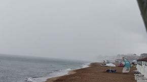
| And an hour of strong summer storm - middle of June '22. | ||
 |
 |
 |
|
|
|
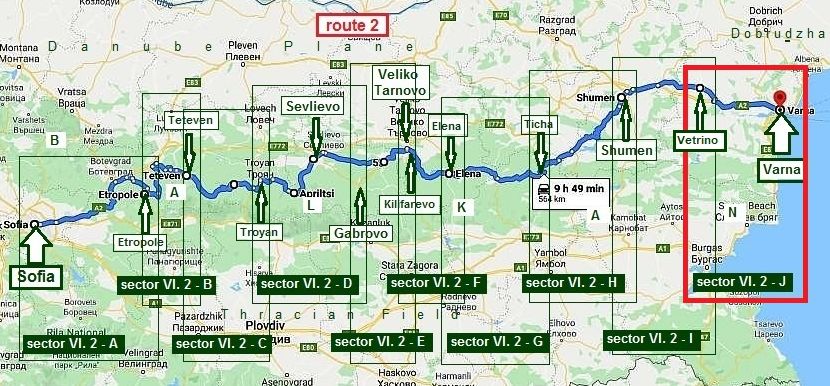
Route 2 From Sofia to Varna The route along the north side of Balkan
|
|
The next route toward Varna is the one along the north side of Balkans. The route is: From Sofia to Vitinia Pass to Botevgrad to Etropole to Teteven to Troyan to Apriltsi to Sevlievo to Kilifarevo to Elena to Ticha to Shumen to Vetrino to Varna. In my estimation this is the most scenery route toward Varna. Starting from Sofia, almost to Shumen the area is mountainous, although there is not a hard for climb on any of hills. This area is especially nice for pedaling in the hot |
summer months, July and August. Here temperatures are not as hot as in the plain areas of the country. The route to Veliki Preslav is along rivers and wooded areas, too. There are many possibilities for overnight accommodations and the area is perfect for camping in the wilderness. Here I will divide this route in several segments and will give more detailed information concerning the route and some alternatives. |
|
|
||
|
The distance from Sofia to Varna here is 570 km, which is 180 km longer than the one of the Route 1. Following |
|
this route, further I will give a lot of opportunities to expand the route and explore this part of the country. |
|
|
||
|
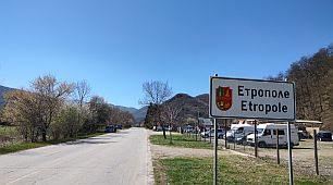
Sector VI. 2 - A From Sofia to Etropole
|
|
Close to each other are two passes: 1. Vitinya Pass (road N1) & 2. Botevgradski Pass (roads 6 (E 871) & 1001). |
A very detail information on these two passes can be found here: Chapter I. Passes in Balkan, Sector I. A 3. Vitinya Pass & 3. A Botevgradski Pass |
|
|
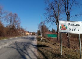
The next can be seen the road profile charts for both Passes Route a: Vitinya Pass From Sofia to Yana to Eleshnitsa to Potop to Churek to Vitinya Pass to Botevgrad to Trudovets to Razliv to Pravets to Etropole.
|
||
|
Route b: Botevgradski Pass From Sofia to Sarantsi to Gorno Kamartsi to Botevgrad to Trudovets to Razliv to Pravets to Etropole.
|
||
|
Consider using route a. For a number of reasons (accidents, reconstruction of the main road A2), sometime the traffic from the main road A2 is redirected along the old road N1, and pedaling is dangerous and very unpleasant from Botevgrad toward Sofia up the Mountain. |
Overnight accommodations are available in Botevgrad. Information and photos for Botevgrad:
|
 |
 |
 |
 |
 |
 |
 |
 |
 |
|
|
||
|
Sector VI. 2 - A. 1
From Botevgrad to Etropole, I point two alternative routes:
Route a The shortest distance between Botevgrad and Etropole;
Route b If you have time to explore this beautiful area, this route is even nicer than the first one, but 20 kilometers longer .
|
||
|
Route a The shortest route between Botevgrad and Etropole, only 26 km. If on a bicycle, a rather easy elevation gain of 260 meters between Pravets and Etropole. |
There is going to be light traffic on this route, too. From Botevgrad (road 3) to Trudovets to Razliv to Pravets (roads 3009 & 37) to Etropole. |
|
|
|
||
|
The road from Botevgrad to Pravets is easy for pedaling. Food is available in the villages along the road. Information for Pravets: |
Next several photos of the route toward Pravets and the lake near Pravets. There is a little golf resort and hotel there, It is nice for bicyclist loving more luxury places. |
 |
 |
 |
 |
 |
 |
 |
 |
 |
| As shown on the road profile chart, between Pravets and Etropole hill is not hard for pedaling. Just before start climbing the mountain, near the road (two or three kilometers after Pravets) there is a restaurant. | ||
 |
 |
 |
 |
 |
 |
| The same area, the end of March '24 | ||
 |
 |
 |
 |
 |
 |
|
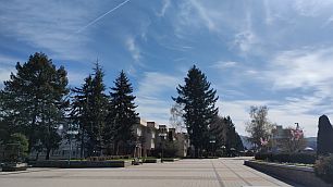
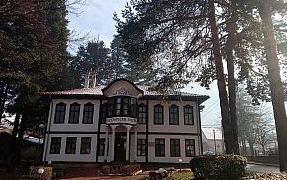
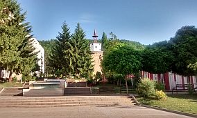
The town of Etropole is a nice place to relax for a night before going further. Accommodations at the hotel, as well as a few restaurants, are not a problem. |
There is a small museum in Etrople. |
 |
 |
 |
 |
 |
 |
|
|
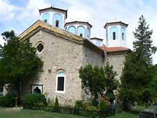
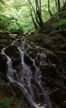
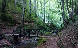
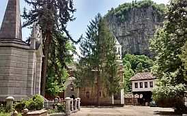
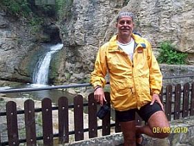
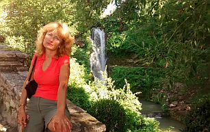
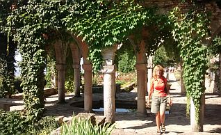
East from Etropole is a monastery, with a scenic waterfall just behind it: http://www.bulgariamonasteries.com https://en.wikipedia.org/wiki/Etropole_Monastery The Etropole Monastery was established in the Middle Ages (1158). It is famous for its limestone base due to the limestone with which the monastery’s church was built. The legend says that the holy cloister’s existence may have been closely related to the name of the hermit Ivan Rilski, who had settled in one of the caves in the ‘Varovitets’ region before choosing solitude life in Rila. Nevertheless, the local people of Etropole declared the place holy and laid the foundations of the present-day monastery.
Etropole
“St.Trinity” monastery was one of the biggest literacy centres at
Bulgarian lands in XVI and XVII century as the popular Etropole
calligraphic and art school was established there. Here is the tranquil
place where many Bulgarian writers, artists have done much work for the
preservation of Bulgarian culture and literature during turbulent times. |
 |
 |
 |
|
|
||
|
|
Route b
This route is a little longer than previous one: 47 km. It is a mountainous area very nice and easy for exploring because roads are along river gorges.
You might consider exploring this beautiful region if you have a time:
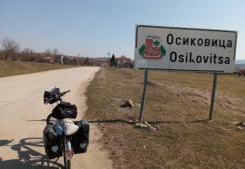
From Botevgrad (road 3) to Trudovets to Razliv to Praveshka Lakavitsa to Osikova Lakavitsa to Osikovitsa to Dzhurovo (road 37) to Malak Iskar to Laga to Etropole.
|
|
The next photos are taken on a 10 day trip late in March, 2022. |
|
 |
 |
 |
 |
 |
 |
 |
 |
 |
| Next three photos are taken in the area between Laga and Etropole. | ||
 |
 |
 |
|
Sector VI. 2 - A
٭Opportnities (If your choice is the shortest route from Sofia to Varna, miss the next opportunities and go to the next Sector VI. 2 - B)
There are several opportunities purposed for bicyclists having more time: Explore Iskar River Gorge (road 16), or a part of it.
Information on Iskar River Gorge can be seen here:
Chapter I Point 2. Iskar River Gorge. |
|
Opportunity 1 Route a: crossing Balkan (from Rebrovo to Botevgrad) |
||
|
The route is: From Sofia to Novi Iskar (Iskar River Gorge - road 16) to Rebrovo to Batulia to Bakyovo to Yablanitsa to Vrachesh to Botevgrad to Etropole. |
Leaving Sofia to north along Iskar River Gorge (road 16), at Rebrovo turn to the right and enter Balkans along Batuliiska River. Next, I will increase the scale a little. |
|
|
|
||
|
Leaving Sofia to the north along Iskar River Gorge (road 16), at Rebrovo turn to the right and enter the Balkans along the Batuliiska River. Next to Batulia there is a monastery: Batyliiski Monastery. A little information for the monastery: http://visit.guide-bulgaria.com/a/1377/batuliyski_ There is neither food nor accommodations offered near the monastery. |
As the road profile chart shows, the climb is not hard. There is an elevation gain of 330 meters over a distance of 30 kilometers, from Rebrovo to the point named "house" on the map above. The road to this point is in good condition and there is little traffic. There is a hotel at the 25th kilometer. The next several photos illustrate the countryside up the Batuliiska River. |
|
 |
 |
 |
 |
 |
 |
 |
 |
|
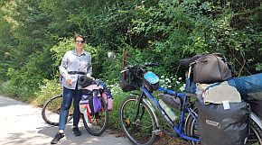
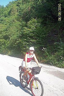
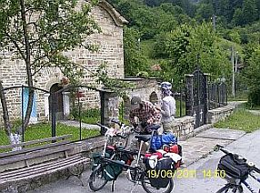
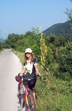
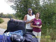
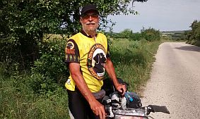
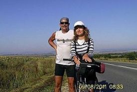
Leaving Yablanitsa, you will see a little shop which serves coffee and food. My daughter, Maya, is sitting in front of the shop in the photo above. |
||
|
|
||
|
Next, I will increase the scale a little. The road is not signed after the little shop. Three kilometers after the hotel, I mentioned above, you have to leave the asphalt |
road and take the off-road to the left. This crossroad can be recognized easily. There is a building there. Unfortunately, I have not a photo. | |
 |
||
|
Following the gravel road you will reach the Balkan ridge (the photo, upper left). At the top of the pass there is a crossroad. Continue down the mountain and you will reach Vrachesh and Botevgrad. Travelling in the opposite direction would be difficult bicycling. The road west, from Vrachesh up the |
mountain, is very steep and rocky. I do not know the distance between Yablanitsa and Vrachesh. There is a segment in the mountain which Google Map does not show the off road. Obviously, for more information I must find a time to explore this area. |
|
 |
Just before entering in Vrachesh there is a Monastery: Vrachesh Monastery. https://en.wikipedia.org/wiki/Vrachesh_Monastery Have in mind that neither food nor accommodation is offered in it. |
|
|
|
|
|
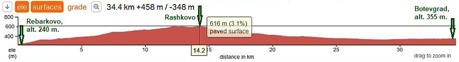
Opportunity 2 Route b: From Rebarkovo to Botevgrad
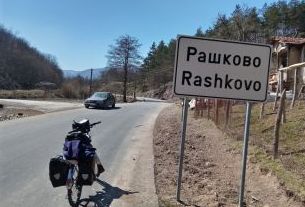
I suggest a route connecting Iskar River Gorge (road 16) and Vitinya Pass (road 1): From Rebarkovo to Rashkovo to Radotina to Litakovo to Botevgrad.
The route is nice and easy for pedaling; away from the traffic, and smooth surfaced. I pedaled it in late March, 2022, while touring toward Veliko Tarnovo. It was an extremely enjoyable tour. I do not remember if any supplies were accessible in the villages along the road. |
||
 |
||
 |
 |
 |
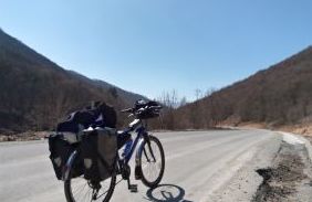
| Starting from Rebarkovo, you will climb almost 15 kilometers up to Rashkovo. The hill is not steep. | ||
 |
 |
 |
 |
 |
|
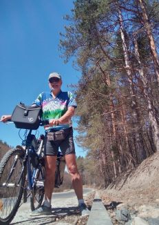
| The next photos illustrate the countryside from Rashkovo to Botevgrad. | ||
 |
 |
 |
| The same route, in the late September '23, the road renovation was over. | ||
 |
 |
 |
 |
 |
 |
 |
 |
 |
|
|
|
Opportunity 3
From Roman to Etropole (via Malak Iskar River Gorge)
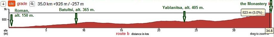
The route would be nice for bicyclists interested in exploring the entire Iskar River Gorge before going toward Varna. The route is: From Sofia to Svoge (Iskar River Gorge) to Mezdra to Roman to Hubavebe to Karash to Sredni Rat to Svode to Kalugerovo to Vidrare to Dzhurovo to Laga Etropole.
This route is longer. The distance from Sofia to Varna is approx 160 - 180 kilometers. But, if you have a time it would be worth it. Both gorges: - of Iskar River: From Sofia to Svoge to Mezdra to Roman, - and the one of Malak Iskar River: From Roman to Hubavene to Karash to Srednirat to Svode to Kalugerovo to Vidrare to Dzhurovo are extremely scenery places. The traffic along Malak Iskar River Gorge is minimal.
Information about the route from Sofia to Roman: - please look here: Chapter IX. How to enter/leave Sofia by bicycle - detail information concerning Iskar River Gorge can be found here: Chapter I. Passes in Balkan, Sector I. A, point 2. Iskar River Gorge
This is one of my favorite routes in BG, I highly recommend you to explore this area.
|
|
|
Opportunity 3. a
From Roman to Hubavene to Karash to Sredni Rat to Svode to Kalugerovo.
This route segment is an exceptionally scenic area and the pedaling here is a great pleasure. There is a 5 – 6 kilometer off road segment, the off road is rocky and can be pedaled on raining days as well. Next two photos illustrate this off road segment. |
|
|
|
|
|
|
As it can be seen on the map, elevation of the road is 100 meters for all the distance of 25 km from Roman to Kalugerovo. Here you will see no more than 3 – 4 cars. |
||
|
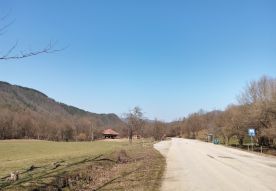
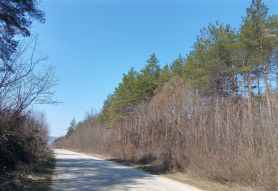
The entire area is extremely scenic, unfortunately, these photos do not show how scenic the area is. There is not a problem accessing with water or food here. |
||
 |
 |
 |
 |
 |
 |
 |
 |
|
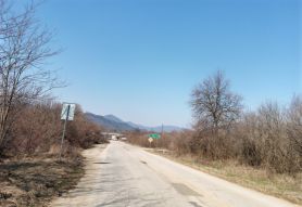
The same distance: From Hubavene to Karash to Sredni Rat to Svode to Kalugerovo. The road is without asphalt cover here and it is not so pleasant in the bask direction. (Photos were taken in the beginning of June '24) |
||
 |
 |
 |
 |
 |
 |
 |
 |
 |
|
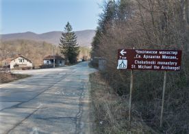
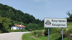
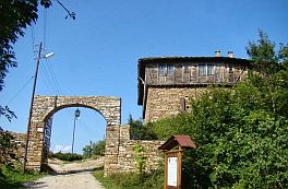
Next to Kalugerovo is the Chekotinski monastery, "St. Archangel Mihail". The monastery maybe the only appropriate place for overnight accommodations between Roman and Etropole. There is a nice hotel in the monastery.
I do not remember if food was available in the monastery.
Information for the Monastery and several photos from this spot: https://bnr.bg/en/post/100789940/st-archangel-michael- monastery-of-chekotin-a-little-known-gem
|
|
The earliest written evidence of its existence goes back to 1646 – it is mentioned in a psalm-book copied by Kalinik, probably from Varovitets monastery. What it says in this psalm-book is that the monastery of Chekotin has been reconstructed. Above the monastery there once was a fortress with thick walls, a rock church and vaults. The monastery and the fortress were destroyed by the Turks at the end of the 14th century. Later monks came from Mount Athos and rebuilt it. As monk Kalinik writes, the |
|
monastery was a hub of the Bulgarian spoken and written word. Books were copied, though not on a grand scale. In the 17th-18th century robbers marauder and destroyed the monastery, though not the church. At the end of the 18th and the beginning of the 19th century Bulgarians came in search of a retreat. They found the deserted remains of the monastery even though they were hidden from view. The church was buried under rocks and earth so as to conceal it. That was when it was rebuilt and the icons and iconostases were made. |
 |
 |
 |
|
|
|
 |
Opportunity 3. b
Here I will suggest 2 routes: Route a From Kalugerovo to Vidrare to Dzhurovo;
Route b From Kalugerovo to Praveshka Lakavitsa to Osikovska Lakavitsa to Osikovitsa to Dzhurovo.
Both routes are very nice, you would be not wrong to choose any one. |
|
Road profile chart for route a: From Svode to Kalugerovo to Vidrare to Dzhurovo
The next photos: the countryside between kalugerovo and Dzhurovo |
|
 |
 |
 |
 |
 |
 |
 |
 |
|
Road profile chart for route b: From Kalugerovo to Praveshka Lakavitsa to Osikovska Lakavitsa to Osikovitsa to Dzhurovo.
The next several photos (taken in the beginning of June '24) illustrate the countryside from Praveshka Lakavitsa to Kalugerovo. There is not any traffic here. |
 |
 |
 |
 |
 |
 |
|
Photos for the distance from Praveshka Lakavitsa
to Dzhurovo are posted in the previous item. |
||

Opportunity 3. c
The last road segment toward Etropole is:
Route a: From Dzhurovo to Malak Iskar to Laga to Etropole.
It is perfect for touring. Etropole is just behind the hill of the right photo.
|
 |
|
|
|
|
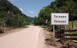
Route b: Is toward Teteven (missing Etropole), You can avoid Etropole heading directly from Malak Iskar to Lopyan to Yamna and Tetevem (the next item). |
The next several photos were taken in 2012, the road was dirty. The road has been paved and now is in very nice condition. |
 |
 |
 |
 |
 |
|
There is a little shop and coffee place in Lopyan. Next to Lopyan there is a nice spot called Holiday |
Village Orlova Skala, which is appropriate for overnight accommodation: |
 |
 |
 |
|
In a conclusion, this is one of the best routes in Bulgaria. I suggest you pedal it if you have the time. You definitely will enjoy your experience here! |
|
Sector VI. 2 - B From Etropole to Teteven
|
|
|
||
|
The route from Etropole to Teteven again is one the best road segment for bicycling. Depending of where you will come in this sector, I will give here 2 possible.
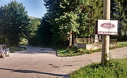
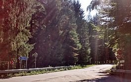
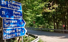
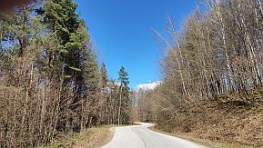
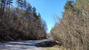
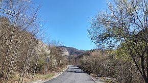
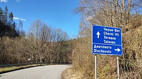
Route a From Etropole to Ribaritsa to Yamna to Cherni Vit to Teteven. East from Teteven here is a place named Ribaritsa. Ribaritsa is extremely pleasant for pedaling because there is hardly any traffic. You will not find this route on Google Maps because the road segment from Yamna toward Cherni Vit is closed for cars. It is still possible to be pedaled, as can be seen further from the photos I post here. |
||
|
The road profile chart shows that the climb in a west to east direction is easier rather than pedaling in the opposite direction.
|
||
 |
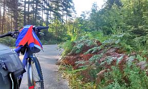
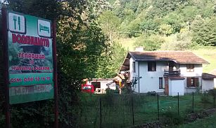
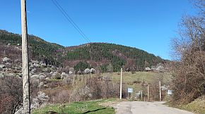
Leaving Etropole toward Yamna you will see a nice hotel. A little further there is a nice place for the camp near nice clean river as well.
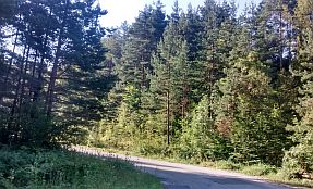
The road from Etropole to Yamna relatively nice. Food can be find in Ribaritsa, I am not sure for Yamna. |
 |
 |
 |
|
 |
 |
 |
 |
 |
|
 |
 |
|
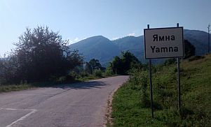
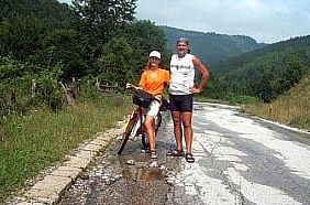
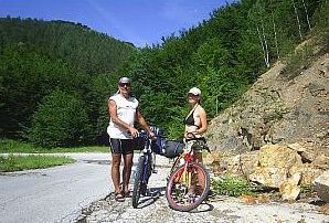
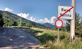
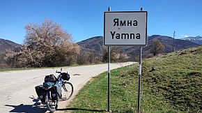
The next several photos show the road toward Yamna before its reconstruction. Leaving Yamna you will see a sign showing the road toward Teteven is closed. |
 |
 |
 |
 |
 |
 |
|
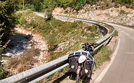
Next 6 photos illustrate the worst part of the road - 2 kilometers down to Cherni Vit. |
 |
 |
 |
 |
 |
 |
|
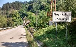
Cherni Vit is a village (the photos with the church) located along Cherni Vit River, maybe the village is 10+ kilometers. |
Food can be find in Cherni Vit. http://www.guide-bulgaria.com/nw/lovech/teteven/cherni_vit The return route is nice for pedaling as well. HAVE a spray against dogs. |
 |
 |
 |
 |
 |
 |
 |
 |
 |
|
The same area in the end of March '24. The road toward Yamna was renovated. |
||
 |
 |
 |
 |
 |
 |
 |
 |
 |
|
|
|
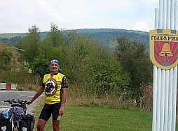
Route b It is an opportunity, for bicyclists coming from Dzhurovo and heading directly to Teteven, missing Etropole. Teteven: From Dzhurovo to Golyam Izvor to Polaten to Teteven |
|
The next several photos are the area near Golyam Izvor. |
||
 |
 |
 |
 |
 |
 |
|
|
||
|
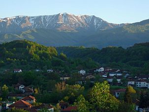
Teteven is placed in the deep valley of the Vit River, surrounded of spectacular rock formations. The view is quite impressive. Overnight accommodations are not a problem. |
Information for Teteven can be seen here: https://en.wikipedia.org/wiki/Teteven http://www.visitbulgaria.net/en/teteven/teteven.html http://www.guide-bulgaria.com/nw/lovech/teteven/teteven Several winter photos of this town I like so much. |
 |
 |
 |
 |
 |
 |
| An old monastery "St. Ilia" from the end of the Second Bulgarian Kingdom with original icons can be seen in Teteven. | ||
 |
 |
 |
|
In the area around Teteven there are several places to explore and visit. Next are several photos of the Balkan above Teteven, near a small mountain village called Babintsi. |
Above the village is placed a little chapel, a well signed trail will lead you to the chapel. A great view is revealed in each direction. |
 |
 |
 |
 |
 |
 |
|
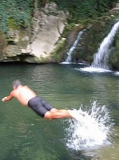
Another option is a walk to a waterfall west from Teteven. You can use a taxi do drive approx 5 kilometers up the mountain. Then, walk half an hour to the waterfall. |
 |
 |
 |
||
 |
||
|
A steep trail will lead you to a little hut just above the town (an hour and 15 minutes walking), it is visible from the town up in the rocks. |
 |
 |
 |
||
 |
||
 |
 |
 |
| Places where we have camped; just before, and after, Teteven near Beli Vit River. | ||
 |
 |
 |
|
|
||

I will expand my description, pointing two additional routes in case your approach is from Iskar River Gorge (from Roman) to Teteven, missing Etropole.
The best routes are:
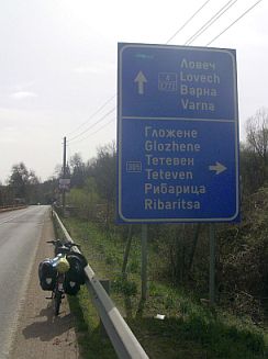
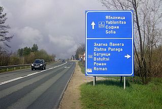
Route a From Roman (road 103) to Batultsi to Oreshene to Zlatna Panega to Asen (road 305) to Glozhene (road 358) toTeteven;
Route b (for bicyclists intending to visit Glozhene Monastery) From Roman to Batultsi to Oreshene (road 358) to Dobrevtsi to Yablanitsa to Malak Izvor to Glozhene Monastery and back to Glozhene to Teteven.
|
|
The road profile chart for the route a
|
||
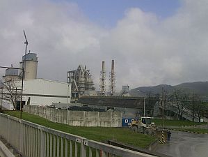
|
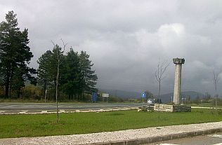
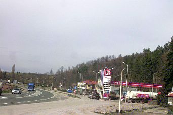
The entire area is the best for exploring. Next several photos are the area from Roman to Zlatna Panega with its huge cement plant. Fortunately there are filters, so no any |
dust and smoke in the region near Zlatna Panega; the place is known with its Karst springs: |
|
 |
 |
 |
 |
 |
|
Not much traffic along this route. There is only 1 - 2 kilometers with very heavy traffic on the road segment of road 4 (between roads 103 and 305). |
 |
 |
 |
 |
 |
|
After crossing Vit River you will see the sign toward Teteven, although in the photos below I am in the opposite direction. |
||
 |
 |
 |
 |
 |
Leaving Glozhene next to the road, you will see a motel and restaurant with impressive waterfall behind it. I have heard the meals there are very tasty. Information for Glozhene: bulgaria.com/nw/lovech/teteven/glojene From Glozhene you can visit Glozhene Monastery, but following this route it will increase the distance considerably. The Monastery is in the mountain, as it is obvious from the road profile chart below. Bicyclists intending to visit Glozhene Monastery can follow the route b - I have shown on the map above. |
 |
||
 |
||
|
Glozhene Monastery is situated on one stone edge in the western part of the Balkan Mountain range beneath the stunning Kamen Lisetc peak (870m altitude). Unfortunately it is one of the not many places in Bulgaria |
I still have not visited. Overnight accommodations are possible in the Monastery, but food is not offered. Information for the monastery and several photos: http://www.bulgariamonasteries.com/en/glozhene_monastery.html |
|
 |
 |
 |
|
Well . . . that is all for this sector . . . after Teteven toward Troyan it follows a long valley of Beli Vit River named Ribaritsa, a vacancy place . . . |
||
|
Sector VI. 2 - C From Teteven to Troyan
|
||
|
The distance from Teteven to Troyan is very pleasant for pedaling. Here is the longest and the highest hill on the road from Sofia to Varnawith altitude gain of more |
than 800m.: From Teteven to Ribaritsa to Shipkovo to Terziisko to Troyan. |
|
|
|
||
|
The road profile chart slows that pedalling from west to east is easier in comparison with the opposite direction. Three - four kilometers after Teteven you will enter |
in a resort area along Beli Vit River called Ribaritsa – at least 15 kilometers long area of small private homes – hotels, so accommodation in it is not a problem. |
 |
 |
 |
 |
 |
 |
 |
 |
Near the road along Ribaritsa there are several very nice local type restaurants offering exceptionally tasty local meals as well.
Information for Ribaritsa: https://bulgariatravel.org/en/
|
 |
|
The area here is a bit touristy, the traffic along the road is little, and after Ribaritsa, you probably will not see any cars. Leaving Ribaritsa, the climb to the highest point (almost in the middle of the road) is a little bit harder, |
especially reaching the first serpentines, where you will find a spring of water. Up the mountain, after Ribaritsa there are a lot of wooded areas, strawberries for picking in June, and raspberries for picking in July. It is also a very nice area to wilderness camp. |
 |
 |
 |
 |
 |
|
| When you reach the highest point (the next photos) you will enjoy of a perfect view in each direction. | ||
 |
 |
 |
 |
 |
|
|
Pedaling in the reverse direction, from Troyan to Teteven, the climb is harder and the road is steeper, especially after Shipkovo. Two to three km after Shipkovo fresh water is available from a tap. |
Shipkovo is a resort village. Overnight accommodations are not a problem here, with a pool of thermal water is available. |
 |
 |
 |
| The scenery after Shipkovo toward the pass. | ||
 |
 |
 |
 |
 |
 |
 |
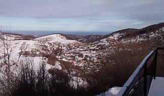
The same area in the end of March '24. A hot dusty air from Sahara entered in our region increasing the temperature up to 30 deg C, but disturbed the visibility for the next 3 days.
|
 |
 |
 |
|
 |
 |
|
And several words and photos from Troyan, where overnight accommodations are not a problem. |
Information for Troyan: |
 |
 |
 |
 |
 |
 |
 |
 |
|
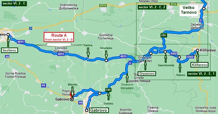
Sector VI. 2 - D From Troyan to Sevlievo (or to Gabrovo)
|
||
|
I will describe two possible routes to the east (toward Drtyanovo & Kilifarevo): I would suggest pedaling the first route because the traffic from Gorna Rositsa to Gabrovo (road N 44) to Dryanovo (road N5, E 85) is busy, especially from Gabrovo to Dryanovo (E 85). The first route is much more better in the back direction as well. |
Route A From Troyan (road 357) to Drashkova Polyana (road 607) to Apriltsi to Ostrats (road 6072) to Stokite to Gorma Rositsa to (roads 4402 and 44) to Sevlievo (road 4401: look in Sector VI. 2 - E for it) to Yantra to Dryanovo; Route B From Troyan to Apriltsi to Stokite to Gorma Rositsa (roads 44) to Novakovtsi to Gabrovo (E86) to Dryanovo. |
|
|
|
||
|
Sector VI. 2 - D. 1 The next more detail map shows an unbelievable pleasant for exploring region from Troyan toward |
Gorna Rositsa and Sevlievo. Pedaling to east, from your right side you will see the highest part of Balkan. | |
|
|
||
|
The route and the road profile chart from Troyan to Sevlievo: From Troyan (road 357) to Oreshak to Drashkova |
|
Polyana (road 607) to Velchevo to Skandaloto to Apriltsi to Ostrets (road 6072) to Kravenik to Stokite to Popska to Batoshevo to Gorna Rositsa (roads 4402 and 44) to Sevlievo. |
|
|
||
|
Entering in Oreshak (overnight accommodation is available in it), you will see a sign toward Troyanski Monastery (the photos below), if you have a time, you can visit it, overnight accommodation is possible in the hotel part of the monastery, or a little further in Cherni Osam.
I think overnight accommodation is better in Oreshak: http://www.guide-bulgaria.com/nw/lovech/troyan/oreshak
Information for the monastery and several photos: |
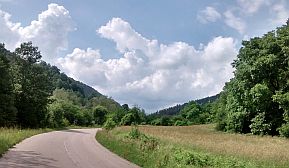
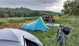
The road toward Apriltsi is easy for pedalling, no any traffic there, the entire area is very nice for camping in the wilderness. |
|||||||||
 |
 |
 |
|||||||
 |
 |
||||||||
 |
 |
||||||||
|
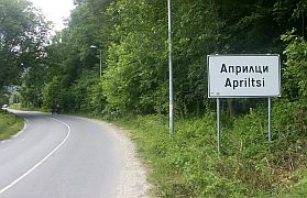
Overnight accommodation in Apriltsi is possible. Information for Apriltsi: |
The next three photos are from Apriltsi. The view is especially impressive April and May, when the Balkan is still covered by snow. |
 |
 |
 |
|
Toward Ostrets. Overnight accommodation in it is possible. |
The highest point of this road segment is two - three kilometers after Ostrets. |
 |
 |
 |
|
Once reaching the highest point, the road toward Gorna Rositsa (and Sevlievo) is down the mountain. |
Food (and a little restaurant) is available in Stokite. |
 |
 |
 |
 |
 |
 |
|
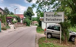
The next several photos are the countryside toward Batoshevo. Near Batoshevo, is Batoshevski Monastery, I pedalled this route several times, I still did not visit it. |
https://bulgariatravel.org/en/ the-batoshevo-monastery-the-nativity-of-the-virgin/ It is not easy to find food in Batoshevo. |
 |
 |
 |
 |
 |
|
 |
 |
|
|
The countryside toward Gorna Rositsa and Sevlievo. |
||
 |
 |
 |
 |
 |
 |
|
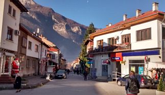
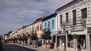
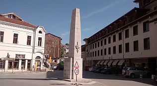
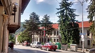
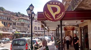
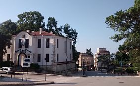
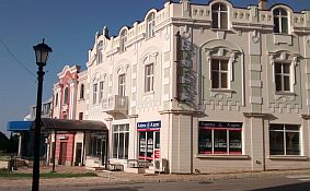
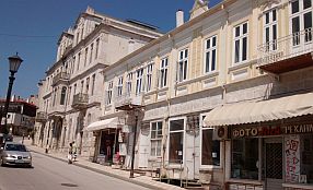
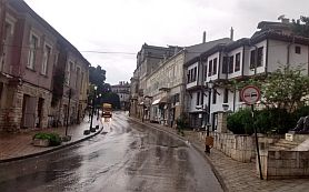
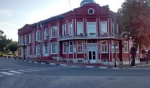
Information for Sevlievo: |
||
 |
 |
 |
|
Sector VI. 2 - D. 2 Route B
|
|
Because of opportunities here, I will increase the resolution a little. Route a To reach Gabrovo my suggestion is to pedal along |
road N44. It is a main road, but, the traffic along it is not bad at all. From Gorna Rositsa to Draganovtsi to Novakovtsi to Vranilovtsi to Yankovtsi to Gabrovo. |
|
|
|
||
|
Route b On the map you will see shortcuts toward Gabrovo from Batoshevo or Gorna Rositsa: |
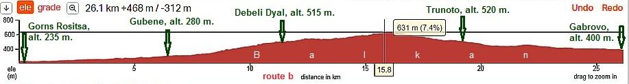
From Gorna Rositsa (road N4404) to Muzga to Debeli Dyal to Tranito to Gabrovo. | |
 |
||
 |
Have in mind, this is a mountain area, roads in this area are not signed well. Some of the villages are deserted, so you will not see anybody to ask about the road. The compensation for exploring this area is the best scenery and very little traffic. I remember we lost a lot of time to eat blackberry. |
|
 |
 |
 |
|
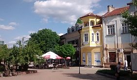
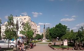
You can choose to visit or pedal around Gabrovo heading toward Dryanovo. Information for Gabrovo: https://en.wikipedia.org/wiki/Gabrovo http://wikitravel.org/en/Gabrovo |
 |
 |
 |
 |
 |
 |
 |
 |
 |
|
٭Opportunities |
||
|
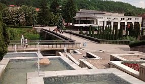
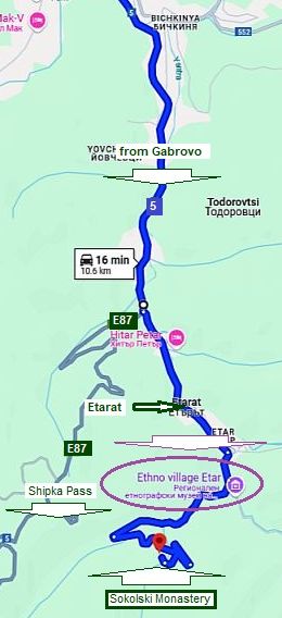
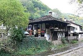
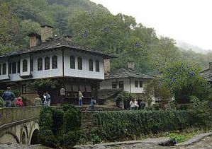
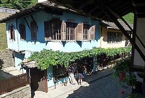
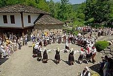
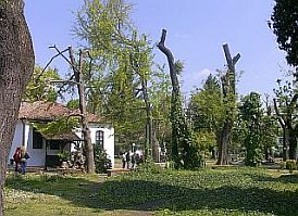
Several kilometers south of Gabrovo is a place called Etar, an interesting architectural ethnographic complex - a museum at work. It is worth seeing (food and overnight accommodations are available in it): |
https://en.wikipedia.org/wiki/Etar_Architectural https://bulgariatravel.org/architectural-and-ethnographic -complex-etar/ |
 |
 |
 |
 |
 |
|
|
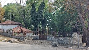
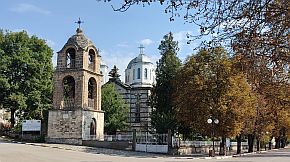
Four kilometers after Etara is Sokolski Monastery, an interesting place, it is worth to be visited. An information for it:
http://www.bulgariamonasteries.com/en/sokolski_monastery.html
|
||
 |
 |
 |
|
|
||
|
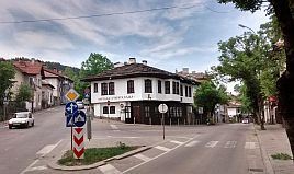
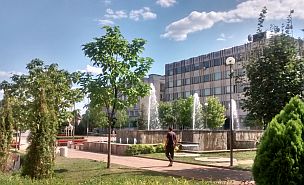
Sector VI. 2 - E From Sevlievo (& Gabrovo) to Dryanovo and Kilifarevo
|
||
|
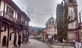
I will begin with a description of the route from Sevlievo to Dryanovo (route a), after I will give information about the route from Gabrovo to Dryanovo to Kilifarevo (route b), ending with several words |
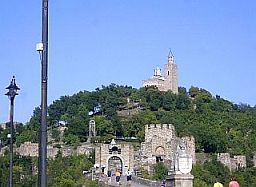
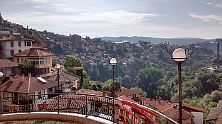
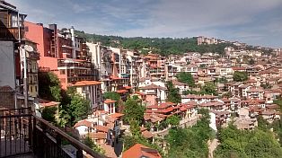
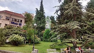
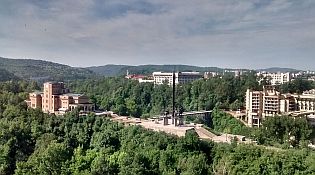
about Veliko Tarnovo - the Capital of the second Bulgarian Kingdom. Veliko Tarnovo is a very touristic place. There is heavy traffic near Veliko Tarnovo. | |
 |
||
|
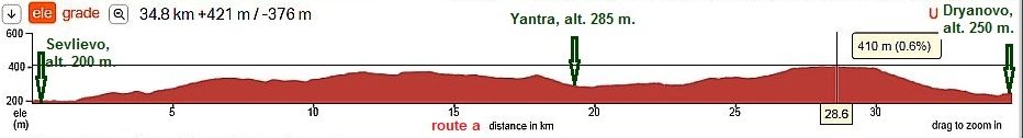
Route A The route from Sevlievo to Dryanovo: From Sevlievo to Yantra to Skalsko to Gaesha to Dryanovo |
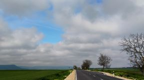
This road is an extremely pleasant for pedaling. The hills here are not steep. There is absolutely no traffic. |
|
 |
||
|
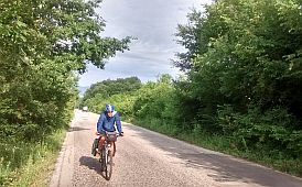
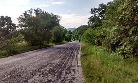
There is a little food shop in Yantra. I don't remember any food shops in Skalsko. Several photos of this beautiful area. |
||
 |
 |
 |
 |
 |
 |
 |
 |
 |
 |
 |
|
 |
 |
|
|
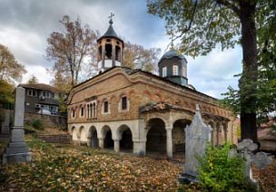
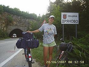
Information for Dryanovo and several photos: |
||
 |
 |
 |
 |
 |
 |
|
The next map shows the approach toward Dryanovo from Gabrovo (or Kievtsi). If you do not want to enter Gabrovo, you can bike along the north ring just before |
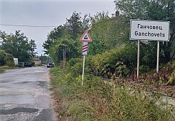
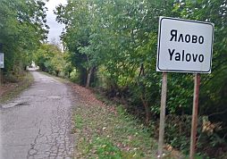
entering Gabrovo (turn to left in Kievtsi, road 5004): From Gabrovo to Dolino to Dryanovo to Ganchovets to Yalovo to Kilifarevo. |
|
|
|
||
|
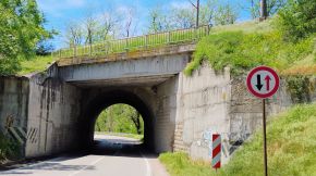
The traffic on the roar E85 is quite busy. Most of the pedaling after Dolino is down hill. Pedaling in the reverse direction (from Dryanovo to Gabrovo) is up the mountain. |
I would not be happy pedaling up that grade. The tunnel just before entering in Dryanovo Municipality (the last photo below) is not long nor dangerous. |
|
 |
 |
 |
|
|
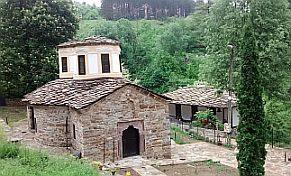
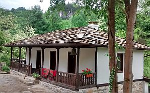
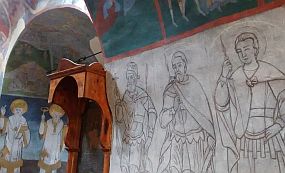
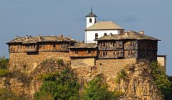
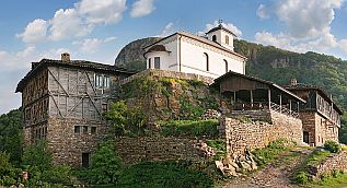
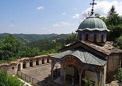
A remarkable place to visit is Dryanovski Monastery and the area near the monastery. The monastery is located in Karst Valley, where 2 rivers meet. The area has different opportunities for overnight accommodations - camping ground, tourist hut, hotels. There are both restaurants & hotels near the monastery.
Information for the Monastery: https://www.youtube.com/watch?v=fsZ_F5AqlcY
https://bulgariatravel.org/en/dryanovo-monastery-st-archangel-michael/
https://en.wikipedia.org/wiki/Dryanovo_Monastery
|
|
|
|
|
|
 |
 |
 |
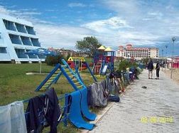
| The rocks of the Karsts chains over the monastery are very impressive; there is a labelled track from the | monastery to the hills above it (just behind the tower on the second photo above). |
 |
 |
 |
 |
||
|
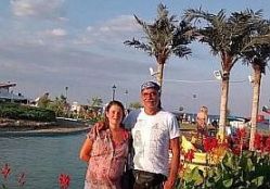
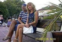
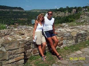
Here is an interesting cave "Bacho Kiro"- just behind my partner above: |
||
 |
 |
 |
|
|
||
|
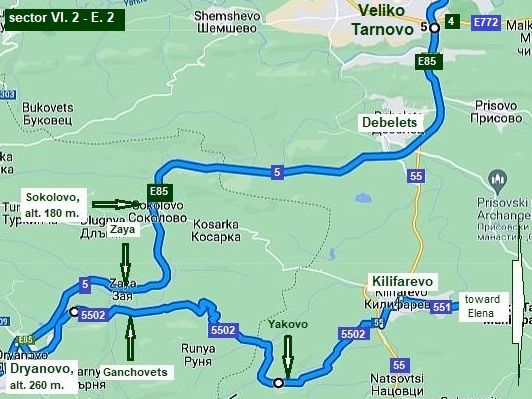
Sector VI. 2 - E. 1
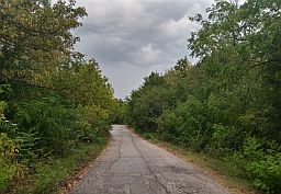
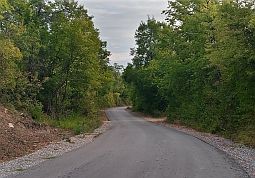
From Dryanovo to Kilifarevo
There is long hill between Ganchovets and Kilifarevo. Once passing Ganchovets, the traffic disappears totally. |
||
|
Sector VI. 2 - E. 1- a
If my memory serves, the road in Dryanovo towards Kilifarevo is not signed well. So, enter Dryanovo and go down to the line station and industrial zone.
Pedaling along the railway you will cross the railway and head toward Ganchovets, after pedal on toward Kilifarevo (road 5502).
This is a very nice route, without any traffic. |
||
 |
 |
 |
 |
 |
|
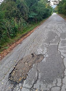
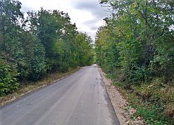
| The road from Ganchovets to Yalovo is not in the best condition, but it is still beautiful for riding, there is not any traffic. | ||
 |
 |
 |
 |
 |
|
|
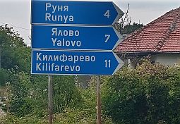
Yalovois on the top of the hill between Ganchovets and Kilifarevo. I do not remember well if food was available in Ganchovets, but there is a water spring there. |
 |
 |
 |
 |
 |
 |
|
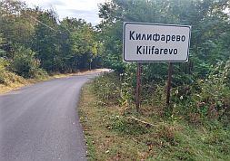
Kilifarevo is a little town, nothing special to say about it. Some information here: http://www.guide-bulgaria.com/NC/veliko_turnovo/veliko_turnovo/kilifarevo |
||
 |
 |
 |
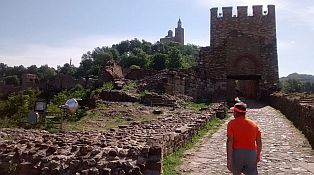
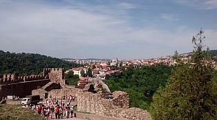
 Sector VI. 2 - E. 3 Close to Dryanovo is the city of Veliko Tarnovo, as a capital of the Second Bulgarian Kingdom, it is interesting to visit. The city is a touristy place, advertised in the guiding books. Traffic around the city is quite intense, especially after Debelets, where roads N5 (E85) and road N55 meet. Be careful if you bicycle there. It is really very dangerous road segment. Avoid road N4 (E772) . It is the main road between Sofia and Varna, the traffic on it is terrible. So, if you intend to visit Veliko Tarnovo, my suggestion is to find accommodations in Dryanovski Monastery (or Dryanovo), and visit Veliko Tarnovo using a taxi. The hotel you are at can call a taxi. |
||
|
Our camp place and entering in Veliko Tarnovo coming from Dryanovo. |
||
 |
 |
 |
|
Next several photos illustrate the traffic conditions on these roads. |
 |
 |
 |
|
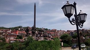
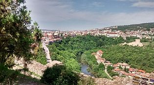
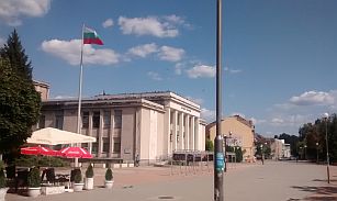
As a Capital of the Second Bulgarian Kingdom, Veliko Tarnovo is very popular destination among tourists. A lot of information, including overnight accommodation about Veliko Tarnovo can be found here: https://en.wikipedia.org/wiki/Veliko_Tarnovo |
||
 |
||
|
Information about the second Bulgarian Kingdom can be found here: https://en.wikipedia.org/wiki/Second_Bulgarian_Empire There are a lot of monasteries in the region near Veliko Tarnovo. Here are several links supplying information about them: http://www.bulgarianmonastery.com/en/region/veliko_tarnovo_monasteries.html |
 |
 |
 |
 |
||
 |
 |
 |
 |
 |
 |
 |
 |
 |
 |
 |
 |
 |
 |
 |
 |
 |
 |
 |
||
 |
|
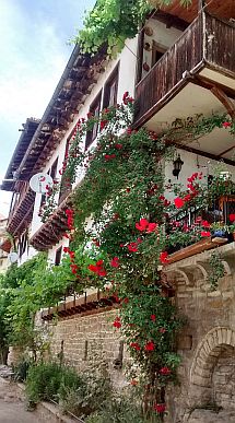
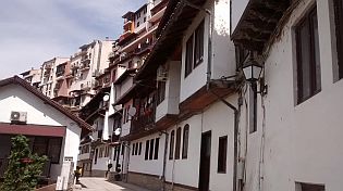
Arbanasi (5-6 kilometers north from Veliko Tarnovo) is also a touristy area, it is connected with Bulgarian history. |
https://en.wikipedia.org/wiki/Arbanasi,_Bulgaria https://bulgariatravel.org/en/the-arbanasi-archeological-reserve/ Several photos of Arbanasi. A great view is available from Arbanasi toward Veliko Tarnovo and Balkans. |
 |
 |
 |
|
|
|
Sector VI. 2 - F From Kilifarevo to Elena
Beautiful area, a calm countryside, away from the main roads. Here I will suggests 2 routes.
Route a: From Kilifarevo to Plakovo to Sredni Kolibi to Gardevtsi to Yakovtsi to Elena.
It is an extremely beautiful area. The road is not wide at all and has been resurfaced. Pedaling here is sage and there is very little traffic. |
||
.jpg) |
.jpg) |
.jpg) |
|
Food and water is available in Plakovo. The next water spring is almost 10 km up the hill from Plakovo. The water from the spring doesn't taste good at all. The route up the mountain is in very nice wooded and you will pedal in the shade. |
|
|
|
|
.jpg) |
.JPG) |
.JPG) |
|
On the highest point of the route is located Sredni Kolibi. I do not remember if food and coffee is available |
there or in the next villages along the road or if there are accommodations in these areas. |
.jpg) |
.jpg) |
.jpg) |
|
The best place here is the area near Lovkovtsi Dam. There is easy access to the dam (just before Yakovtsi). In |
the summer the water is perfect to refresh and the place is perfect for camp in the wilderness. Next to Yakovtsi there is a little hotel and restaurant. |
.jpg) |
.jpg) |
.jpg) |
.jpg) |
.jpg) |
.jpg) |
|
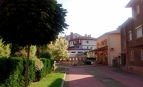
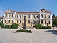
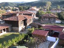
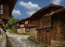
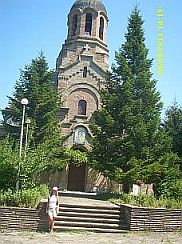
Elena is a touristy spot. Architecture of XIX century is saved. There are overnight accommodations and nice restaurants in the town. |
Information of Elena can be seen here: https://bulgariatravel.org/en/town-of-elena/ https://www.visitbulgaria.net/en/elena/elena.html Several photos from Elena: |
 |
 |
 |
 |
 |
 |
 |
 |
 |
 |
 |
 |
|
Sector VI. 2 - F. 1 Route b Another very nice opportunity (for bicyclists loving off road) in this area is: From Kilifarevo to Velchevo to Plakovski Monastery to Kapinovski Monastery to road N53 to Elena. |
||
|
The road from Kilifarevo to Velchevo to Kapinovski Monastery (from point A to point B) is nice. Leaving Velchevo toward Plakovski Monastery, you will see an ancient tractor. |
||
.jpg) |
.jpg) |
.jpg) |
.jpg) |
.jpg) |
|
|
There are two old monasteries along this road: Plakovski Monastery and Kapinovski Monastery. |
Information for monasteries: |
|
|
|
Neither food nor overnight accommodations are available in Plakovski Monastery (the two photos in left). Kapinovski Monastery is a better of the two place to stay. Next to this monastery there is a camping place, caravans, and a restaurant. To spend a night there is not a bad idea. |
.jpg) |
.jpg) |
.jpg) |
.jpg) |
|
After Kapinovski Monastery the road enters a nice wooded, flat area. The road is soft gravel, though many |
maps suggest it is a nice road. Just before entering Elena we found a water spring. |
.jpg) |
.jpg) |
.jpg) |
|
The last time I was there, just after washing my equipment I noticed there was a big bee garden and |
thousands of bees. Fortunately they were very busy with their busyness and did not pay any attention for me. |
 |
 |
 |
|
The next map shows opportunities for bicyclists decided to visit Veliko Tarnovo and heading toward Elena.
Route a From Veliko Tarnovo (E 85) to Debelets to Plakovo . . . to Elena (as it was described above). (you can pedal Route b in Sector VI. 2 - F. 1 and visit Plakovski and Kapinovski monasteries as well);
Route b From Veliko Tarnovo (E 85) to Prisovo to Pcheliste to Yserova Koria to Kapinovo (road) N53 to Elena; I travelled this route only by a car. (You have to be careful just before Debelets, you can miss easy the road toward Prisovo);
Route c From Veliko Tarnovo (E 772) to Sheremetya to Dragizhevo to Merdanya (road N53) to Elena.
|
|
I am not sure which variant is the best. The distances of all the routes are almost the same. The traffic of both roads: E772 and E85 are terrible, maybe E 85 is more dangerous. |
On some maps you will see a train line from Gorna Oryahovitsa to Elena. This train line is not in operation. The next several photos illustrate the area between the crossroad toward (roads 4004 & 53) Zlataritsa and Elena. |
 |
 |
 |
 |
 |
|
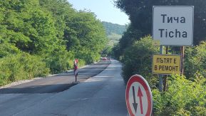
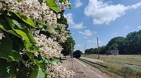
Sector VI. 2 - G From Elena to Ticha
|
||
|
This area is perfect and a pleasure for exploring by bicycle. Hardly any traffic, no steep hills, and beautiful scenery. Exploring this area has always brought me a |
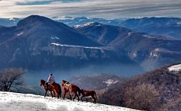
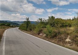
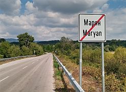
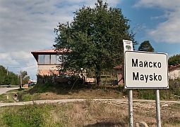
great pleasure. The route: From Elena to Maryan to Berbovo to Konstantin to Maysko to Kipilovo to Ticha . |
|
c.jpg) |
||
|
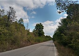
Just after Elena follow the sign toward Sliven. The grade starts. Fortunately, the hill is not long or steep. Beginning from Elena to the east, the next villages are Maryan, Berovo, Konstantin, Maisko, and Stara Reka. |
There are food shops and water springs in all the small villages along the road. I pedaled this area many times, always I felt at my best here. | |
 |
 |
 |
 |
 |
 |
 |
 |
 |
.jpg) |
 |
 |
 |
 |
 |
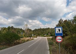
| After Mayslo look for a sign toward Kipilovo, Kotel and Omyrtag. There is a spring of fresh water just there. | ||
 |
 |
.jpg) |
| The countryside from Elena to Konstantin. The photos are taken in the beginning of beautiful May '25. | ||
 |
 |
 |
 |
 |
 |
 |
 |
 |
|
|
||
|
Sector VI. 2 - G. 1 Route a
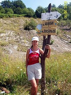
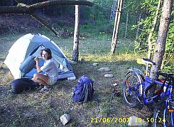
After Kipilovo the road is not signed well, I will show more detail on the map on the left. If you explore this area, be careful and look your kilometrage marker. Thirteen km and six hindered meters east from Kipilovo is the crossroad toward Ticha - Point A. The crossroad is signed, but not so clear.
|
||
a.jpg) |
||
.JPG) |
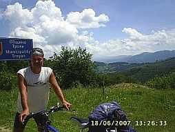
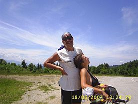
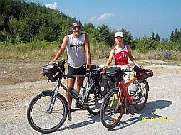
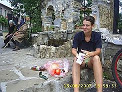
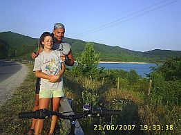
I and Maya between Kipilovo and Point A on the map above ... OMG ... as if it was yesterday . . . :( Summer 2007 I and Maya lost somewhere in this area (after the first hill on the road profile chart above) - next several photos. Fortunately we met woodcutters, they showed us the road. |
.JPG) |
.JPG) |
.JPG) |
.JPG) |
.JPG) |
||
| Next photos are between point A and the bridge over Golyama Kamchia River. | ||
.jpg) |
.jpg) Route b |
.JPG) |
.jpg) |
.jpg) |
|
|
You will be not wrong if you pedal only along the road N 484; you will reach the top of Kotlenski Pass; again, no any traffic here.
|
||
 |
 |
 |
| On the Pass turn to left and you will be in Ticha directly. | ||
 |
 |
 |
 |
 |
 |
|
All these roads are in very nice wood. But . . . according to me the route a is better. |
||
|
٭An opportunity |
||
|
Let I mention, that between Elena and Veliki Preslav (the next item) there is not places for overnight accommodation, so Kotel (from the other side of Balkan) can be used for this |
purpose (look again the map): sector VI. 2 - G. 1). Information for Kotel: |
|
 |
 |
 |
|
|
||
|
|
||
|
Sector VI. 2 - H From Ticha to Shumen
|
||
|
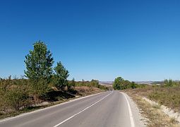
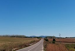
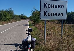
After Ticha already you are leaving the mountain area. From Ticha to Filaretovo to Malko Selo to Yablanovo to Zvezditsa to Mengishevo to Konevo to Ivanovo to |
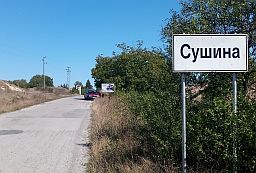
Veliki Preslav to Shumen. The route can be expanded a little including Lovers and Sushina. I do prefer to pedal next to Ticha Dam. |
|
|
The road profile charts show the little differences in the two routes; the pedalling here in the direction from Ticha to Shumen is pleasant and easy.
|
||
|
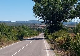
After Ticha the road leaves the mountain area. The road to Yablanovo is in very nice condition. |
The next several photos are the countryside toward Yablanovo. | |
.jpg) |
.jpg) |
.jpg) |
.jpg) |
.jpg) |
.jpg) |
|
Just before entering Yablanovo there is a nice little river, a perfect place to relax for an afternoon. |
Yablanovo is a bigger village. Finding food is not a problem in the villages along this route. |
.jpg) |
.JPG) |
.JPG) |
|
Next photos are the countryside from Yablanovo down toward Ticha Dam. |
||
.jpg) |
.jpg) |
.jpg) |
.jpg) |
.jpg) |
.jpg) |
.jpg) |
.jpg) |
.jpg) |
.jpg)
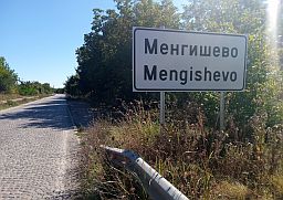
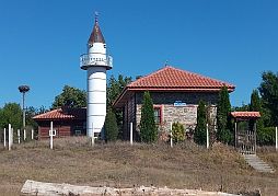
Sector VI. 2 - H. 1 The country side toward Mengishevo to Konevoto to Lovers to Sushina.
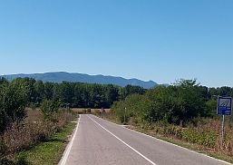
It is an extremely nice area, an easy route for pedaling, with almost no traffic. If my memory serves, food shops and water are available in each village. |
 |
 |
 |
 |
 |
 |
 |
 |
 |
 |
 |
 |
 |
 |
 |
|
The country side up toward Ticha Dam and our camp next to the Ticha Dam wall. The region near Ticha Dam forbids camping. |
The area is a closed zone because the dam is supplies water to towns in the region. The road access to the dam wall is forbidden as well as to the reservoir. |
 |
 |
 |
| Toward Veliki Preslav | ||
 |
 |
 |
|
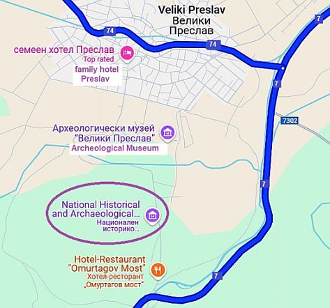
٭An opportunity
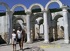
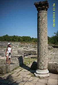
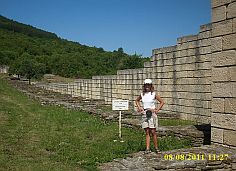
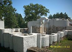
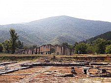
Three to four kilometers south from Veliki Preslav are the historical remains of Preslav, the capital of the First Bulgarian Kingdom IX – X century. A hotel & and restaurant are available in the region of the park.
https://bulgariatravel.org/en/veliki-preslav-national-historical -archaeological-reserve-veliki-preslav-great-preslav/
A little information for the First Bulgarian Kingdom: https://en.wikipedia.org/wiki/First_Bulgarian_Empire
A hotel & and restaurant are available in the region of the park. |
|
|
 |
 |
 |
 |
 |
|
Information for Veliki Preslav: https://en.wikipedia.org/wiki/Veliki_Preslav |
 |
 |
 |
 |
 |
|
 |
 |
 |
| Toward Shumen. | ||
 |
 |
 |
|
Next to Han Krum the road crosses the Golyama Kamchia River. Here is a very nice spot to camp. |
||
 |
 |
 |
 |
 |
 |
|
Next links are the information about Shumen: https://en.wikipedia.org/wiki/Shumen |
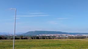
Several photos of the same area - approach to Shumen and the plateau (Shumen Fortress) next to it, the town and my afternoon relax place in the town garden. |
 |
 |
 |
|
|
||
|
Sector VI. 2 - I From Shumen to Vetrino
The entire area here is easy pedaling. The route is: From Shumen to Kaspichan to Novi Pazar to Stan to Vetrino. It is important to avoid the main road A2. Along road N2 there is very little traffic. |
|
The area here is easy for pedalling. This part of country may be too hot July and August.
Nice road, minimal traffic. Next several photos are of the countryside from Shumen to Kaspichan to Novi Pazar, the middle of May, '25. |
 |
 |
 |
 |
 |
 |
 |
||
 |
 |
 |
| The same area, August 2011. | ||
 |
 |
 |
|
|
The next two little towns are Kaspichan and Novi Pazar. Overnight accommodations are available in Kaspichan.Very little information for Novi Pazar: https://en.wikipedia.org/wiki/Kaspichan
Very little information for Novi Pazar is available here: https://en.wikipedia.org/wiki/Novi_Pazar,_ If you research Google for information, have in mind that in Serbia there is Novi Pazar as well. Overnight accommodations are available in Novi Pazar. the last photo below - I am watching the strong spring storm from my hotel room. Very little information for Novi Pazar. |
 |
 |
 |
 |
 |
 |
| Toward Vetrino. | ||
 |
 |
 |
 |
||
 |
 |
 |
|
Vetrino is a bigger settlement, in it can be find food, but overnight accommodation. |
||
 |
 |
 |
| The same area August '17 | ||
 |
 |
 |
 |
 |
 |
|
٭An opportunity |
||
|
In the same region (north - west from Novi Pazar) is Pliska. Next to Pliska are remains of the fortress, the capital of the first Bulgarian Kingdom (VII - VIII centuries). |
https://en.wikipedia.org/wiki/Pliska https://bulgariatravel.org/en/the-pliska-national-historical |
|
 |
 |
 |
|
|
||
|
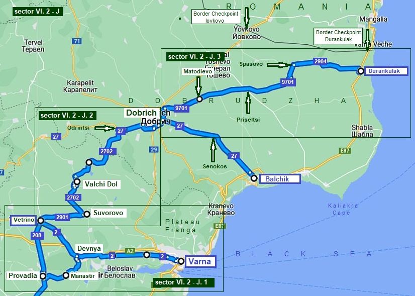
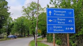
Sector VI. 2 - J From Vetrino - Varna
|
||
| Reaching the last part of pedaling to the seaside, the route from Vetren to Varna. Here I will expand a little my information, giving an additional route from Vetren to | Dobrich to Balchik and to the North most point of Bulgarian seaside: Durankulak. If you have the time, explore this beautiful area. | |
|
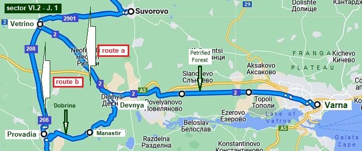
Sector VI. 2 - J. 1
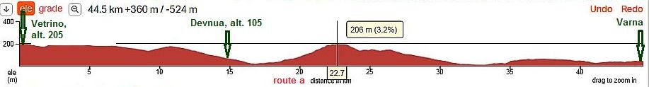
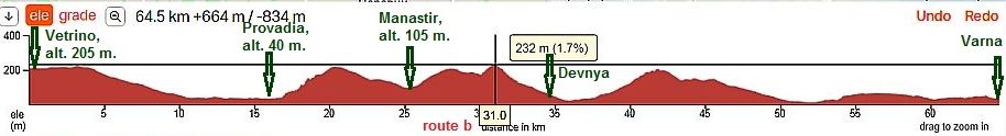
Two routes are possible here: The shortest distance to Varna is: Route a From Vetrino to Devnya to Varna
Route b Provadia is quite scenic. If you have time visit this area. From Vetrino to Provadia to Dobrina to Manastir to Devnya to Varna
|
||
|
Road 2008 (east from Devnya along the Lake of Varna) is available also. But this area is an industrial zone, so the traffic there is quite heavy. |
The next photos are of the countryside, from Vetrino to Provadia. There is a nice water spring just before the long descending after Vetrino. | |
|
|
 |
 |
 |
 |
 |
|
|
Provadia is a scenic place, it is placed in a not deep canyon along Provadiiska River. Overnight accommodation in Provadia is available, although in the touristy season some problems can appear. Information for Provadia and its fortress "Ovech" on the plateau over the town: https://en.wikipedia.org/wiki/Provadia http://trakia-tours.com/provadia-guide-94.html Next several photos of the plateau above Provadia and Ovech Fortres. |
|
|
|
|
|
|
|
|
|
| Several photos from Provadia. | ||
|
|
|
|
|
|
|
|
|
Information for Devnya and its interesting museum of mosaics: https://en.wikipedia.org/wiki/Devnya |
Next several photos are taken along the road just east above Provadia toward Dobrina, Manastir and Varna. |
|
|
|
|
|
|
|
|
|
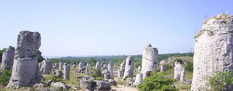
Between Devnya and Varna is placed an interesting place, so called "Stone Forest" or "Petrified Forest": |
||
|
|
||
|
|
|
|
|
|
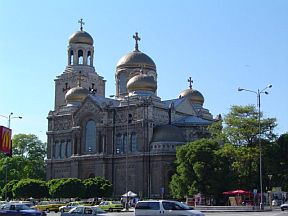
Varna is a nice town, we call it “the Sea Capital” of Bulgaria. Below are several photos of Varna: the City, its walking zone, the Cathedral, the City Garden, and the Sea Garden.
In Internet there is a lot of information for Varna, here are the 2 best sites I like:
https://en.wikipedia.org/wiki/Varna
https://www.britannica.com/place/Varna-Bulgaria
|
|
|
|
|
|
|
|
|
|
|
|
|
|
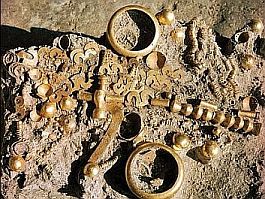
Several years ago on the region of Varna was found a burial, with some of the world's oldest gold jewellery, dating back to 4,600 - 4,200 BC.
|
The artefacts can be seen at the Varna Archaeological Museum. https://en.wikipedia.org/wiki/Varna_Archaeological_Museum Obviously the question concerns some very important person. I would not proceed with my gold in such a manner. |
|
|
|
|
|
Several photos of the Sea Garden in Varna. |
||
|
|
|
|
|
|
|
|
|
|
|
|
|
||
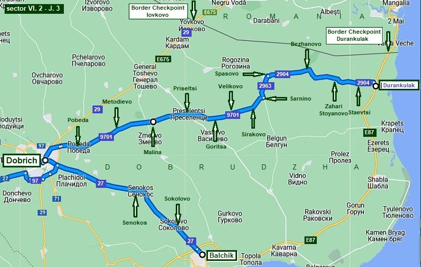
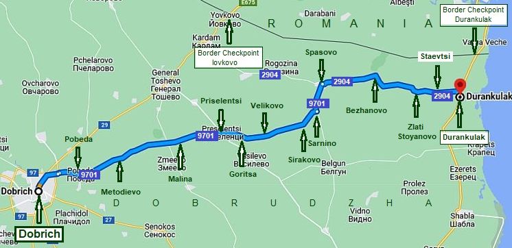
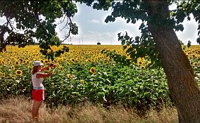
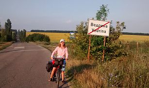
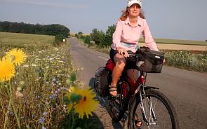
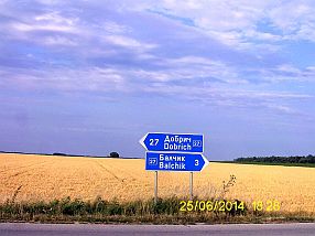
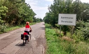
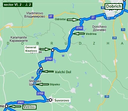 Sector VI. 2 - J. 2 For bicyclists having more time to explore Bulgaria, I will expand a little my description and give an additional route from Vetren to Dobrich to Balchik and to the North most point of Bulgarian seaside Durankulak. The area is called Dobrudzha, or more accurately South Dodrudzha, North Dobrudzha is in Romania - the area between Danube and Black Sea, north from Bulgaria. The area is easy for pedalling - almost flat, or not high rolling hills are available; it is a dry one as well, on the map I have pointed the only 2 water springs between Suvorovo and Vedrina available near the road. |
||
 |
||
 |
 |
 |
 |
 |
 |
|
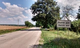
The two bigger settlements along the road here are Suvorovo and Valchi Dol. Some information for them is here: http://www.guide-bulgaria.com/NE/varna/suvorovo/suvorovo http://www.guide-bulgaria.com/NE/varna/vulchi_dol/vulchi_dol |
||
 |
 |
 |
 |
 |
 |
|
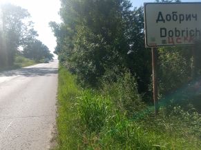
Dobrich is the main town of this district. Overnight accommodation in it is not a problem. |
Information for Dobrich: http://www.guide-bulgaria.com/NE/Dobrich/ http://www.guide-bulgaria.com/ne/dobrich/dobrich-city/dobrich |
 |
 |
 |
 |
 |
 |
|
|
||
|
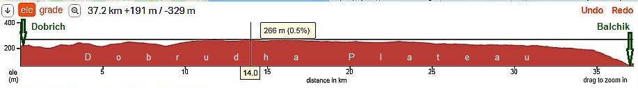
Sector VI. 2 - J. 3 In the last sector are shown roads toward the Black seaside: toward Balchik and Durankulak. |
||
|
From Dobrich to Balcik What
about the route from Dobrich to Balcik, it is a flat area and easy for
pedalling road
on Dobrudzha Plateau.
|
||
 |
 |
 |
 |
 |
 |
 |
 |
 |
|
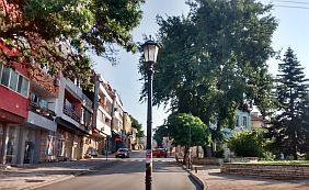
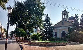
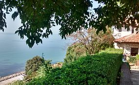
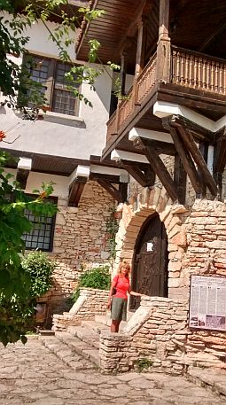
Balchik is a small city located in tiers above the sea. It is a touristy place. Rooms for the night are easily found, along with more luxury hotels. |
I love to stay here for a day or two. Information for Balchik: |
 |
 |
 |
 |
 |
 |
|
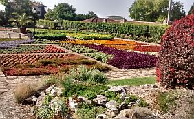
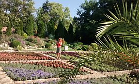
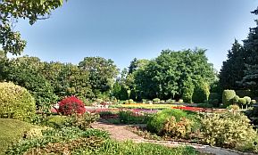
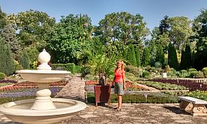
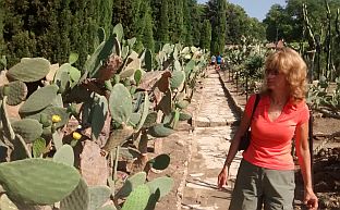
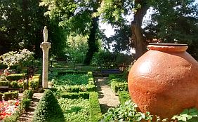
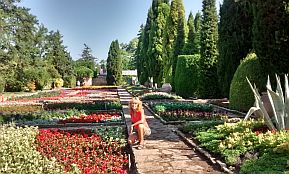
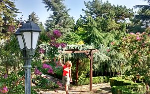
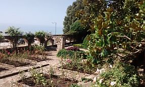
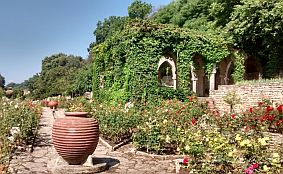
In the town there is a small residence of the Romanian queen with a lovely botanical garden. (This area was under Romanian control 1918 – 1938). Information for this spot: |
https://bulgariatravel.org/en/architectural-park- I like this garden and can not avoid to post more pictures :) |
 |
 |
 |
 |
 |
|
 |
 |
|
 |
 |
 |
 |
 |
|
 |
 |
|
 |
 |
 |
 |
 |
|
 |
 |
|
From Dobrich to Durankulak
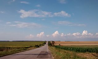
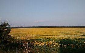
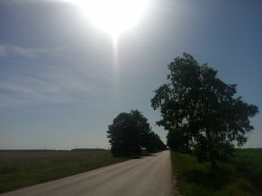
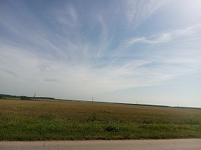
No problem to find food in villages along the road, the area is nice for camp in the wilderness. Photos of this beautiful plane area. |
||
 |
 |
 |
 |
 |
|
 |
 |
|
 |
 |
 |
 |
 |
 |
 |
 |
 |
|
More photos from the same area I took in June '23. I walked it. |
 |
 |
 |
 |
 |
|
 |
 |
|
 |
 |
|
 |
||
 |
||
 |
 |
 |
 |
 |
 |
|
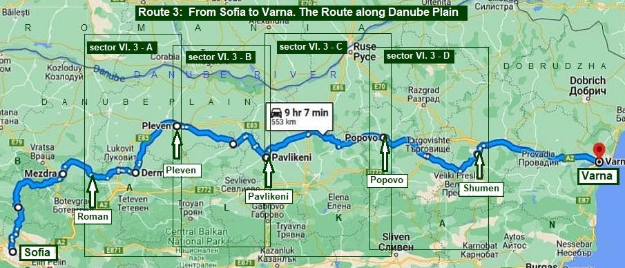
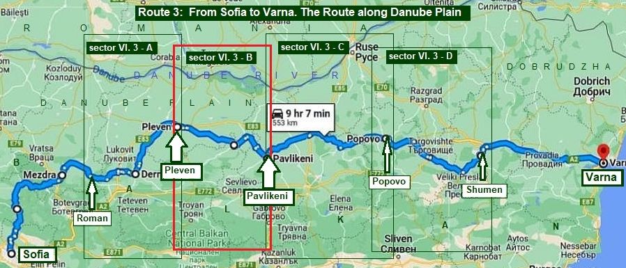
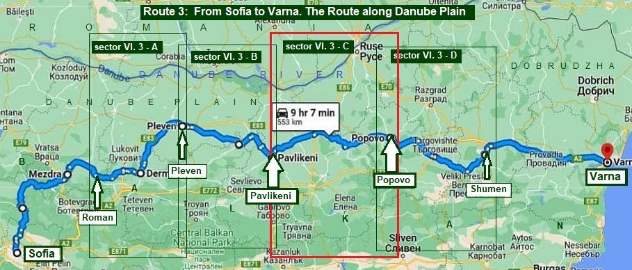
The route 3 From Sofia to Varna The route along Danube River Valley The route toward Varna along Danube River Valley is much more in a plains area.
|
||
|
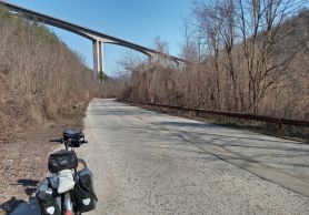
I recommend this route to bicyclists who do not love climbing. Have in mind, that summer time (July - August) here temperatures in the afternoons often exceed 35 deg C, so, this area is very appropriate to be explored spring time (April - middle of the June) and in the autumn time (September – October). This route is very appropriate also for bicyclists entering in Bulgaria in its north - west corner and intending to visit the Black seaside missing Sofia. I would recommend to look in the Chapter II. Routes: |
Further I will begin my description from Roman to Shumen only, as the descriptions of the routes: - From Shumen to Varna is given above in the same Chapter: The route 2, Sector VI. 2 - I: Shumen - Vetrino & Sector VI. 2 - J: Vetrino - Varna. - From Sofia to Roman for a very detail description of this route please look in: Chapter I. Passes in Balkan Point 2. Iskar River Gorge. - Of course you can cross Balkan along Vitinya Pass or Botevgradski Pass from Sofia to Botevgrad, or Etropolski Pass from Sofia to Etropole: look in the Chapter I. Passes in Balkan , points 3 & 4. |
|
|
|
||
|
The next my description concerns the route along Iskar River Gorge. The route is: From Sofia to Iskar River Gorge to Roman to Pleven to Pavlikeni to Popovo to Shumen to Varna.
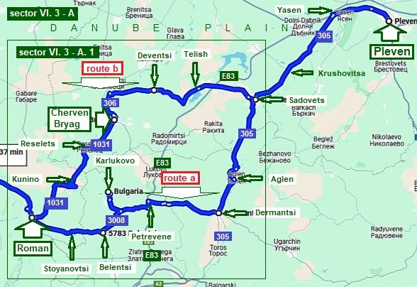
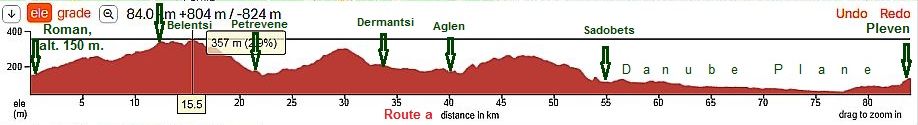
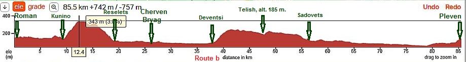
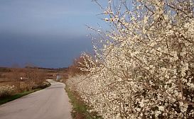
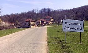
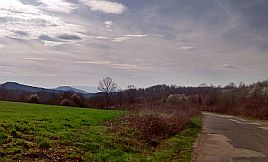
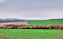
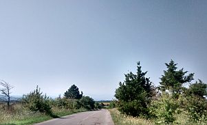
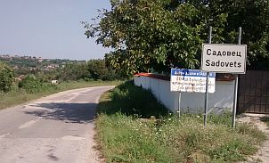
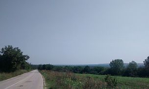
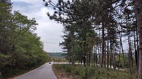
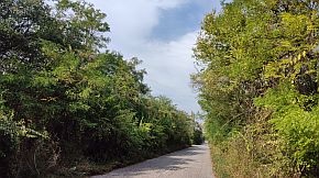
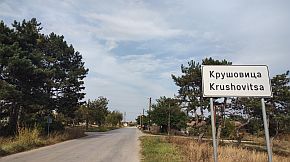
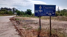
Sector VI. 3 - A From Roman to Pleven Avoid the road E83, it is a busy road. Next I will give two opportunities to reach Pleven: Route a From Roman to Stoyanovtsi to Belentsi to Petrovene to Dermantsi to Aglen to Sadovets to Krushovitsa to Yasen to Pleven. As it can be seen from the road profile chart, it is very nice pedaling area; hills are not steep, the road is absolutely free from traffic. |
||
|
|
||
|
In Roman there is not a possibility for overnight accommodation, but in the end if this paragraph I will mention an interesting opportunity for it in this region. You will leave the valley of Iskar River at Roman of first, Petrevene is in the next valley of Zlatna Panega River, Dermantsi is located in the next valley of Vit River. |
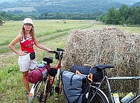
Riding toward Pleven, you will be down the stream of Vit River. Next several photos are taken in April '18 in the area from Roman to Dermantsi. I do not remember is food shops were available in Stoyanovtsi and Belentsi. There are food shops in Petrovene. |
|
 |
 |
 |
 |
 |
|
 |
 |
|
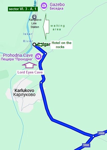
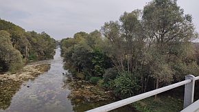
٭An opportunity An opportunity here is to visit a very scenic place Prohodna Cave, caled Lord Eyes Cave as well next to Karlukovo: https://en.wikipedia.org/wiki/Prohodna
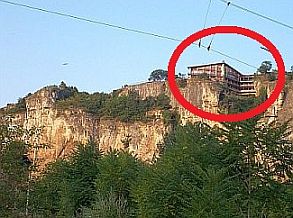
On the rocks above Iskar River there is a renovated hotel: https://ilovebulgaria.eu/en/cave-house-lukovit/
If you have the time, stay there for a night and walk in the region. The scenery is the best, a cave (named the Lord Eyes, or "Prohodna Cave") is a 20 minute walk from the hotel. |
| Toward Karlukovo and our camping place next to Karlukovo. | ||
 |
 |
 |
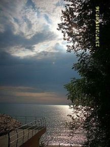
| The view from the hotel to Iskar River Gorge | ||
 |
 |
 |
|
When I pedalled this region in August '16, I wandered in this area on a very hot and strenuous day of pedalling. I chose to stay at the hotel that evening. At the hotel balcony, I enjoyed having a gin and tonic and ice and |
lemon before me. From the hotel there is a signed track to the cave entrance (the 4th photo below). Below are several photos of this area. |
 |
 |
 |
 |
||
 |
 |
 |
|
|
||
|
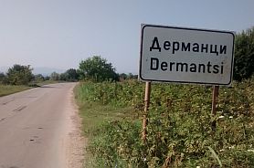
Toward Dermantsi In the center of Dermantsi there is a restaurant. When you almost leave Dermantsi (in north direction), you will |
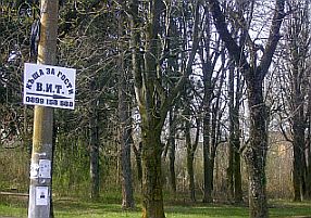
see a sign (the third pic below) for a guest houseand a cell tel. number. Unfortunately, the sign is written in Cyrillic: "къща за гости". |
|
|
|
|
|
The road from Dermantsi to Pleven is easy for pedalling in the both direction. Food is available in villages along the road. |
||
 |
 |
 |
|
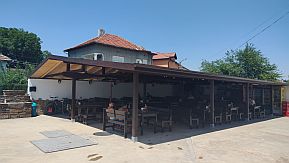
The road surround Aglen, but in the village there is a nice spot for relax in the hot summer afternoons: Hotel complex "Iglen": a food shop, restaurant, swimming pool. https://vila.bg/hotel-iglen-5337.html |
||
 |
 |
 |
 |
 |
 |
 |
 |
 |
 |
 |
 |
| More photos of this beautiful countryside I took in the extremely nice end of September '23. | ||
 |
 |
 |
 |
 |
 |
 |
 |
 |
|
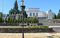
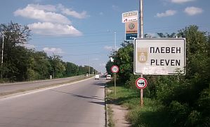
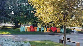
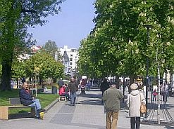
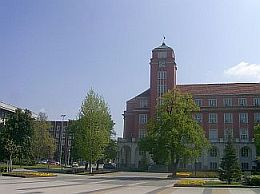
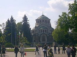
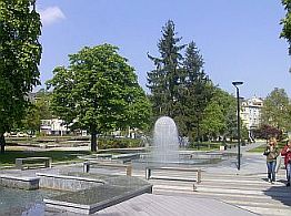
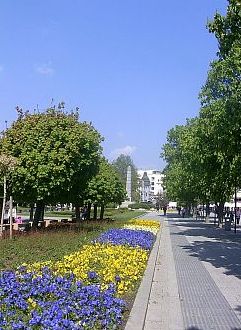
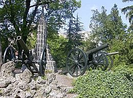
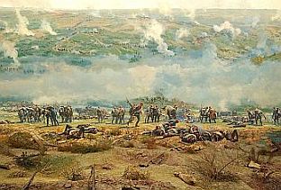
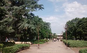
Pleven is known with a heavy battle between the Russian and Turk armies 1877 to 1878. A lot of information about the town is here: |
https://en.wikipedia.org/wiki/Pleven http://www.guide-bulgaria.com/nw/pleven/pleven/pleven https://bulgariatravel.org/en/town-of-pleven/ Below are several photos from Pleven. |
 |
 |
 |
 |
 |
 |
 |
 |
|
|
It is worth visiting Pleven Epopee Panorama: https://bulgariatravel.org/en/pleven-epopee-1877-panorama-pleven/ |
||
 |
 |
 |
|
Route b: From Roman to Kunino to Reselets to Cherven Bryag to Deventsi to Telish to Sadovets to Krushovitsa to Yasen to Pleven. Information about the route from Roman to Cherven Bryag and the opportunities in the region can be seen here:
Chapter I. Passes in Balkan Point 2. Iskar River Gorge: - Sector I. A - 2. e: From Mezdra to Roman to Kunino; - Sector I. A - 2. f: From Kunino to Cherven Bryag
Route b and route a share almost the same distance. |
|
|
|
Overnight accommodations are possible in Cherven Bryag: |
 |
 |
 |
|
The next several photos are of the countryside from Cherven Bryag toward Deventsi, Telish and Sadovets. Food and water is available in the villages. |
||
 |
 |
 |
 |
 |
 |
 |
 |
|
 |
 |
|
|
|
||
|
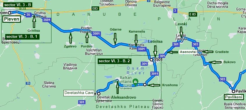
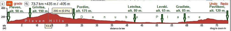
Sector VI. 3 - B: From Pleven to Pavlikeni
|
||
|
Avoid road N 3 (E83), the traffic is demanding. Follow my route. You will enjoy of very nice countryside ride and safe roads without any traffic. The route is: |
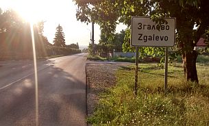
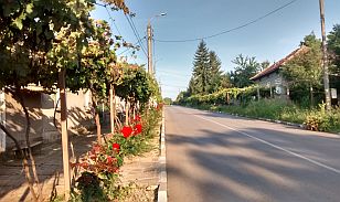
From Pleven to Grivitsa to Zgalevo to Pordim to Odarne to Kamenets to Letnitsa to Asenovtsi to Levski to Gradiste to Bukovo to Pavlikeni. | |
|
|
||
|
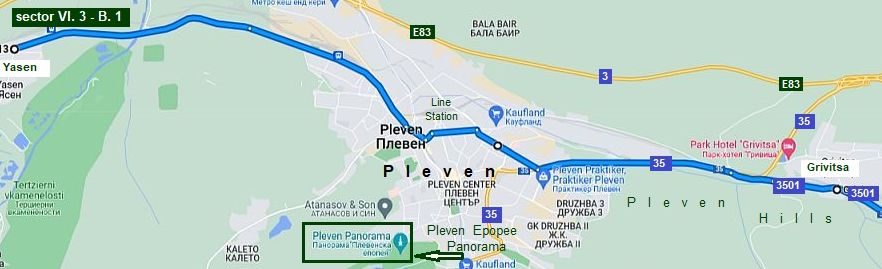
Leaving Pleven, there is a long hill, pedaling this grade on a hot summer afternoon is not pleasant. Avoid E83. Below is a more detailed map showing how to avoid E83. You have to enter in Pleven, then head up toward Grivitsa and Zgalevo. |
Leaving Pleven, for a while you have to pedal along road N 35. The point where you have to be on N 35 is labeled toward Varna or Ruse, not toward Zgalevo. The train tracks must be on your left all the time. Because the road may not be signed well, next is a more detailed map of the region next to Pleven. |
|
|
|
||
|
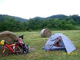
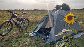
Next several photos show the road from Pleven toward Letnitsa, a really great area to camp in the wilderness, only 200 meters off the road in the field. |
||
 |
 |
 |
 |
 |
 |
| In the villages along the road food is available. | ||
 |
 |
 |
|
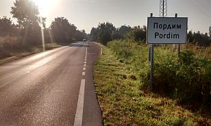
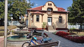
Pordim is a little town connected with our history |
||
 |
 |
 |
 |
 |
 |
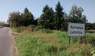
| Toward Letnitsa | ||
 |
 |
 |
|
In Letlnitsa overnight accommodations are available. Information: http://www.guide-bulgaria.com/nw/lovech/letnitsa http://www.guide-bulgaria.com/nw/lovech/letnitsa/letnitsa |
 |
 |
 |
 |
 |
 |
|
|
|
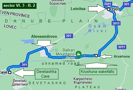
٭Opportunities in this region Sector VI. 3 - B. 3
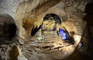
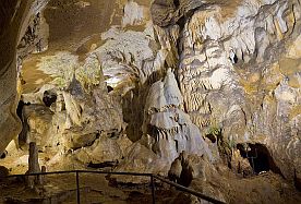
Here I will increase the scale again. Letnitsa there are two nice places worth visiting: A. Waterfalls near Kroshuna; B. Devetashka Cave.
Krushuna has overnight accommodations in small guest houses at fair prices and nice local restaurants. |
|
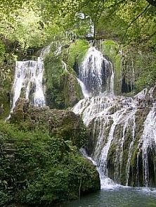
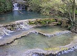
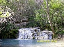
A. Kroshuna Waterfalls Information about Falls and many photos of this amazing place can be seen here: |
||
 |
 |
 |
 |
 |
 |
|
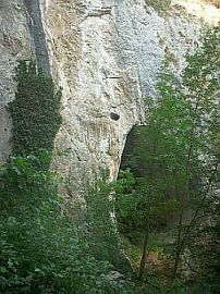
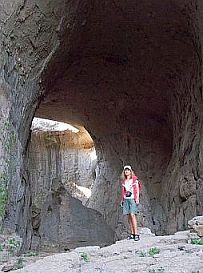
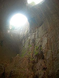
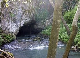
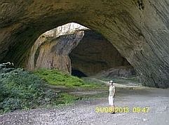
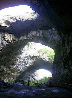
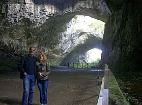
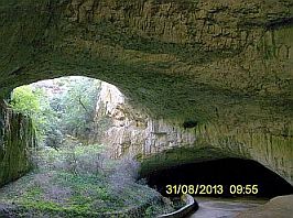
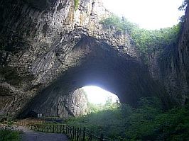
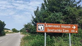
B. Devetashka Cave |
||
|
Devetashka Cave is a must see. The photos I have posted below do not due justice to the beauty there. |
Hollywood movie scenes have been made here. |
|
 |
 |
 |
 |
 |
| My camping place near Devetashka Cave. | ||
 |
 |
 |
|
|
| Toward Levski. Again the road is without any traffic. | ||
 |
 |
 |
 |
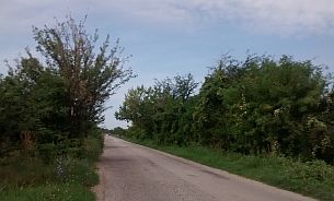 |
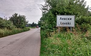 |
| Information for Municipality of Levski and Levski: | ||
 |
 |
 |
| Countryside toward Pavlikeni. | ||
 |
 |
 |
 |
 |
 |
|
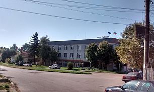
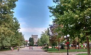
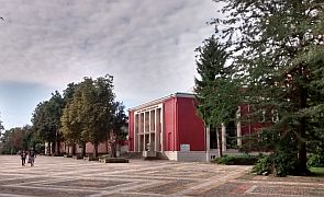
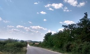
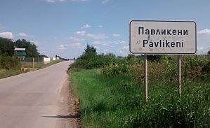
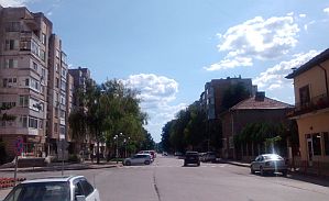
Overnight accommodations are available in Pavlikeni. Here is information for it: https://en.wikipedia.org/wiki/Pavlikeni http://www.visitbulgaria.net/en/pavlikeni/pavlikeni.html |
||
 |
 |
 |
|
|
||
|
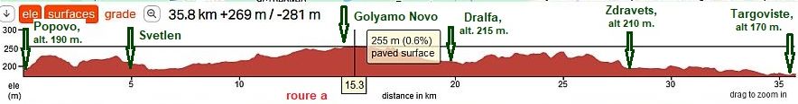
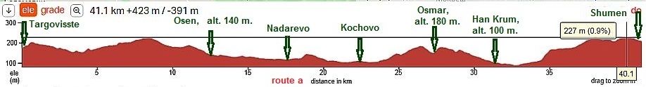
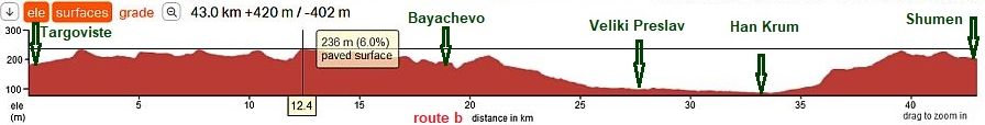
Sector VI. 3 - C From Pavlikeni to Popovo
For better description I will part this in two sectors
Sector VI. 3 - C. 1
Here I will suggest two routes, both of them with very little traffic:
- Route a: toward Polski Trambesh and the and of road 407;
- Route b: toward Dolna Oryahovitsa and the and of road 514. |
||
|
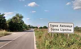
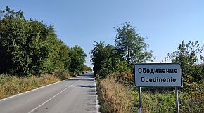
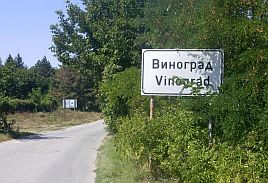
Route a: From Pavlikeni (405) to (502) Patresh to Gorna Lipnitsa to Dolna Lipnitsa to Obedinenie to Ivancha to Klimentovo to Polski Trambesh to Karantsi (407) to Orlovets to Vinograd to Lozen (514). |
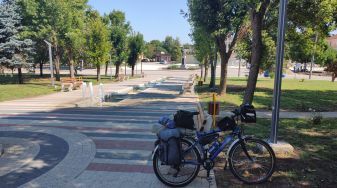
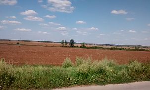
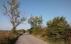
The route from Pavlikeni to Polski Trambesh is a flat plane area (except the 5 km hill leaving Pavlikeni), it is easy and pleasant for bicycling. Food shops are available in villages along the road. The area is very nice for camping in the wilderness. There is very little traffic here. | |
|
|
||
 |
 |
 |
 |
 |
 |
 |
 |
 |
| Food and water is available in the villages along the road. | ||
 |
 |
 |
 |
 |
 |
 |
Overnight accommodations are available in Polski Trambesh. I suggest the Hotel Esperanto as it has English language signage. In the small town they have a nice swimming pool of thermal water. Very little information for Polski Trambesh Municipality and Polski Trambesh is available here: http://www.guide-bulgaria.com/NC/veliko_turnovo/polski_trambesh http://www.guide-bulgaria.com/NC/veliko_turnovo/polski_trambesh/polski_trambesh |
|
 |
 |
 |
| Leaving Polski Trambesh to the east, the road crosses Yantra River. | ||
 |
 |
 |
| Up the hill east from Yantra river. there is a water tap just start climbing. | ||
 |
 |
 |
 |
 |
 |
 |
 |
|
 |
 |
|
|
After Orlovets the area is almost flat plain again. There are several water springs along the road - next to Vinogradi and Lozen |
||
 |
 |
 |
 |
 |
 |
| The next photos illustrate the same area and are taken in the beautiful September ' 23. | ||
 |
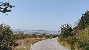 |
 |
| There is a little food shop in the village, open only in the morning and late afternoon. | ||
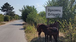 |
 |
 |
 |
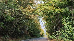 |
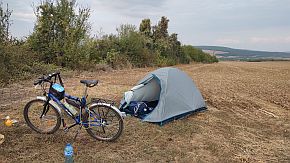 |
 |
 |
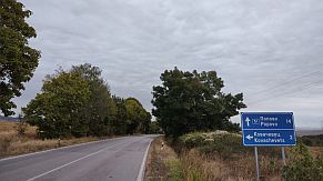 |
| Route b | ||
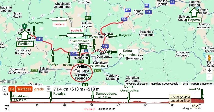 |
||
|
Route b: From Pavlikeni to Stambolovo (road 3031) to Rusalya to Hotnitsa to Samovodene to Parvomaytsi to Pravda to (off road) Dolna Oryahovitsa to Draganovo to the crossroad with 51. Comparing with route a, the distance here is 10 kilometers longer, but the climbing is less. This route is |
close to Veliko Tarnovo - a history place tourists love to visit. The next several photos illustrate the countryside from Pavlikeni toward Samovodene - a typical view of Danube Plane. The route is very easy and extreme pleasant for pedaling. The traffic is minimal, food and water can be found in the villages along the road. |
|
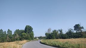 |
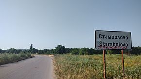 |
 |
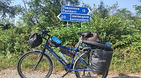 |
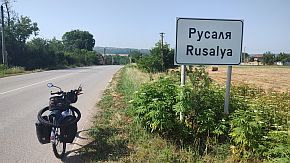 |
 |
| The area is agricultural - photos were taken on 20th June - the harvest time. As the spring'24 came 3 weeks earlier, the sunflowers were flowering at the same time, usually it happens after 5th of July. | ||
 |
 |
 It was unforgettable June 1500 km tour - my 1000 kilometers just next to Hotnitsa. |
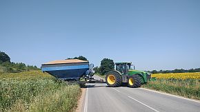 |
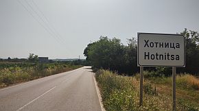 |
|
 |
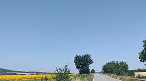 |
|
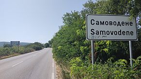 |
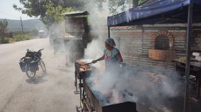 |
Samovodene is a bigger village located on the international road E85 - one of the most dangerous roads in Bulgaria. Fortunatelly in the village the car speed is restricted, so a kilometer and half pedaling along ti is not dangerous. Here you will see a lot of barbeque along the road. |
| Be careful to find the road toward Parvomaytsi, I remember it was not signed. | ||
|
Toward Parvomaytsi and Pravda. |
||
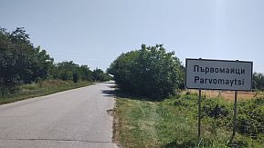 |
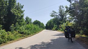 |
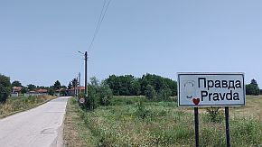 |
| The off road from Pravda to Dolna Oryahovitsa. If its raining, to pedal this off road would be not nice idea. In such a case pedal the route: From Samovodene to Polikraiste to Yantra to Draganovo, road 5003. | ||
 |
 |
 |
|
|
||
|
Gorna Oryahovitsa is a big railway center. The lines crosses Bulgaria from east to east and from north to south. Overnight accommodation is available here. Information is here: http://www.guide-bulgaria.com/NC/veliko_turnovo/gorna_oryahovitsa/gorna_oryahovitsa |
||
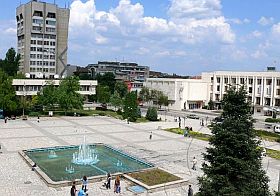 |
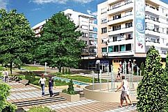 |
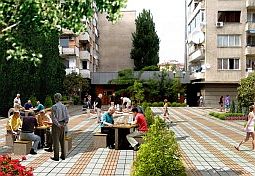 |
|
In the Chapter III. A. North - Central Region, Sector III. A - 3, Route c: From Svistov to Veliko Tarnovo & Sector III. A - 3. c I have given information for the route from Gorna Oryahovitsa to Arbanasi and Veliko Tarnovo, as well as information and photos for them. |
|
Leaving Dolna Oryahovitsa toward Draganovono |
||
 |
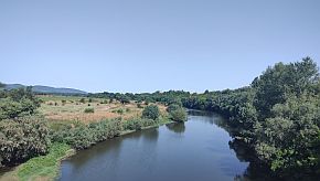 |
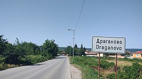 |
|
A view from the hill after Dolna Oryahovitsa toward Draganovo an valley of Yantra River.
|
||
| Soon after Draganovo the road takes east direction, starting with a 10 kilometers not steep and easy for pedaling hill, although the pedaling here may be a | little tough in the hot summer afternoons, when the sun is just behind your back. The road is very nice, the traffic is minimal. |
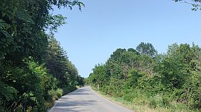 |
 |
 |
 |
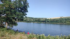 |
|
| In the end of the hill at the crossroad toward Strazhitsa there is a restaurant, All the area is nice for camping. | ||
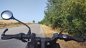 |
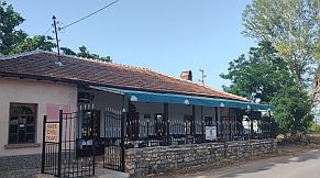 |
 |
|
Sector VI. 3 - C. 2
|
||
|
Soon, east from Lozen (road 407) and Kamen (road 514) , you will be at the crossroad with the road N 51 (from Byala toward Popovo - the first photo below), where the traffic is more intensive. |
||
 |
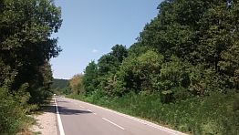 |
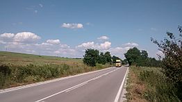 |
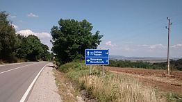 |
 |
 |
|
About 5 to 6 kilometers to Popovo are the remains of a huge ancient Roman fortress, known as Kovachevsko Kale. |
The two first photos below show my camping place next to the fortress. |
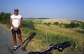 |
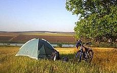 |
 |
|
Very little information for Popovo: |
||
 |
 |
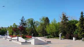 |
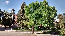 |
 |
|
 |
 |
|
|
|
Sector VI. 3 - D From Popovo to Shumen For more detail description I will the sector on two giving variants intending to avoid the traffic.
|
|
Sector VI. 3 - D.1
Route a: From Popovo (Road 51) to Svetlen to Golyamo Novo to Dralfa (Road 74) to Podgoritsa to Zdravets to Vabel to Targoviste |
||
|
The road profile chart shows the terrain is easy for pedaling. |
||
 |
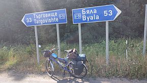 |
 |
 |
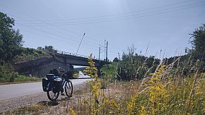 |
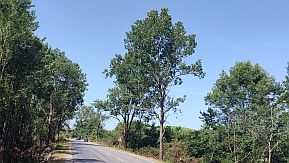 |
| Food shops are available along the road. | ||
 |
 |
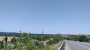 |
| Below the tractor trailer - my relaxing place in the hot summer afternoon. | ||
 |
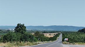 |
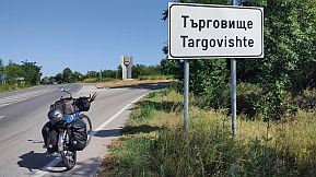 |
|
Information for Targoviste: |
Romania has a town with the same name. Remember this when you are researching in GOOGLE for Targoviste in Bulgaria. |
 |
 |
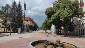 |
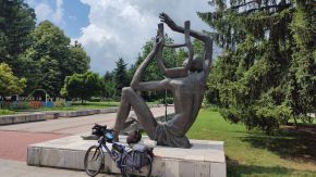 |
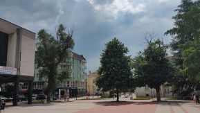 |
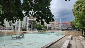 |
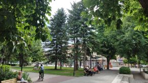 |
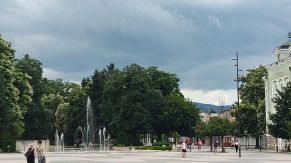 |
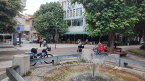 |
|
Route b: The route is: From Popovo (road 51) to Svetlen to Aprilovo (road 409) to Dolna Kabda (road 4009) to Gorna Kabda to Presyan to Aleksandrovo to Lilyak to Targoviste.
Comparing with route a, the distance here is a little bit longer and altitude gain is 450 m - a little bit more than altitude gain of 270 m in altitude gain. The traffic here is minimal. |
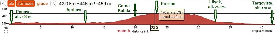 |
| Entering Svetlen you have to turn right following the sign for Omurtag (road 409). Here you will leave the main road. | The next village is Aprilovo. Food is available in Aprilovo. I do not remember if in the next two small villages, Dolna Kabla and Gorna Kabla, have food shops. |
|
|
 |
 |
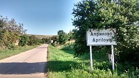 |
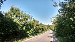 |
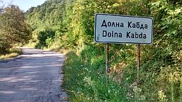 |
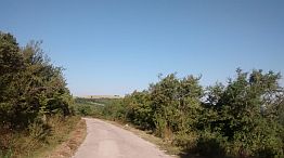 |
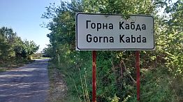 |
 |
|
The next several kilometers after Gorna Kabla are on a plateau. The road is in a poor condition for several |
kilometers, the entire area is a higher, with a nice views in any direction. |
 |
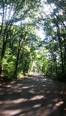 |
 |
 |
 |
|
 |
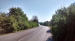 |
|
Sector VI. 3 - D. 2
Here I will suggest two routes: Route a: The route in this very pleasant for pedaling area is: From Targoviste (road E 772) to Vasil Levski (unnamed road) to Lovets to Osen to Nadarevo to Kochovo to Osmar to Troitsa to Han Krum to Shumen.
|
||
|
Leaving Targoviste, you will easily locate the road toward Vasil Levski (V. Levski). The road is signed well. Again, there will be not any traffic once leaving the |
main road E 772. Unfortunately most of the roads you have to travel here are not numbered on the map. |
|
 |
 |
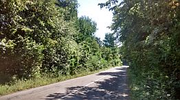 |
 |
 |
 |
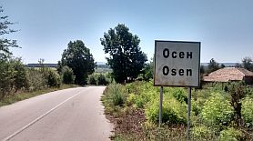 |
 |
 |
|
I remember there was a food shop in Kochovo, the name of the village is something like Ramvill. Below is the symbol of the village. |
||
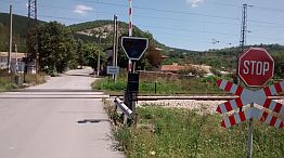 |
 |
 |
 |
 |
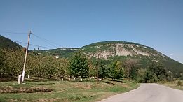 |
 |
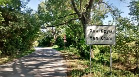 |
 |
|
Route b: From Targoviste (road E 74) to Bayachevo to Pevets to Kraevo to Mostich to Veliki Preslav (road 7) to Han Krum to Shumen.
|
||
|
Next several photos illustrate the countryside from Targoviste to Veliki Preslav. the photos are taken in a |
raining June '22 afternoon and next morning. The traffic here is not heavy and the road is in very nice condition. |
|
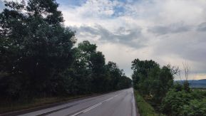 |
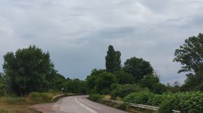 |
 |
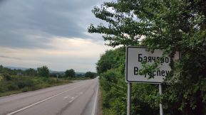 |
 |
 |
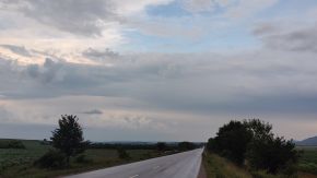 |
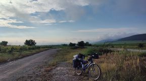 |
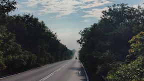 |
 |
 |
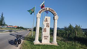 |
|
The same area, a sunny June '24 afternoon.
|
||
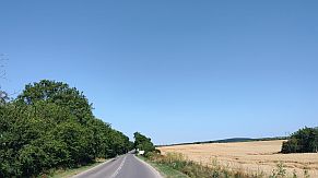 |
 |
 |
|
Information for Veliki Preslav: |
||
|
|
|
|
|
|
|
|
|
|
|
|
|
٭An opportunity
Three to four kilometers south from Veliki Preslav are the historical remains of Preslav, the capital of the First Bulgarian Kingdom IX – X century. A hotel & and restaurant are available in the region of the park.
https://bulgariatravel.org/en/veliki-preslav-national-historical -archaeological-reserve-veliki-preslav-great-preslav/
A little information for the First Bulgarian Kingdom: https://en.wikipedia.org/wiki/First_Bulgarian_Empire
A hotel & and restaurant are available in the region of the park. |
|
|
|
|
|
|
|
|
The road 7 from Veliki Preslav to Shumen is easy for pedalling. A beautiful area for camping in the wilderness is next to Han Krum - Golyama Kamchia River, hot and clean water. |
||
|
|
|
|
|
|
|
|
|
|
|
|
|
Next links are the Information about Shumen:
|
as well as several photos of the same area - approach to Shumen (from North) and the plateau (Shumen Fortress) next to it, the town and my afternoon relax place in the town garden: |
|
|
|
|
|
For the route Shumen - Varna see the same Chapter: The route 2: - Sector VI. 2 - I : Shumen - Vetrino; - Sector VI. 2 - J: Vetrino - Varna.
|
||
.jpg)
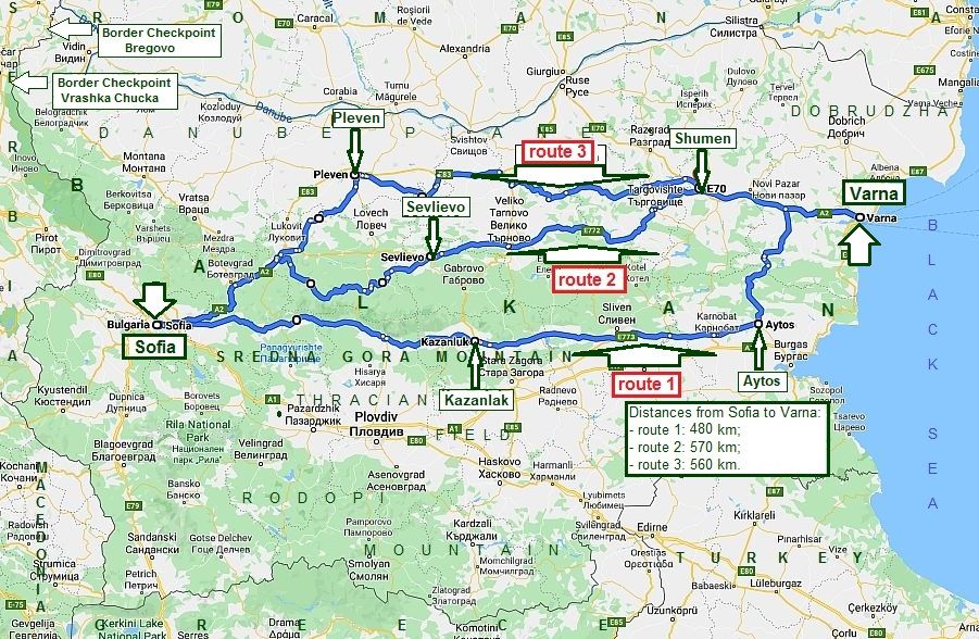

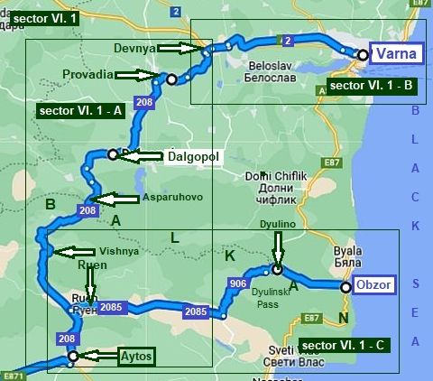
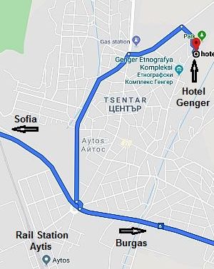
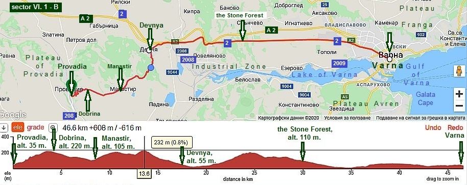
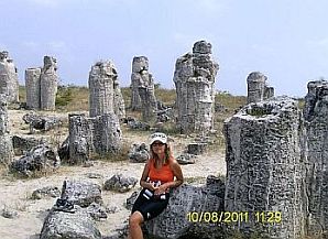
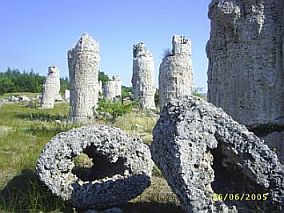
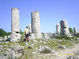

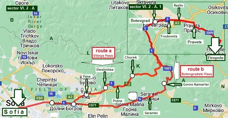
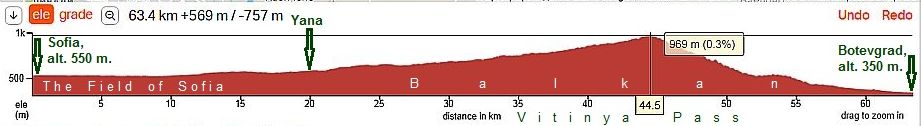
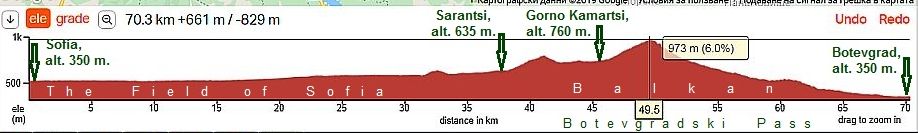


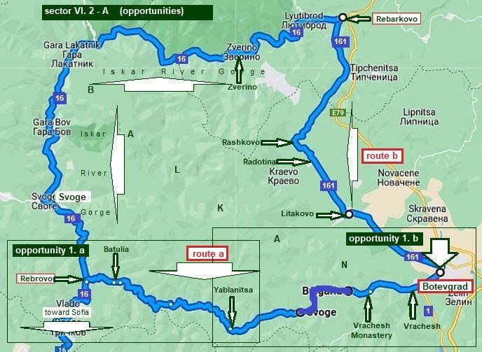


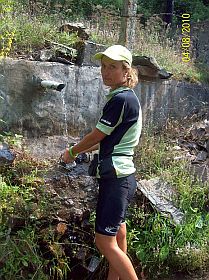
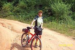
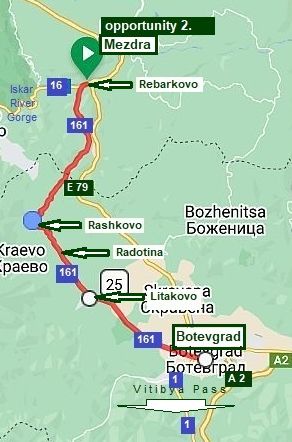


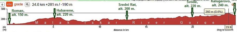
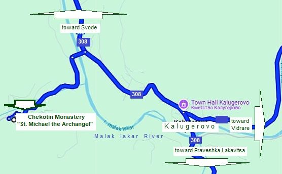

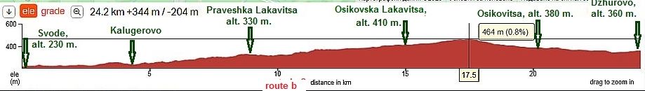


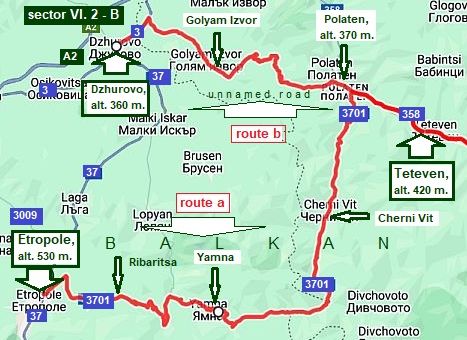
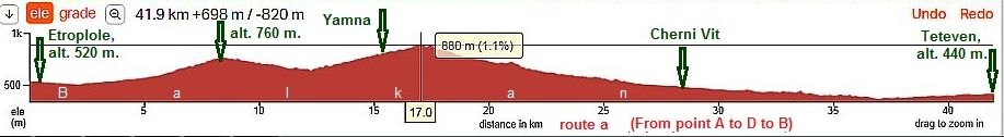

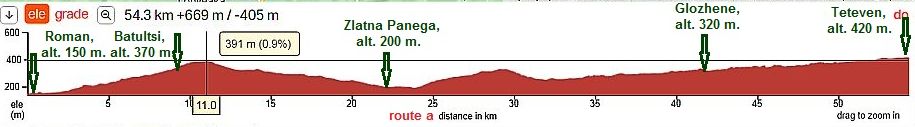
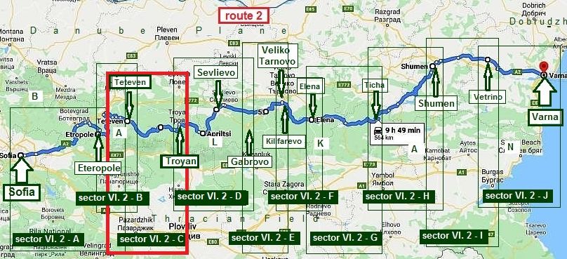
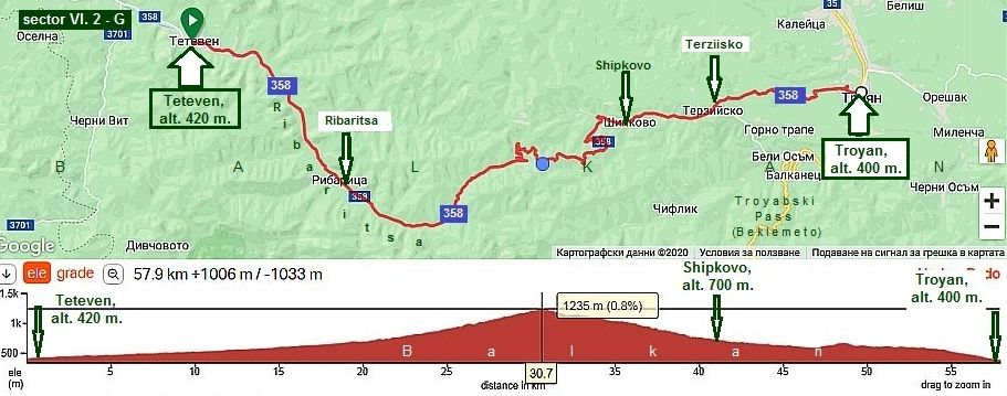
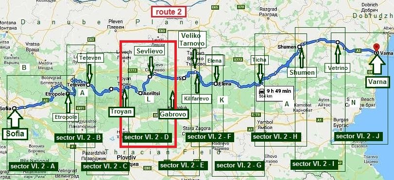
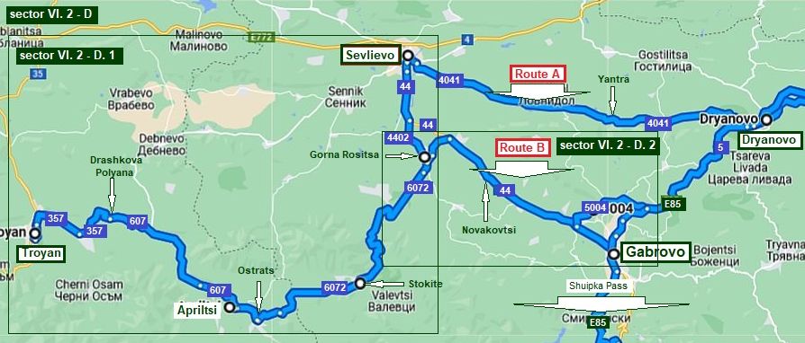

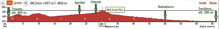
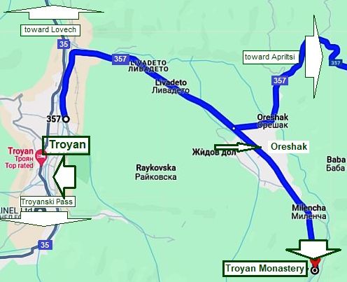
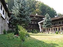
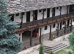
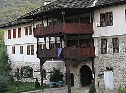
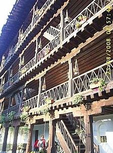
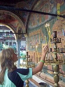
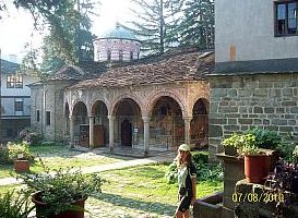
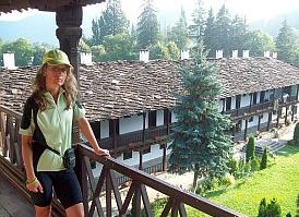
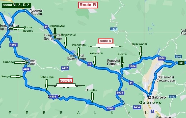
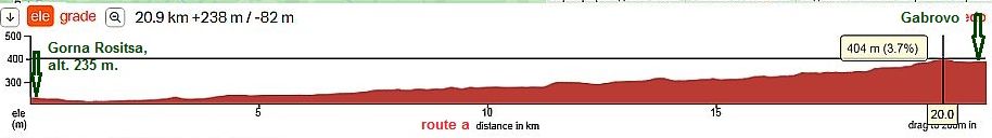
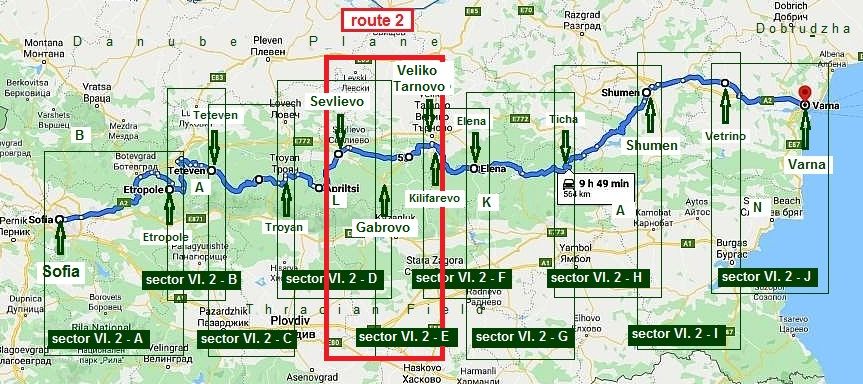
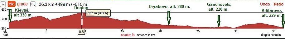


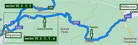
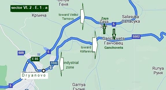
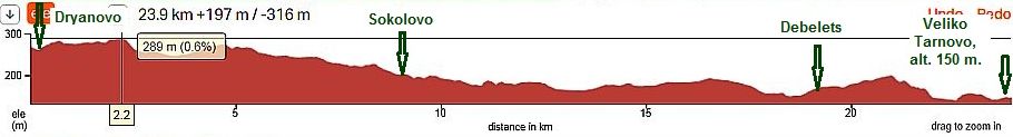
c.jpg)
a.jpg)
.jpg)
.jpg)
.jpg)
.jpg)
c.jpg)
.jpg)
.jpg)
a.jpg)
.jpg)
.jpg)
.jpg)
c.jpg)
.jpg)
.jpg)
c.jpg)
c.jpg)
.jpg)
a.jpg)