|
|
||
|
|
|
|
|
|
||
|
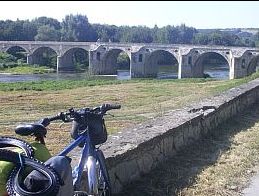
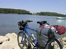
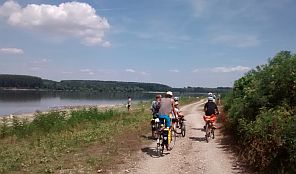
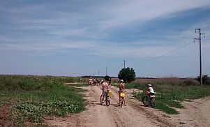
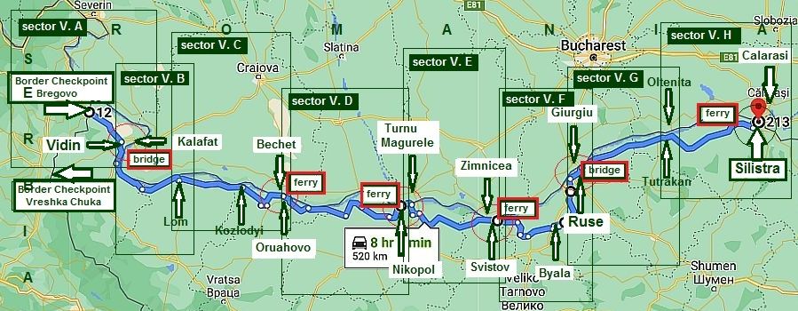
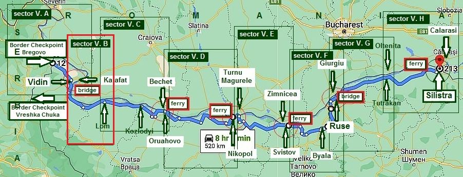
V. Bicycling along Danube River |
||
|
|
||
|
|
||
|
|
|
|
|
|
||
|
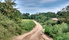
V. Bicycling along Danube River |
||
|
|
||
|
I have seen several sites in Internet and guide books (including not Bulgarian) concerning this route supplying not correct !!! I believe my description here will be usefull. ALWAYS CARRY MOSQUITO REPELLENT !!! Danube . . . the great European River . . . https://www.britannica.com/place/Danube-River
|
||
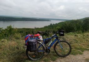
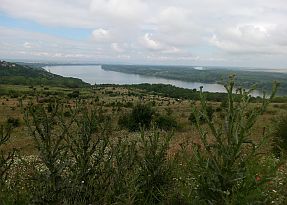
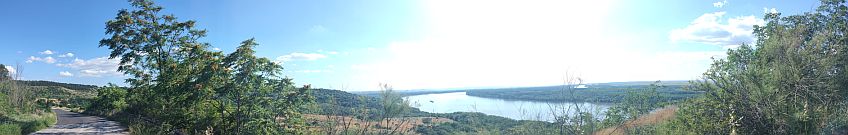
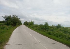
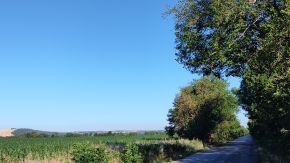
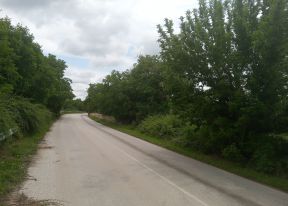
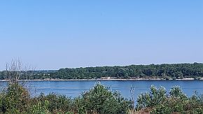
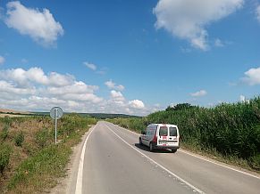
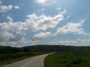
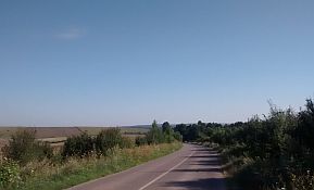
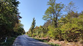
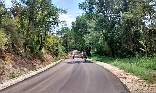
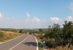
| Bicycling along Danube River: As a destination in Bulgaria there are much more exciting places to be explored, I know that many people, especially ones from Central & West Europe, plan a tour along Danube River – from its spring to its mouth in the Black sea. So, I have decided, that some information in this site concerning this destination would be appropriate and useful. My suggestion is to read this Chapter if you really intend to explore this route. | The area from Vidin to Silistra (Bulgarian part of Danube River) is easy to bicycle, with some minor grades of 1 - 2 kilometers each. Most of the route in this area has limited visibility with the river, but because the Bulgarian riverside is higher than Romanian riverside, there are several places with nice views to the river, usually in towns, which are located at higher places. In the bigger towns near the River there are hotels, so overnight accommodation should be not a problem. | |
|
|
||
|
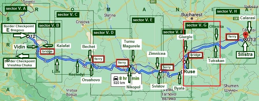
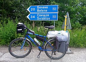
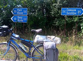
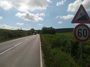
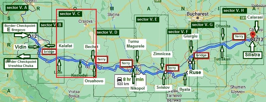
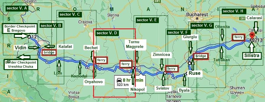
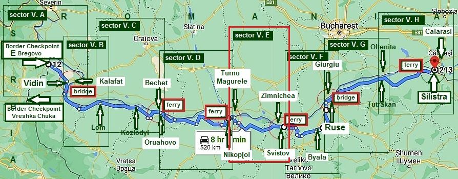
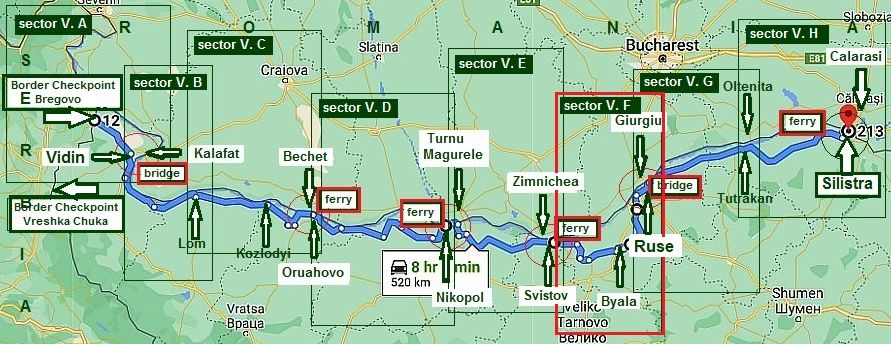
Describing the route further, I will point the places where it is possible to cross the river. The route, almost 520 kilometers long is (West - East): From border checkpoint Bregovo (BG/Serbia Border) to Vidin to Lom to Kozlodui to Oryahovo to Nikopol to Svistov to Byala to Ruse toTutrakan to Silistra. |
For a better and more detail information I parted the route into 8 sectors: V. A to V. H, and it will be content of the Chapter. In the end I will add a little more information concerning two new Border Checkpoints between Bulgaria and Romania east from Silistra, opened 3 - 4 years ago. |
|
|
|
||
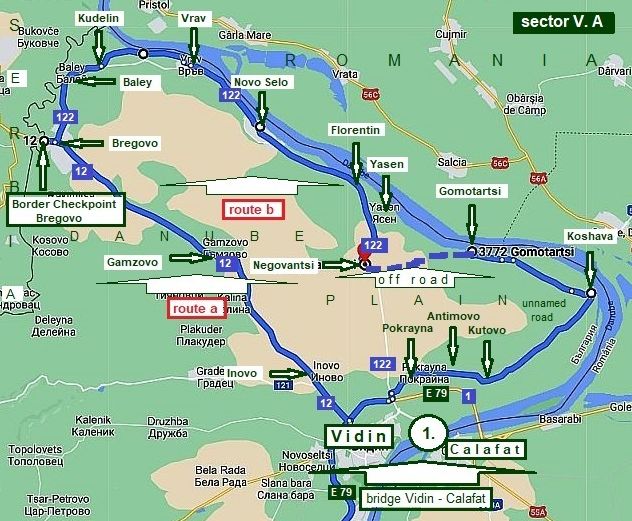
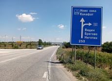
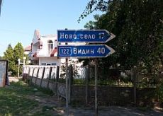
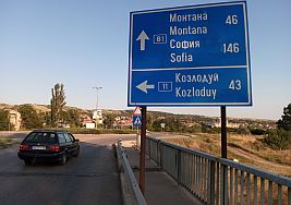
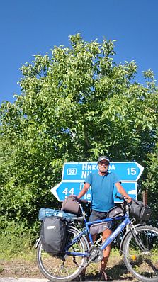
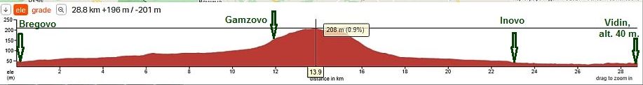
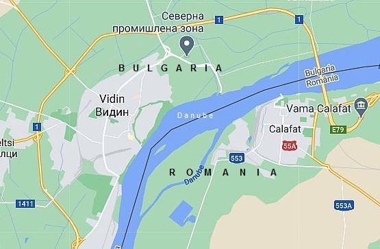
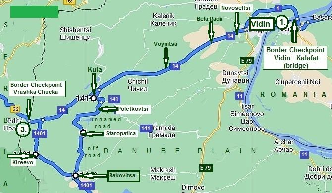
Sector V. A From Border Checkpoint Bregovo to Vidin If you wish is to explore the entire Bulgarian part of this route, you have to enter from Serbia: border checkpoint Bregovo: point 2 on the map below (another point to enter/leave Bulgaria is the bridge near Vidin - point 1 on the map below).
Here are shown two opportunities to reach Vidin from border checkpoint Bregovo:
a) Directly to Vidin - Route a; b) Along Danube River - Route b.
|
|
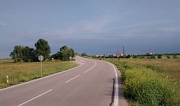
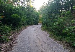
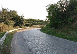
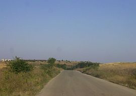
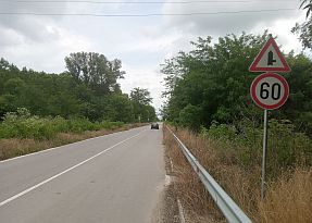
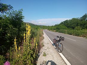
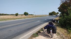
Route a Directly to Vidin City Road 12 is an international road between Bulgaria and Serbia with very little traffic. The route is: From border checkpoint Bregovo to Gamzovo to Inovo to Vidin.
|
|
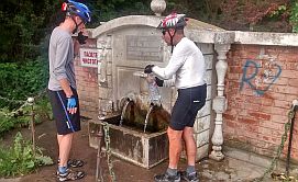
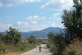
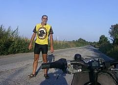
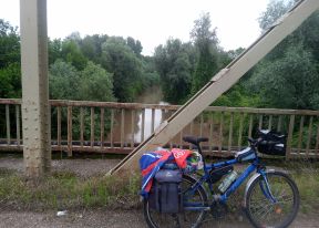
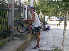
Exploring the area for the first time, I was very surprise to see this big hill between Vidin and Bregovo, I had to climb in one very hot July afternoon. In Bregovo I found a little work shop (I had to replace |
my rear bearing), people there helped me with a wrench N24 and a heavier hammer, the only tools I need to repair each bike damage I do not bring with me . . . too heavy . . . |
 |
 |
 |
| Gamzovo is a little apart from the main road, if you need a food or water, you have to leave road 12. | ||
 |
 |
 |
 |
 |
 |
|
Relaxing in the little garden in Inovo with a big cup of tonic and cubes of ice - just next to the road there was a little restaurant. |
||
 |
 |
 |
|
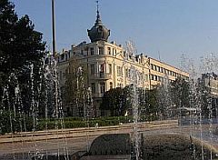
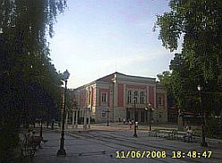
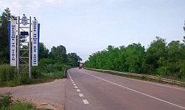
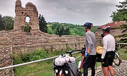
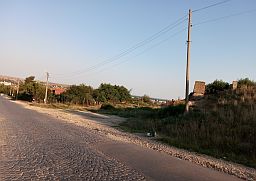
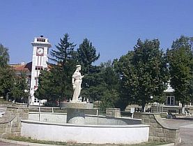
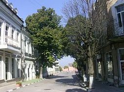
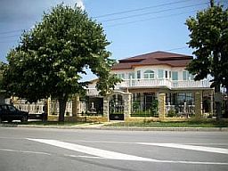
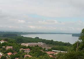
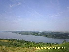
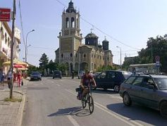
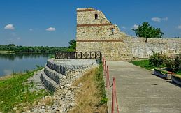
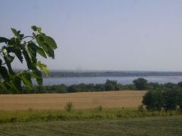
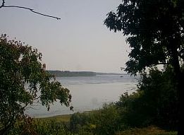
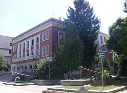
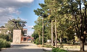
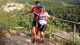
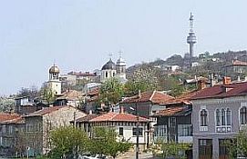
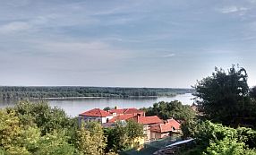
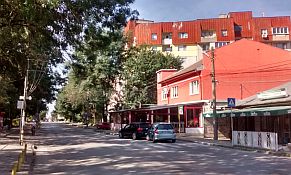
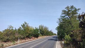
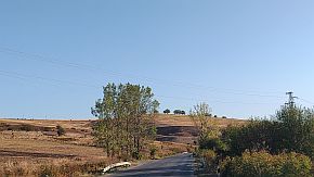
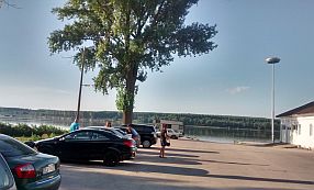
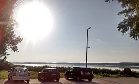
Approaching Vidin, you can choose to enter or surround city. The City played an important role in Bulgarian mediaeval history. Information about the town can be seen in the next two Sites: |
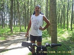
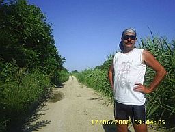
Have in mind that near Vidin Danube River flows to South - West, not to East. It is very easy to lose orientation in this town. Do not be surprised, if you see the sun is rising from West :) . . . Next several photos are from Vidin. |
|
|
|
|
|
|
||
 |
 |
 |
 |
 |
|
 |
 |
 |
|
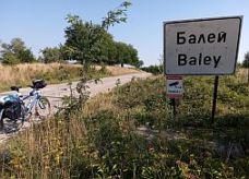
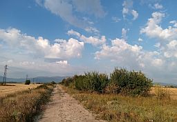
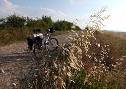
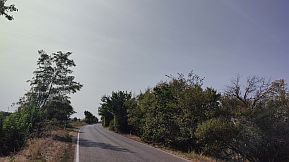
Route b Along Danube River
For bicyclists entering in Bulgaria through border checkpint Bregovo and having more time my suggestion is to take a little the tour, pedaling along Danube River:
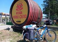
From border checkpoint Bregovo to Bregovo to Baley (road 122) to Kudelin to Vrav to Novo Selo to Yasen to Florentin to Negovantsi to Gomotartsi to Kohhava to Kutovo to Antimovo to Pokrayna to Vidin.
This will be a flat area route.
In Bregovo you have to find the sign toward Novo Selo - road 122.
|
 |
 |
 |
|
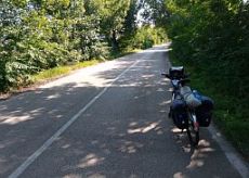
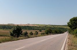
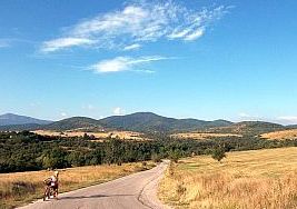
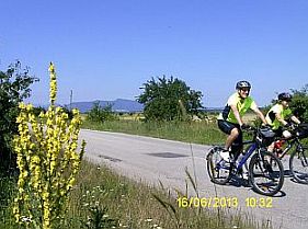
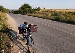
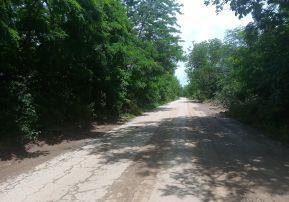
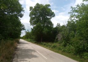
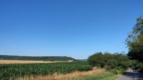
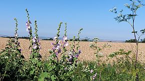
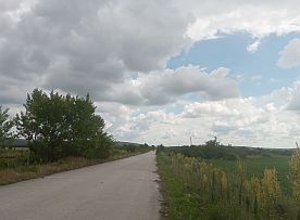
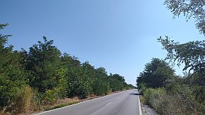
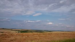
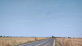
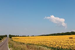
I can say the countryside is beautiful. Roads are nice with very little traffic. Water and food is available in all the small villages along the road. |
 |
 |
 |
 |
 |
|
 |
 |
 |
|
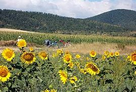
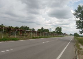
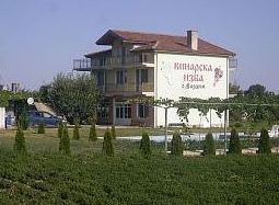
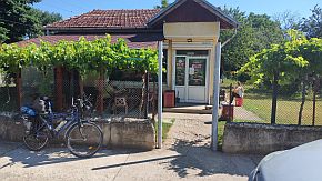
The region is known a lot of vineyards. They produce a local of aromatic red wine called "Gamza". Behind the big woods in the background of the photo below there is a shop offering a lot of these aromatic local wines. |
 |
 |
 |
 |
 |
 |
|
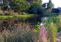
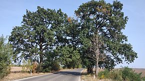
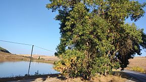
Next to Florentin is a really nice place to take a break and relax. When exploring this area have mosquito repellent with you. Usually, after June, the level of Danube River gets lower. |
 |
 |
 |

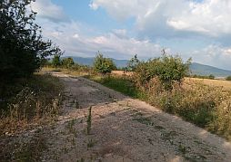
Reaching Negovantsi you can pedal directly toward Vidin. My suggestion is to head back toward Danube river following the off road toward Gomotartsi. The off road is not in bad condition and is not signed, Google Map shows it is only 300 meters long.
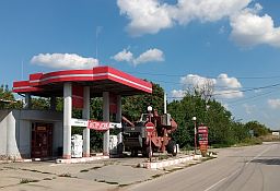
Leaving Negovanovtsi, look for a signs toward Vinarovo (the second photo below) to right, a little ahead is a fuel station. |
||
 |
 |
 |
|
Traveling toward Vinarovo, you have to turn to left (the first photo below), just 100 meters before the fuel station, it is the off road you need to pedal toward Gomotartsi. |
Three hundred meters further your GPS will show that the road ends. Rather, you will reach a bridge over irrigate channel in the field. |
 |
 |
 |
 |
 |
|
Just after the bridge take the left turn (the last photo above) and follow the off road. You should experience any more problems on your travels to Gomotartsi. If memory serves, the village is 10 km further. |
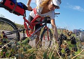
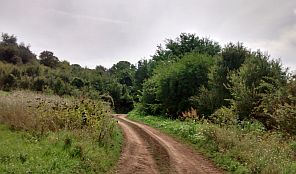
The next several photos illustrate this beautiful countryside. There were a lot of blackberries and pear trees along the route. |
|
|
|
|
|
|
|
|
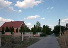
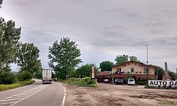
| Just before entering in Gomotartsi you will start pedalling again on asphalt road. Food is available in it. | ||
 |
 |
 |
|
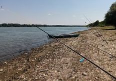
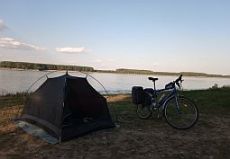
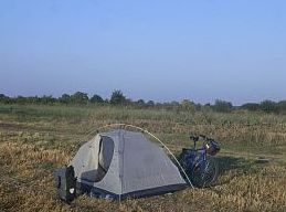
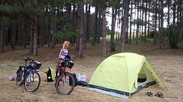
Knowing I was going to arrive late in Koshava, I spent the night next to the Danube River. |
 |
 |
 |
|
This is where I spent my night on the river shore.
My intention, the next morning, was to follow the off road just next to the river, According to Google Map it should have took me to Vidin.
To my surprise, a kilometer later, this road ended - in the bushes - the second photo below.
I pedaled up to Koshava taking the main road toward Kutovo and Vidin. |
||
 |
 |
 |
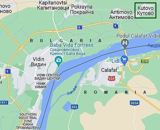
If you choose to not visit Vidin, in Kutovo you can take road 1 (E 79) and go around the city heading toward Lom.
You will again be again on the main road, pedaling in heavy traffic. Maybe, it might be a better idea to pedal through Vidin.
|
||
 |
 |
 |
 |
 |
|
|
|
|
|
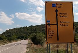
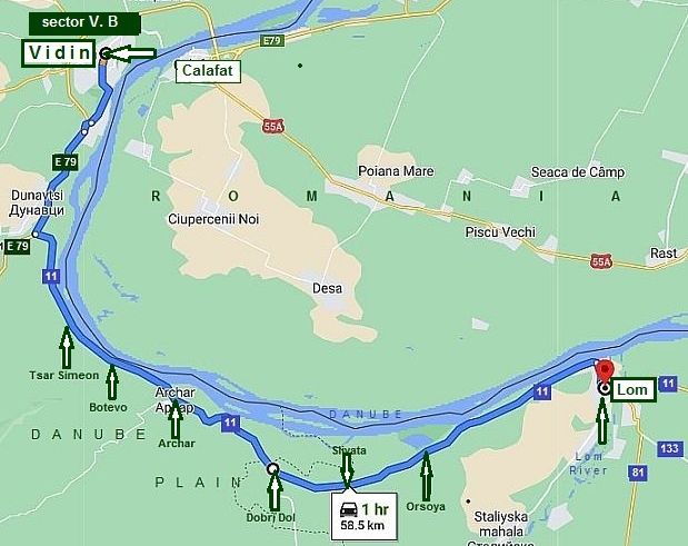
Sector V. B From Vidin to Lom
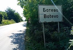
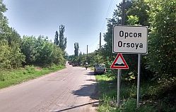
The route is: From Vidin (E79) to Dunavtsi (road 11) to Tsar Simeon to Botevo to Archer to Dobri Dol to Slivata to Orsoya to Lom.
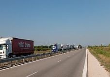
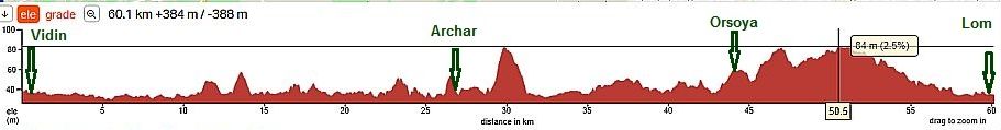
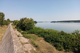
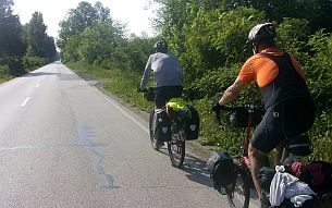
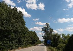
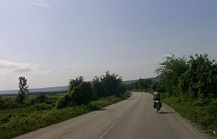
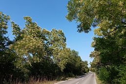
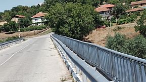
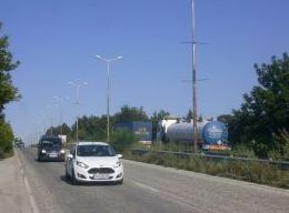
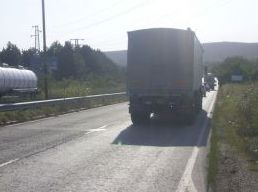
Leaving Vidin you will be pedaling for several kilometer on road E 79. You will also be pedaling is heavy traffic. There is no way to avoid this section of road over the next several kilometers. Once reaching road 11, the situation improves considerably, the traffic disappears, although heavy trucks can be on the road driving further to Archar. Looking at the road profile chart below, the distance is easy and pleasant for pedaling. The area here is mostly flat. There are several places you can stay along the riverside. |
 |
|
 |
 |
 |
 |
 |
 |
|
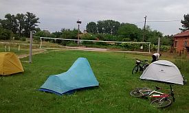
Once leaving the main road, the traffic disappears. Below can be seen our camp place in Tsar Simeonovo, the volleyball ground. In the morning the village major brought us coffee and we spoke about our trip. |
||
 |
 |
 |
|
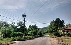
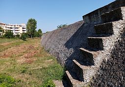
Tsar Simeon is low in elevation. Concrete walls are built near the river. There are not any problems accessing food and water in the little villages along the road. |
||
 |
 |
 |
 |
 |
 |
|
A little restaurant is located between Tsar Simeon and Botevo. They offer fish meals. The fish comes from the Danube river. |
||
 |
 |
 |
 |
 |
 |
|
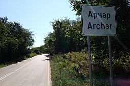
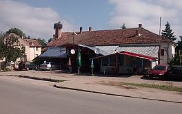
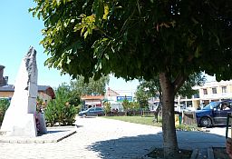
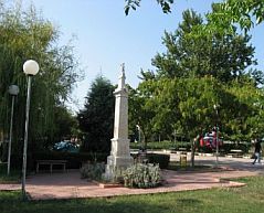
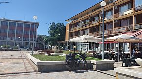
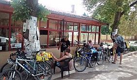
Entering the town of Archar you will see a coffee place and a little workshop. If you need some technical assistance with your bicycle this is the place. The town garden is a nice place to relax in the hot summer afternoon. |
||
 |
 |
 |
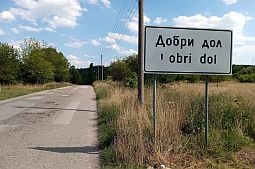
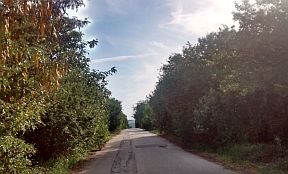
| After Dobri Dol the traffic disappears totally. | ||
 |
 |
 |
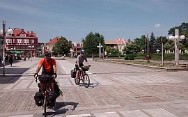
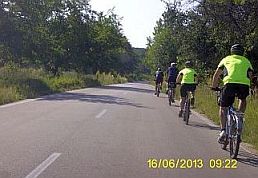
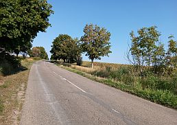
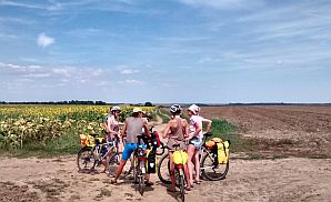
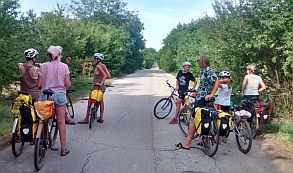
| This route is very popular among EU bicyclists. | ||
 |
 |
 |
 |
 |
 |
|
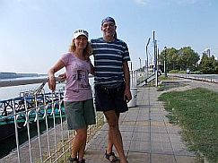
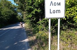
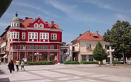
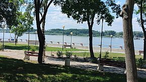
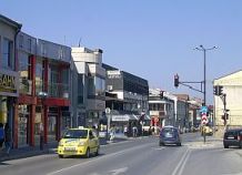
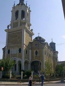
Information for Lom: http://www.visitbulgaria.net/en/lom/lom.html Next to Danube River you can find a nice garden and 2 - 3 hotels. There are shops for bicycle parts, tires and tubes. |
 |
 |
 |
 |
 |
 |
 |
 |
|
|
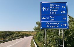
Leaving Lom the road crosses Lom River. My camp place next to the river. |
||
 |
 |
 |
|
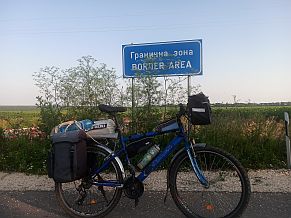
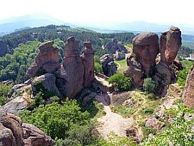
٭An opportunity BELOGRADCHIK
|
||
|
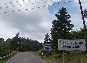
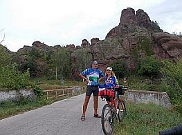
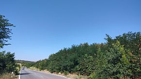
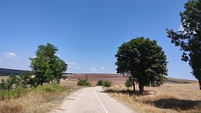
If you visit this part of the country, and have a couple days to spare, it would be very nice to tour and visit Belogradchik. You will not regret the visit. The route I recommend one of the best to be explored by bicycle. The area is easy for pedaling. There will be minimum traffic on the route to Belogradchik. |
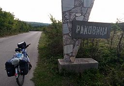
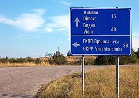
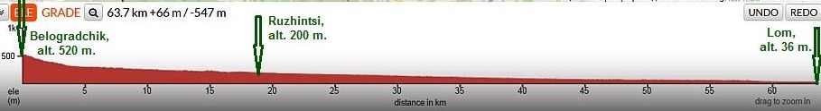
The better bicycle route is by entering in BG via border checkpoint Vrashka Chyka. The route: From border checkpoint Bregovo to Vidin to Kula (from Border Checkpoint Vrashka Chuka) to Kireevo to Rakovitsa to Belogradchik to Ruzhintsi to Drenovets to Lom. |
|
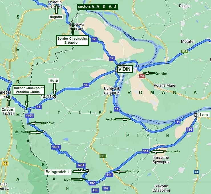
I will split the route in three parts:
a) From Vidin to Rakovitsa;
b) From Rakovitsa to Belogradchik;
c) From Belogradchik to Lom. |
||
|
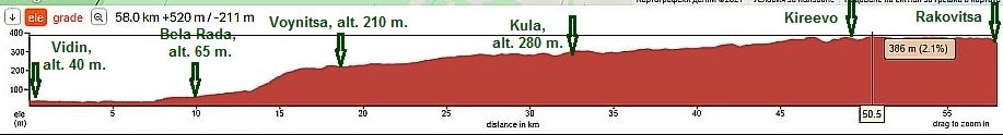
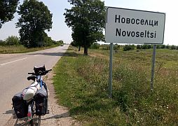
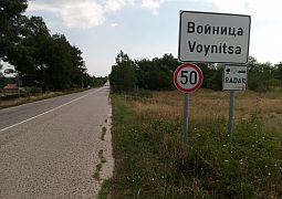
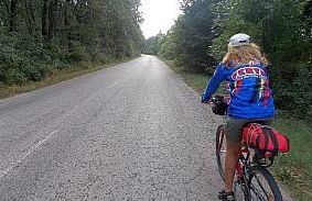
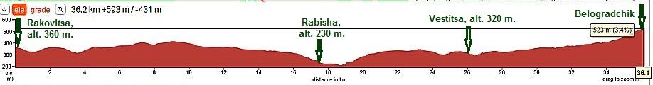
a) From Vidin to Rakovitsa
The route here is:
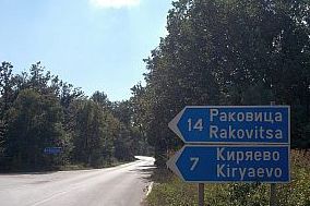
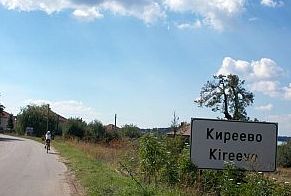
From Vidin to Novoseltsi to Bela Rada to Voynitsa to Kula to Kireevo to Rakovitsa.
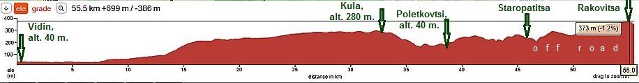
The next road profile chart is from Vidin to Rakovitsa: |
||
 |
||
|
A harder hill here is from Bela Rada to Voynitsa. These little villages may not have food shops. Climbing after Voynitsa toward Kula is not difficult. |
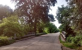
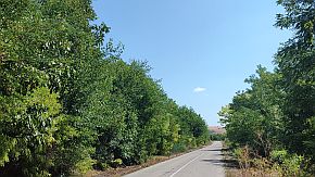
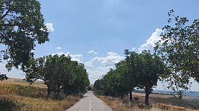
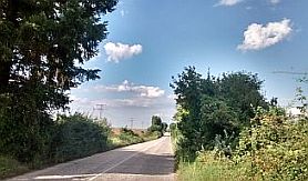
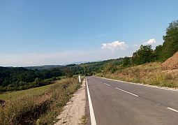
Even though the road N14 is an international road, it is a local one and there is not any traffic. The next photos illustrate the road from Vidin toward Kula. | |
 |
 |
 |
 |
 |
 |
|
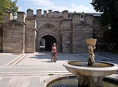
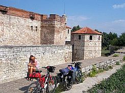
Food and overnight accommodations are available in Kula. (Kula means "Tower" - named for the ancient roman tower remains in the town). |
Information for Kula (photos below):
https://bulgariatravel.org/kastra-martis-fortress-town-of-kula/ |
 |
 |
 |
|
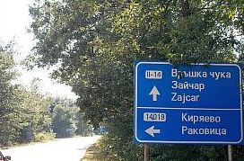
Toward Kireevo . . . pedaling slowly up the hill . . . it is the road toward the Serbian Border (border checkpoint Vrashka Chuka - Zajcar). |
||
 |
 |
 |
|
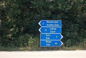
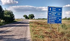
The road toward the Serbian border (border checkpoint Vrashka Chuka - Zajcar), Rakovitsa and Kireevo (Kiryaevo) is well signed. |
||
 |
 |
 |
|
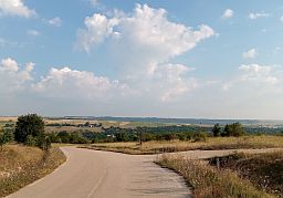
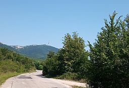
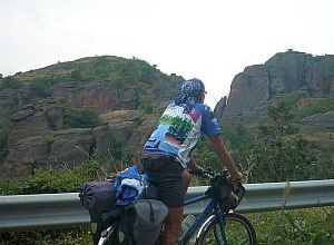
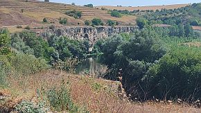
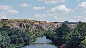
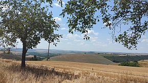
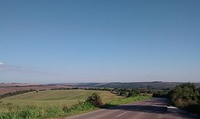
The road ahead is along the periphery of Danube Field. Next to it at your right are the Balkans. Far away ahead on |
the horizon you will see the rock near Belogradchik which is a higher place. |
 |
 |
 |
|
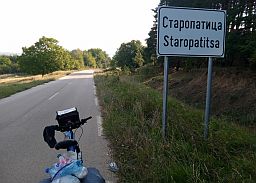
For bicyclists loving off road, I will show an additional route: From Vidin to Novoseltsi to Bela Rada to Voynitsa to Kula to Poletkovtsi to Staropatitsa to Rakovitsa.
This route is better in the reverse direction. Finding the off road in Rakovica is not so easy. The GPS device here would be helpful. |
||
|
|
|
|
|
|
|
|
|
The road from Kula to Poletkovtsi is in beautiful conditions. Next to Staropatitsa it is still nice, after to Rakovitsa is off road. |
||
 |
 |
 |
 |
 |
 |
|
|
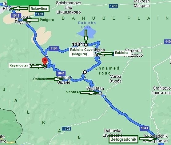
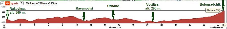
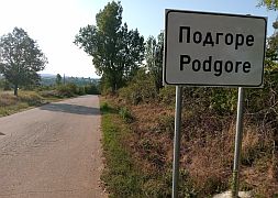
b) from Rakovitsa to Belogradchik The route here is:
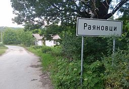
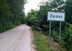
From Rakovitsa (road 1041) to Podgore to Rayanovtsi to Oshane to Vestitsa to Belogradchik.
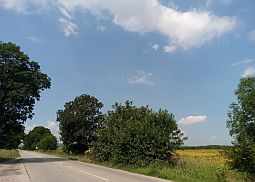
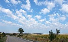
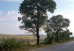
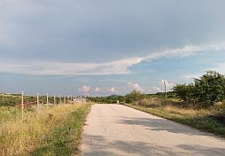
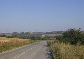
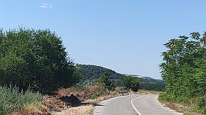
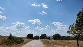
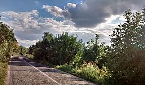
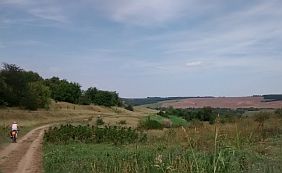
The route is really nice for pedaling. Again, the road further is just along the periphery of Danube Field. The Balkans can be seen to the right. You will be again pedaling in an area of little traffic.
The only village you can find food is in Rayanovtsi.
In the distance you will see the rock near Belogradchik it can be seen from the road profile chart below. |
 |
||
|
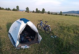
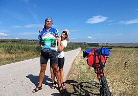
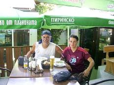
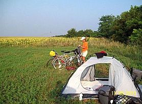
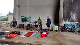
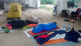
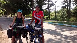
Here are photos of us "Industrial Camping" just before entering Rakovirsa. Three of us arranged in a leave on a rainy day in May night '18. |
We spent a very beautiful evening enjoying a very nice brandy and some chocolate. |
|
|
|
|
|
| My camp place next to Podgore | ||
 |
 |
 |
 |
 |
 |
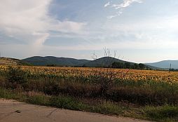
| The road is well signed because it is a border area. July and August there are a lot of blackberries along the road. | ||
 |
 |
 |
 |
 |
 |
|
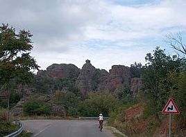
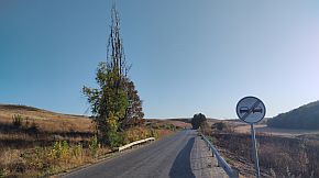
The last 10 kilometers from Vestitsa to Belogradchik are not easy. Bring water. |
||
 |
 |
 |
 |
 |
 |
|
|
||
|
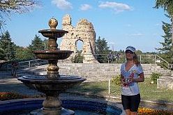
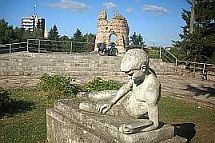
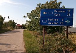
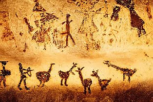
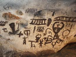
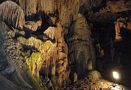
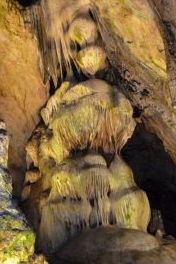
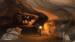
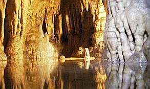
Another place which is worth to be seen in the region is Magurata Cave, or Rabisha Cave. If you have time, you can elongate a little your trip (no more than 5 kilometers) and visit it (road 1104). The Magura Cave has been known to the mankind for millennia. Now it is used not only for tourism but also for producing natural sparking wines. |
In the recent past it has been used also as a sanatorium, a store for cheese, a refuge for partisans and for many other purposes. But maybe one of most interesting periods was the Stone age when our ancestors inhabited the cave. Luckily for us they were quite artistic and left a lot of paintings on the stone walls of the cave. This is one of the oldest cultural monuments in Europe. |
|
|
|
|
Information for the cave can be seen here: https://bulgariatravel.org/en/the-magura-cave-the-rabisha-cave/ https://en.wikipedia.org/wiki/Magura_Cave In the cave, among the stunningly shaped tunnels, you can find more than 700 drawings from different periods: Epiopaleolitic (the Stone ages), Neolitic (New stone ages), Eneolitic (Copper ages) and from the beginning of Bronze ages. |
Our ancestors left us paintings of animals, men and women, cult rituals, one of the first calendars from the Neolithic ages with 366 days for one year, hunting scenes and etc. made by bat guano.
This section of the cave, though, is permanently closed. They restrict tourist visits to save pictures. The first 2 pics below are not mine. |
 |
 |
 |
 |
 |
 |
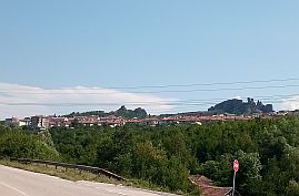
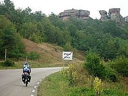
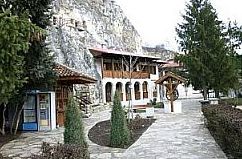
Belogradchik |
||
 |
||
|
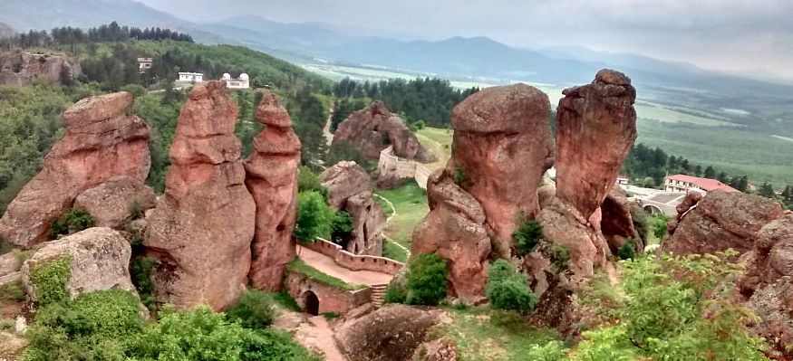
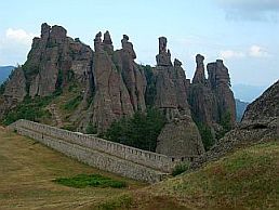
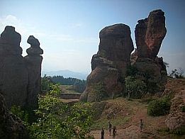
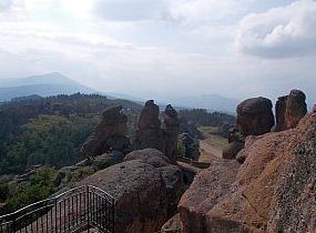
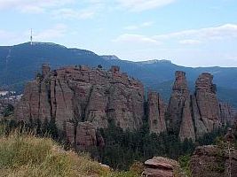
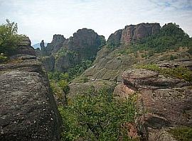
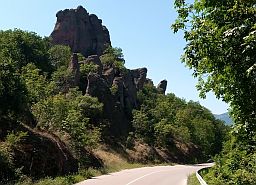
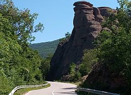
One of the most remarkable places in Bulgaria is Brelogradchik and the area near it. Check out the links below to see what I mean. https://en.wikipedia.org/wiki/Belogradchik_Rocks https://bulgariatravel.org/the-belogradchik-cliffs-a-natural-wonder/ |
||
|
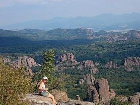
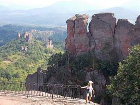
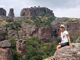
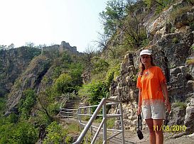
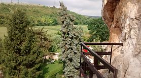
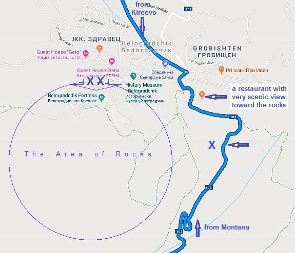
It is worth the time to spend an afternoon there and walk in the area of rocks. There are overnight accommodations in the town. The 3 photos next to the map show an approach to Belogradchik from Montana. If you jump over the road guard rail (the green X on the map - I am stopping with my bike - next to the town label) you can walk in the rock area on the walk track.
|
 |
|
 |
||
 |
||
|
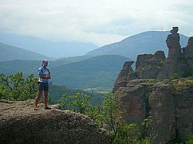
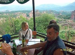
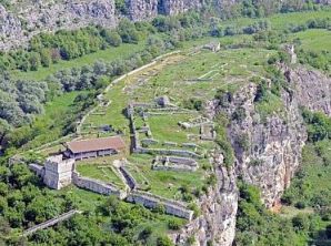
The two green XX on the map above show the place where you can enter and walk in the fortress - photos below. It is worth to spend an evening in the restaurant (I point it on the map above) against the rock - the last photo below. |
||
|
|
|
 |
 |
 |
 |
 |
 |
 |
|
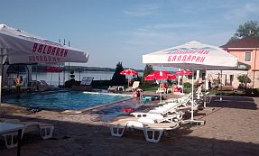
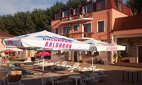
On the map above I have point the place of a restaurant with very scenic view toward the rocks. After the sunset the view is even a little unrealistic, when they light up the rocks. |
||
 |
 |
 |
|
|
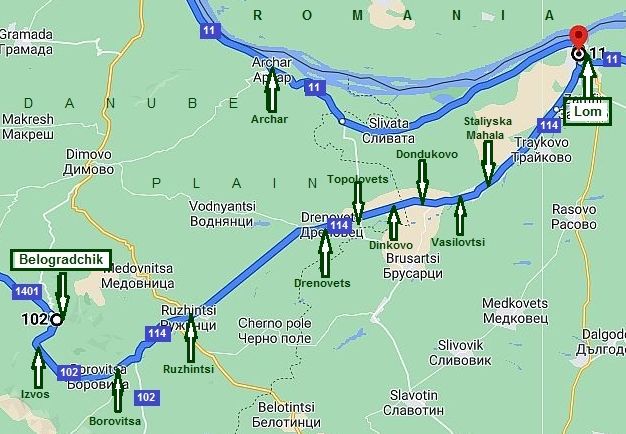
c) From Belogradchik to Lom The route here is: From Belogradchik to Izvos to Borovitsa to Ruzhintsi to Drenovets to Topolovets to Dinkovo to Dondukovo to Vasilovtsi to Stalitska Mahala to Lom. From Belogradchik you can pedal back down toward Lom and Danube River. As it can be seen from the road profile chart, this route is more than beautiful.
|
|
Next photos are the approach toward Belogradchik from Izvos. |
 |
 |
 |
 |
 |
 |
|
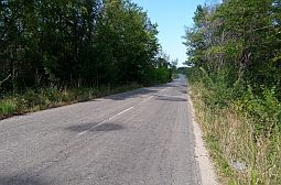
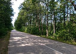
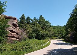
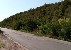
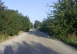
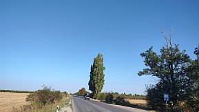
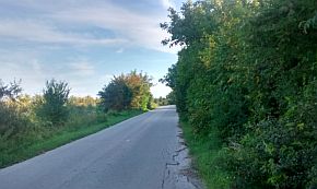
Next several photos are the road from Belogradchik toward Lom. You will find almost no traffic along this road. |
||
 |
 |
 |
 |
 |
 |
|
|
||
|
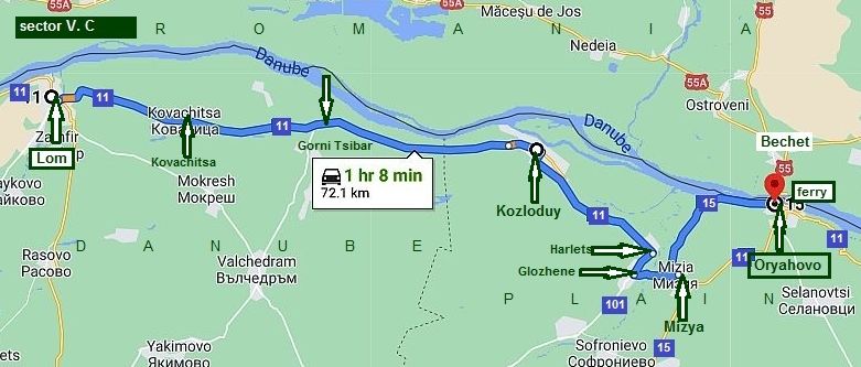
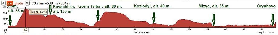
Sector V. C The route from Lom to Oryahovo
Sector V. C
|
||
|
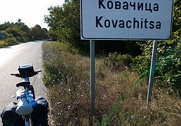
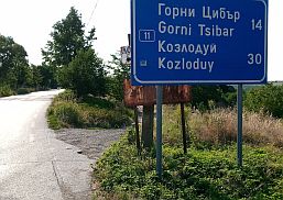
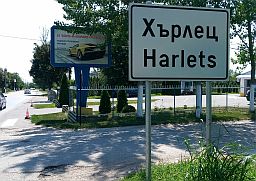
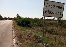
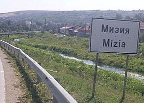
The route is: From Lom (road 11) to Kovachitsa to Gorni Tsibar to Kozlodyi to Harlets to Glozhene to Mizia (road 15) to Oryahovo. |
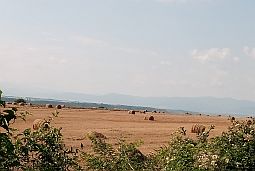
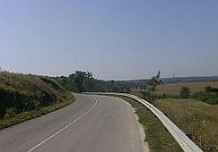
On the next road profile charts can be seen the typical topology of the area: a steeper hills from west to east, relatively high places revealing a beautiful view toward the river and longer down hill road. |
|
|
Leaving Lom the road cross Lom River. My camp place next to the river. |
||
|
|
|
|
|
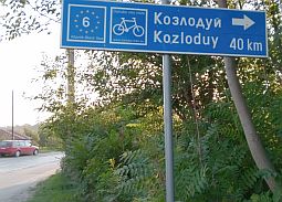
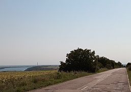
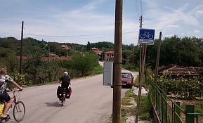
A little further you will see a sign toward Kozloduy, a Danube velo route N6 is on the sign, too. You will see this sign from time to time on your ride to Silistra City. Toward Kozloduy you will enjoy of a road without |
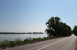
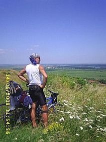
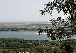
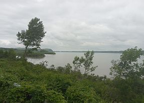
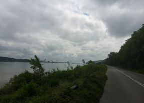
any traffic. After three kilometers of pedaling up the hill along a pavement road you will be on a plateau, where a nice view toward Danube River is seen. |
 |
 |
 |
 |
 |
 |
 |
 |
|
|
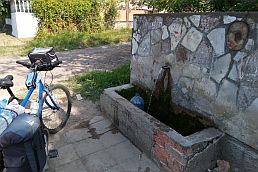
Food shop and coffee are available in Kovachevitsa. Along the road there is not water, so bring it with you. |
||
 |
 |
 |
|
I do not remember if food was available in Gorni Tsibar or Gorni Tsibar. |
||
 |
 |
 |
 |
 |
|
 |
 |
 |
|
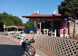
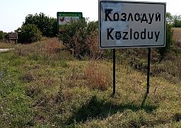
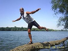
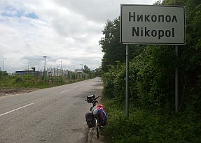
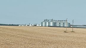
Next town to East is Kozlodyi. Information for Kozloduy: https://en.wikipedia.org/wiki/Kozloduy http://www.guide-bulgaria.com/nw/vratsa/kozloduy The town garden and I balanced just above Danube river. |
||
 |
 |
 |
|
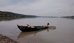
An interesting story with Austro - Hungarian ship abducted by the Bulgarian revolutionaries April 1876 near Kozlodyy. The ship is reconstructed, it is a museum near the town garden.
|
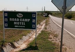
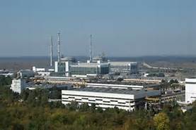
Overnight accommodations are available in Kozlodyu. Leavin Kozloduy you will see a sign pointing to accommodations at Road Camp Motel. Kozloduy has a nuclear power plant, having 2 x 1000 MWA powerful reactors as well. Taking photos in the region is forbidden, I found these on GOOGLE. |
 |
 |
 |
|
Toward Harlets: http://www.guide-bulgaria.com/nw/vratsa/kozloduy/harlets and Hayredin: |
In the first one there is a nice garden, I remember I relaxed in it for an afternoon. |
 |
 |
 |
|
Next little town is Mizia. |
||
 |
 |
 |
|
Toward Oryahovo the countryside is beautiful. I am not sure if overnight accommodations are available in Mizia. |
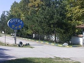
Half way between Mizia and Oryahovo you ca find a motel and restaurant. |
 |
 |
 |
|
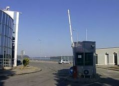
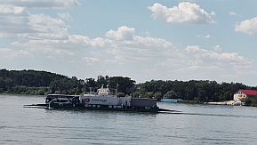
Information for Oryahovo: https://en.wikipedia.org/wiki/Oryahovo http://www.guide-bulgaria.com/NW/vratsa/oryahovo/oryahovo At Oryahovo, there is a ferry crossing for the Danube River. Bechet - Oryahovo: http://ferryboat.bg/ |
Unfortunately the site has no English language interpretation. The ferry runs 24 hours a day, its schedule is: - from Oryahovo to Bechet: each second hour starting from 12; - from Bechet to Oryahovo: each second hour starting from 13. No price for a bicycle, but a walker is charged by 2 EURO :) |
 |
 |
 |
|
On some maps a narrow gauge train runing line from Oryahovo to Cherven Briag is shown. This is not accurate information. The train has not been in operation for decades. |
||
|
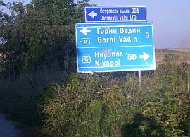
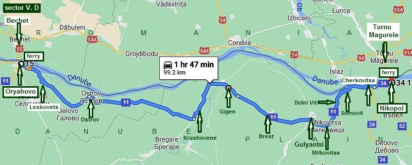
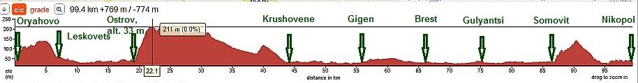
Sector V. D The route from Oryahovo to Nikopol
Sector V. D
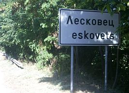
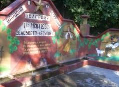
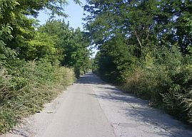
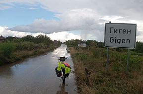
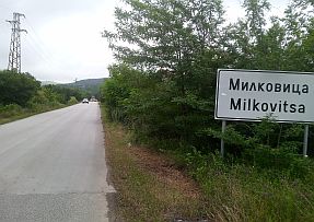
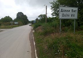
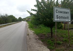
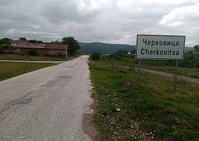
The roure is: From Oryahovo to Leskovets to Ostrov to Krushovene to Gigen to Gulyantsi to Milkovitsa to Dolni Vit to Somovit to Cherkovitsa to Nikopol.
There is not any traffic along this road. I remember the nice cool spring of water next to Leskovets. |
||
 |
 |
 |
 |
 |
 |
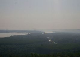
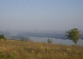
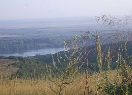
| There is a relatively significant climbing here is just after Ostrov. A nice view from the higher place is | toward Danube River. There was not nice visibility in an early August morning, when I took photos from this place. |
 |
 |
 |
 |
 |
 |
|
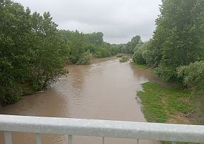
Krushovene is in the valley of Iskar River - already low place. Food is available in Krushovene. |
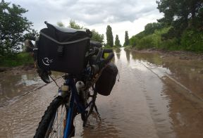
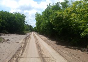
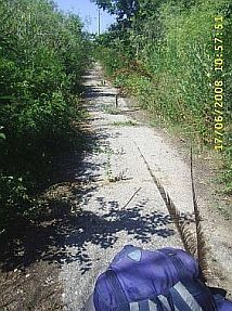
The next photos are taken after a rain, when several road sectors were covered by water and mud. |
 |
 |
 |
| Iskar river overloaded by sediments. | ||
 |
 |
 |
|
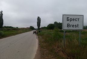
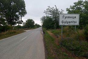
Toward Brest and Gulyantsi. A bigger settlement here is Gulyantsi, I do not believe there is an overnight accommodation in it. A little information for Gulyantsi |
Municipality and Gulyantsi. |
 |
 |
 |
 |
 |
 |
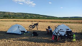
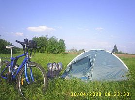
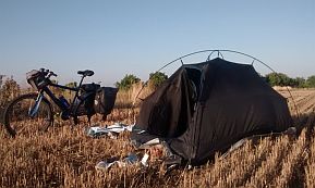
| June 24' - I and my FB friend Armin from RO camped next to Gulyuantsi. | ||
 |
 |
 |
|
You will pedal 40 kilometers of flat road on your ride from Krushovene to Somovit. After climbing the hill east from Somovit, again, you have a nice view of the Danube river. |
||
 |
 |
 |
 |
 |
 |
| No long but steep hill after Somovit - another place you will enjoy of a scenic view toward Danube River. | ||
 |
 |
 |
 |
||
 |
 |
 |
 |
 |
 |
 |
 |
 |
|
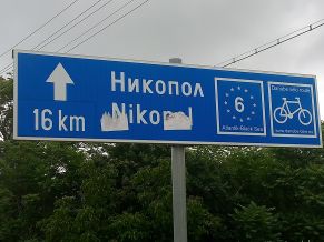
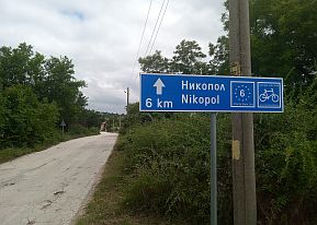
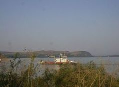
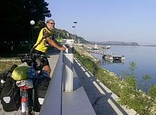
The next point to possibly cross the Danube is at Nikopol: Turnu Magurele - Nikopol. The ferry is located just after the city label. Ferry schedule and prices are available on the link: |
|
Ферибот „БДИН“ - ЗА ПЕРИОДИТЕ:
Ferry
"BDIN" - for periods
Ferry
"EVROPA" - for periods
|
|||||||||||||||||||||||||||||||||||||||||||||||||||||||||||
 |
 |
Hmmmmmmm … no price for bicyclists … hhahh ... !!!
The approach toward the ferry is signed well. |
|||||||||||||||||||||||||||||||||||||||||||||||||||||||||
|
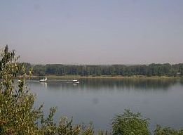
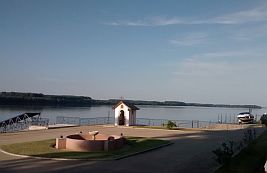
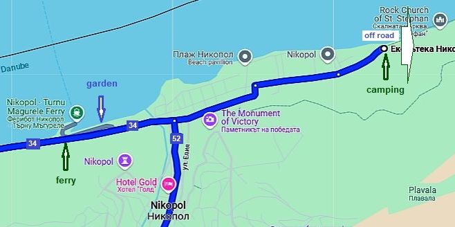
Entering Nikopol just after the ferry port there is a little lovely garden having a nice view toward Danube and Romanian shore. Heading to east along Danube river, leaving the town you will see a camping place. |
 |
 |
 |
 |
||
|
Overnight accommodations are available in the town. And some information for Nikopol: https://en.wikipedia.org/wiki/Nikopol,_Bulgaria http://www.guide-bulgaria.com/nw/pleven/nikopol/nikopol |
||
 |
 |
 |
 |
 |
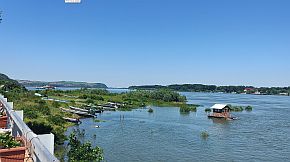 |
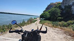
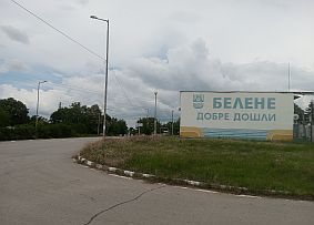
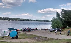
| Heading to east along Danube river, leaving the town you will see a camping place. (in the town there are sighs pointing it) June '24 it was not at work. | A rocky off road is in front of tou. the natives told me it can lead you to Belene, I would not attempt to pedal to it. Anyway, the place is very scenic with the higher rocks. |
 |
 |
 |
|
|
|
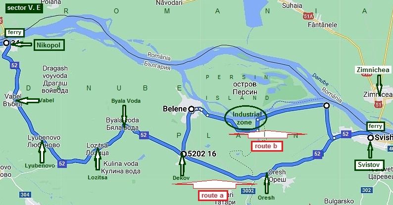
Sector V. E The route from Nikopol to Svistov
Sector V. E
|
|
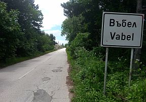
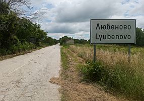
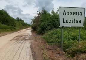
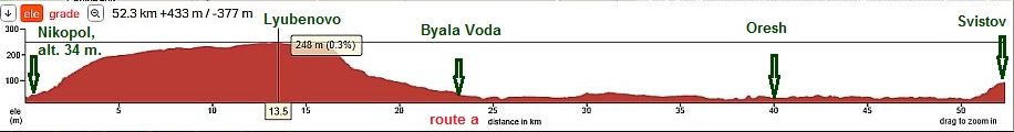
On the map above I have shown two possible routes: Route a: From Nikopol to Vabel (road 52) to Lyubenovo to Lozitsa to Dekov to Oresh Line Station to Svistov.
|
 |
|
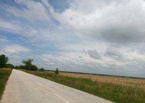
There is almost no traffic on this road and the pedaling here is a real pleasure. Food and water is available in the villages ahead.
In the little village Lyubenovo in the village center there is a food shop (the photo in left), next to it a grass area. The shop owner told me that often bicycle tourists set up tents on that spot. Very bicyclist friendly people !!! |
 |
 |
 |
 |
 |
 |
 |
 |
|
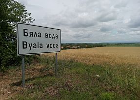
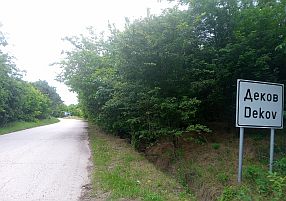
| Toward Byala voda and Dekov. | ||
 |
 |
 |
 |
 |
 |
|
On the map above I point to Oresh. Next to the road is a railroad line station, a nice place to relax. There is a water tap, a very nice option on hot summer days. |
||
 |
 |
 |
 |
 |
 |
| The same area June '24. | ||
 |
 |
 |
 |
 |
|
 |
 |
|
|
Information about Svistov: http://www.guide-bulgaria.com/NC/veliko_turnovo/svishtov/svishtov http://www.visitbulgaria.net/en/svishtov/svishtov.html |
||
 |
 Information for the ferry from Svistov to Zimnichea is given here: http://ferry.bg/ferry_en.php |
 |
 |
 |
|
|
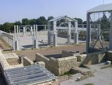
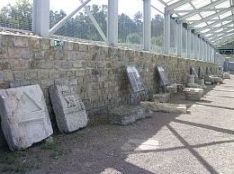
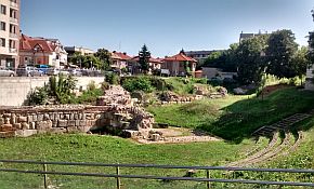
When leaving Svistov to the east, first you will see remains of the ancient Roman town, NOVAE, at your right: https://bulgariatravel.org/en/antique-military-camp-nove-town-of-svishtov |
||
 |
 |
 |
|
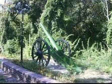
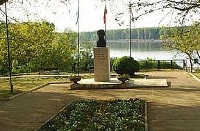
Further, on your left, is the memorial on the place Russian Army crossed Danube 1877, beginning the war against Ottoman Empire resulting in the establishment of the Third Bulgarian Kingdom. |
||
 |
 |
 |
|
Route b |
||
|
A route including Belene: I know bicyclists would prefer this route because it is next to Danube river. When I pedaled it, but east from Belehe I had to turn back to |
to road 52 because there is an industrial zone preventing me from pedaling toward Svistov directly, as shown on the map. So, my suggestion is to pedal route a. |
|
|
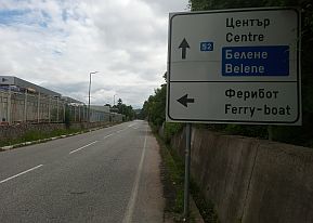
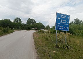
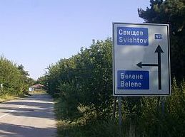
In Dekov you will see a sign toward Belene. |
||
 |
 |
 |
|
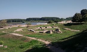
Some information about Belene d the ancient Roman fortress, Dimum: |
||
 |
 |
 |
| Toward Road 52 next to the industrial zone. | ||
 |
 |
 |
|
|
||
|
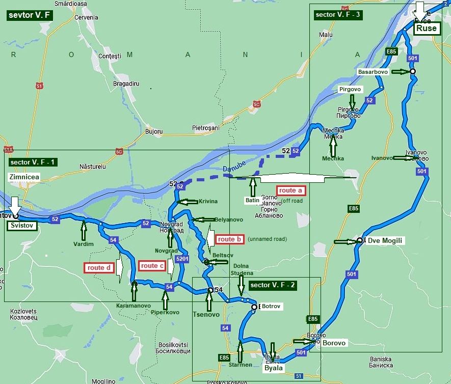
Sector V. F The route from Svistov to Ruse
Sector V. F
|
||
|
|
|
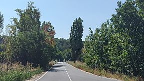
Route a There are several options to Reach Ruse from Svistov, as can be seen from the map above. I will start with the route a, If you are a bicyclists, and prefer to pedal close to Danube river, I say DO NOT CHOOSE THIS ROUTE !!! Use the next route: From Svistov to Vardim to Novgrad to Krivina to Batin (road 52) to Mechka to Pirgovo to Ruse. The area from Svistov toward Vardim the is scenic and easy for pedaling. Leaving Vardim, at your left you will see a nice winery, I am not sure there are overnight accommodations possible there. |
 |
||
 |
 |
 |
 |
 |
 |
|
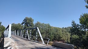
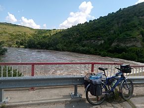
Ten kilometers east from Vardim you will cross Yantra River along an iron bridge, just after it you have to turn left toward Krivina. Just before entering in the bridge, |
200 - 300 meters to right along a gravel road there is a nice spring of drinkable water (behind me on the first photo below). |
 |
 |
 |
 |
 |
Toward Krivina and Batin. Some sites, I have seen have a description of this route as a route closer to Danube River. Yes, it is possible, to pedal here, but my suggestion is to avoid it. Now, information for more adventurous bicyclists: Paper maps show a road from Novgrad to Krivina to Batin. Yes, there is such a road, very nice for exploring. Google map does not show a road east from Krivina. Some sites do show the road I point by a dash line on the map above. Exploring this area, years ago, everything in this area was very nice, even beautiful; off-roads, the river, woods, fishers - the photos in left. |
 |
|
East of Batin, on the other paper maps, can be seen a road to Mechka. The road is between lakes. The road along Danube River has not been maintained for years and is covered with BLACKBERRY BUSHES!!! The next photos illustrate the road east from Batin. In the end all the skin of my legs, arms, neck, and my face were covered with scratches, and combined with the salty sweat, turned me into a deplorable sight. |
Leaving this road, I found myself in a muddy area. So after half a kilometer and half hour pushing carefully my bike along the muddy off road, I was totally exhausted and covered by mud – both I and the bicycle. Somewhere here I totally lost my sense of humor, and failed to take some photos of the situation. The best in this situation was that there was nobody with me. |
 |
 |
 |
|
|
||
|
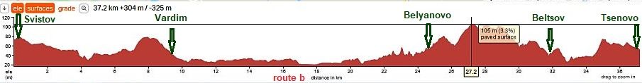
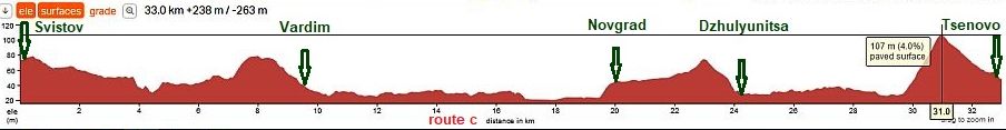
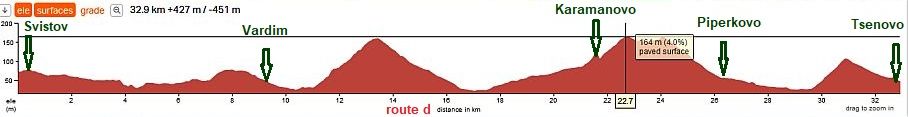
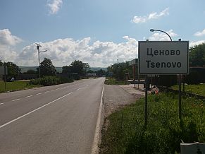
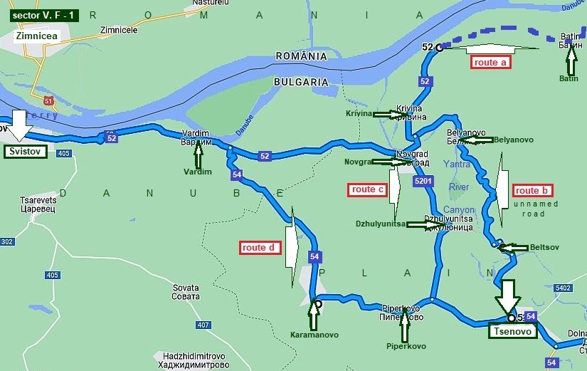
For a better illustration of the other routes, I will increase the scale. Sector V. F - 1 From Svistov to Tsenovo
From the route profile charts it is obvious that all the routes shown on the map above are relatively the same as distances, with elevation gains, too. |
||
|
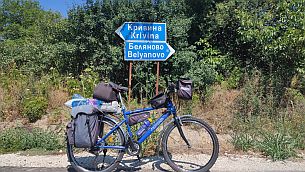
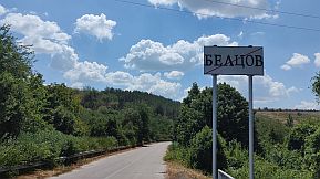
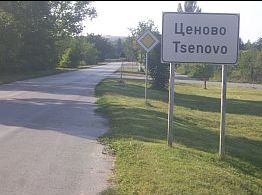
Route b From Svistov (road 52) to Vardim to Belyanovo (unnamed road) to Beltsov to Beltsov to Tsenovo. |
This area is the most scenic, the road follows the canyon of the Yantra River. There is hardly any traffic here. It doesn't matter that this is longest route, I highly recommend you pedal this route ! |
|
 |
||
|
Route c From Svistov (road 52) to Vardim to Novgrad to Dzulyunitsa (road 5201) to Tsenovo. |
June '21, I decided to explore this road. The road has been nicely resurfaced. There were several heavy trucks using the road, but the roadway is safe. That said, I think the route b is a better route. |
|
 |
||
|
Route d (road 54) From Svistov to Vardim to Karamanovo to Piperkovo toTsenovo. |
I have not explored this route. It is obvious that it is more hilly comparing with the other two routes. |
|
 |
||
|
And several words and photos for the route b |
||
|
As I have mentioned, ten kilometers east from Vardim you will cross Yantra River along an iron bridge, just after it you have to turn right toward Belyanovo. Just before |
entering the bridge, 200 - 300 meters to right along a gravel road there is a nice spring of drinkable water (behind me on the first photo below). |
|
|
|
|
|
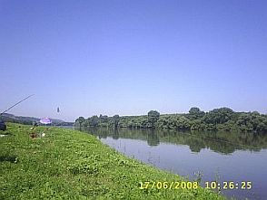
| Next photos are the not deep Yantra River Canyon. | ||
 |
 |
 |
 |
 |
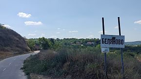 |
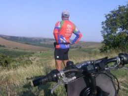
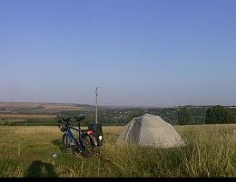
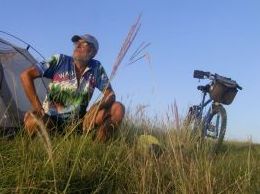
| My camp place near Balyanovo. | ||
 |
 |
 |
| Toward Tsenovo | ||
 |
 |
 |
 |
 |
 |
|
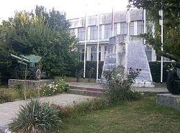
Tsenovo is a bigger settlement in this area, leaving it you will see a little workshop where you can seal punctured tires. |
I am not sure if overnight accommodation is available in Tsenovo. |
 |
 |
 |
| Route c | ||
|
From Svistov (road 52) to Vardim to Novgrad to Dzhulyunitsa (road 5201) to Tsenovo. June '21, I decided to explore this road. The road has been nicely resurfaced. There were several heavy trucks using the road, but the roadway is safe. |
That said, I think `the route b is better. Novgrad is a bigger village. There are several food shops in it. Unfortunatelly I do not remember anything for the next village Dzhulyunitsa. Several photos from this area. |
|
 |
 |
 |
 |
 |
 |
 |
 |
 |
| Route d (road 54) | ||
|
The route is: From Svistov to Vardim to Karamanovo to Piperkovo toTsenovo. |
I have not explored this route. It is obvious that it is more hilly comparing with the other two routes. |
|
|
|
||
|
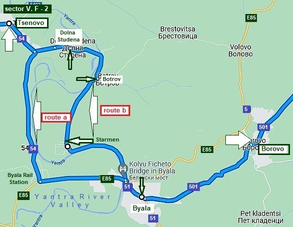
Sector V. F - 2 From Tsenovo to Borovo
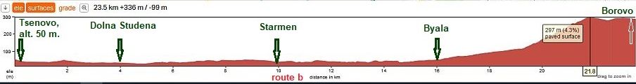
The two possible routes: - Route a: From Tsenovo to Byala Rail Station (road 54) to Buala (road E 85)
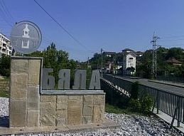
- Route b: From Tsenovo to Dolna Studena (unnamed road) to Botrov to Starmen to Buala (road 51). In this area, avoid the international road E85 . It is one of the deadliest roads in Bulgaria. From Byala Rail Station to Byala the road is broad enough and safe! Pedaling route b , you will avoid a hill between Byala Rail Station and Byala, as it can be seen from the road profile charts shown below. Route a
The several next photos illustrate the traffic just between Byala Line Station and Byala. |
||
 |
 |
 |
|
Overnight accommodations in Byala are possible, very little information for it is available here: https://en.wikipedia.org/wiki/Byala,_Ruse_Province http://www.guide-bulgaria.com/NC/rousse/byala |
||
 |
 |
 |
 |
 |
 |
|
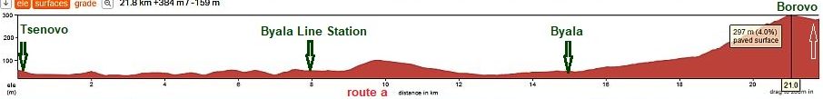
As it can be seen from the road profile chart, the road from Byala to Borovo (road 501) is a gradual elevation gain, with the second half a steep grade. |
|
Fortunately, the roadway is shaded. The climb here is not unpleasant, even in the hot summer days. The next three photos illustrate it. |
 |
 |
 |
|
Very little information for Borovo can be seen here: |
||
|
|
|
|
|
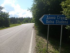
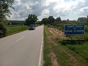
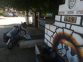
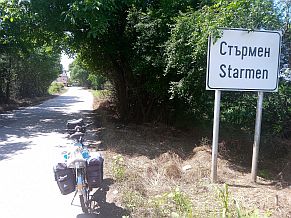
Route b Much better idea is to pedal route b instead the route a: The route is up the stream of Yantra River. From Tsenovo to Dolna Studena (unnamed road) to Botrov to Starmen to Buala (road 51). |
||
 |
||
|
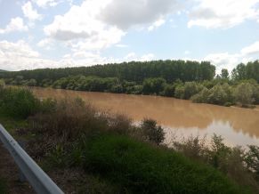
The mileage is the same as the previous route. But, here there is hardly any traffic and the area is much more scenic. The next photos illustrate countryside from |
Tsenovo toward Byala and are taken on an extremely rainy day, June '21, when all the rivers in the north part of the country were in brown from the run off. |
|
 |
 |
 |
 |
 |
 |
 |
 |
 |
|
|
||
|
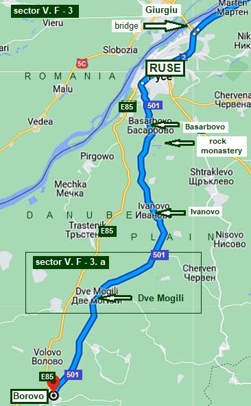
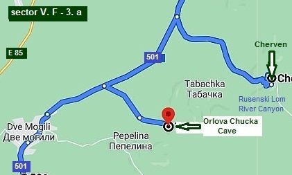
Sector V. F - 3
The route from Borovo to Ruse (road 501)
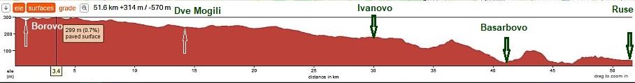
This is one of my favorite routes in this area. It always brings me a great pleasure to visit this area. The route here is away from Danube River:
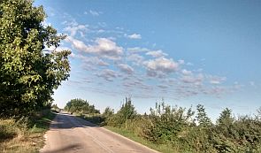
From Borovo to Dve Mogili to Ivanovo to Basarbovo to Ruse.
In this sector AVOID road E85. It is one of the most dangerous roads in Bulgaria. Once reaching Dve Mogili, you are on a higher place, the next route toward Ruse is slowly descending.
The only IMPORTANT thing you MUST know is that road N 85 is extremely dangerous. Always AVOID IT !!!
|
 |
|
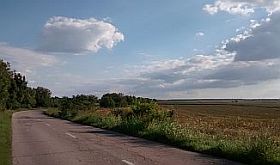
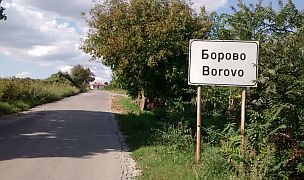
Very little information for Borovo can be seen here: http://www.guide-bulgaria.com/NC/rousse/borovo Next several photos are the countryside toward Dve Mogili. |
||
 |
 |
 |
 |
 |
 |
|
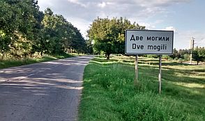
The next little town along your route is Dve Mogili. Some information about the area can be seen here: https://en.wikipedia.org/wiki/Dve_Mogili http://www.guide-bulgaria.com/NC/rousse/dve_mogili/dve_mogili Photos from Dve Mogili and the countryside after it. |
||
 |
 |
 |
 |
 |
 |
|
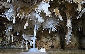
Several kilometers north from Dve Mogili you will see a sign toward Orlova Chucka Cave. The cave is located just over the Canyon of Rusenski Lom River. The cave is very attractive, it is worth visiting.
The place near it is nice to set up a tent, there is a water too. Coffee and drinks are available in the little info centre. |
||
 |
 |
 |
|
Orlova Chucka Cave: |
||
 |
 |
 |
|
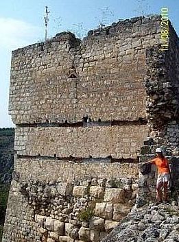
The next several photos are taken at the Cherven mediaeval fortress remains placed in Rusenski Lom River Canyon. The area along Rusenski Lom River is a |
National Reserve: https://bulgariatravel.org/en/rusenski-lom-nature-park/ And a link for the fortress near Cherven: https://bulgariatravel.org/en/medieval-fortified-town-of-cherven/ |
 |
 |
 |
 |
 |
|
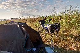
| Needless to say, the entire area is very nice to camp. | ||
 |
 |
 |
|
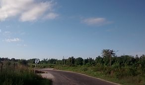
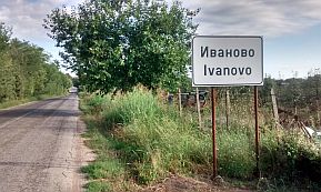
Next village along the road is Ivanovo. The are two guest houses in it. |
||
 |
 |
 |
 |
 |
 |
|
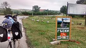
Leaving Ivanovo you will enjoy of beautiful descending toward Basarbovo. Just after entering in Basarbovo you will see a sign, selling of geese. |
||
 |
 |
 |
|
|
||
|
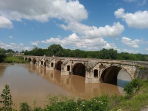
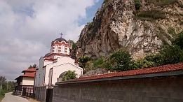
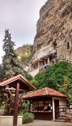
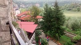
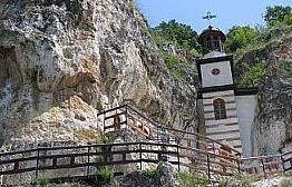
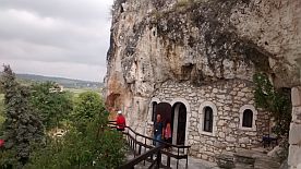
An interesting Rock Monastery can be seen near Basarbovo (the road toward it is signed well): https://bulgariatravel.org/en/rock-monastery-st-dimitrius-basarbovski-village-of-basarbovo/ |
||
 |
 |
 |
 |
 |
 |
 |
 |
|
 |
 |
|
|
|
|
|
|
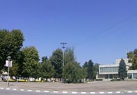
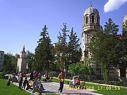
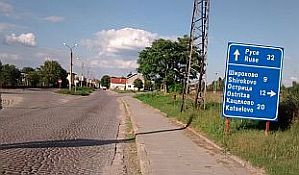
Several words about Ruse:
Ruse town is the biggest BG town at Danube River. Because of the bridge Ruse - Giurgiu, it is easy here to cross Danube River, although I am not sure enough if it is save for bicyclists. The bridge is old and narrow, the traffic is extremely intensive. There is an idea a new bridge to be built next to this one, but nobody knows when it will happen.
A lot of information is available in Internet concerning Ruse: http://en.wikipedia.org/wiki/Ruse,_Bulgaria |
|
Approaching Basarbovo you will see the not so deep but scenic canyon of Rusenski Lom River - the photo in left, there is my camp place, I have pointed on the map above with "X". |
Soon after living Basarbovo you will enter in Ruse. You will see the high bridge (road E85). Do not go there, enter in the town along the industry zone (the left road on the left photo). |
.JPG) |
|
.jpg) |
.jpg) |
.jpg) |
|
| Pedaling further on the road N501, you will reach Hotel Grand Riga (look the map above) - a place with a nice view toward Danube River next to hotel Riga. | ||
.jpg) |
.jpg) |
.jpg) |
| You can go on along Danube River, or enter in the City Cente. | ||
.jpg) |
||
.jpg) |
.jpg) |
|
.jpg) |
||
.jpg) |
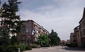
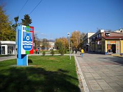
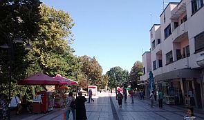
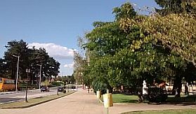
The walking area of the Ruse City
|
.jpg) |
.jpg) |
.jpg) |
|
.jpg) |
.jpg) |
|
|
|
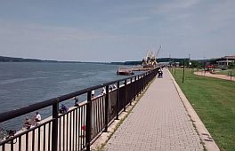
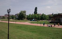
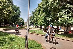
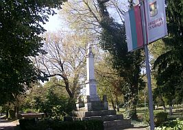
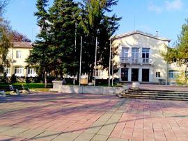
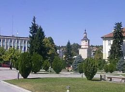
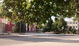
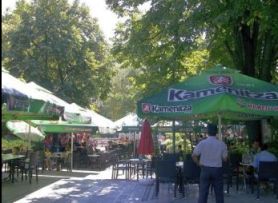
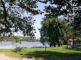
It will be very nice, if you find out and enter in the town garden. You can use different park lanes, you can pedal closer to Danube River.
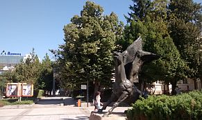
In the park is locater the National Transport Museum, there are a lot of specimens of old steam engines in the park. |
|
.jpg) |
.jpg) |
.jpg) |
.jpg) |
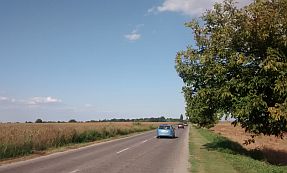
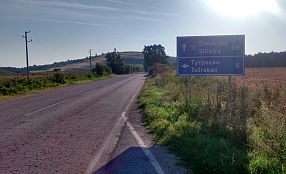
Toward Tutrakan and Silistra leave Ruse along road N21. An opportunity here is to leave Bulgaria via the bridge over Danube River, although I think to cross Danube just here is not so nice idea: the bridge is old and barrow, the traffic is very intensive. The next photos illustrate road toward Tutrakan and Silistra. |
.jpg) |
.jpg) |
.jpg) |
|
|
||
|
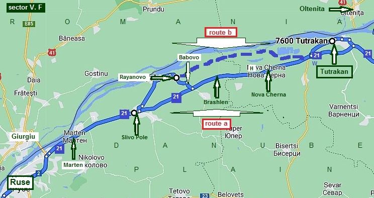
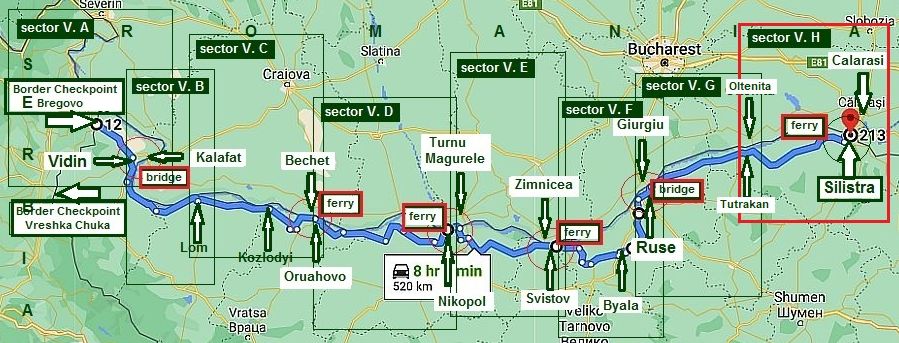
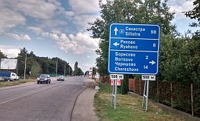
Sector V. G The route form Ruse to Tutrakan
Sector V. G There is not a ferry between Tutrakan and Oltenita, For now, it is only a dream.
|
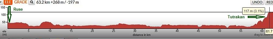
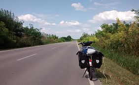
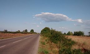
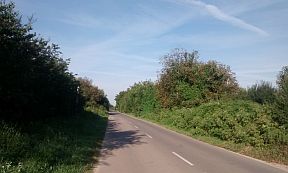
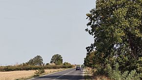
As it can be seen from the road profile chart, the entire area from Ruse to Tutrakan is absolutely flat. Last years the traffic here is relatively heavy, I think it is not a dangerous road to pedal. The only place you can see Danube River is Tutrakan. |
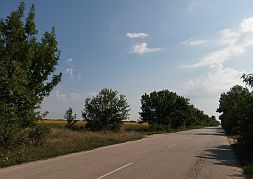
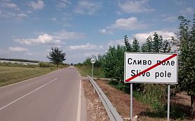
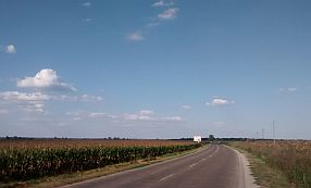
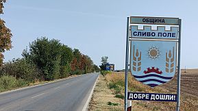
From Ruse to Marten to Slivo Pole to Brashlen to Nova Cherna toTutrakan. Along the road from Slivo Pole to Tutrakan (to Silistra) you will notice peach trees, which bear fruit from about the second half of June to the beginning of July. |
|
The next several photos illustrate the countryside toward Slivo Pole. |
||
 |
 |
 |
 |
 |
 |
|
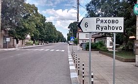
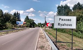
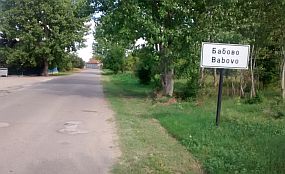
A DISCLAIMER: Researching in the Net, there are sites pointing a route from Slivo Pole to Ryahovo to Babovo and after next to the river to Tutracan. According to instructions in this site the road is |
purposed for bicyclists. August 2018, I explored this area. I DID NOT FIND SUCH A ROUTE !!! The road toward Ryahovo is signed well in Slivo Pole. No much information for Slivo Pole: http://www.guide-bulgaria.com/NC/rousse/slivo_pole/slivo_pole |
 |
 |
 |
|
The next photos are the area from Slivo Pole toward Ryahovo and Babovo. |
||
 |
 |
 |
 |
 |
 |
|
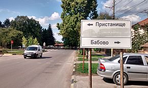
In Ryahovo you can visit Danube river shore - in the village there is a sign toward it, unfortunately in Cyrillic. I mention it because there is a restaurant offering a large |
number of dishes with fish from Danube. No much information for Ryahovo: |
 |
 |
 |
|
So my suggestion is after Babovo to go back to the main road toward Tutrakan. Next to the crossroad toward |
Nova Cherna there is a hotel and restaurant near the road (the last photo below). |
 |
 |
 |
 |
 |
 |
|
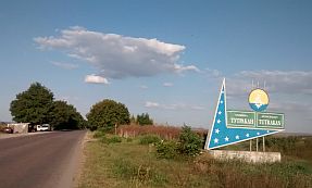
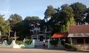
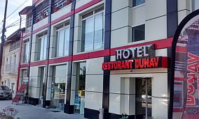
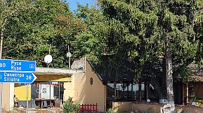
You can either enter Tutrakan, or go around the city. Entering Tutrakan you will see a bicycle repair shop. A little further you will see a hotel and restaurant. |
 |
 |
 |
|
Information for Tutrakan (overnight accommodations are possible) and for the Great European War (IWW): |
http://www.guide-bulgaria.com/NC/silistra/tutrakan/tutrakan |
 |
 |
 |
|
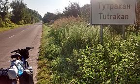
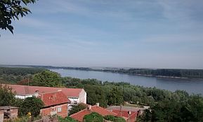
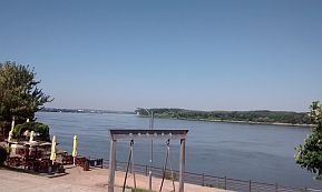
The town is located on a hill above Danube - you have to climb to the upper part of the little town. |
||
 |
 |
 |
| Several photos from the same area: Ruse - Tutrakan, taken in the beginning of October '23, when everything is yellow. | ||
 |
 |
 |
 |
 |
 |
 |
 |
 |
|
|
||
|
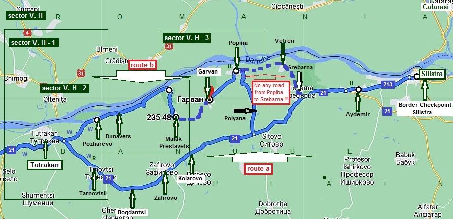
Sector V. H The route form Tutrakan to Silistra
Sector V. H
|
||
|
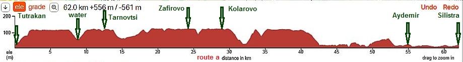
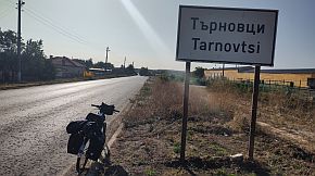
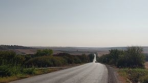
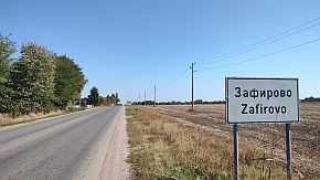
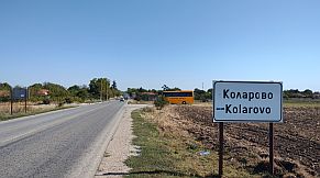
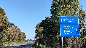
Route a (It is the main road N21:) From Tutrakan to Tarnovtsi to Bogdantsi to Zafirovo to Kolarovo to Aidemir to Silistra. The road profile chart between Tutrakan and Silistra shows Dobrudzha Plateau cut by dry river valleys. |
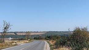
Obviously during the last ice age here there was a lot of water here. The area now is dry; the last river mouth in Danube from Bulgaria is Rusenski Lom River. The road is in very nice condition. The traffic is not intensive. |
|
|
|
||
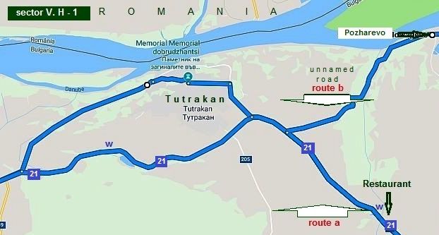 |
Sector V. H - 1
You can either enter Tutrakan, or go around the city. If you choose to go around the city soon you will see a tap of drinkable water and a nice place to camp. |
 |
 |
 |
| Food and water is available in villages along the road | ||
 |
 |
 |
 |
 |
 |
 |
 |
 |
|
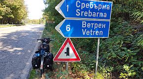
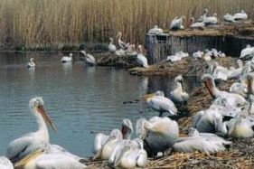
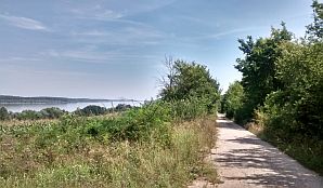
Twenty kilometers from Silistra is located a UNESCO protected bird sanctuary, "Srebarna". The lake can be seen from the road after the last descent toward Silistra. |
https://en.wikipedia.org/wiki/Srebarna_Nature_Reserve |
 |
 |
 |
 |
 |
 |
|
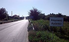
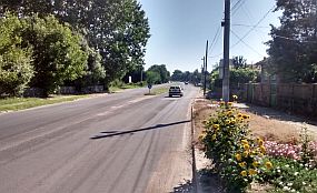
Approaching Aidemir it would be better to enter Aidemir - you will avoid the ring of the transited traffic. |
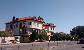
Overnight accommodations are available in Aidemir. |
 |
 |
 |
|
|
|
|
Soon you will enter Silistra. Here your trip along Danube River in Bulgarian section ends (or maybe starts). Information for Silistra:
https://en.wikipedia.org/wiki/Silistra
|
|
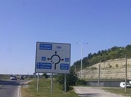
You can cross Danube by a ferry to Chiuciu (Calarasi) or head east toward Constanta (road 3) at Black Sea. The more detail map above shows the disposition of both ferry and the border checkpoint. For the ferry schedule look here: |
Google map shows two ways to cross Danube River here. The first is the ferry I point below road 215; the second one - go to the border checkpoint Silistra - Ostrov, and after obviously in Romania there is an opportunity to cross Danube River to Chiuciu. I can not find information in Internet about it. |
|
|
|
||
 |
 |
 |
 |
 |
 |
 |
 |
 |
|
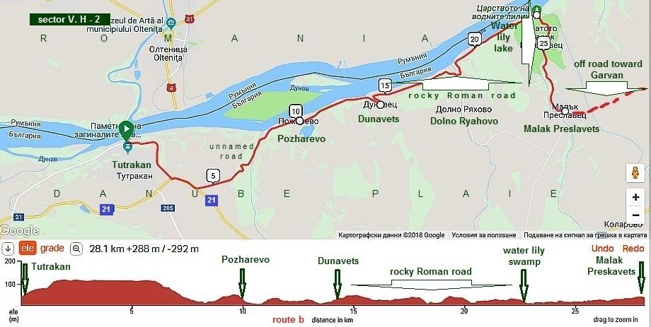
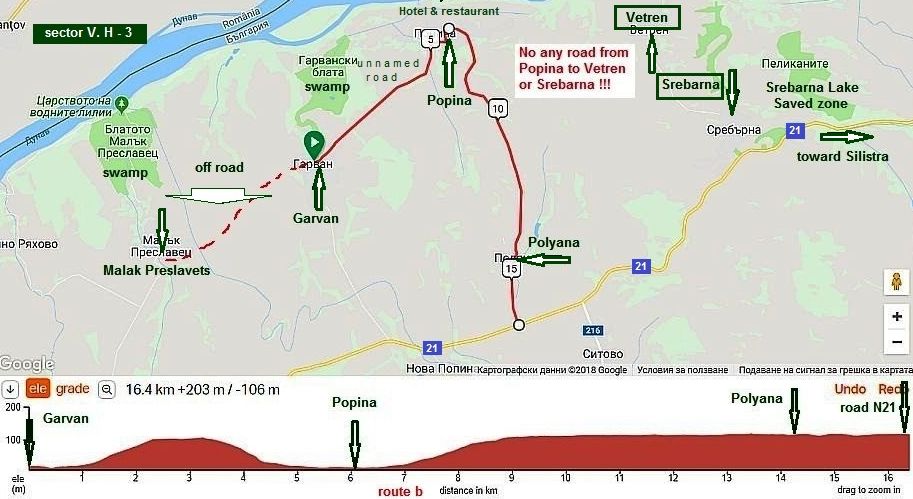
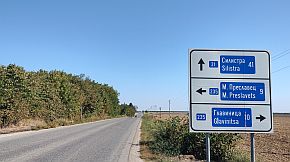
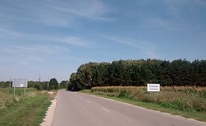
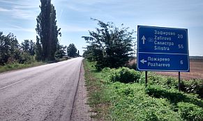
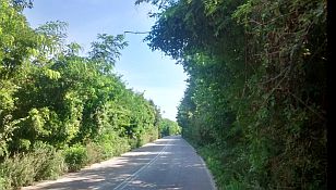
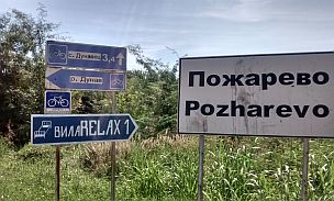
Route b This route is for more adventurous bicyclists, after reading my next description, you will decide to follow this route, or not. I will part it in 2 sectors: Sector V. H - 2 The route here is: From Tutrakan to Pozharevo to Dunavets to Malak Preslavets.
Once going on the plateau above Tutrakan, you will see a sign toward Pozharevo. Turning left, you will enter a woody area, and you will enjoy very nice descent, almost to Pozharevo. |
||
 |
 |
 |
 |
 |
 |
|
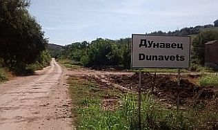
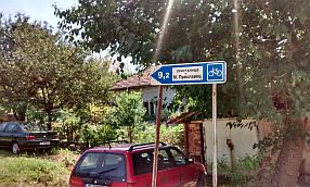
There is not any traffic here. There you will see the first sign showing you are along a bike lane; on the sign is pointing the next village (Dunavets) and the distance to it. |
||
 |
 |
 |
 |
 |
 |
|
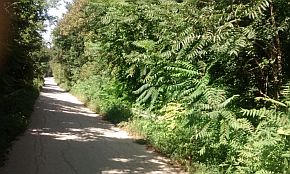
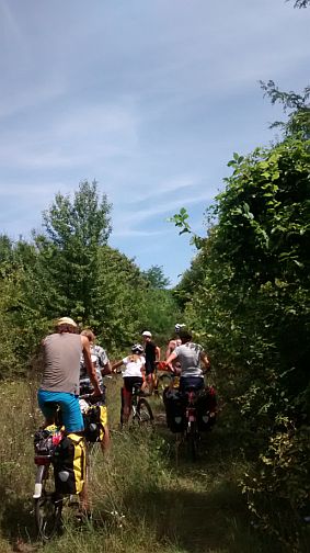
Soon after Dunavets a group of 8 bicyclists (2 families) from Austria came up with me, so we went on together, I knew they may need a help further. The |
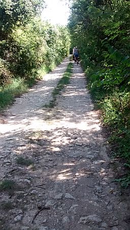
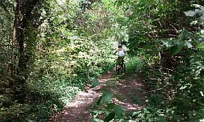
asphalt road finished and we pedaled on along the ancient Roman road. I think that bicyclists in the ancient Roman Impair do not feel fine along their roads :) |
 |
 |
 |
 |
 |
|
 |
 |
|
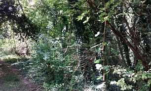
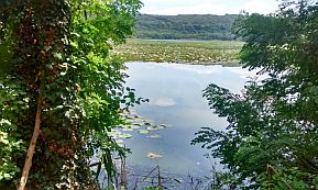
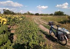
| To the Water Lily Lake the road was getting worse and worse - rocky and brushy. It seems the Lake and area near it is a saved zone; I can not remember if there was a restaurant or food there, probably not. | ||
 |
 |
 |
 |
 |
|
 |
 |
|
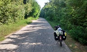
| From this spot to the next village Malak Preslavets the road is reconstructed and nice. | ||
 |
 |
 |
|
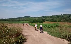
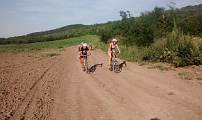
There is a food shop in Malak Preslavets, but it is open only mornings and late afternoons. Sector V. H - 3 The road toward next village Garvan is labelled. Have in mind that again it is a dirty road crossing the field.
|
||
|
I am sure that if it is raining, or just after a rain, it will be absolutely impossible to pedal on this road. It would be much better in such a case to pedal toward the main road N21. |
||
 |
 |
 |
 |
 |
 |
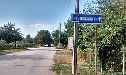
| A food shop in Garvan is available, the road toward Popina is nice. | ||
 |
 |
 |
|
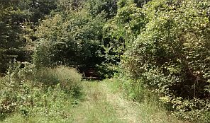
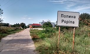
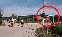
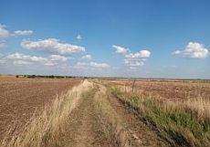
Popina is a bigger village. You will see signs leading you toward the next village, Vetren. Leaving the village, a sign will lead you to the left. A kilometer further the road finishes in the bushes. |
Follow the Google map for here as if is correct. it is not much of a road. But in some sites advertising the bicycle route along Danube River such a road exists. The road exists in the Austrian Guide Book peddlers brought with them as well. |
 |
 |
 |
|
|
Apparently there was a road, many years ago, but, not now.
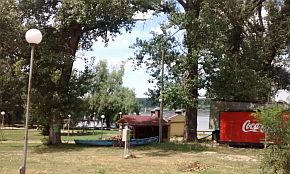
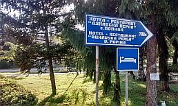
On the Danube bank next to Popina there is a hotel: |
|
 |
 |
 |
 |
 |
 |
|
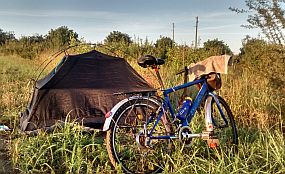
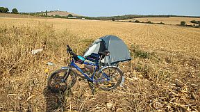
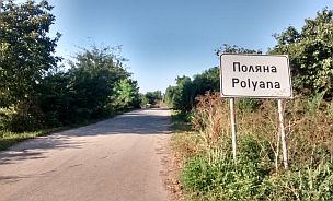
So I left them and followed my way toward Silistra spending a night in the field just before Polyana. Next day I reached Silistra along the main road 21. |
||
 |
 |
 |
|
Well, here out pedaling along Danube River is finishing. |
||
|
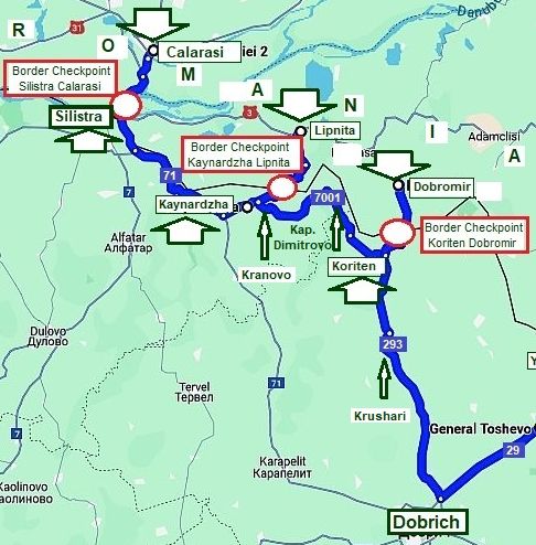
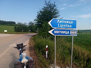
APPENDIX I I was asked for the next information
In an exploitation are two relatively new open Border checkpoints on the Bulgaria/Romanian border east from Silistra:
- Border Checkpoint Kaynardzha - Lipnitsa - open 2017, works between 8 am and 8 pm;
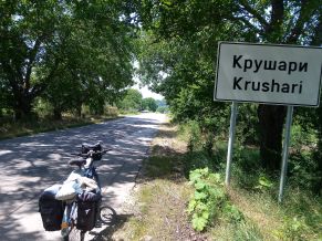
- Border Checkpoint Krushari - Dobromir - open 2018, having the same work time.
On the map in left I point this two new Border Checkpoints. June '21 I explored this area and my information is very real. |
|
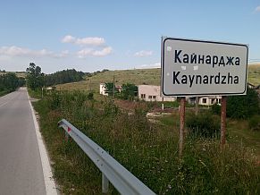
If you use Border Checkpoint Kaynardzha - Lipnitsa head west toward Kaynardzha (road 71). |
 |
 |
 |
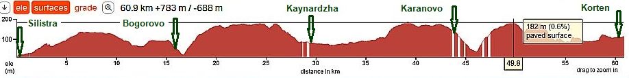
| There will be 5 - 6 km ascending leaving Silistra, soon all this climbing appeared to be in vain - at Bogorovo you will be again in the altitude of Silistra. | ||
 |
 |
 |
 |
 |
|
 |
 |
|
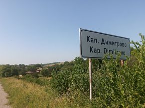
| Kaynardzha is a small village, my memory serves that there was not big choice of food in it. | ||
 |
 |
 |
|
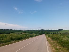
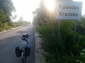
East toward Kranovo road is nice to this very small village. |
||
 |
 |
 |
 |
 |
|
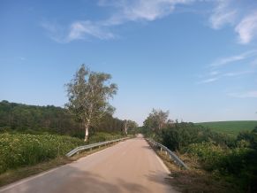
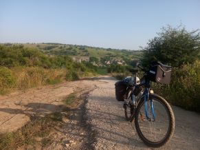
| The road between Kranovo and Kapitan Dimitrovo is out of maintenance, it is in very poor conditions. But the field was beautiful ! | ||
 |
 |
 |
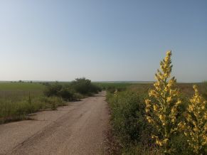
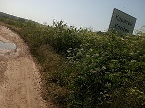
| Toward Koriten, Krushari and Dobrich the road in nice. Having problems with the bike tires I did not take more photos from this area. | ||
 |
 |
 |
|
If you decide to pedal toward Bulgarian part of the Black seaside, you can look in the: |
||
|
Chapter III: Crossing Bulgaria from north to south (from Romania to Turkey & Greece), Point 3. Calarashi – Silistra: ferry & Constanta – Silistra (border checkpoint Silistra) |
Chapter VI. Crossing Bulgaria from west to east. Routes:
Sector VI. 2 - J From Vetrino - Varna |
|
|
(On the next map are available Border Checkpoints between Bulgaria and Romania) |
||
|
|
||
|
|
.jpg)
.jpg)


.jpg)
.jpg)
.jpg)
.jpg)
.jpg)