|
I. BALKAN PASSES Sector I. B |
|
|
|
I. BALKAN PASSES Sector I. B |
|
|
|
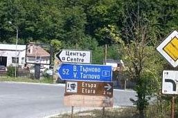
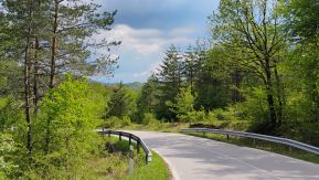
Sector I. B The routes in the sector I. B are as follows: |
|
|
6. Rusaliiski pass: 7. Shipka Pass 8. Trevnenski Pass: 9. Pass of the Republic (Hainboaz): 10. Tvardishki Pass: 11. Vratnik Pass: |
From Apriltsi to Tazha (unnamed road); From Gabrovo to Kazanlak (E 85, road 5); From Tryavna to Dabovo (road 609) ; From (Veliko Tarnovo to) Kilifarevo to Gurkovo (road 55); From Elena to Tvarditsa (road 662); From Elena to Sliven (road 53). |
|
|
|
|
|
|
|
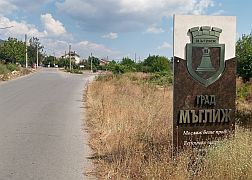
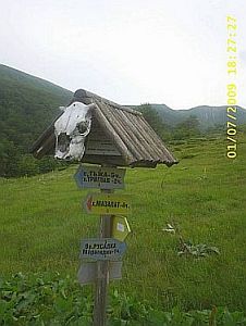
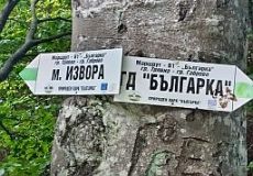
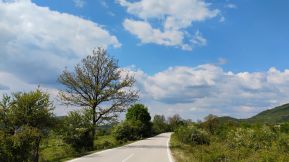
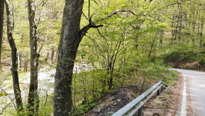
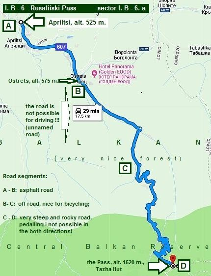
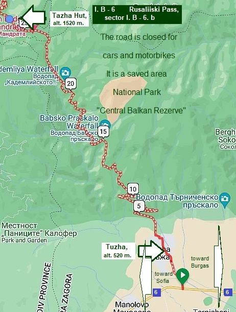
6. Rusaliiski Pass (unnamed road) |
||
|
Information for Rusaliiski Pass van be seen here: |
The pass crosses a saved area - "Central Balkan Reserve": |
|
|
|
||
|
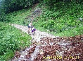
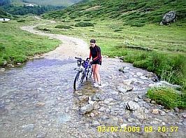
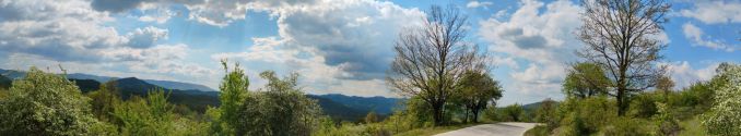
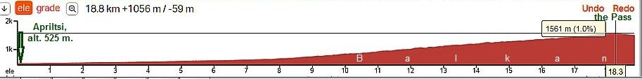
Sector I. B - 6. a From Apriltsi to the mountain divide
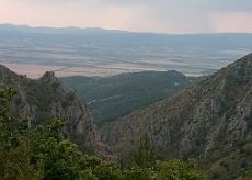
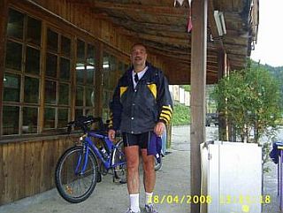
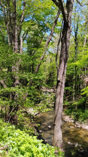
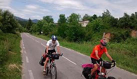
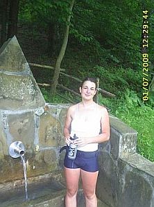
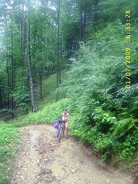
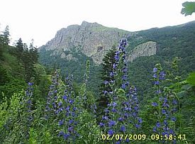
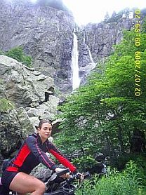
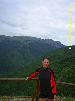
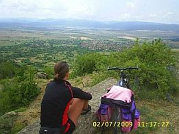
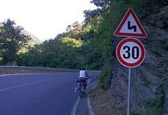
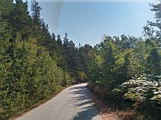
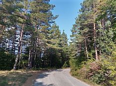
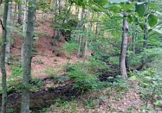
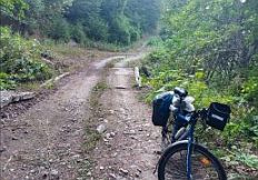
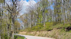
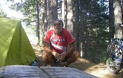
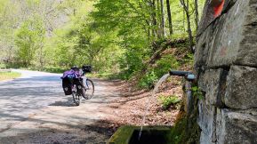
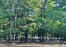
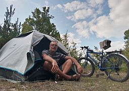
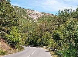
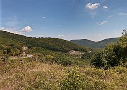
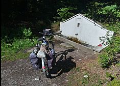
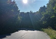
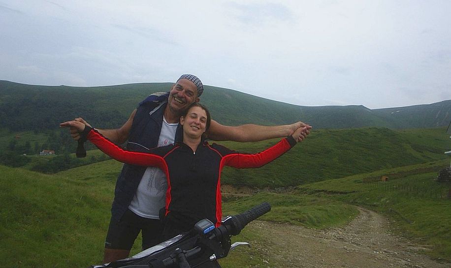
The Pass is between Apriltsi and Tazha. More accurately rocky off-road. Rusaliiski Pass again is one of the highest in Balkan – its altitude is 1520 meters (1550 was the altitude according to other maps). I will give a little more detailed description of this Pass, because I have seen maps on which it is described as a nice road, when in fact the true is quite different. Beginning at Apriltsi (point A) the road will lead to Ostrets (point B). Immediately after Ostrets, the road conditions deteriorate to 'off road' conditions. Initially, the climb is pleasant (up to point C), with road conditions becoming more difficult with conditions at times leading to walking your bicycle up the grade. The road surface turns to something close to talus conditions. The scenery, though, is very pretty, very nicely wooded. Fresh water is available everywhere. The road is not signed, and you might find yourself pushing your bike up the mountain. Two to three kilometers before the mountain top the road's angle of assent starts to taper off, but bicycling will be difficult because the road is very rocky. Once the ridge is reached (Point D on the map), you will have a perfect view in any direction. There you will see a primitive mountain hut “Tazha”, as it is named on the Google map, also "Taja", as I have seen on other maps. I believe tea is served at the hut. When the weather is bad, the hut can be used for a night. The area on the ridge is perfect for camping. You need to bring your own food. |
|
|
|
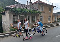
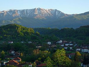
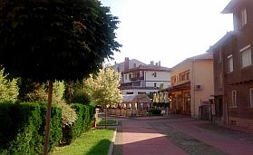
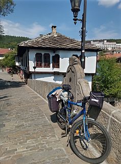
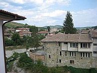
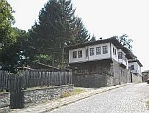
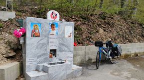
Overnight accommodation in Apriltsi is possible. Information and several photos from Apriltsi: |
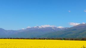
The view is especially impressive in April and May, when the Balkan mountains are still covered by snow. |
 |
 |
 |
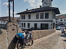
| Toward Ostrets. Overnight accommodation in it is possible as well. | ||
 |
 |
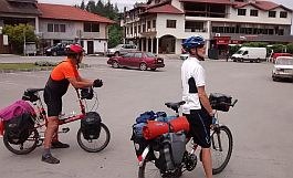 |
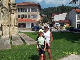
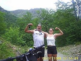
| . . . the long and hard climbing is beginning . . . I have thought my girl will be not happy just here, but everything was OK . . . in the end, the idea to explore this pass was not mine. | ||
 |
 |
 |
 |
||
 |
 |
 |
 |
 |
|
|
|
||
|
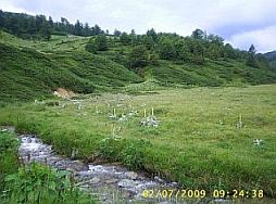
Sector I. B - 6. b From Tazha to the mountain divide
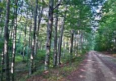
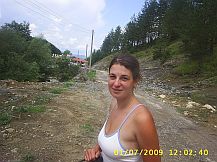
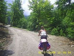
Down the mountain you will find 3 - 4 kilometers of nice off road conditions, which are not too steep. But the next road segment to Tazha village is rather steep and rocky, making bicycling a bit of a challenge. Plan on taking 4 hours to go down to the village of Tazha.
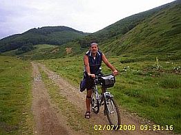
If you are in the back direction, the climb from the south mountain side begins just after the village at Tazha. I have never climbed the Pass from its southern side (and I will never do it). The road is steep and rocky. I think bicycling here is not possible. You will need at least 6 hours to walk a bicycle up to the mountain ridge.
If you are pedaling in the reverse direction, the climb from the south mountain side begins just after the village of Tazha. I have never climbed the Pass from its southern side and I do not recommend you doing it, either. The road is steep and rocky. You will need at least 6 hours to walk a bicycle up to the mountain ridge. I do not recommend to climb the Pass from south to north, but if you decide to give it a go, the best views are to the south and will be your best reward for the suffering, while pushing your bike up and up the mountain. |
||
|
|
||
 |
 |
 |
 |
 |
 |
 |
 |
 |
 |
||
|
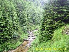
The period between May and September is the best time to walk in this area. I believe it would be best to bring winter equipment and to have your own food supplies. The weather in the mountain is very changeable, snow always is possible, and all that area is considered no-mans land |
by the locals. There is nobody to help you if assistance is needed. My suggestion: Avoid this Pass without an experienced guide. But if you are a real adventurer - do it! There are aggressive dogs in this area. Carry dog spray for your protection. |
|
|
|
||
|
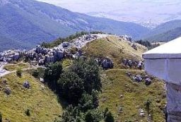
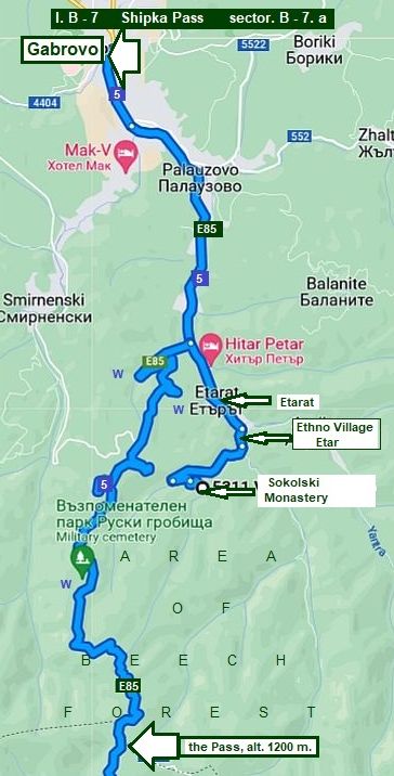
7. Shipka Pass (E 85, road 5)
|
|
|
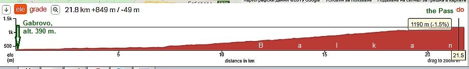
Sector I. B - 7. a From Gabrovo to the mountain divide
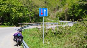
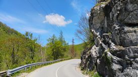
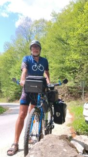
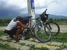
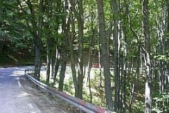
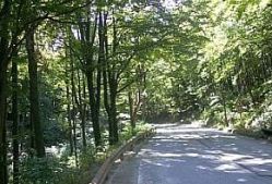
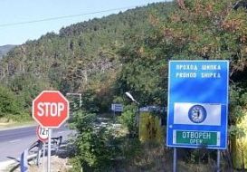
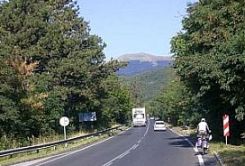
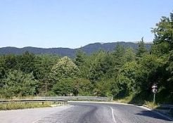
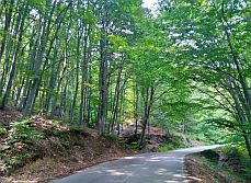
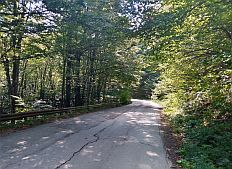
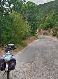
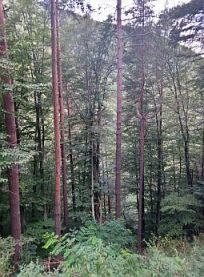
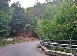
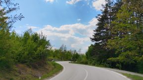
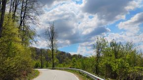
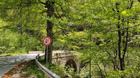
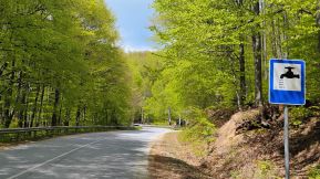
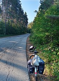
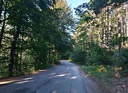
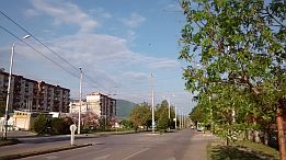
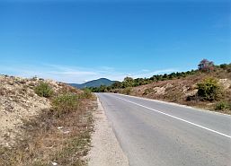
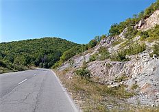
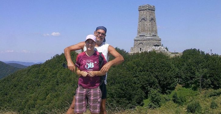
Shipka Pass (altitude 1200 meters) is one of the base Balkan passes shown on the map as N5 or E75. The pass is closed to trucks heavier than 12 metric tons; traffic on this road is relatively intense, although car speeds are not high because turns and other restrictions. August 2015, I pedaled this section from south to north, I would say, it was not an unpleasant ride. The road is important, it is maintained and always is in very nice conditions. The north side of the Pass (woody place) is longer, especially if you are coming from Veliko Tarnovo. The road passes a very nice beech forest up the mountain, making for a nice ride any time of the day. There are 3 springs of drinkable water to the divide (pointed by "w" on the map). The road profile is a continual slope of about 6 - 7 %.
The Pass is also a place connected with our history: https://en.wikipedia.org/wiki/Battle_of_Shipka_Pass
|
 |
||
|
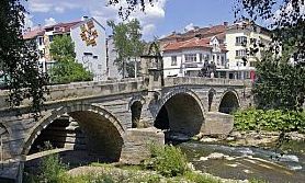
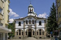
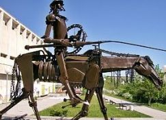
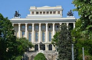
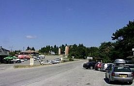
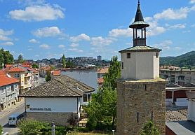
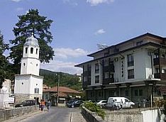
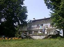
Gabrovo is a bigger city, a regional center. Overnight accommodations are easy to find here. |
For information about Gabrovo: |
|
 |
 |
 |
 |
 |
 |
 |
 |
 |
|
٭Opportunities: |
||
|
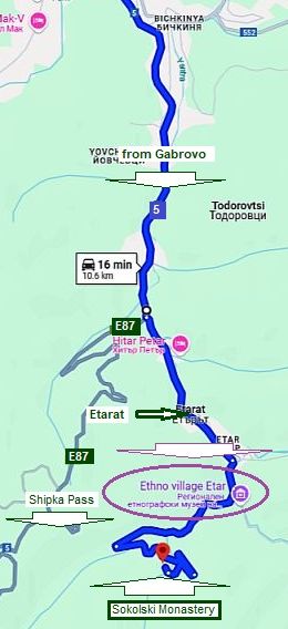
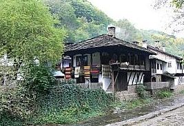
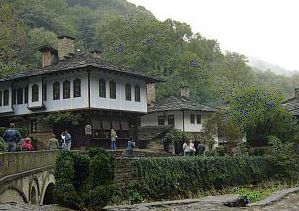
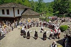
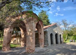
Etara: Several kilometers south from Gabrovo, is an interesting architectural ethnographic complex - a museum at work. It is worth seeing: |
https://en.wikipedia.org/wiki/Etar_Architectural https://bulgariatravel.org/architectural-and-ethnographic -complex-etar/ |
|
 |
 |
 |
 |
 |
|
|
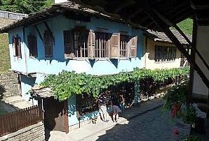
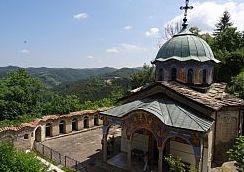
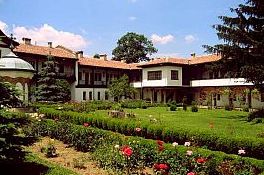
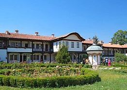
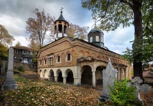
Sokolski Monastery: Four kilometers after Etara is Sokolski Monastery, an interesting place, it is worth to be visited. An information for it: http://www.bulgariamonasteries.com/en/sokolski_monastery.html |
||
 |
 |
 |
|
Below are several photos of the north side of the Pass: |
||
 |
 |
 |
 |
 |
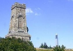
On the mountain divide there are 2-3 restaurants, a small hotel.
The Pass is also a place connected with our history:
https://en.wikipedia.org/wiki/
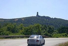
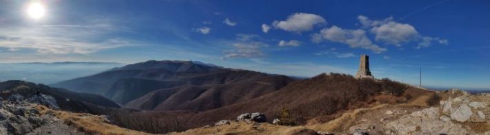
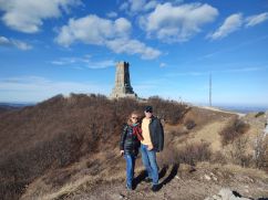
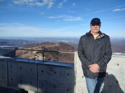
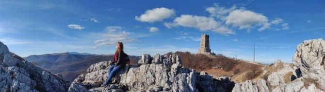
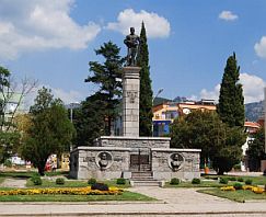
There is interesting monument and a stairway having approx 900 steps up to the monument. The view from the top of the monument is remarkable - photos below. |
 |
 |
 |
 |
 |
 |
 |
|
|
||
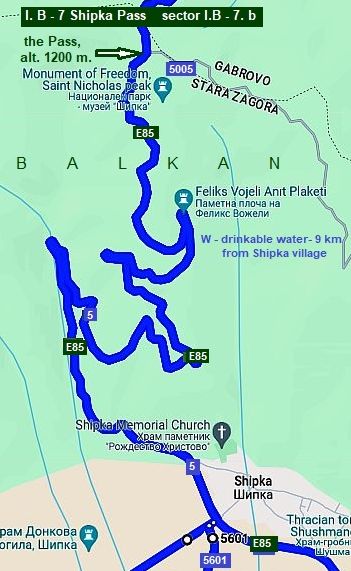
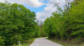
Sector I. B - 7. b B. From Kazanlak to the mountain divide
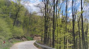
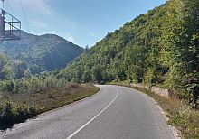
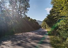
Climbing the Balkan from its south side begins after Shipka village (the first photo below). The road slopes at approx 6 - 7% up to the mountain divide. Comparing with the north Balkan side, here the road is better and wider.
In the heat of summer, try to begin climbing the Pass as early as possible, before 8:00 – 8:30 am, you will pedal in shade. Try to avoid climbing of the Pass in the hot summer afternoons.
Nine kilometer after Shipka Village up in the mountain is the only spring of nice drinkable water.
|
|
|
|
The next several photos are the climbing of the south Pass side. starting from Shipka village. |
||
 |
 |
 |
 |
 |
 |
 |
 |
 |
|
|
٭Opportunities:
Here I will increase the scale near Shipka village I want to suggest a visit
- Shipka Memorial Church - next to Shipka village:
https://bulgariatravel.org/the-shipka-monastery/
- Seuthes Tomb.
(surrounded on the map in left). |
|
Shipka Memorial Church
|
.jpg) |
.jpg) |
|
.jpg) |
|
|
|
|
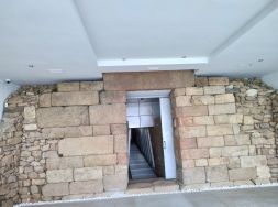
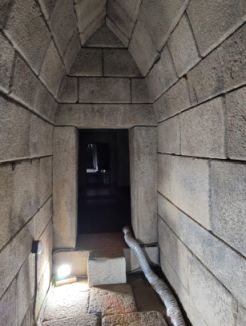
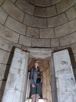
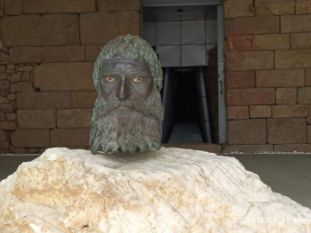
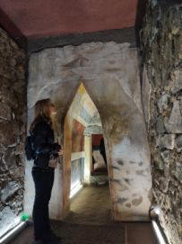
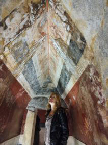
The next photos illustrate details of Seuthes Tomb: And the last https://en.wikipedia.org/wiki/Tomb_of_Seuthes_III https://www.muzei-kazanlak.org/
|
 |
|
|
||
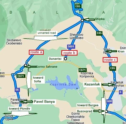
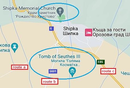
|
Now I will increase again the scale a little, the map in left shows approaches toward Shipka Village (Shipka) Pass. You can use routes a, b or c depending on your general route.
The route a is off road, in Shipka village the road is not signed well (toward Gorno Sahrane). It is convenient if you are coming from Plovdiv, or head toward it. See information about it in the Chapter I. Passes in Balkan Sector I. E
Routes toward Sofia (to west), or Burgas (to east) are shown in the Chapter VI. Crossing Bulgaria from west to east. Routes: A. From Sofia to Burgas
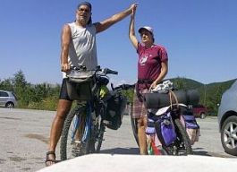
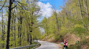
The next three photos show the countryside along route a from Shipka to Gorno Sahrane - in the first picture Maya is pointing to the Monument on Shipka Pass. |
||
 |
 |
 |
|
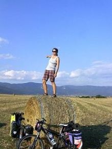
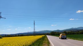
The next six photos show the countryside along route a from E871 toward Pavel Banya in the sunny April '25. Photos can not impress the great view toward Balkan Mountains.
|
||
 |
 |
 |
 |
 |
 |
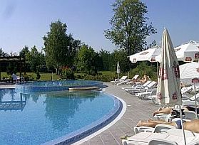
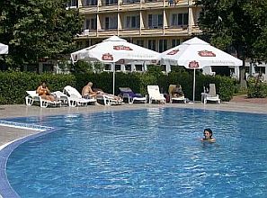
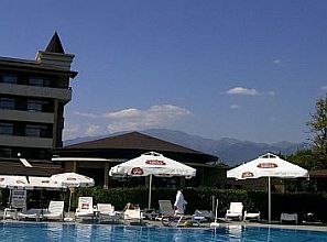
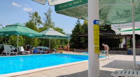
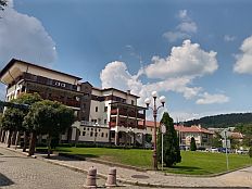
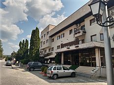
| Pavel Banya is a nice spa resort. There are a lot of nice spots - hotels and swimming pools - nice to relax after a hard bike day. links for Pavel Banya and photos below: |
https://www.visitbulgaria.net/en/pavel http://www.guide-bulgaria.com/SE/stara_zagora/pavel_banya/pavel_banya |
.jpg) |
.jpg) |
.jpg) |
.jpg) |
.jpg) |
.jpg) |
 |
 |
 |
|
|
||
|
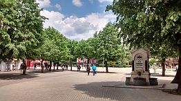
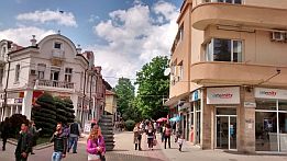
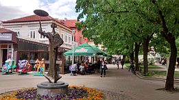
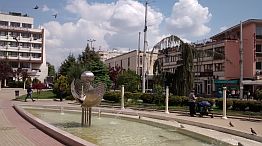
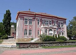
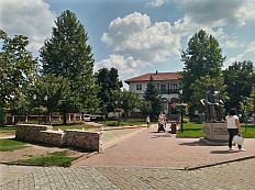
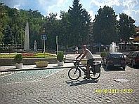
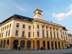
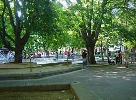
Kazanlak is a middle size town for us, I like it. Information about Kazanlak can be seen here: |
https://bulgariatravel.org/en/the-town-of-kazanlak/ http://www.visitbulgaria.net/en/kazanlak/kazanlak.html Several photos from Kazanlak: |
|
 |
 |
 |
 |
 |
 |
|
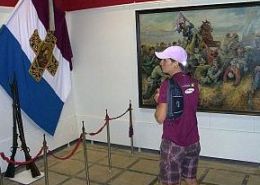
The entire area near Kazanlak is known as a valley of kings. There are a lot interesting places connected with the ancient Thracian History to see here, more details can be found out in the Historis Museum:
https://bulgariatravel.org/en/historical-museum-of-kazanlak/
It is interesting to visit and see Roze Museum: |
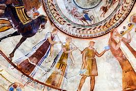
There is an interesting Thracian tomb near Kazanlak, unique frescos can be seen in it, I think it is under UNESCO protection (next photos). https://bulgariatravel.org/en/kazanlak-tomb/ It is not possible to visit it, but next to it a replica of it is built - you can visit it. Several times I have mention Thracian in my Home Page, they were the ancient population living in the east part of Balkans, their culture is much other than the one in Egypt, scientists still do not love to speak about it. |
 |
 |
 |
 |
|
|
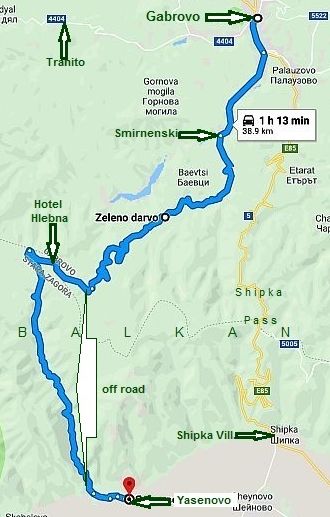 |
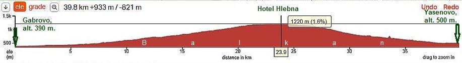
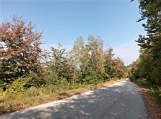
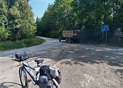
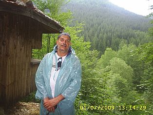
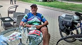
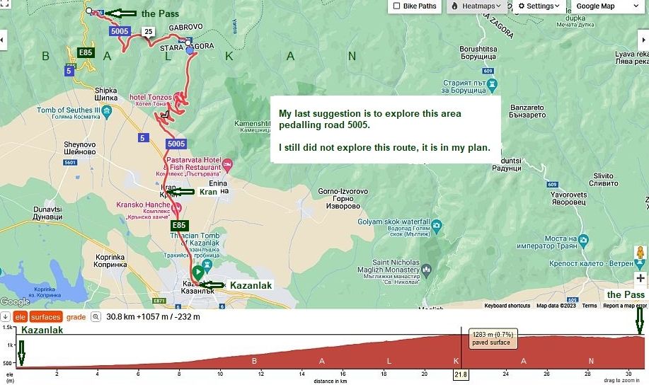
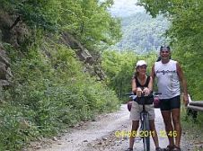
٭Opportunities Next, I want to mention an alternative road to cross Balkan: From Gabrovo to Zeleno darvo to Hotel “Hlebna” (on the mountain divide) to down to Iasenovo. From Gabrovo, up to the hotel Hlebna (it is on the divide), the road is very nice and not hard for bicycling. After that, the road follows an off-road section. After the Hotel Hlebna, the road is not signed and very easy to lose your direction. There are too many off-roads used by the wood cutters – no signs, nobody to consult, the area is woody, with no visibility. August 2013, Maya and I were lost there (photos below). We started pedaling from Tranito (west from Gabrovo) to Gabrovo to Smirnenski to Zeleno Darvo, up the mountain. We had a lunch in the hotel’s "Hlebna" restaurant at the highest point of the pass. Late in the afternoon we were strongly surprised to be back in Tranito. All the time I did not know we are bicycling to the wrong direction down the mountain. Even on Google Maps I cannot find out the road we were on. It didn't help that it was a very cloudy day; we never saw the sun.
In short, I do not recommend using this route, although Hotel "Hlebna" (the first photo below) is very pleasant place to relax, and enjoy a meal at the restaurant.
I mention here this route because I have heard that GPS devices shows this road as very appropriate to overcome Balkan. NO! This road is not appropriate. Often cars and tourist bus drivers have been mislead and must drive back to Gabrovo town from the highest point of the Pass. |
|
|
||
 |
 |
 |
 |
 |
 |
|
|
||
 |
||
|
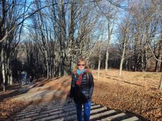
Shipka, the end of December '22 |
||
 |
||
 |
 |
 |
 |
||
|
|
||
 |
|
8. Trevnenski Pass (road 609) https://www.getamap.net/maps/bulgaria/gabrovo/_trevnenskiprokhod/ |
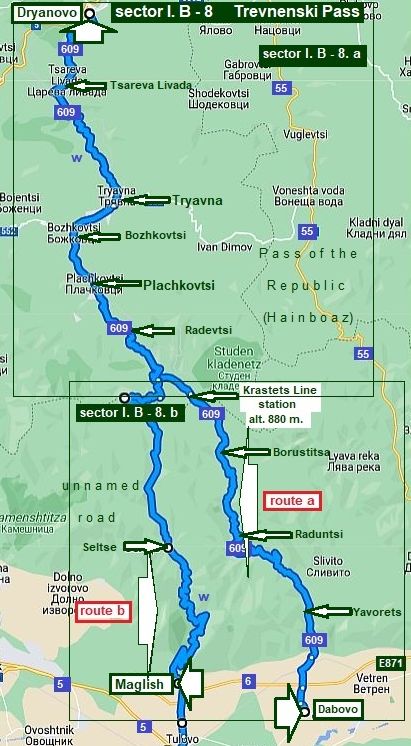 |
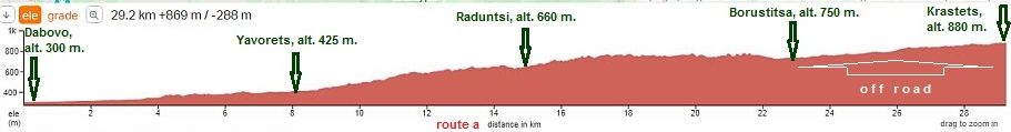
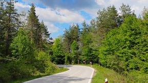
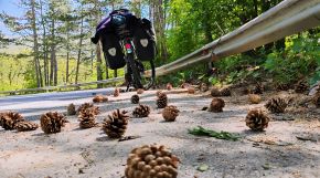
This Pass is an amazing area and I recommend warmly to cross Balkan just here in both directions. The Pass is between Tryavna and Dabovo, but I will expand my description a little, including the route to Dryanovo. If you choose, there is a train between Dryanovo and Dabovo crossing the mountain. The most important thing to know here is that there is NOT ANY TRAFFIC along this road !!! On some maps the road between Borustitsa and Krastets Rail Station - route a), is even not shown. The Pass altitude is 960 meters. The north side of the road I will describe here: From Dryanovo to Tsareva Livada to Tryavna to Bozhkovtsi to Plachkovtsi to Radevtsi to Krastets Line Station. Climbing from north to south up to the mountain divide is not hard, yet, not so easy. The road is asphalt, and in a nice condition Pedaling up the mountain, to reach Krastets Line Station, you must be careful to find the off road further down the mountain – simply follow the railway immediately after the Line Station (the right side of the train line). You will need to take your own water up the north mountain side because there is no water access. From the south side of the mountain there are two routes: - route a: Climbing the south Balkan side begins from: From Dabovo to Yavorets to Raduntsi to Borustitsa to Krastets Railway Station. As it can be seen in the road profile chart, the climb is long, pleasant, but not steep. The road segment from Borustitsa to Krastets Line Station is off-road (some maps do not even show the road). Needless to say, there is minimum traffic here. The area is very nice, with comfortable places for camp in the wilderness at higher elevations. No way to be wrong along this road – it is next to the railway (the south part of the pass). Bring water and food. In Raduntsi, I remember, there was a food shop. Water is available at springs higher up the mountain. - route b: From Maglish to Seltse to the mountain Divide. In the summer 2020 I explored this route, it is beautiful, although from Seltse to the mountain divide the road is dirty. |
|
|
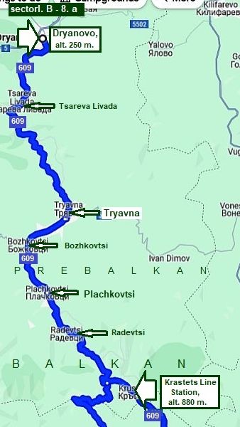 |
Sector I. B - 8. a From Dryanovo to the mountain divide
The north side of the road I will describe here:
From Dryanovo to Tsareva Livada to Tryavna to Bozhkovtsi to Plachkovtsi to Radevtsi to Krastets Line Station.
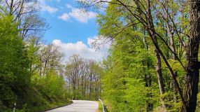
Climbing from north to south up to the mountain divide is not hard, yet, not so easy. The road is asphalt, and in a nice condition.
Up the north mountain side you will need to bring your own water as there aren't any fresh water sources.
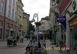
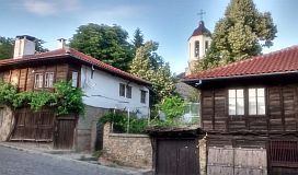
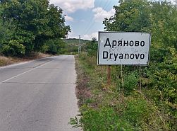
Dryanovo is a little lovely town, where you can easily find overnight accommodations. It can be used as a base to stay for a night and visit Veliko Tarnovo by taxi or public transport. Have in mind that the traffic toward Veliko Tarnovo is very intensive and it can be dangerous to pedal it.
Information for Dryanovo and several photos: |
 |
 |
 |
 |
 |
 |
|
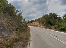
The next several photos illustrate the road from Dryanovo toward Tsareva Libada and Tryavna. As it is obvious from the road profile chart above, there is |
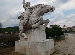
a climbing here and there are road segments, where the road is steeper. Leaving Dryanovo, you will see an ugly statue. |
 |
 |
 |
|
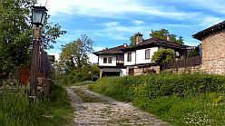
The picturesque Bulgarian village of Tsareva Livada, which is known with its beautiful nature and pure air, is situated 5 km from the town of Dryanovo, in the direction of Tryavna. The village is located between the areas of Veliko Tarnovo and Gabrovo in |
the middle of the lovely Central Pre-Balkan hills. The climate in this region is very healthy for people with respiratory and lung problems. Overnight accommodation in it is possible. http://www.guide-bulgaria.com/NC/gabrovo/dryanovo/tsareva_livada |
 |
 |
 |
 |
Overnight accommodation in Tsareva Livada it is possible. A nice place to stay for an afternoon and night is Complex Asenevtsi - it is shown in Google Map. |
|
 |
 |
|
|
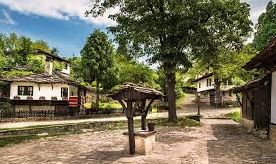
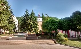
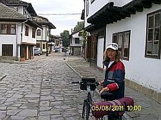
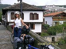
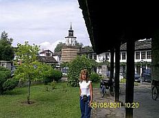
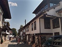
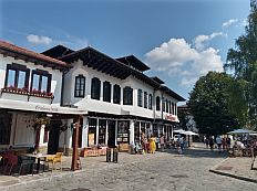
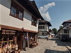
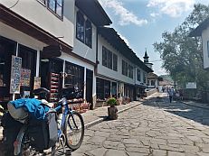
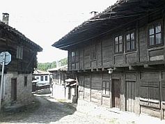
Tryavna it a touristy spot, overnight accommodation here is not a problem there are several nice restaurants as well; for information about Tryavna: |
https://en.wikipedia.org/wiki/Tryavna http://www.guide-bulgaria.com/NC/gabrovo/tryavna/tryavna I love his little town with its saved architecture from the middle of XIX century, so, more pictures from this place. |
 |
 |
 |
 |
 |
 |
 |
 |
 |
 |
 |
|
 |
 |
 |
|
The next little town ahead is Plachkovtsi. http://www.guide-bulgaria.com/NC/gabrovo/tryavna/plachkovtsi The Pass climbing starts after it. bring water and food with you. |
||
 |
 |
 |
 |
 |
|
|
|
 |
|
|
The last photo above is just the cross road of route 1 and route 2. Roads there are signed well, but if you climb this Pass from north to south, I would suggest you to choose further route 1. |
||
 |
Sector I. B - 8. b
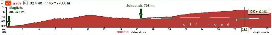
From the south side of the mountain I will give two routes: - route a: From Dabovo to Yavorets to Raduntsi to Borustitsa to Krastets Railway Station. As it can be seen in the road profile chart, the climb is long, pleasant, and not steep. The road segment from Borustitsa to Krastets Line Station is off-road (some maps do not even show the road). Needless to say, there is hardly any traffic here. The area is very nice, with comfortable places for camp in the wilderness at higher elevations. No way to be wrong along this road – it is next to the railway. Bring water and food, although in Raduntsi, I remember there was a food shop. Water is available at springs higher up the mountain. Have in mind that in Dabovo Line Station all the trains traveling in both directions: from west to east (from Sofia to Burgas) and from north to south (from Ruse to Kardzhali) have a stop. - route b: From Maglish to Seltse to the mountain Divide. In the summer 2020 I explored this route, it is beautiful, although from Seltse to the mountain divide the road is dirty.
The next two road profile charts illustrate differences between route a and route b. The second one is a little bit harder, the climb here is more than 200 meters, the off road here is much longer comparing with the first one. I recommend it only to bicyclists loving mountain area and off road riding. |
|
route a
route b
|
||
|
B. From Dabovo to the mountain divide Route a: The next several photos illustrate area from Dabovo to Krastets. I can say the pedalling here is pleasant, the road is in relatively nice condition, the off |
road is only several kilometers. Food can be find in Radunrsi, but it would be better to bring it with you. The only spring of drinkable water is higher in the mountain just before Borustitsa. |
|
|
|
 |
|
 |
 |
 |
|
|
|
|
|
||
|
|
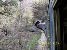
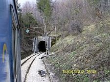
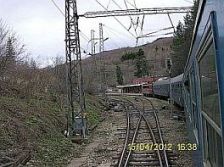
٭An opportunitiy The train offers an opportunity to cross Balkan by this pass. It serves the line from Gorna Oriahovitsa to Veliko Tarnovo to Dryanovo to Tryavna to Krastets Line Station to Dabovo to Stara Zagora. Traveling by train, especially when the train is in the mountain, is truly spectacular. Usually in the train there are not many people, so handling with the bicycles and baggage is not a problem. The left photo here is the off-road between Borustitsa and Krastets Railway Station along the river - I was in the train on one cool and raining afternoon. |
|
 |
 |
 |
|
|
||
| C. From Maglizh to the mountain divide | ||
|
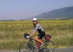
Route b: Next description is the route starting from Maglish. It is little town, overnight accommodation in it is possible. some information for it: |
http://www.guide-bulgaria.com/SE/stara_zagora/maglij/maglij Starting from Maglizh, you will have 10 kilometers of climbing. |
|
|
|
|
|
|
|
 |
|
|
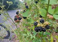
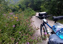
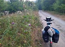
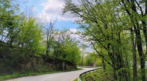
The road toward Seltse is in nice condition, the slope is no more than 8%. Since the end of July there are a |
lot of blackberry along the road. Here you will not see any cars. |
 |
 |
|
|
I remember there were 2 springs of water up the mountain, but un the late August 2020 I explored this route there was no water there. |
The only nice spring of water was 2 - 3 kilometers to Seltse, the pic in the middle below. |
 |
 |
 |
 |
|
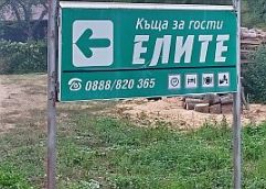
Seltse is small village up the mountain. A little information about it is available here. There is a guest |
house there (Елите), maybe food is available in it as well. I did not visit it, but I heard music and voices there. |
 |
 |
 |
 |
 |
|
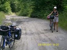
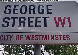
Pedaling a little further you will be surprised you are pedaling along "George" Street W1, City of Westminster, and soon you will be again in the wilderness. |
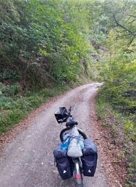
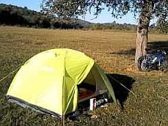
The first several kilometers the off road is easy for pedalling, but higher in the mountain you have to push your bike, especially if it is heavy loaded. The area up the mountain is perfect to camp next to the river. |
 |
 |
 |
|
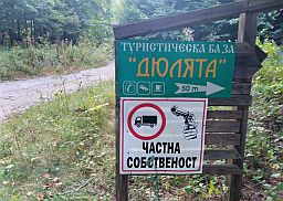
Up the mountain you will see an interesting sign meaning it is a "Tourist Base", it seems coffee and |
beds are available in it. Do not be afraid of the gun on the sign, it means the area is guarded. |
 |
 |
 |
 |
 |
|
|
Approaching to the mountain divide, you will see 2 huts. One of them is a new one, still under building, |
another one was abandoned. There was nobody there to inform for the opportunities there. |
 |
 |
|
|
There are several kilometers on the Balkan divide to pedal before seeing signs to Krastets, Maglizh, |
Plachkovtsi, Tryavna, and you again will be on the aspholt road down toward Tryavna. |
|
|
 |
 |
|
I would say it is very nice route, one day I will pedal there again. I definitely recommend the route to |
bicyclists loving off road, mountains, camping in the wilderness. |
|
|
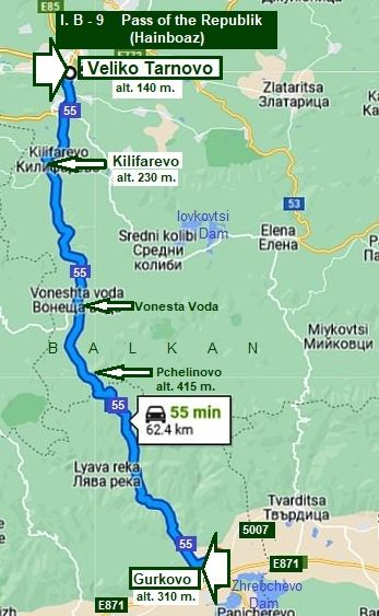
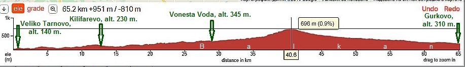
9. Pass of the Republic (Hainboaz) (road 55)
One of the basic Balkan passes (altitude: 700 meters). The pass is a segment on the international road E85:
From Turkey border to Nova Zagora to Gurkovo to Pchelinovo to Raikovtsi to Vaglevtsi to Kilifarevo to Veliko Tarnovo to Byala to Ruse to Romania. https://de.wikipedia.org/wiki/Pass_der_Republik
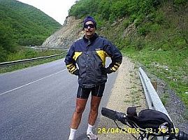
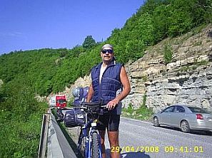
Because this route is heavy with tourist traffic, there are a lot of hotels, motels, restaurants along the road. The pass is very easy for bicycling in both direction, but it would be better to avoid it as the road can be busy with a lot of heavy, industrial truck traffic – in both directions. Also, there are no restrictions concerning truck tonnage. The only time I pedalled this Pass was April, 2008, and I would not repeat it.
Veliko Tarnovo is located on the route from Sofia to Varna, look in the Chapter VI. Crossing Bulgaria from west to east. Routes: Gurkovo is located on the route from Sofia to Burgas, look in the Chapter VI. Crossing Bulgaria from west to east. Routes:
AVOID THIS PASS !!! |
||
|
|
||
|
|
|
|
|
|
|
|
|
|
||
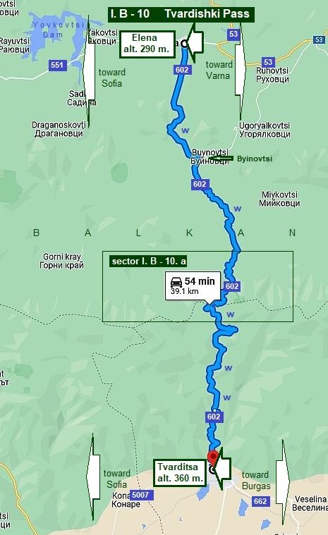
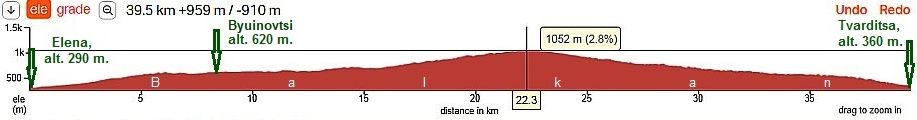
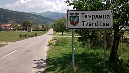
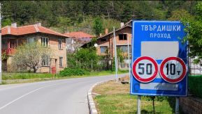
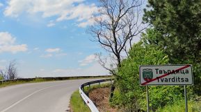
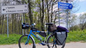
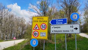
10. Tvardishki Pass (road 662)
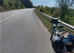
Tvardishki Pass (altitude: 1050 meters) is one of the best ways to cross this part of the Balkans. The pass connects Elena and Tvarditsa (road N662) which was in very nice condition, and still should be.
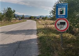
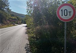
This pass has very little traffic, I would be surprised if you see more than 5 - 6 cars per hour. It is closed to trucks heavier than 10 metric tons, so I recommend to cross Balkan just here. The entire area is very scenic, almost all the time you will pedal in wooded areas.
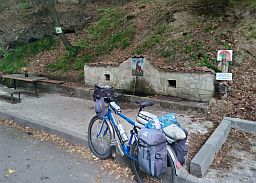
Drinkable water is available on the both sides of Balkan.
In the month of August there are a lot of beautiful blackberry along all the road; the last time I explored this area I lost a lot of time to eat it.
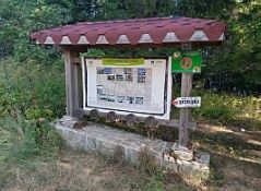
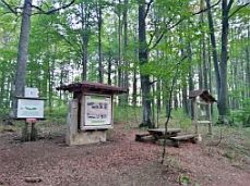
On the top of the Pass there are 2 huts, next I have posted pictures and details about huts (sector I. B - 10. a).
Elena is located on the route from Sofia to Varna, look in the Chapter VI. Crossing Bulgaria from west to east. Routes:
Tvarditsa is located on the route from Sofia to Burgas, look in the Chapter VI. Crossing Bulgaria from west to east. Routes: |
|
From Elena to the mountain divide |
|
Elena is a touristy spot, architecture of XIX century is saved. There are overnight accommodation and nice restaurants in the town. Information of Elena can be seen here: |
https://www.visitbulgaria.net/en/elena/elena.html https://bulgariatravel.org/en/town-of-elena/ Several photos from Elena: |
 |
 |
 |
 |
 |
 |
 |
 |
 |
 |
 |
 |
| The road south from Elena to the top of the pass begins at the center of Elena, is a steep grade up to Byinovtsi, and is very pleasant pedaling after that in the perfect mountain area. |
The route is very scenic and there are nice places for camp in the wilderness. It can be mentioned that overnight accommodation is possible next to the small village Byinovtsi, where guest houses are available. |
 |
 |
 |
 |
||
| Six - seven kilometers in the mountain the hill is not so steep, the pedaling is easier for the next 7 kilometers. | ||
 |
 |
 |
 |
 |
 |
| The last еight kilometers to the top of the Pass road is steeper again, | ||
 |
 |
 |
| Drinkable water is available approximately 7 and 13 kilometers from Elena up in the mountain. | ||
 |
 |
 |
| The Mountain divide - there is no big flat open area nice for camp in the wilderness. | ||
 |
 |
|
| From Tvarditsa to the mountain divide | ||
|
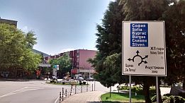
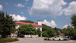
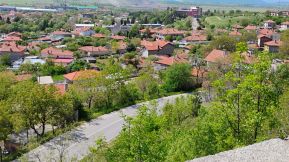
The climbing from the south side the Pass begins from the center of Tvarditsa - the road toward Elena is signed well. Overnight accommodation is available in Tvarditsa: |
you will see labels attached on the poles near the road for guests houses. I can not find any English language information for this little town. Veeeeery little information for the Tvarditsa: |
|
 |
 |
 |
|
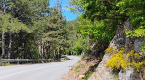
Climbing the south pass segment (north from Tvarditsa) is harder, as it can be seen from the road profile chart above. |
||
 |
 |
 |
|
There is a beautiful view to south as well. Two - three kilometers up the mountain there is a nice place for camp next to the road. |
||
 |
 |
 |
|
|
Along the road there is very nice cool river; nice springs of cool fresh water can be found 8, 10, 16 kilometers after Tvarditsa up the mountain.
|
|
 |
 |
|
 |
 |
|
|
Area here is woody, I recommend to start climbing no later than 8.30 am in the summer time.
|
|
 |
 |
|
 |
 |
 |
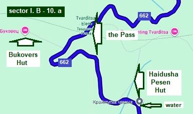
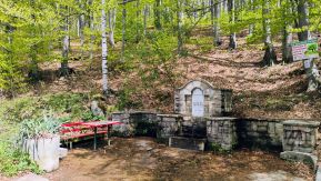
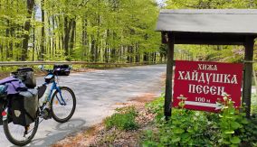
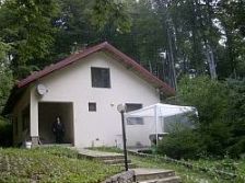
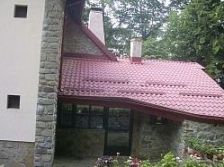
Approaching the mountain divide are two huts. To right is the first one is "Haidushka Pesen" Hut, the road toward it is labeled, unfortunately using Cyrillic. Here is comfortable (and more expensive) for overnight accommodation, but food & coffee is not available. The road again is signed using only Cyrillic.
|
||
 |
 |
 |
 |
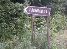
A kilometer further up the mountain is the crossroad toward the next one (to left): "Bukovets" Hut, signedin Cyrillic again. It is a little primitive for overnight accommodation, but coffee and food is available there. |
|
 |
 |
|
| Soon the climbin will be over. | ||
 |
 |
 |
|
|
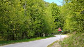
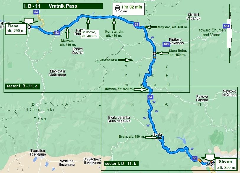
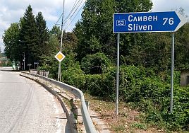
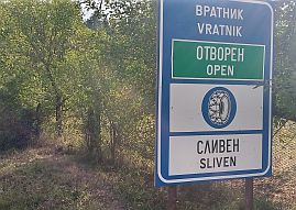
11. Vratnik Pass (road 53) |
||
|
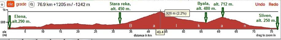
Another very nice road (N 53) to cross the Balkans. The road connects Elena and Sliven. The highest pass point has altitude 1100 meters, although the Google map shows me 920 meters. The entire road is in very nice condition, there is very |
little traffic, I can even say there is not any traffic. In addition the pass is closed for trucks heavier than 10 metric tons. Food is available in all the villages along the road. |
|
|
|
||

|
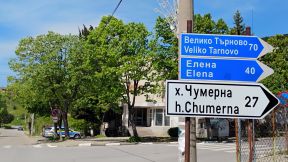
Sector I. B - 11. a From Elena to the mountain divide
Information concerning Elena: https://www.visitbulgaria.net/en/elena/elena.html https://bulgariatravel.org/en/town-of-elena/
several photos of Elena previous item, I will not put here is again.
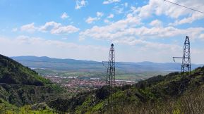
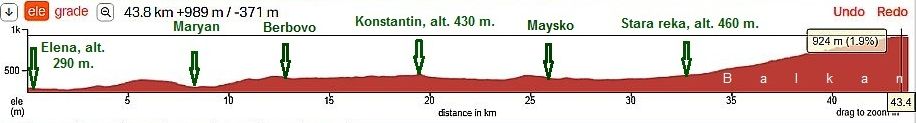
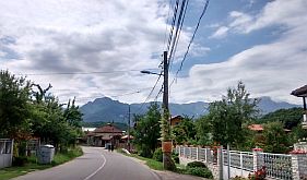
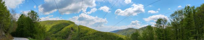
I can say this is one of my favorite areas in this region. More than 30 kilometers after Elena the road is in the region of so called Pre - Balkan, which is a hilly area with not long and steep hills.
|
|
|
||
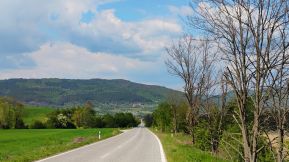
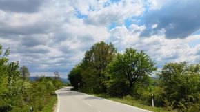
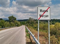
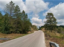
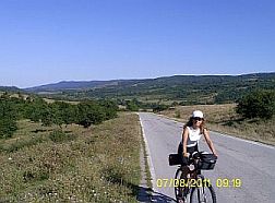
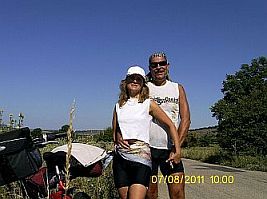
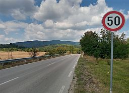
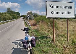
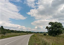
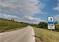
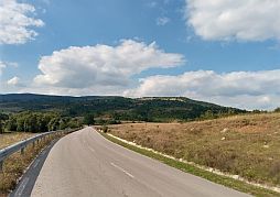
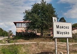
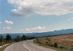
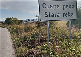
| Just after Elena the climbing is starting, fortunately the hill is not long and steep. Beginning from Elena to east, the next villages are Maryan, Berovo, Konstantin, Maisko, and Stara reka. | There are food shops and water springs in all the small villages along the road. I pedaled this area many times, always I felt at my best here. | |
 |
 |
 |
 |
 |
 |
 |
 |
 |
 |
 |
 |
 |
 |
 |
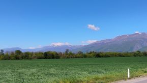
| The same area: countryside from Elena to Konstantin. The photos are taken in the beginning of beautiful May '25. | ||
 |
 |
 |
 |
 |
 |
 |
 |
 |
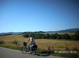
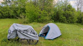
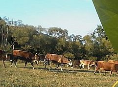
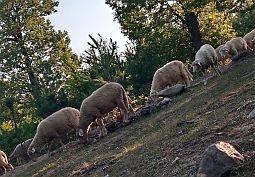
| Unfortunately, last years I see more and more cow farms in the region. So, if you camp in the wilderness you have to be more careful, you might wake up early | in the morning surrounded by hundreds of caws and all the area was covered with fresh caw shits - it happened to me August '16. |
 |
 |
 |
 |
 |
 |
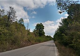
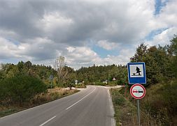
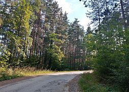
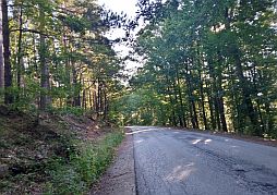
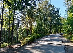
| Climbing of the pass begins after Stara Reka. It is very nice countryside, the north Balkan side is a nice wooded area. Climbing is long, 12 - 13 km, but not steep | and very pleasant. Carry water when climbing the mountain. At the top of the pass there was a little restaurant, which is closed. |
 |
 |
 |
 |
 |
 |
 |
 |
|
 |
 |
 |
|
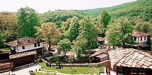
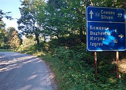
Nearby is located a little village Bozhentsi, an ethnographic village having saved XIX century |
architecture, it is a tourist destination, I still do not visit it. https://www.visitbulgaria.net/en/bozhentsi/bozhentsi.html |
|
|
|
|
|
|
||
|
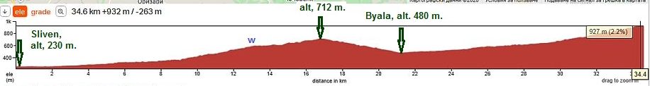
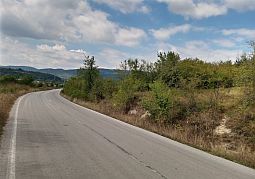
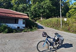
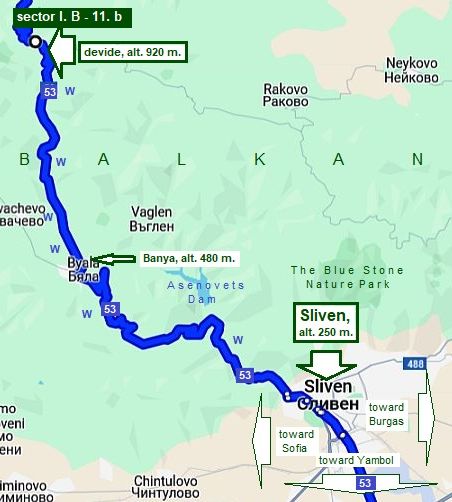
Sector I. B - 11. b From Sliven to the mountain divide
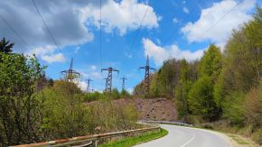
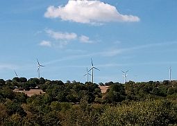
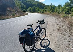
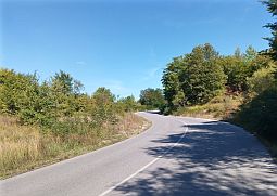
The south side of the pass is steeper and harder for bicycling (especially just after Sliven). No wooded areas or shade, so it would be better to avoid climbing here in the sunny, hot summer afternoons. Bring water with you, there is only one spring of fresh water along the hill after Sliven. Food can be found in Banya. The region near Sliven is a windy area. High on the horizon can be seen a lot of wind electro generators.
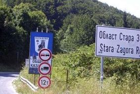
Sliven is located on the route Sofia - Burgas, information for it can be seen in the Chapter VI. Crossing Bulgaria from west to east. Routes: A. From Sofia to Burgas
The route toward Yambol and BG/Turkey Border can be seen in the Chapter III. Crossing Bulgaria from north to south (from Romania to Turkey & Greece): |
|
|
||
|
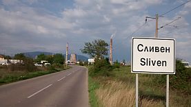
Overnight accommodation in Sliven is not a problem. Information about Sliven can be seen here: |
http://wikitravel.org/en/Sliven |
|
 |
 |
 |
 |
 |
 |
|
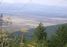
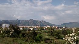
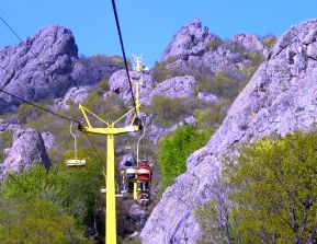
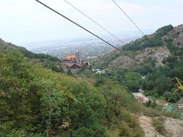
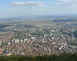
In the north end of the town there is a chair type lift up to "Sinite Kamani Natural Park" - the Blue Stone |
Nature Park. The view to the plane low down is great. |
 |
 |
 |
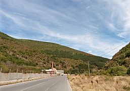
| Leaving Sliven, you will pedal along a little river and a valley of fabrics and plans, some of them are abandoned, the view here always was not pleasant for me. The slope of the hill here is still not so steep, but | entering in the mountain, it increases. It is very sunny place, I am sure, in the summer afternoon the climbing here will be not pleasant. In the middle of the hill there is a nice spring of cool and fresh water. |
 |
 |
 |
 |
 |
 |
 |
 |
 |
|
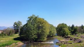
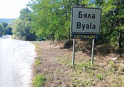
Byala is a nice place to relax. There is a food shop, coffee, spring ad eater in it. |
||
 |
 |
 |
|
13 - 14 kilometers up the mountain is the pass. There are several springs of water up the mountain. |
No any traffic here. No food up the mountain as well. |
 |
 |
 |
 |
 |
 |

.jpg)
.jpg)