|
|
|
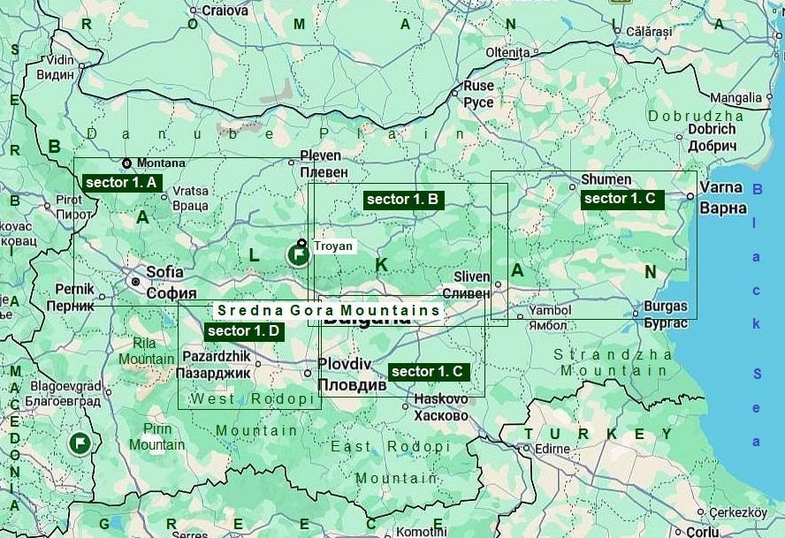
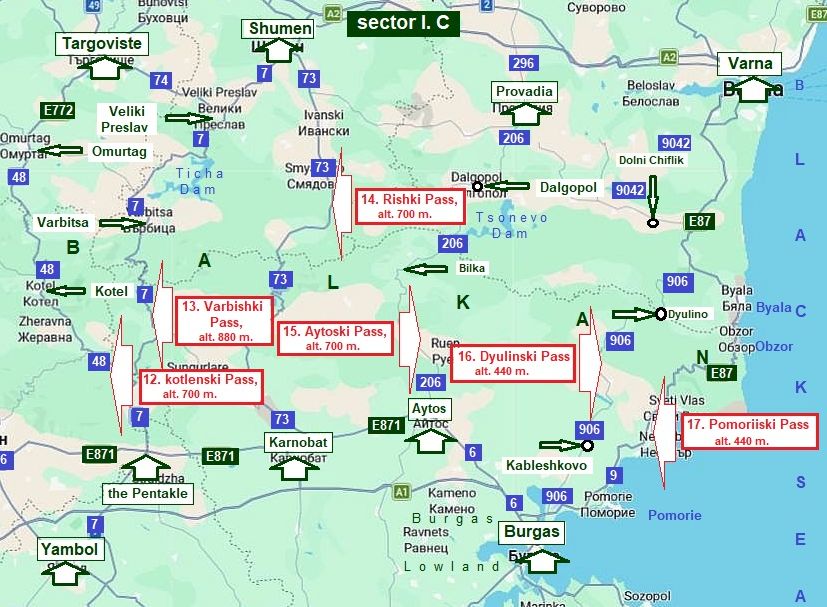
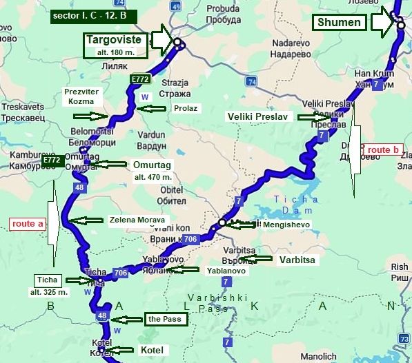
Sector I. C |
||
|
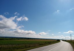
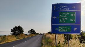
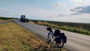
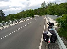
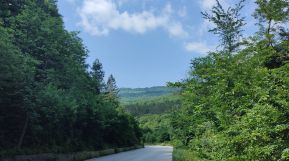
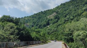
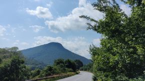
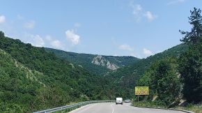
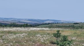
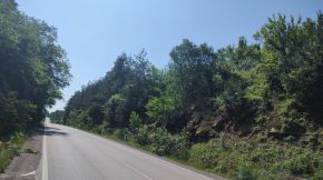
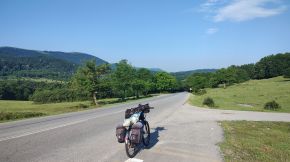
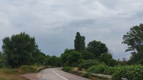
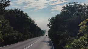
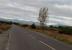
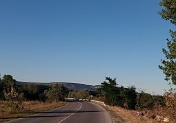
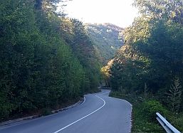
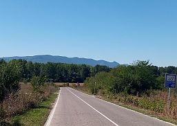
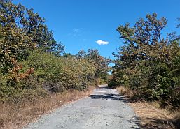
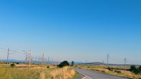
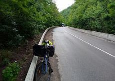
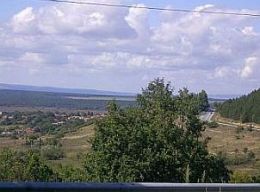
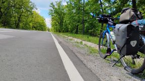
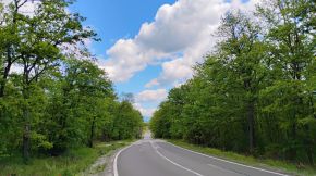
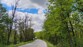
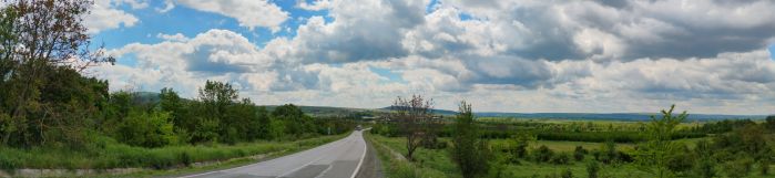
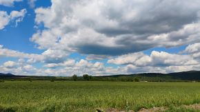
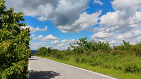
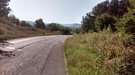
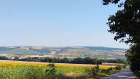
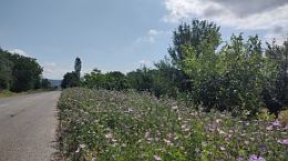
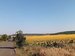
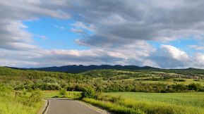
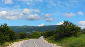
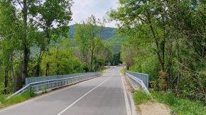
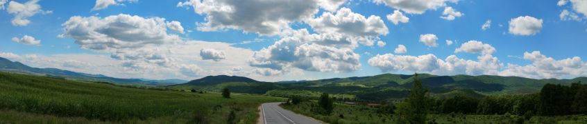
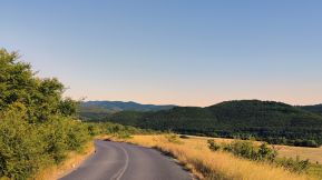
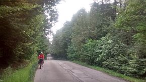
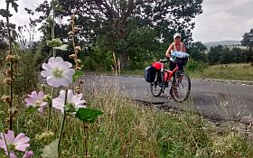
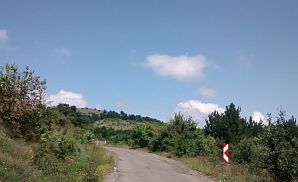
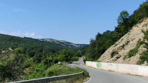
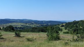
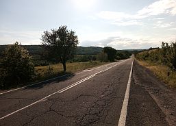
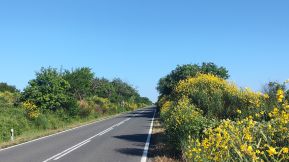
Sector I. C includes Passes in the east part of Balkans. The mountain in its eastern part is getting wide, it is not so high and the road profile include several shorter ascents and descents. This part of the mountain is easy to access, |
and easy for bicycling, riding either from the north or the south. I will give more detailed descriptions of the passes here - it would be helpful for bicyclists intending to cross the country from north to south or back. | |
|
Content: |
|
|
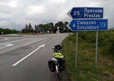
12. Kotlenski Pass: 13. Varbishki pass: 14. Rishki pass: 15. Aitoski pass: 16. Dyulinski Pass: 17. Pomoriiski Pass: |
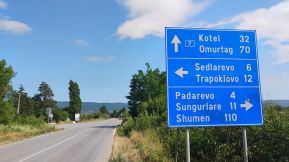
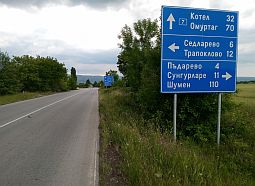
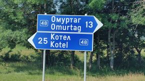
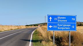
From Targoviste to Omurtag to Kotel to Gradets to the Pentacle to Yambol (E772, roads 48&7); From Shumen (Targoviste) to Varbitsa to the Pentacle (to Sungutlare to Karnobat) (road 7); From Shumen to Veselinovo to Lozarevo to Karnobat (road 73); From Provadia to Dalgopol to Bilka to Aytos (to Burgas) (road 208); From Varna to Dolni Chiflik to Dyulino to Kableshkovo to Burgas (roads 9042 & 906); From Varna to Byala to Obzor to Nesebar to Pomotie to Burgas (E 87); |
|
|
|
|
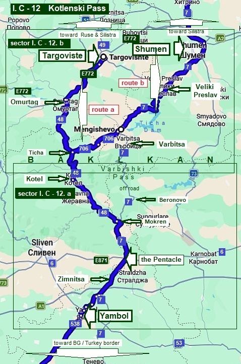
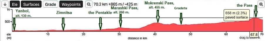
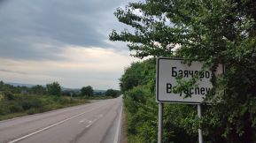
12. Kotlenski Pass
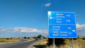
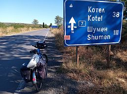
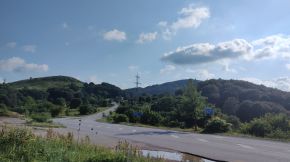
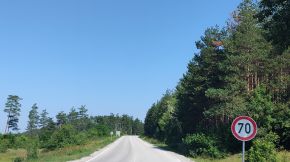
The routes I describe here is: route a From Targoviste (road E772) to Omurtag (road 48) to Ticha to Kotel to Mokren (road 7) to the Pentacle to Zimnitsa to Yambol.
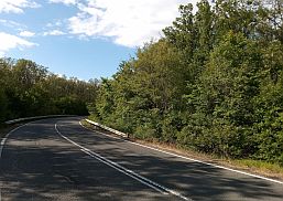
The road segment, Targoviste to Yambol, is one of the shortest roads, when the country is crossed from the Romanian Border (Silistra or Ruse) to the Turkish border (border checkpoints Lesovo or Kapitan Andreevo), or the Greece border (border checkpoint Kapitan Petko Voyvoda). This section of road is relatively easy for bicycling in both directions, is in very nice condition, the traffic here is not intensive, except along the road segment from Targoviste to Omurtag (E 772). Even though the road is wide enough, I do not like it and do not recommend bicycling of this road segment, especially north to south (up the mountain).
On the map here I show an approach toward Kotlenski Pass from Shumen as well: route b From Shumen to Veliki Preslav (road N7) to Mengishevo (road N706) to Ticha (road N48) to Kotel to Mokren (road N7) to the Pentacle to Yambol.
Bicyclists crossing Bulgaria in this direction (starting or heading to Shumen) can use Kotlenski Pass as well, instead the next one: Varbishki Pass (road 7) - east from Kotlenski Pass, because a part of Varbishki Pass is off road. (Varbishki Pass is the next item in this Chapter). |
|
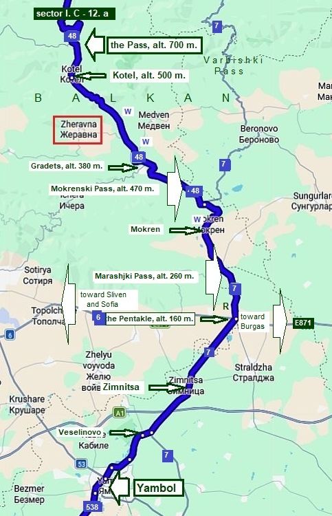
Sector I. C - 12. a
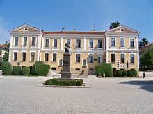
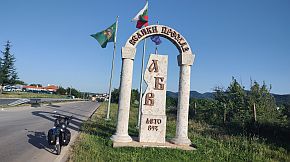
My description will start from the crossroad on the south most point Yambol City - a center of Yambol Region.
Information for Yambol: https://en.wikipedia.org/wiki/Yambol https://www.visitbulgaria.net/en/yambol
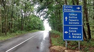
As it can be seen from the map in left, the route includes, from south to north, 3 passes:
- Marashki Pass (alt. 224 m.);
- Mokrenski (Avramovski) Pass (alt. 470 m.);
- Kotlenski Pass (alt. 660 m.) - the highest one.
All the three passes make for easy climbing in the south to north direction.
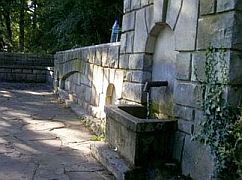
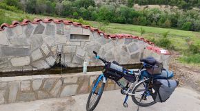
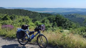
There are several water springs along the road, but the water is not very tasty in the hot summer months. I recommend you bring your own water. Food can be found in villages along the road.
|
|
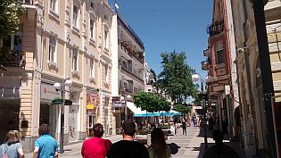
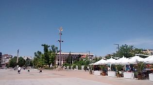
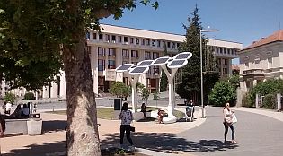
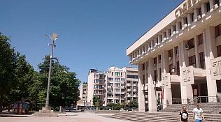
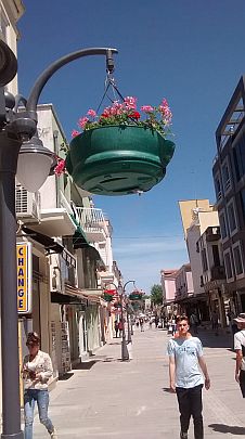
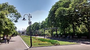
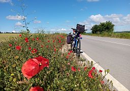
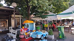
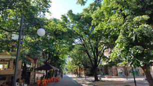
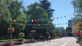
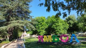
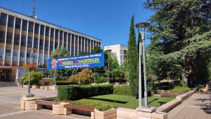
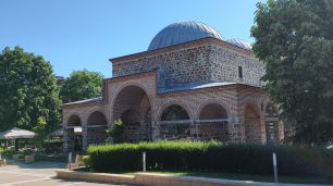
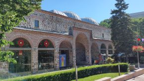
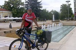
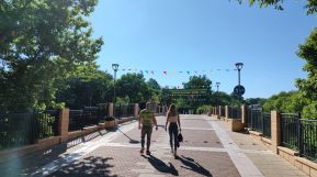
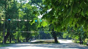
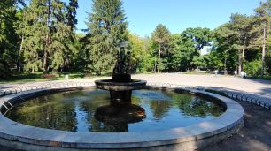
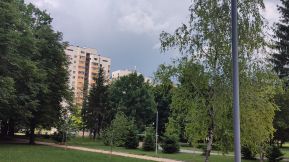
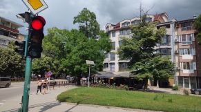
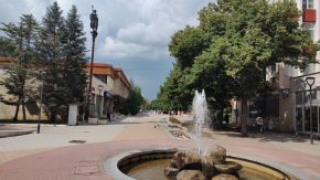
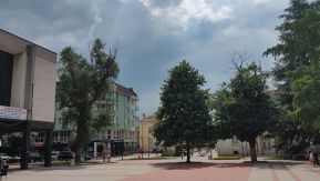
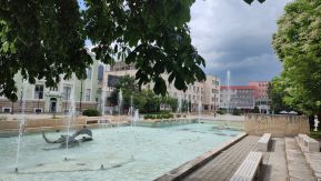
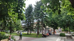
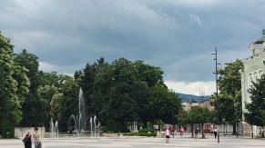
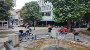
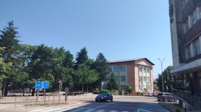
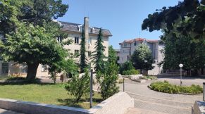
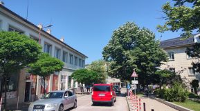
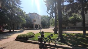
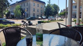
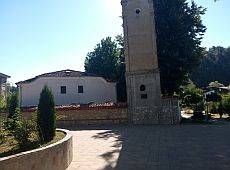
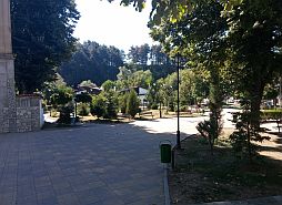
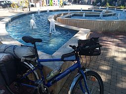
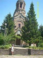
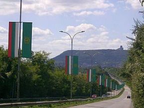
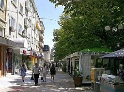
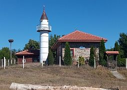
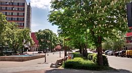
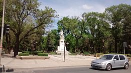
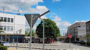
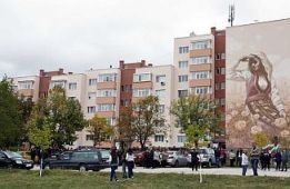
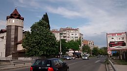
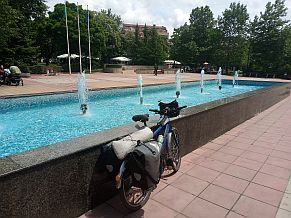
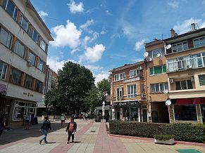
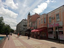
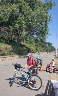
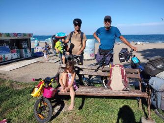
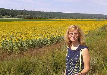
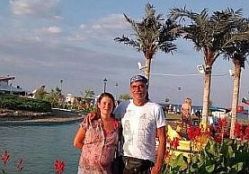
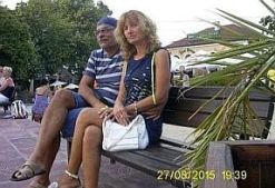
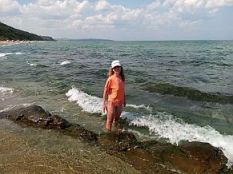
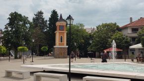
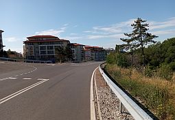
Several pictures from Yambol. |
 |
 |
 |
 |
 |
 |
 |
 |
 |
|
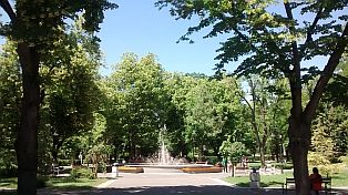
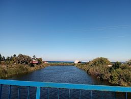
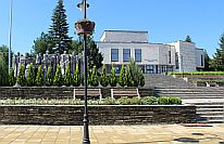
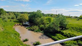
The town has very nice garden in its east end next to Tundzha River. Very nice spot to relax for 3 hours in the hot summer afternoons. |
||
 |
 |
 |
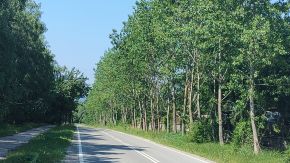
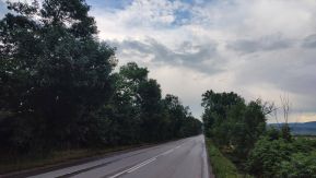
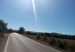
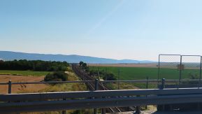
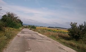
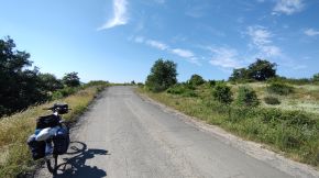
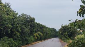
| Leaving Yambol in North direction, after the Veselinovo the local road join with road 7 - a road with more intensive traffic. | ||
 |
 |
 |
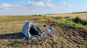
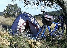
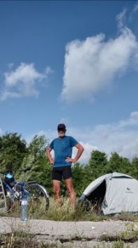
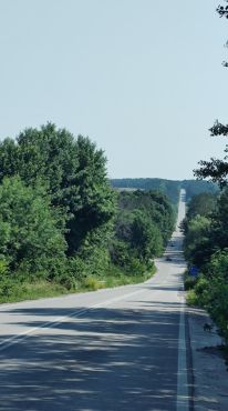
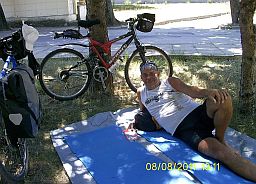
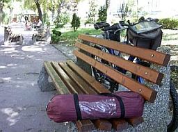
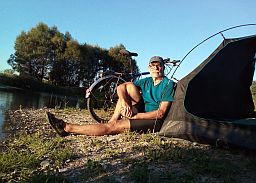
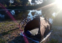
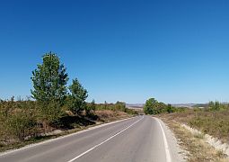
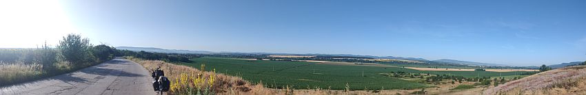
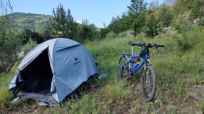
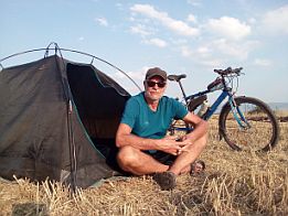
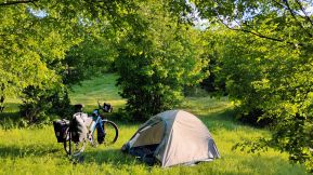
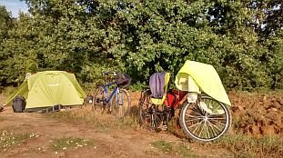
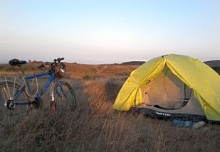
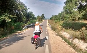
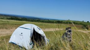
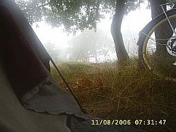
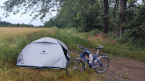
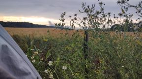
| The traffic decreases significantly after the crossroad. The area is nice to camp in the wilderness - my tent in the middle of the field next to an irrigative channel of clean cool water, the perfect place in this hot late summer afternoon. | ||
 |
 |
 |
|
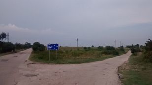
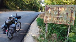
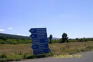
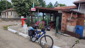
Zimnitsa is little town, I was surprised I was not able to find a coffee place in the early Sunday morning. http://www.guide-bulgaria.com/SE/yambol/straldja/zimnitsa Towards the Pentacle - a crossroad of five roads - restaurants and a hotel is available there. |
||
 |
 |
 |
 |
 |
 |
|
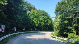
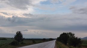
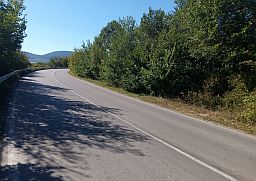
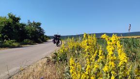
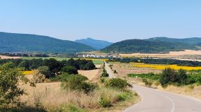
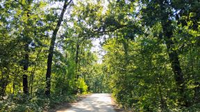
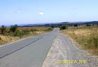
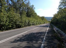
Next photos illustrate approach to Marashki Pass and Mokren from the Pentacle. The climb here is not much, the difference in the altitudes here is only 100 meters. |
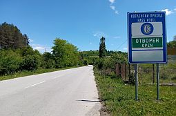
Usually at the beginning of some passes you will see a “Open”, informing drivers in the winter time the pass is clear of snow and passable. |
 |
 |
 |
|
At the highest point of Mokrenski pass you will see a sign toward Sungurlare and Shumen directing the traffic toward Shumen to the Rishki Pass, so further the road will be without any traffic. |
Food shop is available in Mokren, but it is not visible from the road. A water spring is available too, but the water is not nice. |
 |
 |
|
|
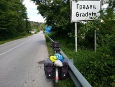
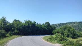
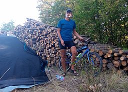
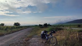
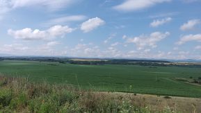
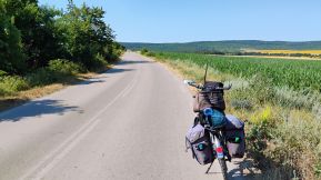
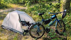
The climbing of the next Pass: Mokrenski or Avramovsk Pass is longer, the difference in altitudes here is almost 250 meters. All the area here is very nice for camping |
in the wilderness. The road is next to Gradets, I have never entered in it, so I am not sure if food is available there. |
|
|
 |
 |
|
|
 |
|
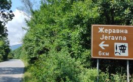
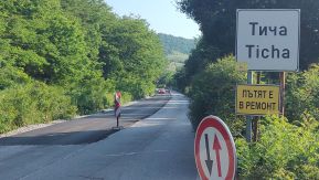
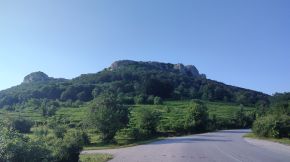
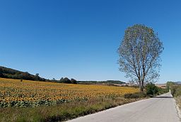
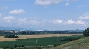
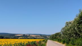
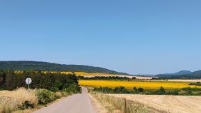
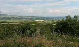
Next photos illustrate the countryside toward Kotel. tourists having time nay visit Zheravna (I have pointed it on the map above. |
Just after the crossroad toward Gradets there is a nice spring of water, after is the climbing of the last Pass here: Kotlenski Pass. |
 |
 |
|
 |
 |
 |
|
|
 |
|
|
|
||
|
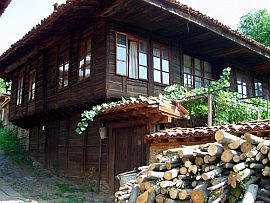
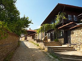
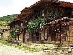
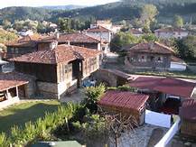
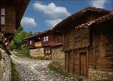
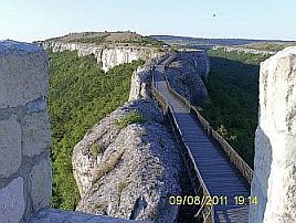
٭An opportunity Close to this route is Zheravna - an architectural - historical reserve, very popular tourist destination, More information is given in the next sites, especially the second one: |
|
http://www.guide-bulgaria.com/SE/sliven/kotel/jeravna https://bulgariatravel.org/en/zheravna-architectural- I still did not find a time to visit it. Overnight accommodation there is possible, it seems it would be nice to spent a night there. |
 |
 |
 |
|
|
||
|
Overnight accommodation in Kotel is possible. Information for Kotel: |
 |
 |
 |
|
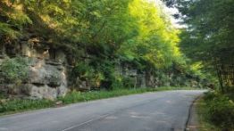
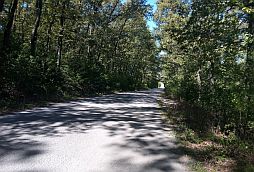
The distance from Kotel to the mountain divide is 7 - 8 kilometers, the climbing here is not hard. On the divide there is a nice spot to camp there. |
 |
 |
 |
 |
 |
|
|
|
 |
 |
 |
 |
|
|
Sector I. C - 12. b
As I have mention, I will elongate here the routes little, starting from Targoviste - route a and Shumen - route b.
Route a:
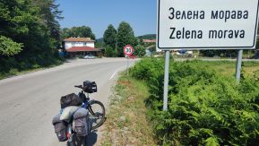
From Targoviste (road 772) to Prolaz to Prezviter Kozma to Omurtag (road 48) to Zelena Moreva to Ticha.
The road segment from Targoviste to Omurtag is with quite intensive traffic so pedalling here is not very pleasant, especially in this direction. In the back direction: from Omurtag toward Targoviste situation is much better - it is a nice descending.
Leaving Omurtag (road 48), the traffic disappear, the pedalling here is very comfortable and save. |
|
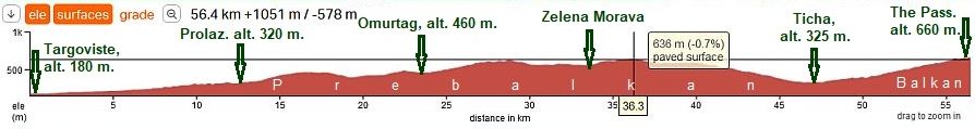
The road profile chart shows that Ticha is placed in a low place – the valley of Ticha River it makes this route harder in both directions of bicycling. Food can be find in Ticha.
|
|
Information for Targoviste: |
Have in mind that in Romania there is a town with the same name, so take it into account when you are researching in GOOGLE for it. |
 |
 |
 |
 |
 |
 |
 |
 |
 |
|
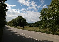
Starting from Targoviste, there is ascending road, starting from 180 m. altitude to 640 m. altitude after Zelena Moravka. The altitude gain of more than 460 meters for |
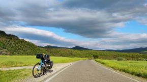
36 kilometers is not too much, so pedalling is not so hard. The last time I explored this route, June '22 I was surprised to see very little traffic. There is nice water spring next to Prolaz. |
 |
 |
 |
 |
 |
 |
|
|
 |
 |
|
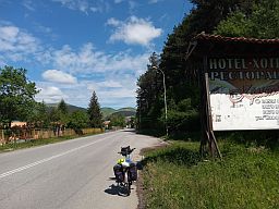
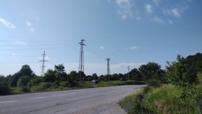
The road segment from Omurtag to the top of the pass is very pleasant for pedaling in the both direction. Notice that Ticha is placed in a low place – it makes this route harder in both directions of bicycling. Food can be find in Ticha. Overnight accommodation is available in Omurtag. |
Some information about it: http://www.bestbgproperties.com/bulgarian_districts/
The town is named on Khan Omurtag, a little history: https://en.wikipedia.org/wiki/Omurtag_of_Bulgaria Several photos from Omurtag. |
 |
 |
 |
 |
 |
 |
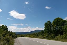
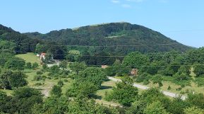
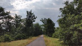
| The country side between Omurtag and the Ticha: very nice mountain area, roads without traffic. | ||
 |
 |
 |
 |
 |
|
 |
 |
|
| At the crossroad toward Zelena Morava there is a restaurant. | ||
 |
 |
 |
 |
 |
 |
 |
 |
 |
| Food shop is available in Ticha. After it, there is 10 - 11 kms climbing toward the mountain divide. | ||
 |
 |
 |
 |
 |
 |
|
route b (road 7):
From Shumen to Veliki Preslav to Mengishevo to Uablanovo to Ticha,
Here I will not write about route b: a very detail information concerning this route can be seen in the next point of the same Chapter: Sector I. C - 13. c Sector I. C - 13. d
as well as in the Chapter VI. Crossing Bulgaria from west to east. Routes: Sector VI. 2 - H, From Ticha to Shumen. |
||
|
|
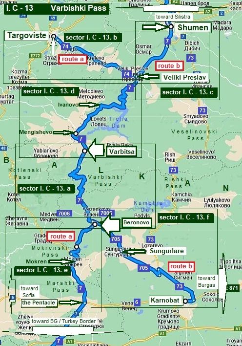 |
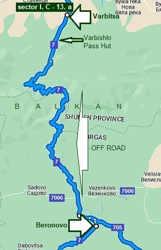
13. Varbishki Pass
Varbishki Pass is the one of the very appropriate for pedaling passes and roads in Eastern Balkan connecting both north and the south parts of the country.
The Pass can be used for crossing Bulgaria north – south (or vice versa) as follows:
From Ruse (Silistra) to Targoviste to Veliki Preslav to Varbitsa to the Pentacle to Yambol to Turkey/BG border (Border Checkpoint Lesovo),
or
From Ruse (Silistra) to Targoviste (or Shumen) to Veliki Preslav to Varbitsa to Sungurlare to Karnobat to Aitos to Burgas to Malko Tarnovo to Turkey/BG border (Border Checkpoint Malko Tarnovo).
So, intending to give a more detail information, I will expand a little my description here, starting:
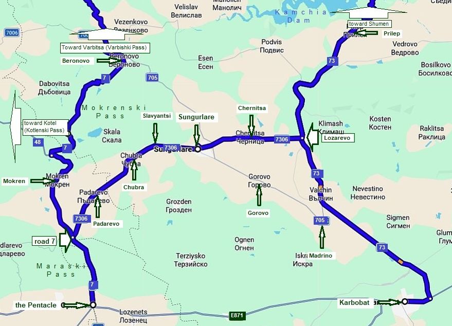
Sector I. C - 13. a: From Beronovo to Varbitsa; Sector I. C - 13. b: From Targoviste to Veliki Preslav; Sector I. C - 13. c: From Shumen to Veliki Preslav; Sector I. C - 13. d: From Veliki Preslav to Varbitsa; Sector I. C - 13. e: From the Pentacle to Beronovo; Sector I. C - 13. f: From Karnobat to Beronovo.
|
|
|
|
||
|
|
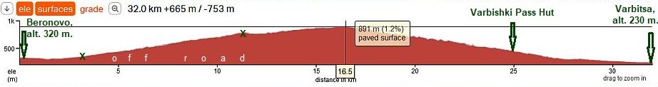
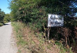
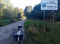
Sector I. C - 13. a From Beronovo to Varbitsa
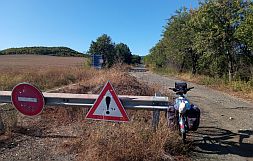
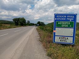
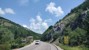
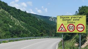
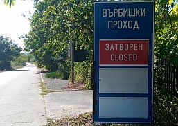
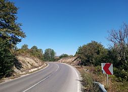
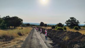
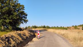
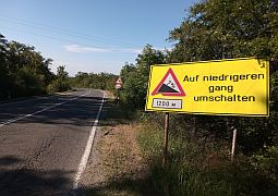
In fact it is Varbishki Pass itself. The traffic of the south side of the Pass is forbidden, so it is excellent for bicycling – I definitely recommend this route. If you see here a car, you have to be sure, that its GPS device has misled the driver that the road is in a nice conditions.
Just being the crossroad of roads N7 and N 7006 you even will see 2 - 3 sand heaps on the road N7 and many signs pointing that the Pass is closed, as it is obvious from the photo above. Never mind that the Google map shows that the road is paved, in fact it is off road between two "X" on the road profile chart below. |
|
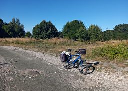
Food and water is available in Beronovo, you will see a sign that the pass is closed. |
||
 |
 |
 |
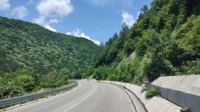
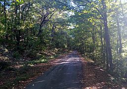
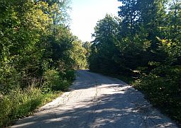
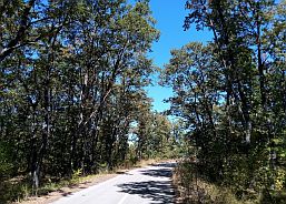
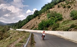
| Up the Mountain. Have in mind, that it is a dry place, bring water with you. In the hot summer afternoons it is better to start climbing after 5 pm. After the first 2 - 3 kilometers up the mountain, you will pedal in the shade. | ||
 |
 |
 |
 |
 |
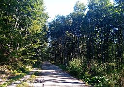 |
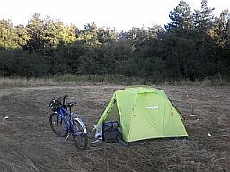
| The mountain divide is almost a flat area, it is very nice to camp there for a night. | ||
 |
 |
|
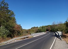
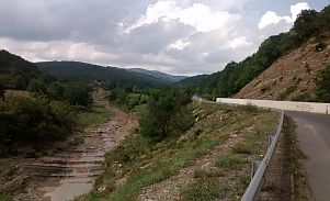
| At the mountain divide there is a flight control station, so the road down the mountain to Varbitsa is well maintained. | ||
 |
 |
 |
 |
 |
|
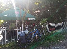
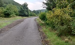
| Seven kilometers to Varbitsa there is a hut, nice restaurant and fresh water, it is a small local resort. | ||
 |
 |
 |
|
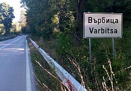
Very little information for Varbitsa can be seen here: http://www.guide-bulgaria.com/NE/shoumen/varbitsa/varbitsa I am not sure if overnight accommodation is available in it. |
||
 |
 |
 |
|
|
||
|
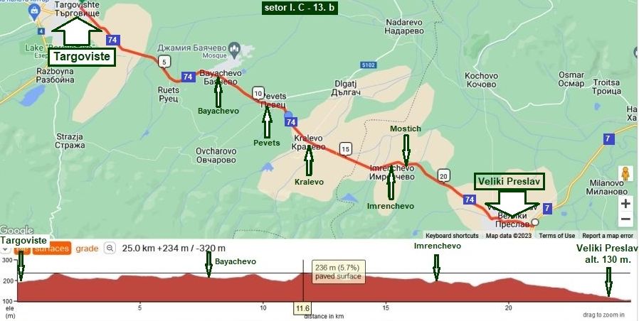
The next three sectors are the approach toward the Pass from North. Sector I. C - 13. b route a From Targoviste to Veliki Preslav
|
|
Information for Targoviste: |
Have in mind that in Romania there is a town with the same name, so take it into account when you are researching in GOOGLE for it. |
|
|
|
|
|
|
|
|
|
|
|
|
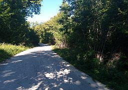
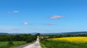
| Next several photos illustrate the countryside from Targoviste to Veliki Preslav. I explored this area in the middle of June ' 22 - a drizzling afternoon and night | and misty morning. Again, the traffic here is not intensive, the road is in very nice conditions. |
 |
 |
 |
 |
 |
 |
 |
 |
 |
 |
 |
 |
|
The same area, a sunny June '24 afternoon.
|
||
 |
 |
 |
|
Information for Veliki Preslav: |
 |
 |
 |
 |
 |
|
 |
 |
 |
|
|
||
|
|
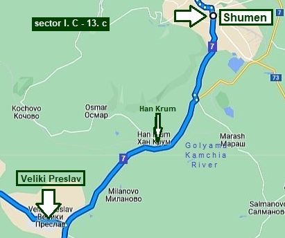
Sector I. C - 13. c route b
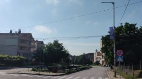
From Shumen to Veliki Preslav It is easy and pleasant for pedalling route. There is a traffic here, but the road is save.
Next links are the information about Shumen:
https://en.wikipedia.org/wiki/Shumen https://travelro.wordpress.com/category/shumen-bulgaria/ http://www.guide-bulgaria.com/NE/shoumen/shoumen/shoumen
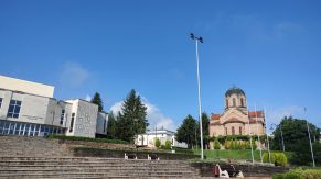
as well as several photos of the same area - approach to Shumen from north and the plateau (Shumen Fortress) next to it, the town and my afternoon relax place in the town garden.
|
 |
||
 |
 |
 |
|
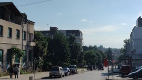
The countryside from Shumen to Veliki Preslav. |
||
 |
 |
 |
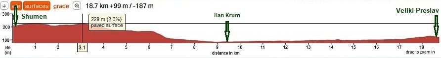
| A beautiful area for camping in the wilderness is next to Han Krum - Golyama Kamchia River, hot and clean water. | ||
 |
 |
 |
 |
 |
 |
|
|
||
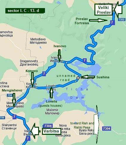 |
Sector
I. C - 13. d
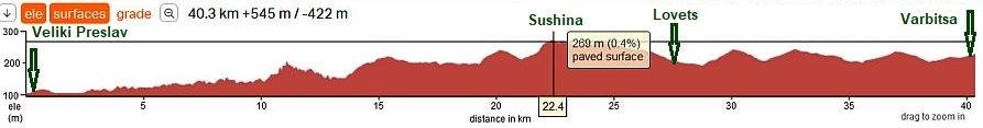
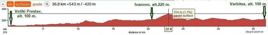
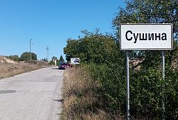
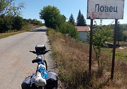
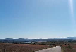
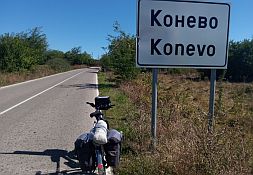
From Veliki Preslav to Varbitsa The road from Veliki Preslav toward Varbitsa is very nice for pedalling. There is not any traffic, there are places to supply with food and water. Next to Ticha Dam I have shown two route opportunities: - From Ivanovo directly to Konevo (road 7), - From Ivanovo to Sushina to Lovets to Konevo (unnamed road), usually I pedal the one next to the Dam, it is a little longer, but more scenic than the first one.
For a comparison, down are the road profile charts for both opportunities. |
|
|
|
|
٭An opportunity
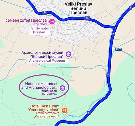
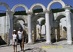
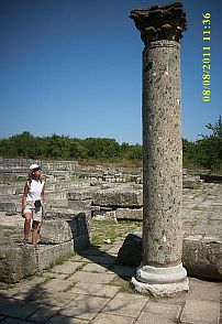
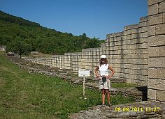
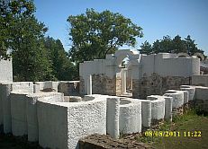
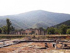
Three to four kilometers south from Veliki Preslav are the historical remains of Preslav, the capital of the First Bulgarian Kingdom IX – X century. A hotel & and restaurant are available in the region of the park.
https://bulgariatravel.org/en/veliki-preslav-national-historical -archaeological-reserve-veliki-preslav-great-preslav/
A little information for the First Bulgarian Kingdom: https://en.wikipedia.org/wiki/First_Bulgarian_Empire
A hotel & and restaurant are available in the region of the park. |
 |
 |
 |
 |
 |
|
The country side up toward Ticha Dam and our camp place next to the Ticha Dam wall. The access to the dam wall is forbidden as well as to the reservoir, because it is water supply area. |
||
 |
 |
 |
 |
 |
 |
| Next photos are the countryside from Ivanovo toward Varbitsa. | ||
.jpg) |
.jpg) |
.jpg) |
.jpg) |
.jpg) |
.jpg) |
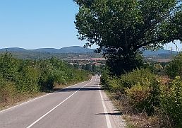
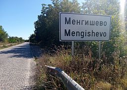
| The other opportunity - toward Sushina to Lovers to Konevo to Mengishevo to Varbitsa; it is extremely nice place, easy route for pedalling, no any traffic. | If my memory serves, food shops and water are available in each village. I have always pedalled this area in the back direction. |
 |
 |
 |
 |
 |
 |
 |
 |
 |
 |
 |
 |
 |
 |
 |
 |
 |
 |
|
|
||
|
|
The next two sectors are the approach toward the Pass from South
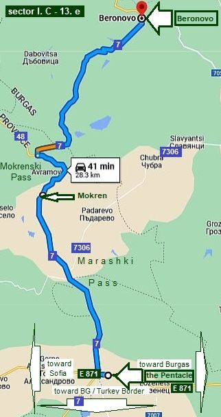
Sector I. C - 13. e
From the Pentacle to Beronovo.
Two approaches to the Pass are possible from its south side, depending on your trip schedule:
- route a (road 7): From the Pentacle to Mokren to Beronovo to Varbitsa;
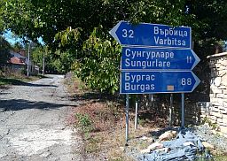
If you start or finish this route stage, have in mind that at the Pentacle there are several restaurants and hotel, the same is 4 kilometers to Varbitsa.
- route b (roads 73 & 705): From Karnobat (road 73) to Madrino (road 705) to Sungurlare to Balabanchevo to Beronovo to Varbitsa. (not shown on the map in left)
|
|
Route a (road 7)
The Pentacle is a crossroad of five roads - restaurants and a hotel is available there. |
|
|
|
|
|
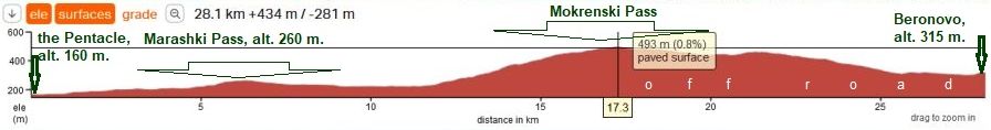
Next photos illustrate approach to Marashki Pass and Mokren from the Pentacle. The climb here is not much, the difference in the altitudes here is only 100 meters. |
Usually at the beginning of some passes you will see a “Open”, informing drivers in the winter time the pass is clear of snow and passable. |
|
|
|
|
|
At the highest point of Mokrenski pass you will see a sign toward Sungurlare and Shumen directing the traffic toward Shumen to the Rishki Pass, so further the road will be without any traffic. |
Food shop is available in Mokren, but it is not visible from the road. A water spring is available too, but the water is not nice. |
|
|
|
|
|
|
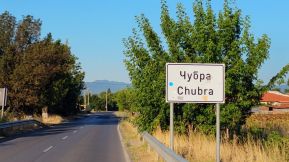
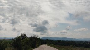
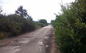
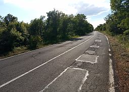
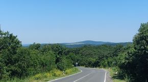
The climbing of the next Pass: Mokrenski or Avramovski Pass is longer, the difference in altitudes here is almost 250 meters. All the area here is appropriate for camping in the wilderness. At the highest point (my camping place) of the Pass is the crossroad toward Beronovo. Never mind that road 7 is pointed as a main road, very soon you will be surprised to see it is in a very bad conditions. There are especially damaged road parts, which is obvious from next photos. The best is, that there is not any traffic here. (If you start at the Pentacle, you can avoid this broken road heading toward Padarevo (road 7306) to Chubra to Slaviantsi to Sungurlare). |
 |
 |
 |
 |
 |
 |
 |
|
Beronovo is a little village, there is a food shop and spring of water in it. There you will see signs pointing that Varbishki Pass is closed. |
||
|
|
|
|
|
|
||
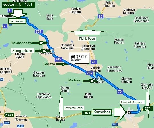
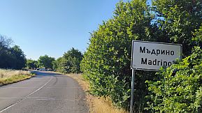
Sector I. C - 13. f Route b From Karnobat to Beronovo
Here is important to find the local road 705 because the traffic along road 73 is more intensive.
Route b (roads 73 & 705): From Karnobat (road 73) to Madrino (road 705) to Sungurlare to Balabanchevo to Beronovo to Varbitsa. |
|
|
|
|
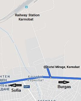
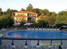
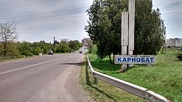
Overnight accommodation is possible in Karnobat - there are several hotels in the town. Information about Karnobat: http://www.guide-bulgaria.com/SE/bourgas/karnobat/karnobat A nice relax spot in Karnobat is hotel Mirage - there is a nice swimming pool there, the hotel restaurant is nice as well. The scheme in left shows how you can find it. |
|
 |
 |
|
 |
 |
 |
| From E871 toward Sungurlare, July '25 | ||
 |
 |
 |
 |
 |
 |
 |
 |
 |
|
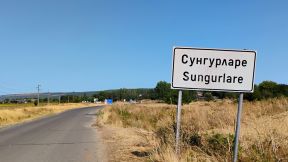
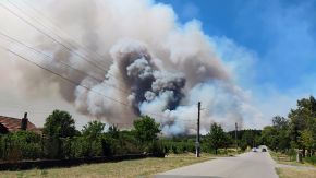
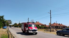
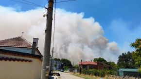
A little information for Sungurlare. I am not sure if overnight accommodation is available in it. http://www.guide-bulgaria.com/SE/bourgas/sungurlare/sungurlare |
||
 |
 |
 |
| Visiting a friend August '25 I had to stay it the little town for three days because of a large fire just next to the town, roads were closed. Fortunately the wind was in the opposite direction. They tried to suppress the fire | using little fire engines, but it did not work, so at the second day the fire was suppressed by bigger engines, airplanes and helicopters. The nights were windless, the smoke was everywhere, it was terrible at all. |
 |
 |
 |
|
|
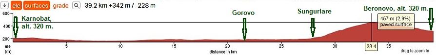
Have in mind that hte road toward Balabanchevo and Beronovo is not signed well and it is in a poor conditions. The photo in left is the highest point next to Balabanchevo, I pointed its altitude 457 m. on the road profile chart above.
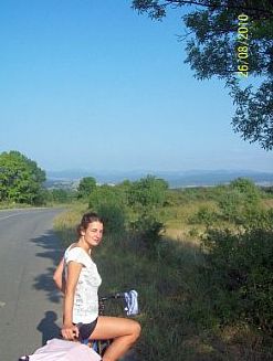
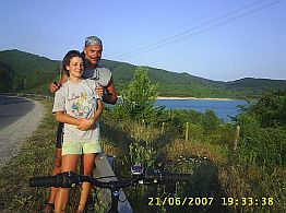
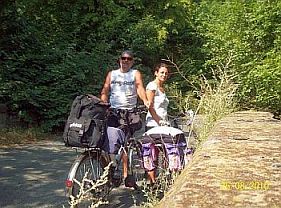
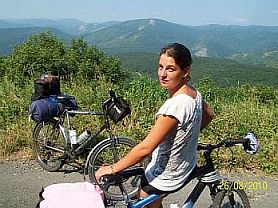
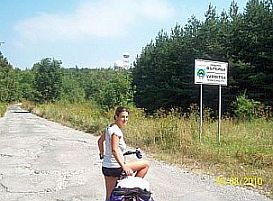
The next photos are taken when I first time climbed Varbitsa Pass 2010 together with my daughter. I remember that higher in the mountain, when it was the lunch time, Maya was thinking that I am bringing food, but I believed the food is in her panniers. Never mind, we spent great time together. |
 |
 |
 |
|
|
|
14. Rishki Pass
On the maps this road is signed as N73, it connects Shumen to Karnobat. The highest pass point has an altitude of 420 m. (pointed on the map), it is not a problem to be bicycled in both directions. A little history: https://en.wikipedia.org/wiki/Battle_of_the_Rishki_Pass
The route is convenient to cross the country north - south (or vice versa). The road is in very nice condition, but the traffic is relatively intensive (comparing with the traffic on the previous two passes). But, it is convenient and is wide enough, truck speeds are safe because of the slopes and turns in the route.
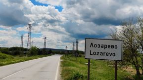
The route is: From Shumen to Smiadovo to Veselinovo to Prilep to Lozarevo to Karnobat.
Well, I do not recommend to cross Balkan just here at all. If you intend to cross Balkan starting from Shumen, much better would be, if you choose the next Pass - Aytoski Pass:
From Shumen to Ivanski to Kalnovo to Yankovo to Zhalad to Arkovna to Komunari to Asparuhovo to Aytos (road 208).
Information for Aytoski Pass is in the next point 15 of the same Chapter. |
|
Next links are the information about Shumen: |
as well as several photos of the same area - approach to Shumen and the plateau (Shumen Fortress) next to it, the town and my afternoon relax place in the town garden: |
|
|
|
|
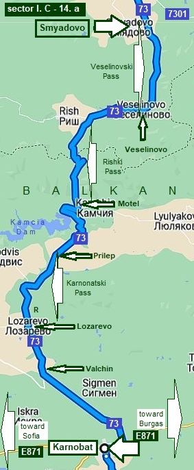 |
Sector I. C - 14. a The mountain area of this route is between Smyadovo and Lozarevo. Smyadovo is a small town, it is not just on the road 73. I have never visited it and am not sure if overnight accommodation is available in it. Some information for Smyadovo: |
|
 |
 |
|
|
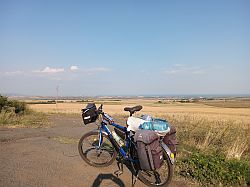
All this area is beautiful countryside. There are nice places to wild camp. Food can be found in Veselinovo, Prilep and Lozarevo. A part of this route I pedaled August '16. I was disappointed with the amount of traffic. I really did not expect it. Three months later a friend of mine told me that there is not any traffic along this route. But, this was an opinion of car driver. Because there are no restrictions with respect to truck load tonnage I think it would be better to avoid this route.
|
||
|
The first 3 photos are taken between Shumen and Smyadovo, an easy for pedaling area. |
||
 |
||
 |
 |
 |
| Toward Veselinovo and Veselinovski Pass. | ||
 |
 |
 |
 |
 |
 |
 |
 |
 |
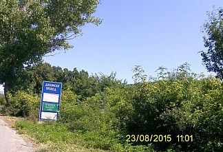
| My camp place next to Alexandrovo and up to the Pass. | ||
 |
 |
 |
 |
 |
 |
| Toward Prilep | ||
 |
 |
 |
| Toward Lozarevo. | ||
 |
 |
 |
 |
 |
 |
 |
||
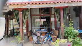
| Entering Lozarevo at your left there is a nice restaurant. Just behind it there is a nice meadow - the restaurant owners would not have anything account to set up your tent there. There are toilet facilities too. | ||
 |
 |
 |
|
|
Overnight accommodation is possible in Karnobat - there are several hotels in the town. Information about Karnobat: http://www.guide-bulgaria.com/SE/bourgas/karnobat/karnobat A nice relax spot in Karnobat is hotel Mirage - there is a nice swimming pool there, the hotel restaurant is nice as well. The scheme in left shows how you can find it. |
|
|
|
|
|
|
|
|
|
|
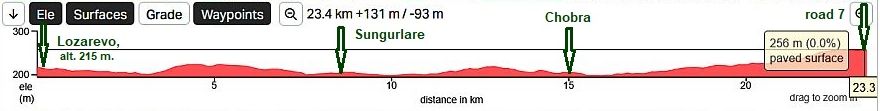
A shortcut from road 73 - Karnobatski Pass and road 7 - Varbishki Pass (and road 48 Kotlenski Pass). |
||
|
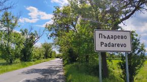
It is the route: from Lozarevo to Chernitsa to Sungurlare to Slavtantsi to Chubra to Padarevo to road 7
|
||
| It is an easy and pleasant route in both directions with a minimal traffic.Toward Sungurlare. | ||
 |
 |
 |
|
A little information for Sungurlare. I am not sure if overnight accommodation is available in it. http://www.guide-bulgaria.com/SE/bourgas/sungurlare/sungurlare |
||
|
|
|
|
| Visiting a friend August '25 I had to stay it the little town for three days because of a large fire just next to the town, roads were closed. Fortunately the wind was in the opposite direction. They tried to suppress the fire | using little fire engines, but it did not work, so at the second day the fire was suppressed by bigger engines, airplanes and helicopters. The nights were windless, the smoke was everywhere, it was terrible at all. |
|
|
|
|
| The region is known with wine and rakia production. | ||
 |
 |
 |
 |
 |
|
 |
 |
|
| The last 2-3 kilometers to the crossroad of roads 7306 & 7. | ||
 |
||
|
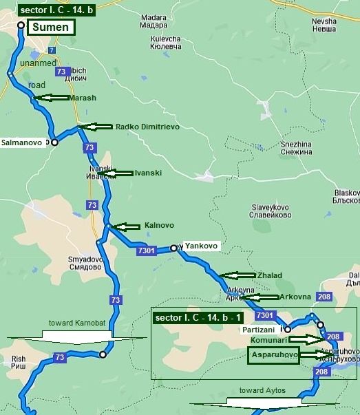
Sector I. C - 14. b
The next information is for bicyclists intending to pedal from Shumen to Burgas or back.
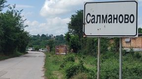
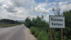
The bypass between Rishki Pass and Aytoski Pass: From Shumen to Marash to Salmanovo to Radko Dimitrievo (road 73) to Ivanski (road 7301) to Kalnovo to Yankovo to Zhalad to Arkovna to Partizani to Komunari to Asparuhovo (toward Aytos). will lead you to road 208. It is much more save, the traffic along it is much less than on the road 73.
Have in mind that villages Yankovo, Zhalad here are almost left, so I do not remember if food shops are available there.
Information for road 208 is in the next point 15 Aytoski Pass of the same Chapter.
The road profile chart shows that th route is easy for pedalling. The countryside is beautiful, the pedalling here is a real pleasure. I have pedalled this route many times. |
||
 |
||
| In Shumen look for the road toward Marash, the road is not named. | ||
 |
 |
 |
 |
 |
 |
| Only 2 - 3 kilometers from Radko Dimitrievo and Ivanski the route includes the main road 73. | ||
 |
 |
 |
 |
 |
 |
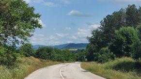
| June ' 22 the road was in renovation. I think now it is in very nice conditions. | ||
 |
 |
 |
 |
 |
 |
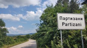
| Partizani is a bigger village, food shops are available in it. | ||
 |
 |
 |
|
Sector I. C - 14. b - 1
I will increase the scale a little to show the shortcut between Partizani and Asparuhovo. As Komunari is in a low point, if you follow the shortcut, you will avoid unnecessary descending and ascending from Partizani and Asparuhovo.
The shortcut is not numbered on the map, so GPS would be useful.
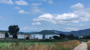
Asparuhovo is located near Tsonevo Dam, There are several nice places for overnight accommodation in it for fishers. A little information about Asparuhovo: http://www.guide-bulgaria.com/NE/
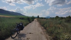
Next photos show how beautiful is thos countryside. |
||
 |
 |
 |
 |
 |
|
 |
 |
|
|
|
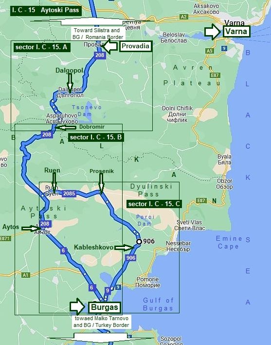
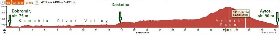
15. Aytoski Pass
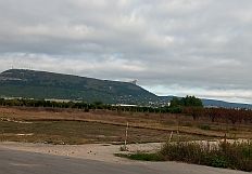
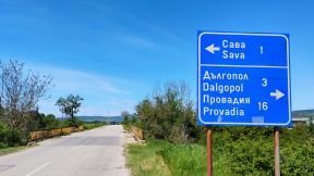
As I have mentioned above, in its east part the mountain is wide and low. Aytoski Pass itself is only a short part of the route I describe here. This route (road 208) should be strongly considered to cross the country north - south (or back), rather than the previous one. It connects Provadia, Dalgopol, Aytos and Burgas. The road 208 is just after reconstruction, it is very nice conditions. The highest point of the Aytosski Pass has altitude 400 meters (several kilometers north from Aytos), so this Pass is nice and easy for bicycling in both directions, over more this area is very nice countryside as well as there is not intensive traffic. This would be a great area to take time and tour. There are villages along this road, no problem finding food and water. Many times I toured in this area and wild camped. The route can be used to cross country north - south: From Silistra to Alfatar to Tervel to Kochmar to Vekilski to Kaloyan to Vetrino to Provadia to Dalgopol to Dobromir to Aytos to Burgas to Malko Tarnovo to Turkey/BG border (Border Checkpoint Malko Tarnovo). For more information look also in: Chapter III: Crossing Bulgaria from north to south (from Romania to Turkey & Greece) : |
|
For more detail description, further I will split this route in three sectors.
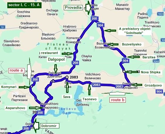
Sector I. C - 15. A
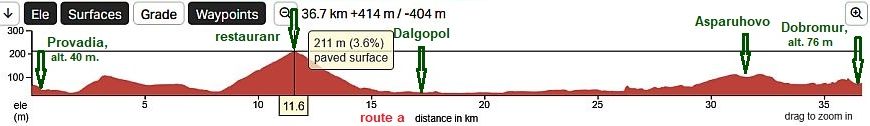
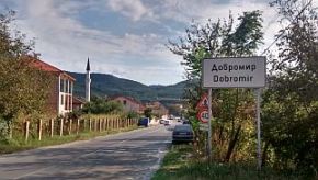
I would sugest two routes: Route a (road 208): From Provadia to Dalgopol to Komunari to Asparuhovo to Dobromir. A little bit more intensive traffic here is from Provadia to Dalgopol. The heavy trucks use the route as well, but I can say the road is not dangerous for bicyclists.
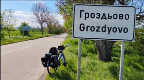
Route b (road 904): From Provadia (road 904) to Bozvelievo to Barzitsa to Nova Shipka to Grozdyovo (road 2083) to Tsonevo to Sava to Asparuhovo to Dobromir.
|
|
Route a (road 208)
Route b (road 904) This route is 15 kilometers longer , ascending too, but the traffic here is minimal.
Provadia is a scenic place, it is placed in a not deep canyon along Provadiiska River. Overnight accommodation in Provadia is available, although in the touristy season some problems can appear. |
 |
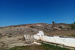
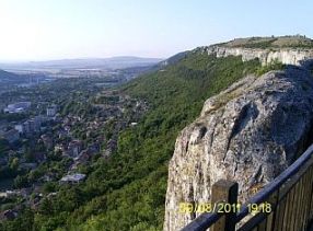
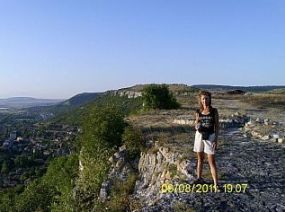
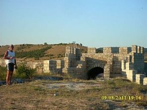
Information for Provadia and its fortress "Ovech" on the plateau over the town: https://en.wikipedia.org/wiki/Provadia http://trakia-tours.com/provadia-guide-94.html Next several photos of the plateau above Provadia and Ovech Fortres. |
|
 |
 |
|
 |
 |
 |
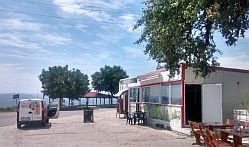
| Several photos from Provadia. | ||
 |
 |
 |
 |
 |
 |
|
Route a (road 208) The road toward Dalgopol is crossing a hilly area, 12 - 13 kilometers after Provadia is the highest hill, where there is a little restaurant (the second photo below). A nice view toward Tsonevo Dam is revealing here. |
 |
 |
 |
|
Dalgopol is a little city, I do not think overnight accommodation is available in it. A little information for it: |
 |
 |
 |
| Toward Asparuhovo. | ||
 |
 |
 |
| Just before enter in Asparuhovo near the road there is a hotel & restaurant - the last photo below. | ||
 |
 |
 |
|
Asparuhovo is placed near Tsonevo Dam, in it there are several hotels and guest houses - fishers use it as a base for their weekends. The next photos are guest house "Vega" I spent a raining night May '25. |
Information for Asparuhovo andTsonevo Dam:
|
 |
 |
 |
|
The
next road segment (from Asparuhovo
to Dobromir) may
be the most scenic one.
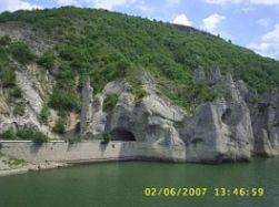
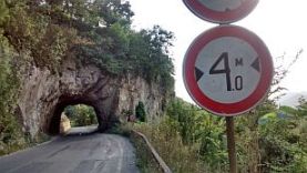
Crossing Tsonevo Dam you will see a very pretty place: “The Wonderful Rocks”: |
The phenomenon consists of three massifs. Three tunnels are dug through along their entire length, where an automobile road made of crushed stones passes. Since they can be seen from the main road, the rocks often attract travelers, which come by to enjoy the view.
|
 |
 |
 |
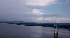
| Last years the water level in the dam is too low, so an ancient roman bridge can be seen in it. | ||
 |
 |
 |
|
Route b (road 904)
From Provadia (road 904) to Bozvelievo to Barzitsa to Nova Shipka to Grozdyovo (road 2083) to Tsonevo to Sava to Asparuhovo to Dobromir.
This route is 15 kilometers longer than route a, ascending too, but the traffic here is minimal. I recommend this route to bikers having more time.
|
||
|
After leaving Provadia hit the road 904. |
||
 |
 |
 |
|
Soon from your left side you will see a sign toward the prehistoric complex Provadia-Solnitsata. It represents the remains of the oldest known salt production center in Europe (5600 – 4350 BC), which later developed into the first prehistoric urban center on the continent (4700 – 4350 BC). The emergence and development of the site are directly linked to the largest and, in fact, only rock salt deposit in the Eastern Balkans – the so-called Mirovo salt deposit, on which the complex is situated. Throughout most of the Late Prehistory, the producers of cooking salt held a monopoly over the “white gold” across a vast region stretching from the Danube to the Aegean Sea and from the Black Sea to the Central Balkans. Salt became a strategic resource and a key driver of economic and social development. Due to its value, salt also assumed the function of commodity money, making Provadia-Solnitsata the earliest “mint” in prehistoric Europe. |
The boiling of brine in ceramic vessels at Provadia-Solnitsata represents the earliest recorded case in Europe of this salt extraction technology.
This method was used at the site for
over a millennium. The necessary heat for the process was either
accumulated in specialized installations or provided directly by open
fire, both relying on wood burning. Towards the end of the Heliolithic
period, the technology changed: saltwater was evaporated in large
open-air basins using the heat of the sun. |
 |
 |
 |
|
A view from the top of the first hill just before Nova Shipka
From Grozdyovo to Sava the road is in the Valley of Kamchia River. |
||
 |
 |
 |
 |
 |
 |
|
The pics above were takeen in the middle of May '25, the next ones show the countryside from Sava to Asparuhovo - in the middle of August '25 - a sky without any clouds and yellow fields.. |
||
 |
 |
 |
 |
 |
 |
|
|
||
|
|
Sector I. C - 15. B (From Dobromir to Aytos)
The next several kilometers from Dobromir to Daskotna are along Kamchia River Gorge. It is not attractive as Iskar River Gorge, but pedaling along it is still a pleasure. A food and coffee is available in the villages along the road, there are nice places to camp in the wilderness.
|
|
 |
 |
|
 |
 |
|
 |
||
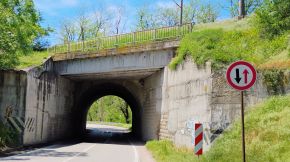
| Several more photos of this scenic route. The heavy trucks avoid it because of several narrow tunnels. | ||
 |
 |
 |
 |
 |
 |
|
Food shop is available in Daskotna, here you will leave Kamchia River Valley. After Kitka there is a |
motel and restaurant just next to the road. Summer '25 it was not at work. |
 |
 |
 |
 |
 |
 |
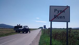
| Soon is the crossroad toward Ruen, after it is Aytoski Pass. | ||
 |
 |
 |
 |
 |
 |
|
|
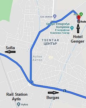
Information about Aytos: http://www.guide-bulgaria.com/SE/bourgas/aytos/aytos
For overnight accommodations in Aytos, I recommend the Hotel Genger. https://hotelkamynite.com/en/entertainments/entertainment /ethnographic-complex-genger-aytos
Look for a spot named Genger as you begin climbing Aytoski pass, road N 208. It is in a park area, like a mini ethno - village. There is a trail up to the ethno-village, to a restaurant and pool.
Photos from Aytos |
|
 |
 |
 |
 |
 |
 |
|
In Chapter VI. Routes: A. From Sofia to Burgas Sector VI. A - 7 are shown opportunities for pedaling from Aytos to Burgas or Sunny Beach Resort. |
||
| Sector I. C - 15. C | ||
|
If you decide to pedal toward Nesebar, or Sunny Beach Resort, it is not necessary to climb Aytoski Pass, you can head to east, toward Ruen. To give a complete information for roads in this sector, I will part route c into three different routes. |
Next routes would be nice, if you head toward Birgas or another point at the seaside: Sunny Beach Resort, Nesebar, Aheloy, Pomorie or Sarafovo. Information for all these places can be seen in the Chapter IV. BLACK SEASIDE Bicycling along Black sea side |
|
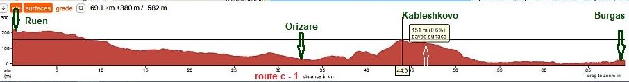
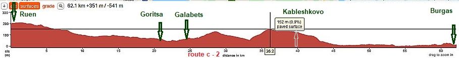
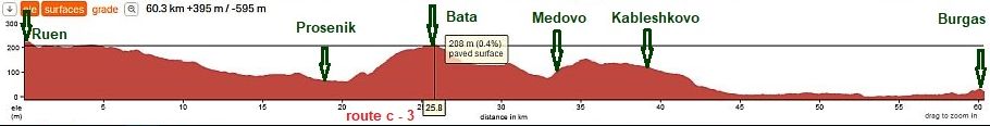
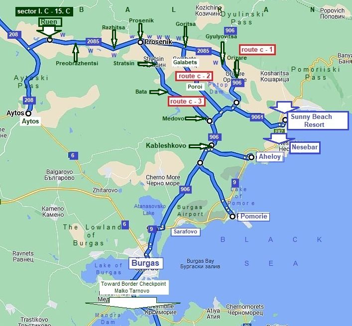 Next three road profile charts show opportunities to reach Burgas from Ruen. I pedalled all these routes. |
Route c - 1
Route c - 2
Route c - 3
|
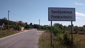
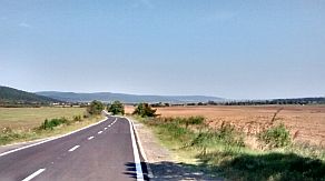
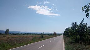
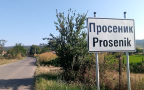
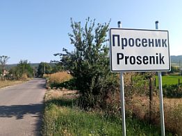
Route c - 1: The route is easier, comparing with the others; it is appropriate toward Sunny Beach Resort: From Ruen to Preobrazhentsi to Razhitsa to Prosenik to Goritsa Goritsa Gyulyovitsa to Orizare to Sunny Beach Resort. |
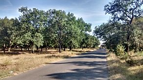
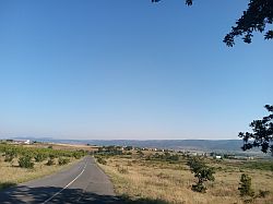
The road from Ruen toward Orizare is extremely pleasant, there are a lot of water springs along the road, although the water is not so nice for drinking - it is too hot in the summer. |
 |
 |
 |
 |
 |
|
 |
 |
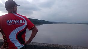
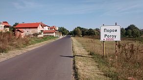
| And I staying on the wall of Poroy Dam. | ||
 |
 |
 |
|
Again I will say, information for sunny Beach Resort can be seen in the Chapter IV. BLACK SEASIDE Bicycling along Black sea side |
|
Route c - 1
Route c - 2
Route c - 3
|
|
Route c - 2 From Goritsa to Kableshkovo area is hilly but still very nice for exploring. No any traffic here. Reaching Kableshkovo, away in front of you is Burgas. |
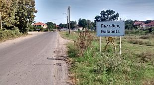
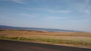
The next several photos are the countryside from Goritsa to Galabets to Poroy. The distance is the same as the one of route c - 1, although here there is one additional hill. The traffic is a little less than the previous route. |
 |
 |
 |
 |
 |
 |
|
Route c - 3 This route is the shortest one, it is the hardest one - |
the area include longer climbing, but here there is not any traffic, I do recommend it ! |
 |
 |
 |
 |
 |
 |
 |
 |
 |
|
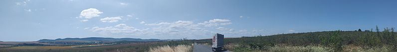
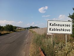
Toward Kableshkovo. Very little information for Kableshkovo is available here: |
Kableshkovo is placed on a higher place, a nice view is toward all that area - Sunny beach resort, Nesebar, Pomorie and Burgas. |
 |
 |
 |
 |
||
 |
 |
 |
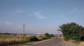
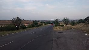
| Down toward Burgas City. | ||
 |
 |
 |
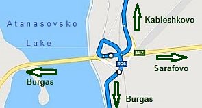
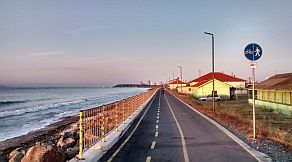
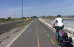
| Soon after you see the sign for Burgas, you have to be careful (look the red circle on the map above): You must miss the main road where the awful traffic is available. | The crossroad here is a little complicated and your direction is not signed. Missing the motor road, soon you will be at the seaside, follow the bicycle lane and you will be in Burgas. |
 |
 |
 |
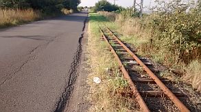
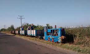
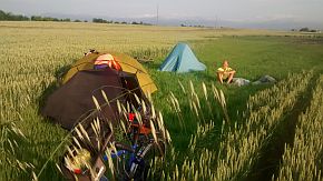
| The area here is just fine for camp before entering in Burgas. (summer '22 the narrow gage train line was dismantled). | ||
 |
 |
 |
 |
 |
 |
|
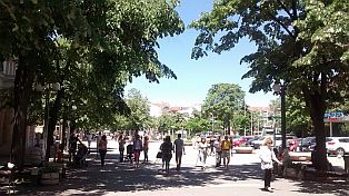
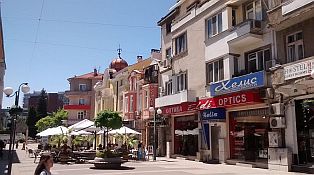
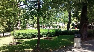
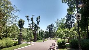
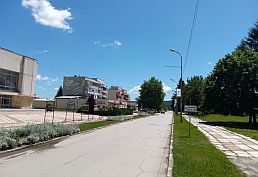
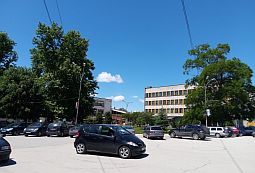
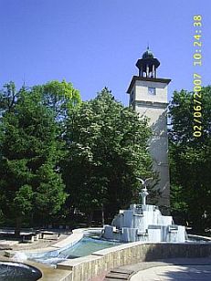
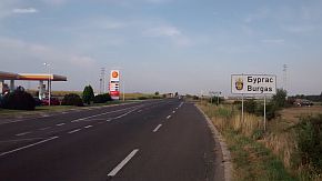
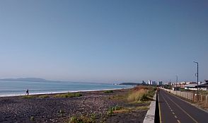
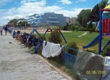
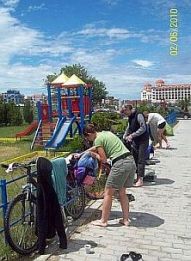
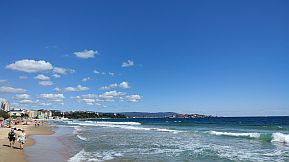
Burgas is a big Bulgarian town at the sea coast. I love its Sea Garden. Information for Burgas: |
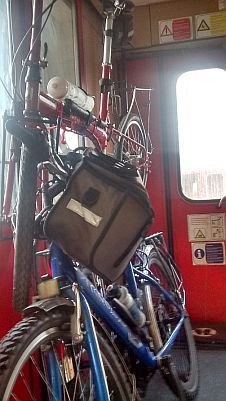
Some of my tours finish in Burgas, and I go back home by a train; at Burgas rail Station is very convenient to load bikes on the train, it is there an hour to its departing, Several photos from Burgas and its Sea Garden: |
|
|
|
|
|
|
|
|
|
|
|
|
|
|
|
|
|
|
|
|
|
|
|
 |
 |
 |
 |
 |
 |
|
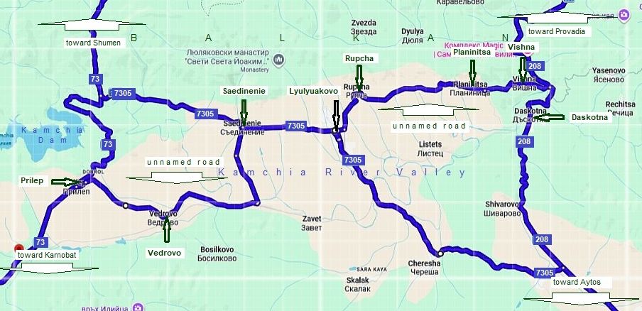
As an addition here I will add shortcuts between Aytoski Pass (road 208) and Rishki Pass (road 73). The next map shows all the opportunities here; having in mind that road 73 is busy and north from Prilep pedaling would be not pleasant because of trucks and busses, I would suggest the following routes:
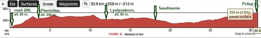
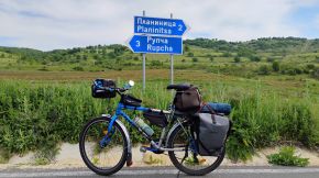
- Bicyclists coming from Shumen to Burgas can use the route: From Shumen (Road 73) to road 7305 to Saedinenie to Lyulyakovo - road 7305 - road 208 toward Burgas. I still did not explored the road segment from Lyulyuakovo - road 7306 to road 208, I am sure it is nice for pedaling. I would not suggest the back route. If you are heading toward Shumen from Aytos - USE road 208!
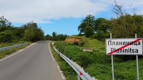
- Bicyclisys coming from Provadia toward Karnobat, or the Pentacle can use: From Provadia (road 208) toward Vishna ( or Daskotna) to Planinitsa to Rupcha to Lyulyuakovo to Saedinenie to Vedrovo to Prilep to Karnobat or the Pentacle. The back direction is nice for pedaling too. |
|
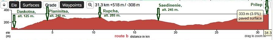
The next more detail mal shows the route: From road 208 toward Vishna ( or Daskotna) to Planinitsa to Rupcha to Lyulyuakovo to Saedinenie to Vedrovo to Prilep to Karnobat or the Pentacle.
The map shows two opportunities here: - route a: from road 208 to head toward Vishna and Planinitsa,
- route b: to reach Planinitsa from Daskotna.
|
|
Route a The only difference are the initial several kilometers: route a is steeper comparing with the second one. The next photos are taken un the end of May '25. |
|
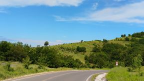
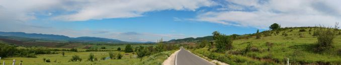
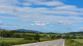
The countryside toward Planinitsa. There are several springs of or water along the road to Saedinenie, I did not point on it on the map. Food shops are available in the villages. |
 |
 |
 |
| My camping place just after Vishna. | ||
 |
 |
 |
 |
||
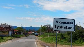
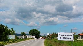
| Toward Lyulyakovo and Saedinenie. | ||
 |
 |
 |
 |
 |
 |
 |
||
|
Route b The same area starting from Daskotna. In fact the crossroad toward Planinitsa is before entering in Daskotna. Next photos are taken in the middle of August '25. |
||
|
|
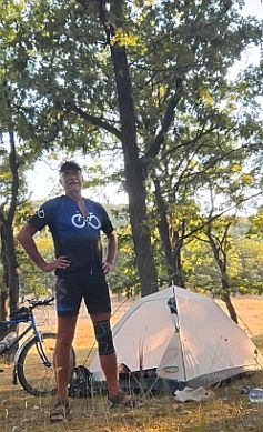
My camping place just after Planinitsa.
|
|
 |
 |
|
 |
 |
|
|
|
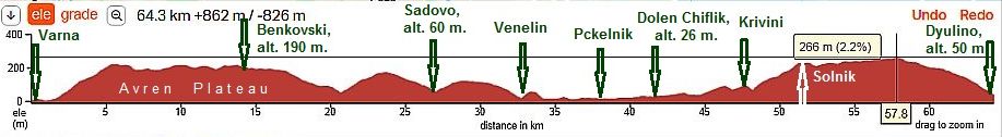
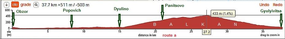
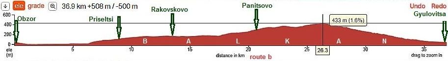
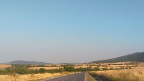
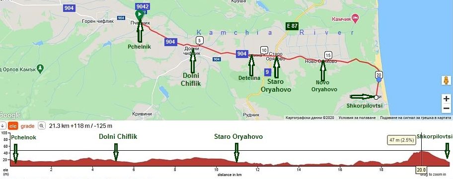
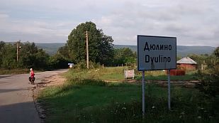
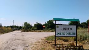
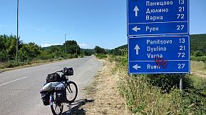
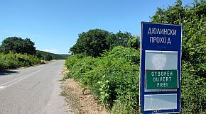
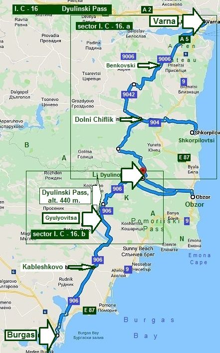 16. Dyulinski Pass
As in the previous point 15 of this Chapter, again the Pass I describe here: Dyulinski Pass, is a short road segment of the wide East end of Balkan. I will elongate a little my explanation here giving information of the route from Varna to Burgas (and back); my goal is to give an alternative which will avoid the road E87 (9) along the seaside, where the traffic in the tourist season July - August is more than terrible and it MUST be avoid. The Pass itself is located between Dyulino and Gyulyovitsa, its altitude is 440 m. The pass is an easy ride in both directions. The pass is closed for cars heavier than 3,5 metric tons, and because of not nice road conditions, the traffic here is negligible. Further I will part this route in 2: Sector I. C - 16. a: From Varna to Dyulino, and Sector I. C - 16. b: From Dyulino to Gyulyovitsa I will not describe the road from Gyulyovitsa to Burgas, it is the same like in the previous point of the same Chapter. I will say several words how to visit some points at the seaside like Shkorpilovtsi and Obzor as well. |
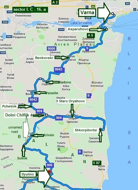
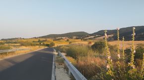
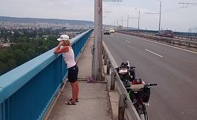
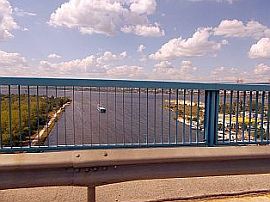
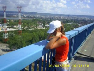
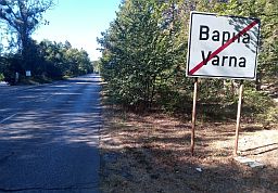
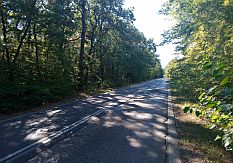
Sector I. C - 16. a The route is: From Varna to Asparuhovo Neibour to Benkovski (road 9006) to Sadovo (road 9402) to Venelin to Pchelnik to (road 904) Dolni Chiflik. Leaving Varna, very important here is to avoid the motor road A5 and take the road N9, just after the huge bridge over the Lake of Varna (the first photo below). There are 5-6 kilometers hill here, not so hard for climbing until you are up on the Avren Plateau; here you will be in a forest - you will be in the shade, but unfortunately there are a lot of little tedious flies (especially if the period is humid), which will follow you and make your climbing very unpleasant if your speed is low than 16 km/hour, so it would be very nice if you have a veil near your face. Further you have to pedal a kilometer along E87, be careful, the traffic here is crazy. Ones heading toward Benkovski (road 9006), you will be on a local roads without any traffic.
|
|
The bridge over the Channel |
 |
 |
 |
|
The passing the bridge is not a pleasure at all because of the traffic. After it is Asparuhovo suburb. Unfortunately, just after it there is 5 – 6 kilometers of |
climbing. If you climbing morning no later than 10, or in the afternoon after 4, you will enjoy of a shade. The place is woody. |
 |
 |
 |
|
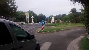
Further you have to pedal a kilometer along E87, be careful, the traffic here is crazy. Ones heading toward Benkovski (road 9006) , you will be on a local roads without any traffic. The photos in right illustrate the crossroad toward Benkovski and the local road without any traffic. |
 |
 |
|
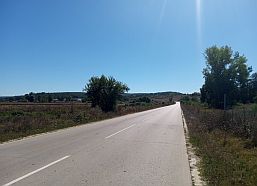
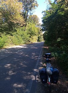
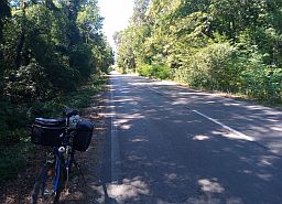
Next several photos are the countryside toward Dolen Chiflik. The local road 904 is without any traffic, extremely pleasant for pedaling. The road from village to village you have to follow is labelled well. Food and water is available in the villages along your route. |
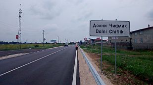
The entire area is nice for camping in the wilderness. After Venelin you will be in the valley of Kamchia River, a bigger settlement here is Dolen Chiflik, here is a little information for it: http://www.guide-bulgaria.com/NE/varna/dolni_chiflik/dolni_chiflik |
 |
 |
 |
 |
 |
|
 |
 |
| If you want to visit the seaside, you can reach it heading after Dolni Chiflik toward Staro Oryahovo and Shkorpilovtsi - a little resort near the sea. | The area is beautiful to explore it by bicycle - easy road, no any traffic. So on the next map I will increase the scale a little: | |
 |
||
|
Information for Dolni Chiflik is available here. The little town is appropriate to have a lunch here and to supply with food and water, if you go up toward Krivini and Dyulino. |
http://www.guide-bulgaria.com/NE/varna/dolni Photos from Dolni Chiflik and the road toward Staro Oryahovo: |
|
|
|
|
|
|
|
|
|
|
The next little town is Staro Oryahovo. Information for it is available here:
http://www.guide-bulgaria.com/NE/varna/dolni_chiflik/staro_oryahovo
|
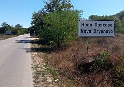
At the crossroad of roads 904 and E 87 there is a reetaurand offering very testy meals, although is appearance is not nice. The next photos are the road toward from Staro Oryahovo toward Novo Oryahovo and Shkorpilovtsi. |
 |
 |
 |
 |
 |
|
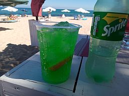
Little restaurants and food shops, along with rooms can be found in Shkorpilovtsi, but in general, I pedal past this area, although I spent very nice afternoon in the |
sunny and hot September 2020 having our type of "Margarita" (Daisy) - Mentha, Sprite and cubes of ice, all that in a big cup . . . extremely refreshing !!! |
|
|
|
|
 |
 |
 |
|
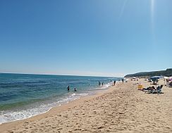
Because of the rocks in the surf, and the action of the waves along the beach, it is not safe to enter the waters in front of Shkorpilovtsi. I have seen badly injured swimmers here. A kilometer to north from |
Shkorpilovtsi it is safe because there are no more rocks in the surf. Next three photos are the endless beach between Shkorpilovtsi and Kamchia River Mouth. |
|
|
|
|
|
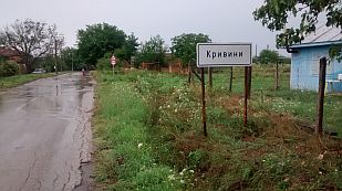
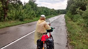
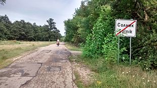
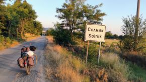
Next 2 villages toward Dyulino here are Krivini and Solnik, if my memory serves in the first one there was not a food shop. Again have in mind my note concerning the flies here. |
Our experience climbing the mountain here was very unpleasant because of thousands of flies attacking us all the time we were up the hill. Yhe same area from Dyulino toward Solnik and |
 |
 |
 |
 |
 |
 |
 |
 |
 |
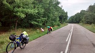
| The same area from Dyulino toward Solnik and Dolni Chiflik, August '25. | ||
 |
 |
 |
 |
 |
 |
|
|
||
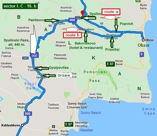
Sector I. C - 16. b
From Dyulino to Gyulyovitsa
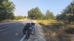
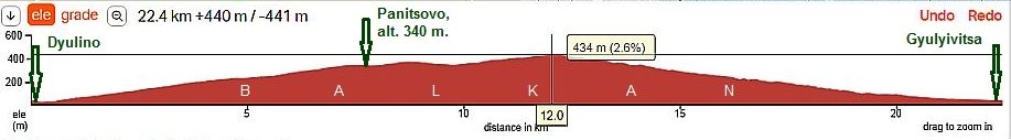
It is the road segment, where you will climb Dyulinski Pass. I'd like to mention, that I have never pedaled the part of the road between Dyulino and the point 906 on the map on left; the road profile map below shows that it would be not hard for climbing.
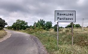
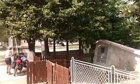
Have in mind that it is a dry area, so bring water with you. Along the road is lokated Panitsovo; you will not find food there, but there is a nice tap with drinkable water. |
||
 |
||
 |
 |
 |
 |
 |
 |
|
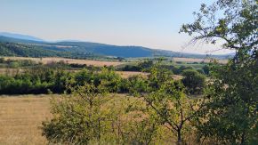
Soon after Panitsovo is the mountain divide - a wide open area, several times I camped there. |
||
 |
||
 |
 |
 |
| The climbing from the opposite side: from Gyulyovitsa to the pass top is a little bit harder. Again I will say that it is extremely dry area, so bring water with you. The situation | here was different in the extreme raining July '18, when from the south side of the Pass there was even a river. Just after Gyulyovitsa there is a tap of drinkable water. |
 |
 |
 |
 |
 |
 |
 |
||
|
For tourists loving the sea side, I would suggest to visit Obzor. It is nice small resort, there you can find guest houses or hotels with each class of luxory. The beach here is very nice. More information for this place can be seen in the Chapter IV. |
I will not write here about it. If you are coming here from south, I will suggest 2 routes shown in the map above: next three photos are from this area: Route a From Gyulyovitsa to Panitsovo to Dyulino to Popovich to Obzor. |
|
Text three photos are taken from this area between Popovich and Obzor. |
||
 |
 |
 |
|
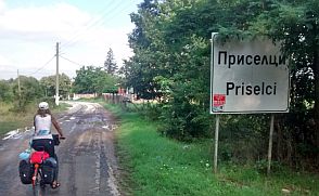
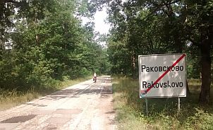
Route b It is the route I would recommend, especially if you are going to/back from Obzor. From Obzor to Priseltsi to Rakovskovo to Panitsovo to Gyulyovitsa. |
The climbing here is much easier as it is obvious from the road profile charts of the 2 routes. I would recommend this route in the both directions. |
|
In Rakovskovo is available a hotel and restaurant. Next several photos are from this area. |
||
 |
 |
 |
 |
 |
 |
 |
 |
 |
| Dyulinski Pass - the middle of June '22. | ||
 |
 |
 |
 |
 |
|
 |
 |
|
 |
 |
 |
 |
 |
 |
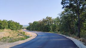
| Summer the road was in renovation. It means, after it finishes, the traffic here will be intensive. | ||
 |
 |
 |
|
Some information & several photos from Obzor: |
 |
 |
 |
 |
 |
|
 |
 |
 |
|
|
 |
 |
 |
 |
 |
 |
 |
| And an hour of strong summer storm - middle of June '22. | ||
 |
 |
 |
|
|
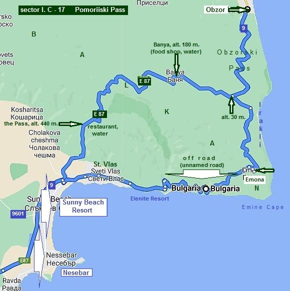
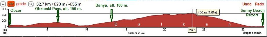
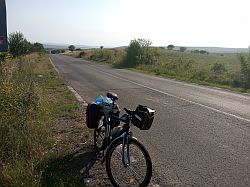
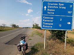
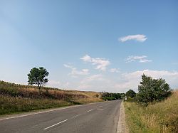
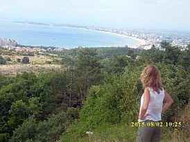
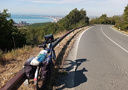
17. Pomoriiski Pass
Pomoriiski Pass is on the road E87 connecting Varna and Burgas. On some maps you will see the name ot the same pass as Primorski Pass, whish is not correct.
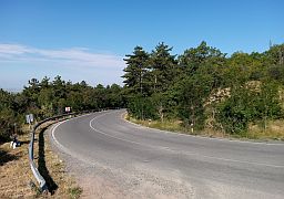
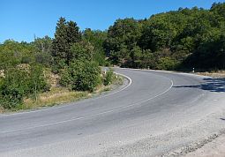
The pass is located between Sunny Beach Resort and Obzor. Year round the traffic here is quite intensive, especially summer time in the tourist season (July to 5 - 6 September) it is even terrible. The road has many turns, narrow segments, the south side of the mountain is steeper. Drivers are very nervous because of the traffic, and often heavy accidents occur.
Although I bicycled this pass many times (the last time was in the beginning of May 2020, but because of the COVID epidemic there was not any traffig), my suggestion is ALWAYS AVOID THIS ROAD! It is dangerous signed as “forbidden for bicycling”. Needless to say more.
On the top of the pass there is a little restaurant and fresh water. |
|
|
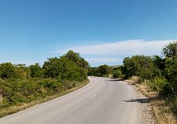
| Starting from Obzor, it follows Obzorski Pass. It is not so high, but the road segment here is extremely unpleasant because or too many turns and traffic. | I really hate it. The next several photos are from Obzor to the crossroad to Irakli and Emona. |
 |
 |
 |
 |
 |
 |
 |
 |
 |
|
The road toward Irakli and Emona is signed well. More about this area and how to avoid the road 9 (E 87) can be seen in the Chapter IV. Bicycling along Black sea side - Segment IV- C. From Varna to Emine Cape, Points 16. Irakli and 17. Emona; - Segment IV- D. From Emine Cape to Burgas, point 18. from Emona to Nesebar. |
|
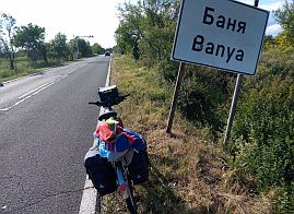
After the crossroad starts the Pass climbing. Three, fore kilometers up the mountain is Banya, water and food are available in it.
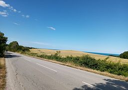
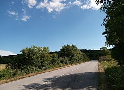
The entire climbing of the pass from its north part is approx 14 - 15 km. the area is nice to camp in the wilderness. |
 |
 |
 |
 |
 |
 |
 |
 |
|
On the divide there is a little restaurant (summer '22 it was not working) and a tap of water, although the |
water is not so nice. There is a nice place to camp there. |
 |
 |
 |
|
From its south side the Pass is a little bit stepper and the climbing starting just after sunny Beach Resort is shorter. The slope is not more than 7 - 8%. No water up the mountain, so bring it with you. |
Because it is the south side of Balkan, it would be nice to climb it in the morning. It is not a shade place. The pass is closed for trucks heavier than 10 metric tons, the problem here are tourist busses. |
 |
|
 |
 |
 |
 |
 |
 |
 |
| Pomoriiski Pass, the middle of June '22 | ||
 |
 |
 |
 |
 |
 |
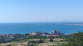
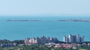
| To explore this Pass is better from north to south, you will enjoy of very nice view toward Sunny Beach Resort and Nesebar. | ||
 |
 |
 |
|
|
||
|
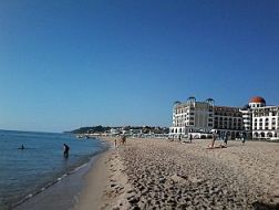
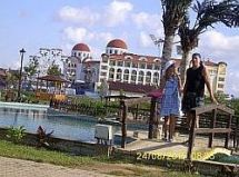
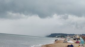
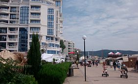
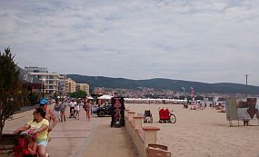
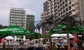
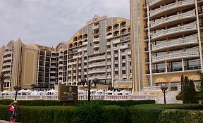
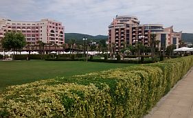
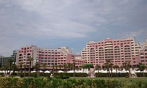
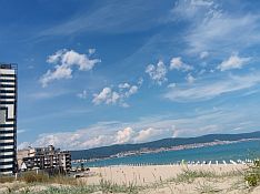
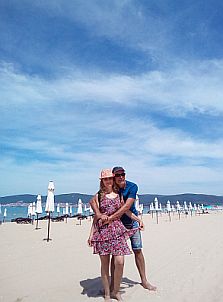
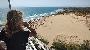
And several photos from Sunny Beach Resort, the biggest one south from Balkan. If you love absolutely crowded place - it is just the place for you. |
Information in details for Sunny Beach Resort: |
 |
 |
 |
 |
 |
 |
 |
 |
 |
|
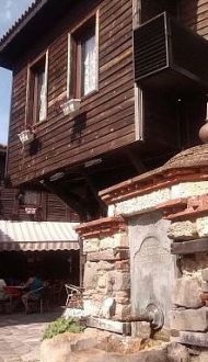
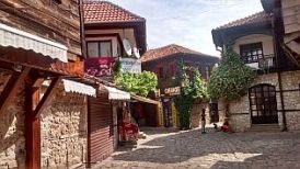
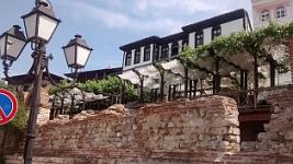
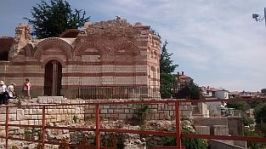
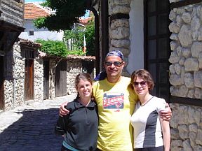
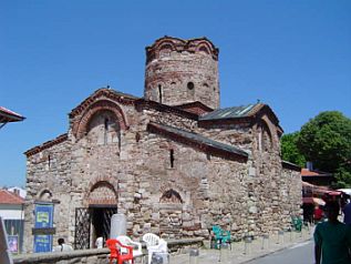
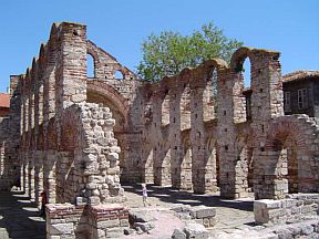
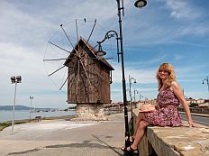
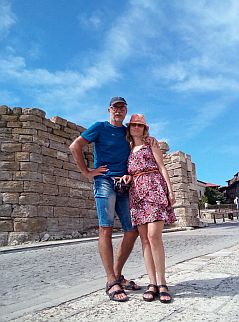
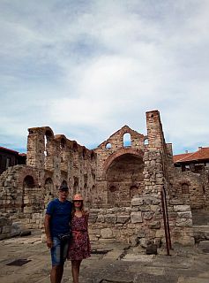
The place I love in this region is the old history town Nesebar, You may visit the peninsula with the old part of Nesebar, it is protected by UNESCO (next photos). |
A lot information for Nesebar is available in the next sites: https://en.wikipedia.org/wiki/Nesebar |
 |
 |
 |
 |
 |
 |
|
|
|
|
|
|
|
|
|
|
|
|
|
|
|
|
|
|
|
|
|
|
|
|
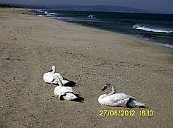
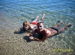
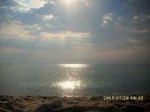
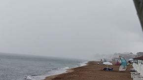
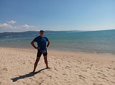
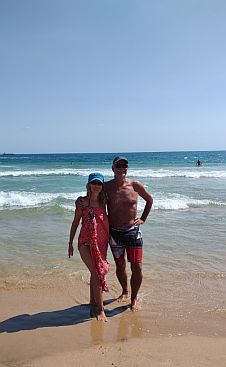
More photos of this spot taken in the early June 2020, when the resorts were empty because of the COVID 19 epidemics . . . |
We decided that for us it is not dangerous and spend several sunny days there enjoying of the empty beaches. |
 |
 |
 |
 |
 |
 |
 |
 |
 |
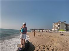
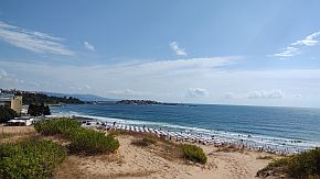
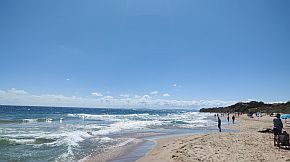
| And several photos from the south beach of Nesedar, took in the beautiful early September '23 | ||
 |
 |
 |
 |
 |
|
 |
 |
|
|
|
||