|
|
||
.jpg) |
|
|
|
|
||
|
|
||
|
|
|
|
|
|
||
|
VII. NICE ROUTES IN MOUTAINS RILA Mountain
|
|
The highest mountain in the region of Balkan is Rila Mountain. An interesting information for it can be seen here: http://en.wikipedia.org/wiki/Rila
|
|
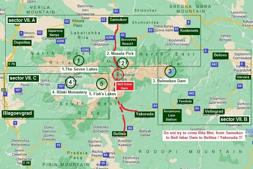
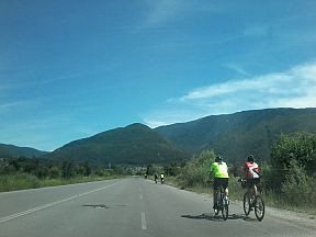
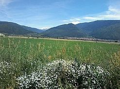
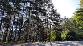
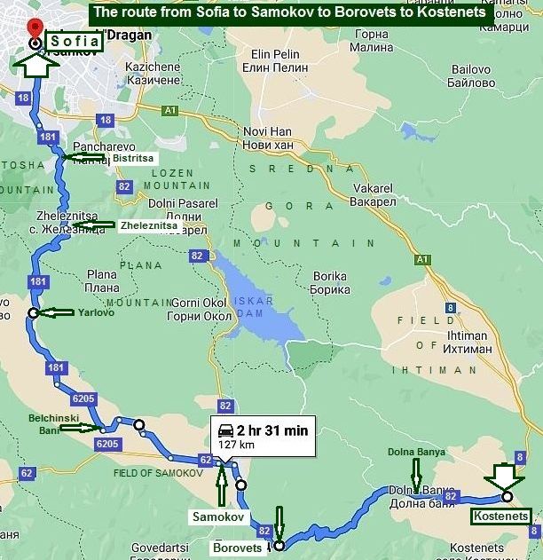
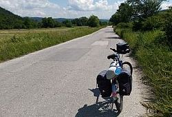
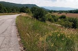
Several common considerations: - On the map above I have pointed in red circle Beli Iskar Dam: on some maps a road toward Beli Iskar Dam crossing Rila Mountain can be seen, yes, there is such a road, but it is steep and extremely rocky. I have heard the region around Beli Iskar Dam is a closed zone because it is a water supply one. Do not visit this place, do not try to cross Rila here as well !!!; - Have in mind that the mountain is high, the climate in its higher part (having altitude above 2200 m. is just like the one behind the north polar circle). Exploring the higher mountain area always have a winter equipment with you, food and well charged cell phones !!!; - Look also for the weather forecast - the daily forecasts are enough precise, if there will be rain, it would be not worth to walk in the mountain; - Roads, which are better to be avoided because of the intensive traffic around Rila Mountains are: a) road N 62: From Dupnitsa to Klisura Pass to Samokov (the road segment from Samokov to Borovets Resort to Kostenec, road 82, is nice for pedaling - no traffic there); b) road N19: from Simitli to Razlog: The climbing from Simitli to Predela Pass is significant - 28 km, weekends the road is relatively busy; c) road N 84: from Varvara to Velingrad: it would be not nice to breath here expositive car gases up the mountain. In the back direction situation is much better; |
- The road Sofia - Samokov (road N 82) really is very scenery, but also is the one having very intensive traffic. I have seen bicyclists pedaling along it, my suggestion is to avoid it ! Next I will give a nice opportunity for this destination; - The mountain is rocky, especially its higher part and it is not so appropriate for bicycling. I have seen young boys climbing up in the higher mountain areas carrying bikes on their shoulders, but I do not thing it is a great pleasure, especially if panniers are available as well, never mind, it is only my opinion. My suggestion is to approach the most interesting places in the mountain by bikes, to leave bikes and to walk in the mountain for a while. There are several places, which are worth to be explored (on the map above I have pointed these places), and the content of this Chapter further will be:
Content: 1. Region around the Seven Lakes (sector VII. A); 2. Borovets Resort and the highest pick Musala, altitude 2925 meters (sector VII. A); 3.The region near Belmeken Dam (sector VII. B); 4. Rilski Monastery (sector VII. C); 5. Fish’s lakes (sector VII. C). The logic of my description will be of first to show the best approach to them, after to illustrate these beautiful spots. |
|
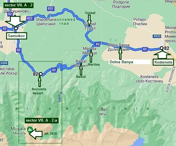
Sector VII. A |
||
|
In this sector are two of the objects of interest:
1. Region around the Seven Lakes; 2. Borovets Resort and the highest pick Musala, altitude 2925 meters. |
Of first I will show approaches toward The Seven Lakes from Dupnitsa and Samokov (sector VII. A - 1); next - approaches toward Borovets from Samokov and Kostenets (sector VII. A - 2). In addition I will show two approaches from Sofia to Samokov. | |
 |
||
|
1. Region around the Seven Lakes |
||
|
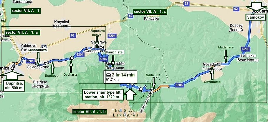
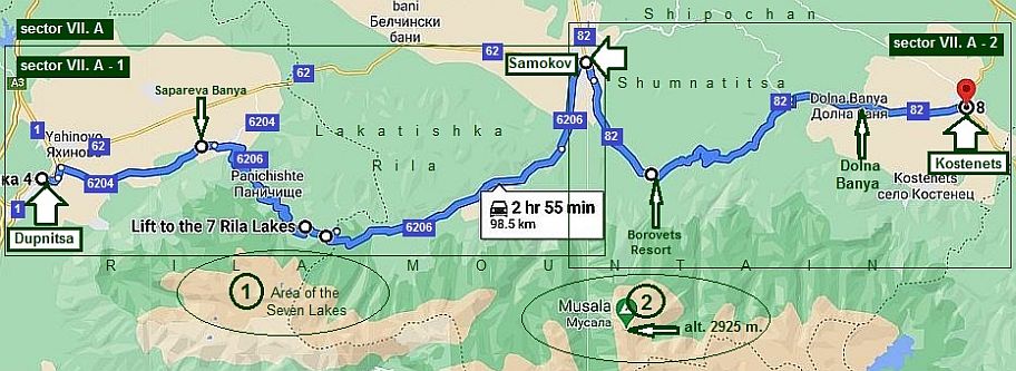
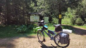
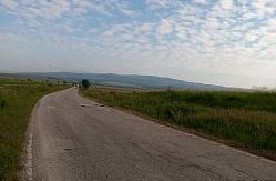
Sector VII. A - 1 From Dupnitsa to Samokov As an initial points toward The Seven Lakes region can be regarded Dupnitsa, or Samokov. The way to reach Dupnitsa (from Sofia) is shown in the Chapter II. Routes: |
An additional information how to reach the same region from Sofia: https://freesofiatour.com/blog/how-get-seven-
The way to reach Samokov from Sofia or Kostenets will be shown in the next item. |
|
|
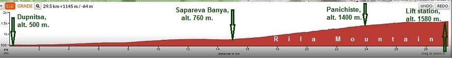
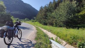
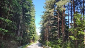
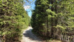
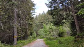
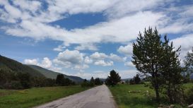
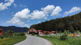
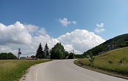
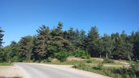
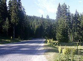
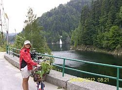
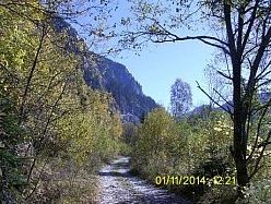
On the map above I have shown the road: From Dupnitsa to Samoranovo to Resilovo to Ovchartsi to Sapareva Banya to Panichiste Resort to Vada Hut to Govedartsi to Madzhare to Samokov.
|
||
|
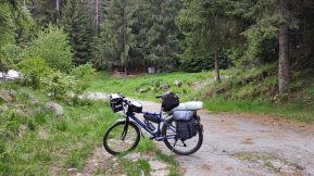
On the road profile chart can be seen that the ascending from Sapareva Banya toward Panichiste is considerable - 500 meters for 10 kilometer distance. Never mind, the entire area is perfect for bicycling; as it is pointed on the map, between the lower chair lift station |
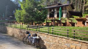
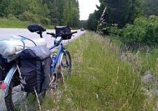
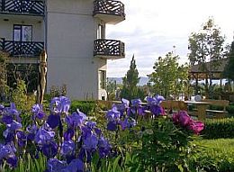
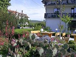
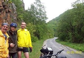
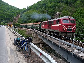
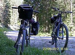
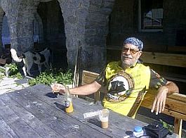
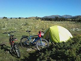
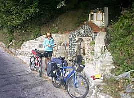
and Vada Hut the road is dirty, this area is almost flat and pleasant for exploring. Overnight accommodation is possible in Dupnitsa. Some information for it and several photos: |
|
 |
 |
 |
|
|
||
|
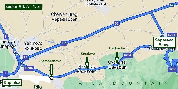
Sector VII. A - 1. a
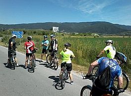
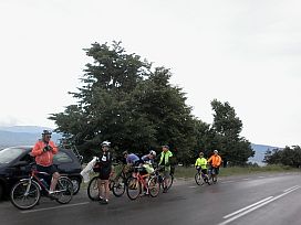
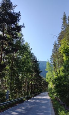
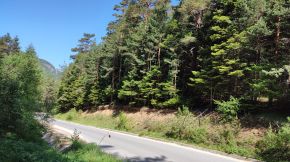
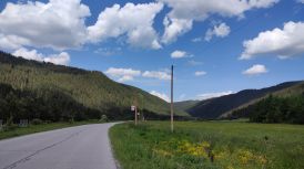
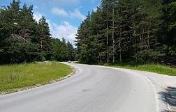
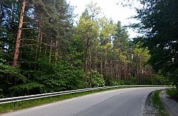
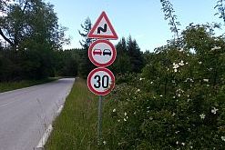
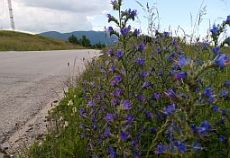
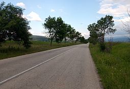
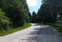
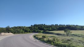
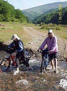
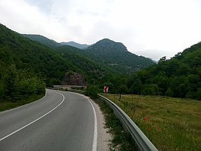
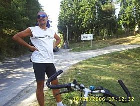
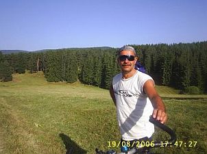
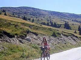
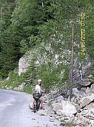
Two routes are possible between Dupnitsa and Sapareva Banya, as I have shown on the map below: - road N 62: the traffic here is a little bit more intensive, I do not think that the pedalling here is dangerous, the road is wide and nice; - road 6204: including all the little villages in the region. This route is hilly comparing with the first one.
The next three photos illustrate the road 62. |
||
 |
 |
 |
|
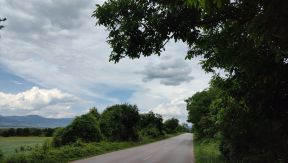
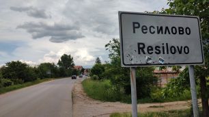
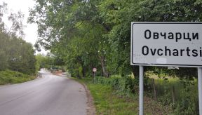
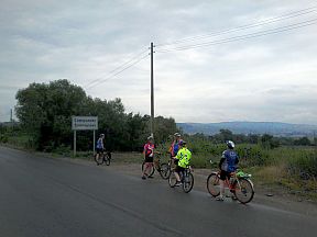
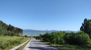
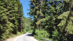
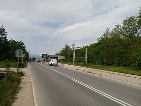
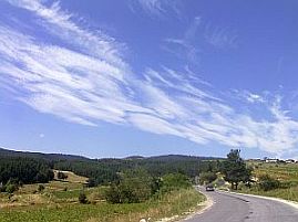
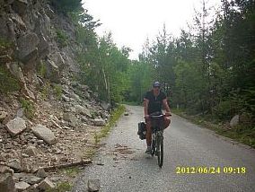
The road 6204 is: From Dupnitsa to Samoranovo to Resilovo to Ovchartsi to Sapareva Banya.
Thr pedalling from Dunitsa to Sapareva Banya is relatively easy. |
||
 |
 |
 |
|
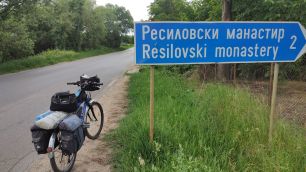
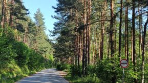
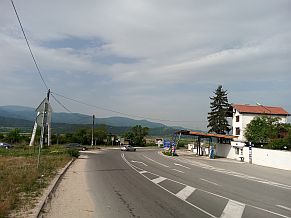
In all the villages along the road food is available. In the same region next to Resilovo there is a monastery: http://www.bulgarianmonastery.com/en/monastery/resilovo_monastery |
||
 |
 |
 |
 |
 |
 |
|
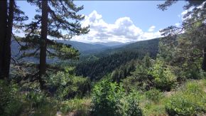
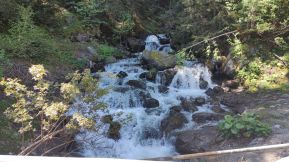
Next to Ovchartsi are so called Goritsa Waterfalls: |
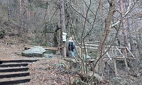 |
 |
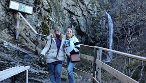 |
| Toward Sapareva Banya | ||
 |
 |
 |
 |
 |
 |
|
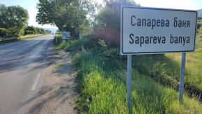
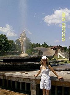
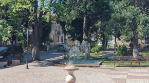
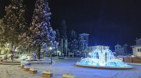
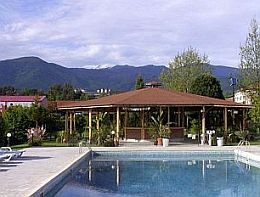
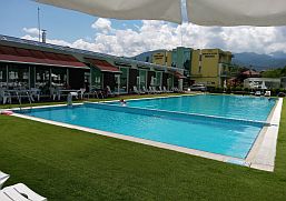
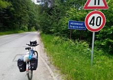
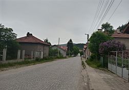
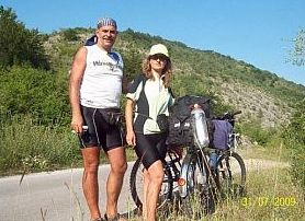
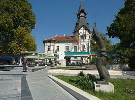
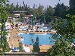
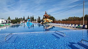
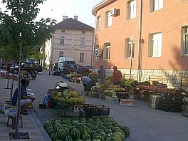
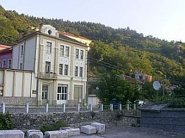
Sapareva Banya is a convenient point to enter in Rila mountain. Here is the most hot thermal spring - geyser in BG, water temp is 103 deg C; It is a small spa resort as well, there are a lot hotels and guest houses for overnight accommodation. |
Information and photos from Sapareva Banya : https://bulgariatravel.org/en/sapareva-banya/
|
 |
 |
 |
 |
 |
|
 |
 |
 |
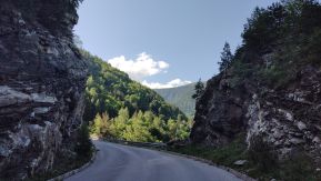
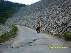
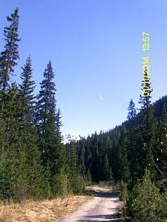
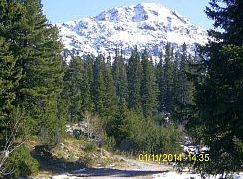
| Up in the mountain: the ascending from Sapareva Banya up to Panichiste Resort to the chairlift station is | considerable, as it can be seen from the road profile chart below. | |
|
The next photos are taken early June '22 |
||
 |
 |
 |
 |
 |
|
 |
 |
 |
 |
 |
|
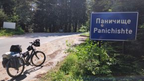
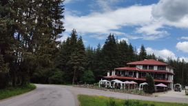
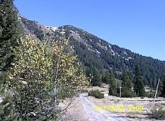
Panichiste Resort is a winter resort popular among lovers of skiing. No many tourists summertime in it, little |
restaurant is available there. Some information for it: |
 |
 |
 |
|
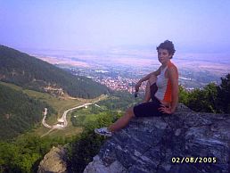
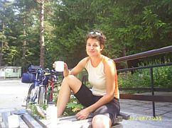
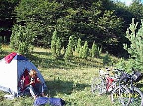
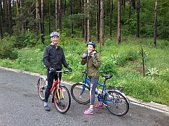
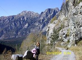
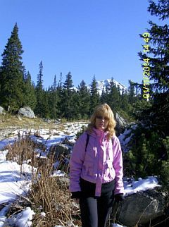
The same area I and my daughter explored August 2005. Updating this section 2023, I see how fast the time is passing |
|
|
 |
 |
 |
 |
| The next coffee place is the lower chair lift station (toward the Seven Lakes) | ||
 |
 |
 |
 |
 |
 |
|
|
||
|
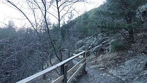
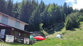
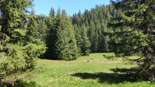
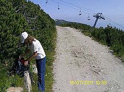
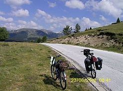
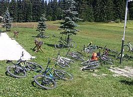
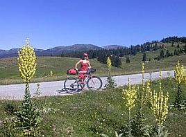
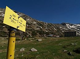
You can leave the bikes at the chair lift station and visit the Seven Lakes. Be careful with the weather forecast, higher in the mountain it can be very changeable, do not go up the mountain without winter equipment.
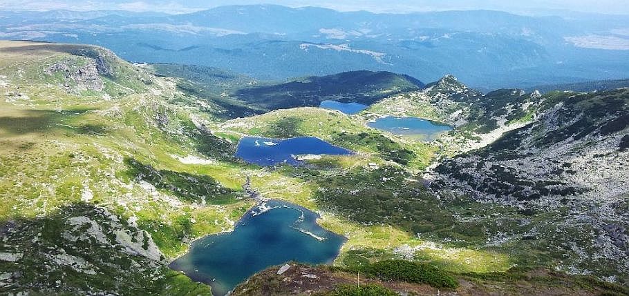
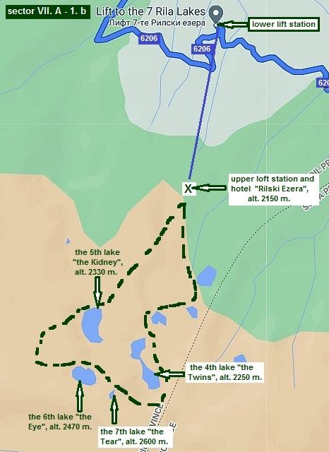
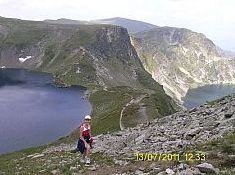
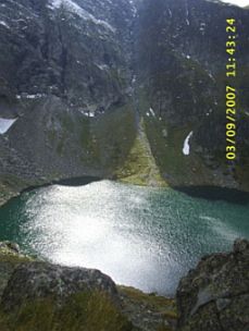
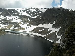
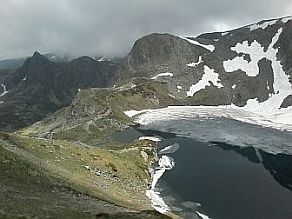
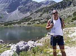
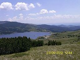
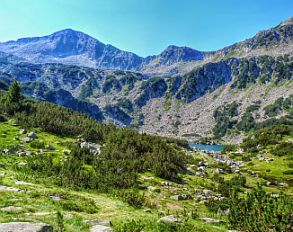
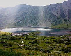
Sector VII. A - 1. b The Seven Lakes
The area of the Seven Lakes maybe is one of the most scenic area in Rila Mountains. https://en.wikipedia.org/wiki/Seven_Rila_Lakes
https://bulgariatravel.org/en/the-seven-rila-lakes/
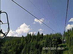
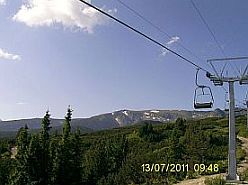
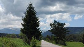
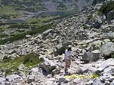
As I have mentioned above, there is a chair lift to the area of the Seven Lakes. Between lift poles there is an off road to the upper lift station, it is very rocky and steep.
The lift Site is: https://rilskiezera.bg/en/lift-working-hours/
Have in mind that the July and August weekends there are a lot of lazy tourists visiting this place by the lift, so you can wait an hour even more to use it. I really have stopped to visit this place since it was crowded so much.
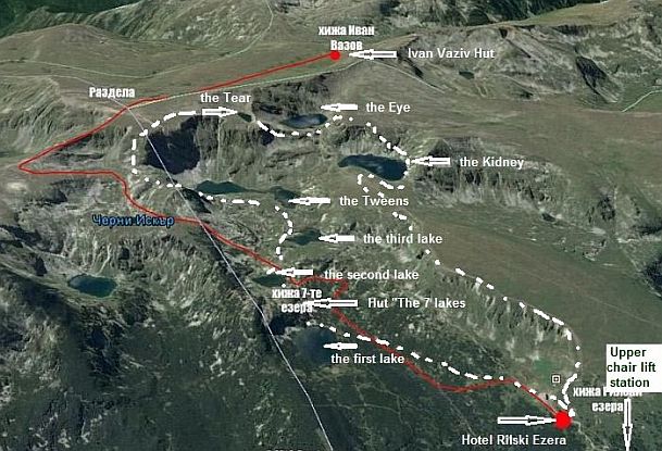
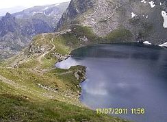
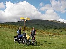
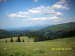
The best thing I can recommend is to do 4 – 6 hour walk around the lake circus because the visibility is perfect, it is not necessary to go along the tracks, but be careful. (The white dashed line on the map below and the green one on the map in left). |
||
|
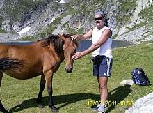
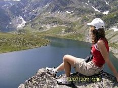
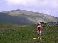
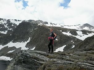
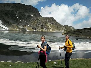
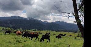
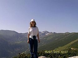
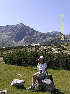
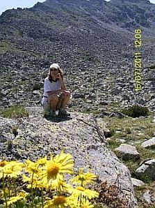
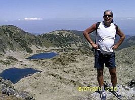
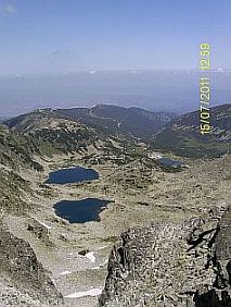
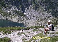
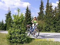
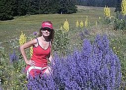
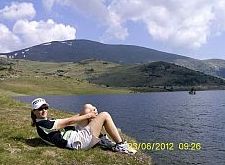
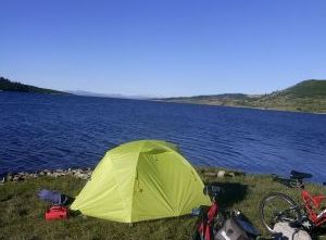
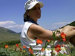
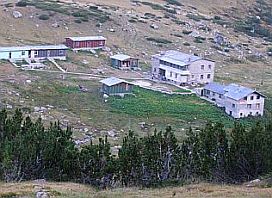
Almost each summer I do it starting from Hotel Rilski Ezera toward the Kidney Lake, and always I have a great time there. Always have a winter equipment visiting this area, convenient shoes, food and well charged cell phone. The weather high in the mountain is very changeable.
I can not refrain of posting of more pictures of this beautiful place. |
||
 |
 |
 |
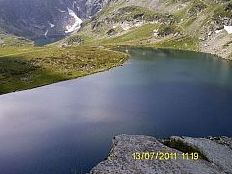
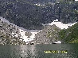
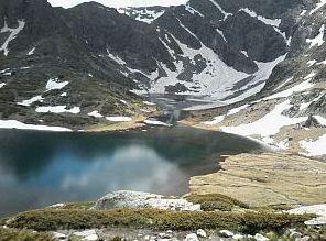
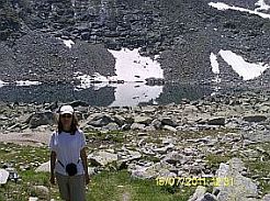
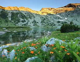
| Above the lake named "the Kidney" (named because of its shape). Usually I walk above it without any tracks. | ||
 |
 |
 |
 |
 |
|
|
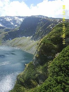
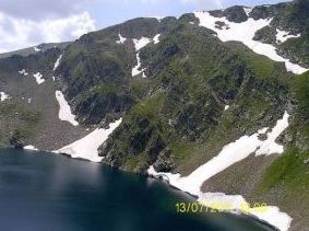
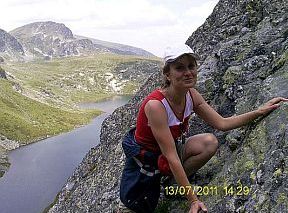
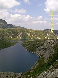
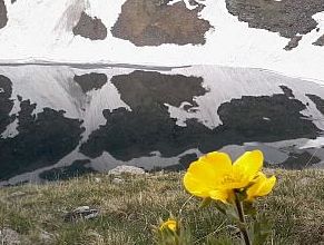
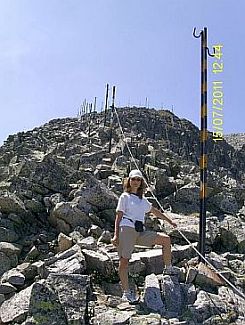
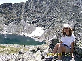
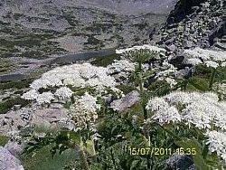
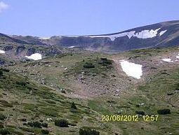
Next three pictures are taken above the lake named "The Eye". On the first photo can be seen the track coming |
from "The Kidney" and going to the highest lake "the Tear". |
 |
 |
 |
|
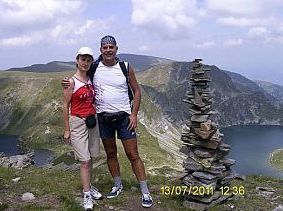
Walking down toward "The Eye". The upper point of the walk (above "The Tear" - the place is recognized |
easy - a lot of stone pyramids are made by tourists there) and down toward "The Twins". |
 |
 |
 |
 |
 |
|
|
If you do not walk along the track, choose carefully your route here, the place is very steep. |
||
 |
 |
 |
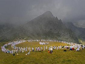 Have in mind that the last 10 days of August the region is overcrowded by people who are members of a peaceful international sect “The White Brothers” (followers of Peter Deunov – the Teacher). Deunov’s doctrine (as long as I can appreciate it) is a mixture of Buddhism, Christianity, old pagan customs (cult of the sun) and God knows what else. Several days the pilgrims in white are rotating in huge concentric circles, they dance and sing songs devoted to the Sun (I have never noticed if the sun pays any attention of all that, but I hope they know it better): http://en.wikipedia.org/wiki/Peter_Deunov The view of all that is interesting even impressive. |
||
|
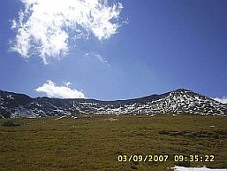
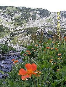
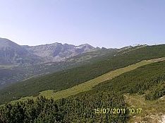
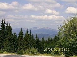
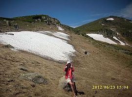
Next several photos were taken in the middle of June '17. The climate in the mountain areas above 2000 meters is just like one behind the Polar Circle. |
Have it in mind visiting this area and always bring with you a nice winter equipment. |
 |
 |
 |
 |
 |
 |
|
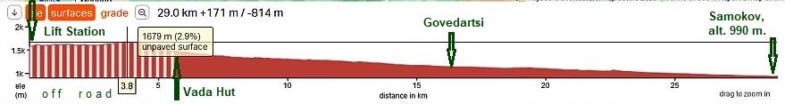
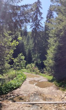
Sector VII. A - 1. c From the Lower Chair Lift Station to Samokov
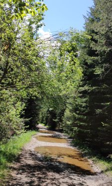
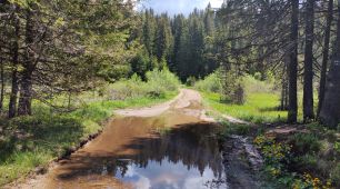
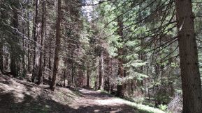
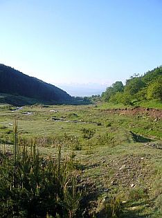
Between the lower chair lift station and Vada Hut the road is dirty, The area here is almost flat, although a kilometer to the Hut, the road ascending and riding of the heavy loaded bike is not possible. |
 |
 |
 |
 |
||
 |
|
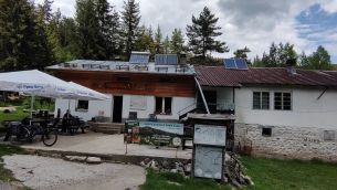
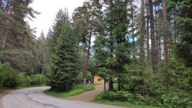
The road toward Vada Hut is marked well. Coffee and overnight accommodation are possible in the hut, |
I am not sure for food. Some information for the Hut: |
 |
 |
 |
 |
 |
|
 |
 |
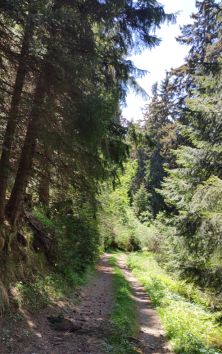
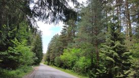
| Further the road toward Govedartsi and Samokov is paved. | ||
 |
 |
 |
 |
 |
 |
 |
 |
 |
|
Overnight accommodation and food areavailable in Govedartsi and Beli Iskar: |
 |
 |
 |
 |
 |
 |
|
An information for Samokov - in the next item. |
||
|
Sector VII. A
|
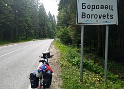
2. Borovets Resort and the highest pick Musala
The initial point to the region of the highest pick of Rila Mountaih - Musala, having altitude of 2926 meters, is Borovets Skiing Rezort.
In the previous item I have shown the approach toward Samokov from Dupnitsa along roads 6204 & 6206. If you are exploring this area, have in mind that the traffic on road 62 is intensive, so I would recommend you to avoid it especially in direction from Dupnitsa to Samokov.
Of first I will expand a little my description, starting with the three alternative approaches to Samokov and Borovets:
2.1 Approach toward Samokov from Sofia;
2.2 Approach toward Borovets and Samokov from Kostenets;
2.3 An alternative route toward Samokov from Sofia crossing Vitosha Mountain (not shown in the map in left). |
|
|
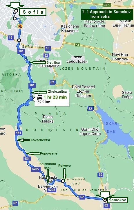
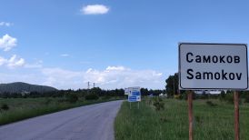
2.1 Approach to Samokov from Sofia.
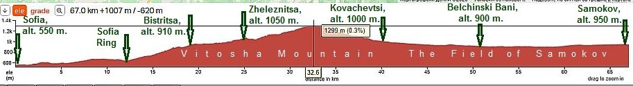
From Sofia to Bistritsa to Zhelesnitsa to Kovachevtsi to Belchin to Samokov to Borovets.
The leaving of Sofia (road 181) here is a little complicated and I can not give you an acceptable advice what to do, so, a decision here is to follow your GPS device looking for the road N181.
The road profile chart shows that climbing starts immediately after Sofia ring (road 18). And very soon a nice panoramic view is revealed behind you. |
|
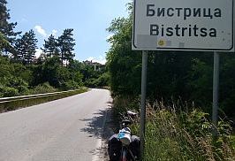
Yes, there is a traffic here towards Bistritsa and Zheleznitsa, but I think the road is not dangerous - it is steep and narrow as well as there are a lot of turns, so car's velocity is very low here. Heavy trucks are not driving here, but busses of the public transport are available. |
 |
||
|
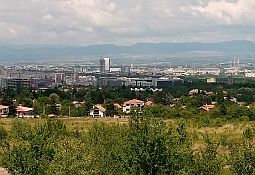
So, starting from Sofia Center towards the highest point there are more than 30 kilometers of climbing. Bistritsa and Zheleznitsa are like suburbs of Sofia, |
many people prefer to live there an travel to work in Sofia. Food shops, hotels are available there. |
|
 |
 |
 |
 |
 |
 |
 |
 |
 |
|
After Zheleznitsa the traffic disappears. To the top of the mountain there are 7 - 8 km. |
On the top there is again restaurant, hotel and spring of fresh water. |
 |
 |
 |
 |
 |
 |
|
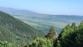
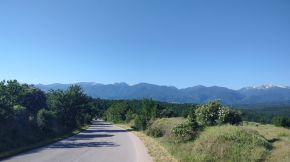
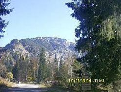
Once reaching the mountain divide, a very nice view toward Rila Mountain is revealed in front of you, |
but when I took next photos. Usually in May the mountain is covered by clouds. |
 |
 |
 |
 |
 |
 |
 |
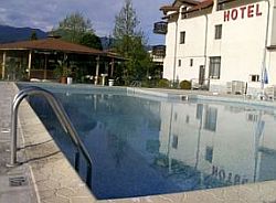
In Belchinski Bani there is a nice swimming pool of thermal water just next to the road (the photo on the left). I think there is a place for overnight accommodation. Food shops are available in all the villages along the road. All that area is very nice to camp in the wilderness. A little information for Belchindki Bani: https://bulgariatravel.org/en/belchinski-bani-belchin-baths/ |
|
 |
 |
 |
 |
 |
|
|
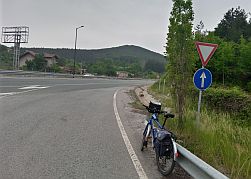
Because road 62 has intensive traffic, my suggestion is from Belchinski Bani to head toward Relyovo, so you will avoid pedaling several more kilometers along road 62. |
 |
 |
 |
|
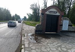
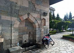
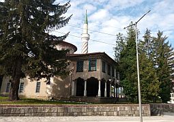
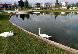
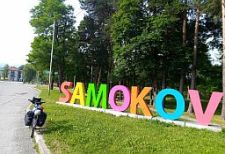
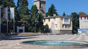
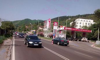
So, soon you will be in Samokov. The town has developed considerably the last years, because it is close to Borovets - a skiing resort in Rila Mountain. |
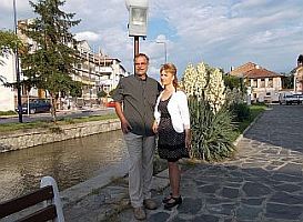
Overnight accommodation is available in Samokov. Several photos and information for it: |
 |
 |
 |
 |
 |
 |
|
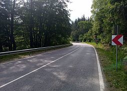
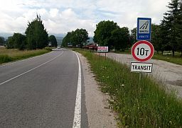
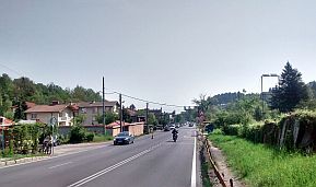
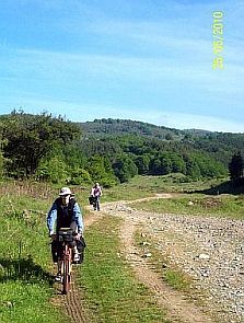
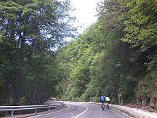
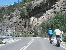
The next several photos illustrate the area after Samokov toward Borovets. The climbing is a little more than 10 kilometers, it is not hard at all. The road is nice, the traffic here is available in the winter, when tourists |
use Samokov as a overnight accommodation base of Borovets Skiing Resort. Summertime there is not any traffic, the road is forbidden for heavy trucks as well. |
 |
 |
 |
 |
 |
|
|
||
|
Sector VII. A
|
||
 Sector VII. A - 2
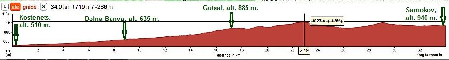
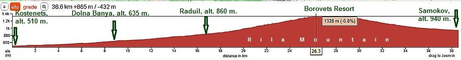
2.2 Approach to Borovets and Samokov from Kostenets.
The route is: From Kostenets to Dolna Banya to Masritsa to Radyil Borovets to Kostenets.
Information concerning this route from Sofia to Kostenets can be seen in the: Chapter VI. Routes: D. From Sofia to Plovdiv and Edirne (in Turkey) Point 1. From Sofia to Pazardzhik, route a
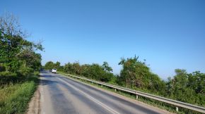
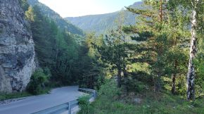
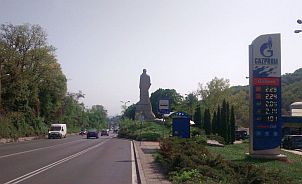
Immediately after Kostenets the climbing is starting. After Dolna Banya abd especially after Raduil climbing gets harder and harder. If I have to be true, I pedalled this route only in the back direction. Next three photos are the area from Kostenets up toward Dolna Nanya. |
||
 |
||
| The countryside rom Kostenets toward Dolna Banya. | ||
 |
 |
 |
|
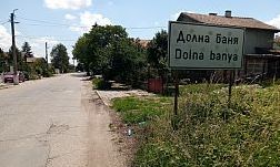
A nice place for overnight accommodation is the next little town Dolna Banya. More information about Dolna Banya can be seen here: |
||
 |
 |
 |
 |
 |
 |
|
|
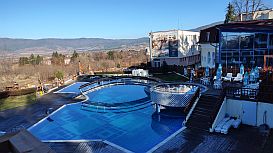
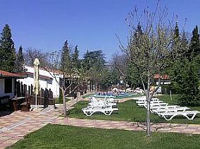
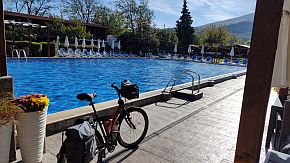
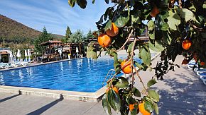
Just entering in the Dolna Banya (road 82), you will see a hotel and a beautiful swimming pool of thermal water are near it. Although the hotel is not the best place, its garden, restaurant and especially the swimming pool are perfect.
Another nice place up the road is hotel Nikol, I have not photos of it. |
|
 |
 |
 |
 |
A little further is so called Complex Europe (it is easy to be seen from the road, maybe it is the best place in Dolna Banya, and well, a little expensive (the photo in left). There are three perfect swimming pools with thermal water of different temperature in each, you can choose the best for you. Another advantage is that there is not so crowded like the first I have mentioned above.
The climbing toward Raduil and Borovets is considerable. |
|
 |
 |
 |
|
Food and overnight accommodation are available in Radyil and Maritsa. A little information for Raduil: |
||
 |
 |
 |
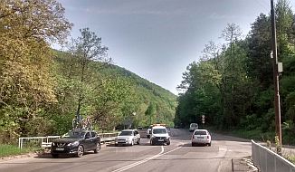
| From Raduil to Borovets. The climbing here is not easy . . . | ||
 |
 |
 |
|
To complete with all the opportunities in the Sector VII. A - 2, I will mention that if you are exploring the region |
and decide to miss Borovets, you can follow the route: From Kostenets to Dolna Banya to Gutsal to Samokov |
|
|
The climbing here is more than 300 meters less comparing with the route including Borovets. More steep are 2 - 4 kilometres to Gutsal |
||
 |
 |
 |
 |
 |
 |
 |
 |
 |
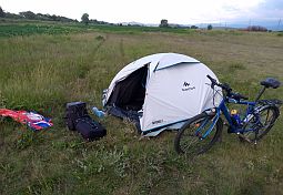
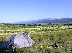
| My camp place several kilometers to Samokov. | ||
 |
 |
 |
|
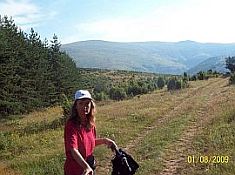
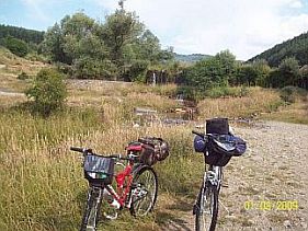
In Gutsal, there might not be a food shop, but there is spring water available. Next photos are we pedaled this |
unnamed road August 2009, when it was still a dirty road. Now is is in very nice condition. |
 |
 |
 |
|
|
|
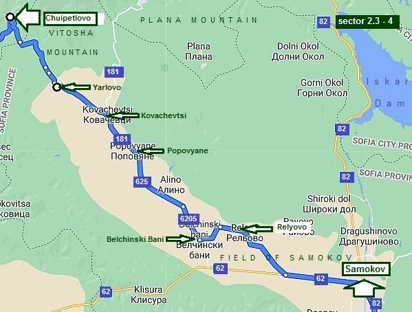
2.3 An alternative route toward Samokov from Sofia crossing Vitosha Mountain.
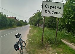
This route is intended for bicyclists loving to explore mountains including off road pedaling. The route is: From Sofia to Vladaya to Dragichevo to Studena to Bosnek to Chyipetlovo to Yarlovo to Kovachevtsi to Popovyane to Belchinski Bani to Relyovo to Samokov to Borovets.
In the raining and wet weather it will be nice to avoid this route. It is not appropriate for tricycles and recumbent as well. This opportunity, according to me, to reach Borovets Resort from Sofia is much more exciting comparing with above described, unluckily the road segment in Vitosha Mountain: from Chyipetlovo to Yarlovo is not signed well off road, here GPS device would be nice to be used. Dealing with this map, Google map define this distance as 2h 15min driving, which makes me laugh, because the road segment from Chuipetlovo to Yarlovo (sector 2.3 - 3) is off road, I do not believe it is possible to be driven by cars. |
|
|
||
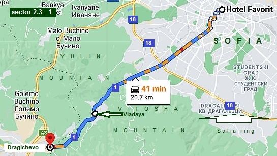
Sector 2.3 - 1
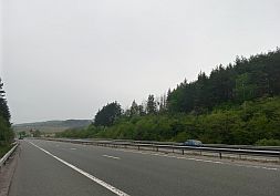
The traffic along the road 1 is very intensive, especially mornings toward Sofia and late afternoons in the back direction, as well as Sunday afternoons, it would be better to be avoided, especially when leave Sofia. Too much exhaustive gasses up to Vladaiski Pass. In the opposite direction the situation is a little better. |
||
|
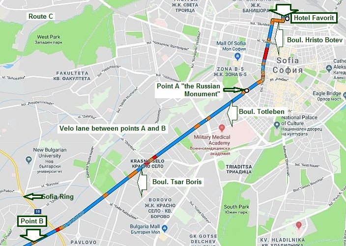
I will increase the scale a little, the next scheme shows a convenient way to leave Sofia.
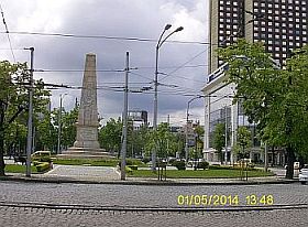
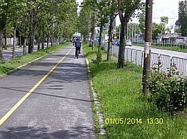
An advantage here is that there is very convenient velo lane in Sofia town between point A (so called “Russian" Monument the first photo below) and point B (behind Sofia Ring). |
||
 |
 |
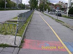 |
| Once leaving Sofia an ascending begins toward Vladaya. Maybe this is the most unpleasant road segment here. | ||
 |
 |
 |
 |
 |
 |
 |
 |
 |
|
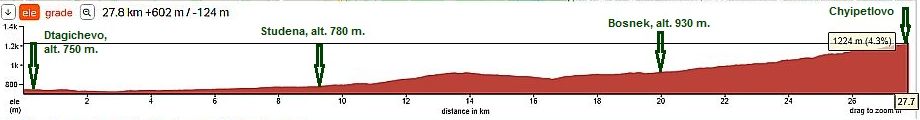
Sector 2.3 - 2
The biggest disadvantage of this route is that just after Stydena up to the crossroad toward Bosnek you have to pedal along the high way A3 (approx 3 km) . No alternative.
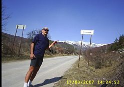
After leaving the high way toward Bosnek (the first photo below), you will be in the scenic wilderness, no any traffic. Up to Chyipetlovo there is no problem with the road except the crossroad towards Studena Dam. It is saved and closed zone, there is guard post, often dogs are running free. Never mind that dogs are not so dangerous, I always use my spray against dogs here.
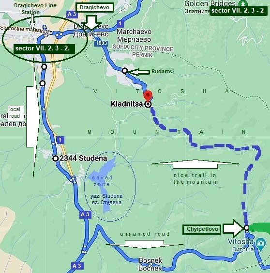
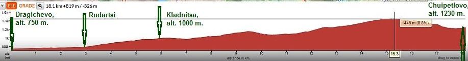
Another opportunity here is a nice track crossing Vitosha Mountain - the dashed green line: Drom Dragichevo to Rudartsi to Kladnitsa to Chuipetlovo, (further there will be several words about it) |
||
|
Sector VII. D - 1 |
||
|
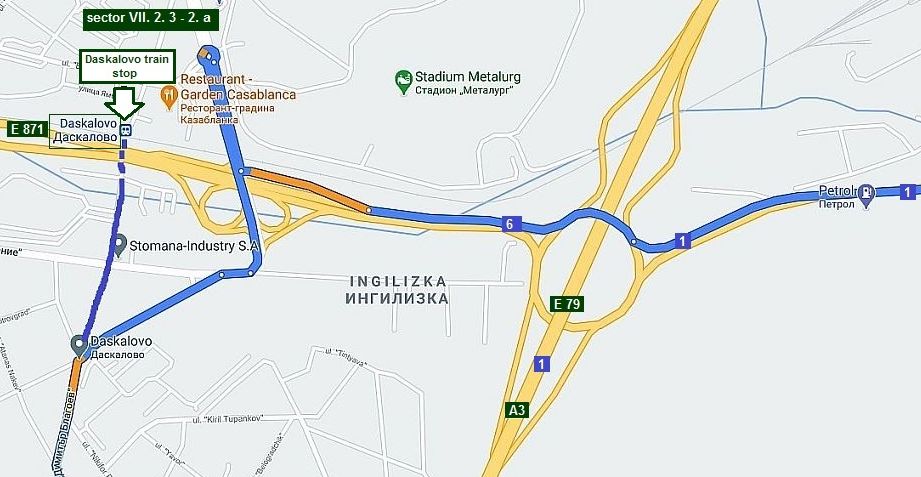
Here is important to avoid the motor road A3, so I increase here the scale because the crossroad toward Studena is a little complicated. Here I have pointed Daskalovo Train Stop; you may use a train from Sofia to Pernik, in other to avoid traffic from Sofia to Vladaya to Pernik. |
Toward Studena there is a local road without traffic. The sector VII. D - 1 on the next map (sector VII. D) is a complicated crossroad: follow the blue line on the map below and you will miss the high way between Dragichevo and Studena (sector VII. D - 1). |
|
|
The next photos illustrate the route from Dragichevo toward Studena, Bosnek and Chyipetlovo. |
||
 |
 |
 |
|
Leaving Studena, you have to pedal 3 - 4 kilometers on the motor road A 3 (E 79); it is forbidden for |
bicyclists, but nobody will stop you to do it. No way to avoid it just here. |
 |
 |
 |
 |
 |
 |
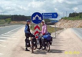
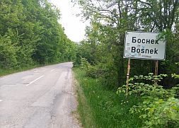
| The road toward Bosnek is signed well. It is a place to supply with food, if necessary. | ||
 |
 |
 |
|
Up to Chyipetlovo the road is in a nice condition. I did not visited it after the Motor road A 4 is in exploitation, so I am not sure, if in it there is a food shop. Near the road here is the longest cave in Bulgaria, |
the Duhla Cave: https://bulgariatravel.org/en/the-duhla-cave/ It is dangerous and youth love to visit it, so to avoid problems, its enter is locked. |
 |
 |
 |
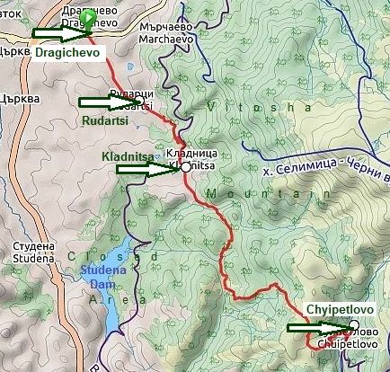
An opportunity here is a nice trail crossing Vitosha Mountain: From Dragichevo to Rudartsi to Kladnitsa to Chuipetlovo
Unfortunately the road in Kladnitsa toward Chuipetlovo is not signed, although once finding it, no more problems to reach Chuipetlovo. I think, it would be better to avoid it without a guide.
I am not sure that GPS device will work here, in the moment I am renovating this chapter, Google Map does not permit me to trace this route.
|
 |
|
The area between Kladnitsa and Chuipetlovo was a closed area, the forest is full of game - a reserve for communistic lords in the years of communism. Exploring this area in the end of December 2001, suddenly 21 black boars (6 of them were very big) crossed my track several meters before me. I was scared up totally, I had neither spray not knife, the only thing I did was to count them. |
I never visited this place again. Maybe it is not so wise to walk there. Vitosha Mountain is the oldest National reserve in Bulgaria. Information for the Mountain: https://en.wikipedia.org/wiki/Vitosha |
|
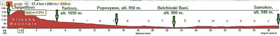
Sector 2.3 - 4
Just before entering in Chuipetlovo, you have to take the dirty road to right. Here and further up to the mountain ridge there is not any signs. I will only say, while climbing (up to the ridge) always take the left road.
Once reaching the mountain ridge (the first 6 photos below), you will find easy the road towards Yarlowo - bike only down the hill.
Because the road 62 is with an intensive traffic, my suggestion is from Belchinski Bani to head toward Relyovo, so you will avoid pedaling several more kilometers along road 62 (it was in very poor conditions, but the last time I pedaled there - May '20, it was in reconstruction). |
 |
 |
 |
 |
 |
 |
 |
|
I am not sure the back route from Yarlovo toward Chyipetlovo can be recognized easily. GPS device here will work definitely. |
||
 |
 |
 |
 |
 |
 |
| The road from Yarlovo to Samokov is in very nice condition. No any traffic here. | ||
|
|
|
|
|
|
|
|
|
|
In Belchinski Bani there is a nice swimming pool of thermal water just next to the road (the photo on the left). I think there is a place for overnight accommodation. Food shops are available in all the villages along the road. All that area is very nice to camp in the wilderness.
A little information for Belchindki Bani: https://bulgariatravel.org/en/belchinski-bani-belchin-baths/ |
|
|
|
|
|
|
|
|
|
|
Because the road 62 is with an intensive traffic, my suggestion is from Belchinski Bani to head toward Relyovo, so you will avoid pedaling several |
more kilometers along road 62 (it was in very poor conditions, but the last time I pedaled there - May '20, it was in reconstruction). |
|
|
|
|
|
So, soon you will be in Samokov. The town has developed considerably the last years, because it is close to Borovets - a skiing resort in Rila Mountain. |
Overnight accommodation is available in Samokov. Several photos and information for it: |
|
|
|
|
|
|
|
|
|
The next several photos illustrate the area after Samokov toward Borovets. The climbing is a little more than 10 kilometers, it is not hard at all. The road is nice, the traffic here is available in the winter, when |
tourists use Samokov as a overnight accommodation base of Borovets Skiing Resort. Summertime there is not any traffic, the road is forbidden for heavy trucks as well. |
|
|
|
|
|
|
|
|
|
||
|
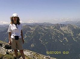
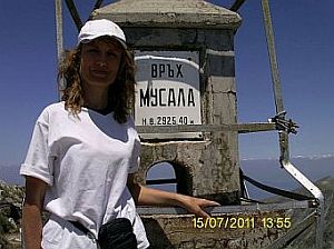
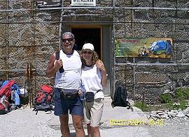
Sector VII. A - 2 Borovets Resort and Musala
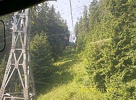
In the end we explored all the opportunities to reach Borovets. Borovets is a winter skiing resort: https://bulgariatravel.org/en/borovets/ https://www.borovets-bg.com/en Reaching it, it is worth to visit the highest pick in Rila Mountains: “Musala”, do it only if the weather is nice. Have in mind that high in the mountain the weather can change for minutes. From Borovets resort to the higher part of the mountain there is a gondola type lift. The lift is almost 5 kilometers, it overcome altitude of more than kilometer beginning from alt. of 1320 merers, reaching alt. of 2370 meters for approx. 20 minutes. https://www.borovets-bg.com/en/page/
Information for the lift: |
||

Some guys load bikes in the lift and after descend madly down to Borovets Resort along skiing tracks, but I do not believe it is a wise decision. It would be much better to do 2 – 2.30 hour walk to the pick. The walk is easy, a harder climbing is 30 minutes just before the peak. The scenery is amazing, you will not regret if you visit this place. If it is clear, the visibility in each direction is more than 200 kilometers. Have heavy factor skin cream and some cream for your lips because the sun high in the mountain is very strong.
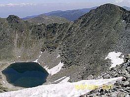
Pictures from this area. Here also there are seven lakes, but they are not so nice like those in the previous item. |
||
 |
 |
 |
 |
 |
|
 |
 |
 |
 |
 |
|
 |
 |
 |
 |
||
 |
 |
 |
 |
 |
 |
|
|
||
|
Sector VII. B
3. Belmeken Dam |
|
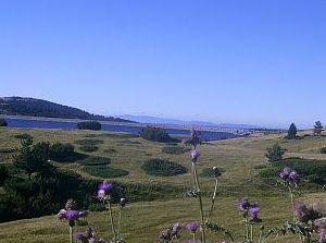
Next amazing place convenient for bicycling is the region near Belmeken Dam. The Dam is a part of an interesting hydro - electro - power system including several reservoirs and three electro power plants. The aim of the system is to supply BG electro-system with power in the pick hours of consumption working on a generate mode, and pump the water back in the hours of min power consumption. |
A detail description of the system: https://www.scribd.com/document/97058507/%D0%A5%D0%B8%D0% B4%D1%80%D0%BE%D0%B5%D0%BD%D0%B5%D1%80%D0%B3%D0 %B8%D0%B9%D0%BD%D0%B8-%D0%BA%D0%B0%D1%81%D0%BA% D0%B0%D0%B4%D0%B8-%D0%B8-%D1%8F%D0%B7%D0%BE%D0%B 2%D0%B8%D1%80%D0%B8-Hydro-Power-Cascades-and-Dams A kilometer from the Belmeken dam contra wall is placed Belmeken Alpine Sports Complex (it is signed). Hotel and restaurant can be found out there: |
|
|
|
||
|
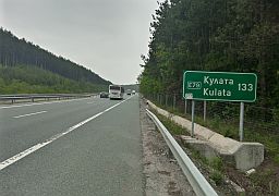
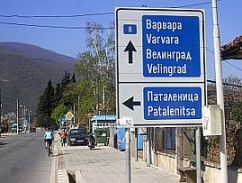
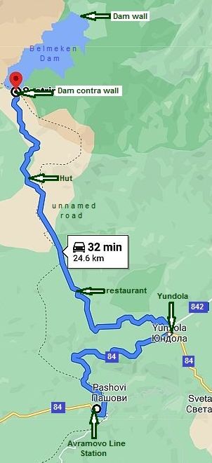
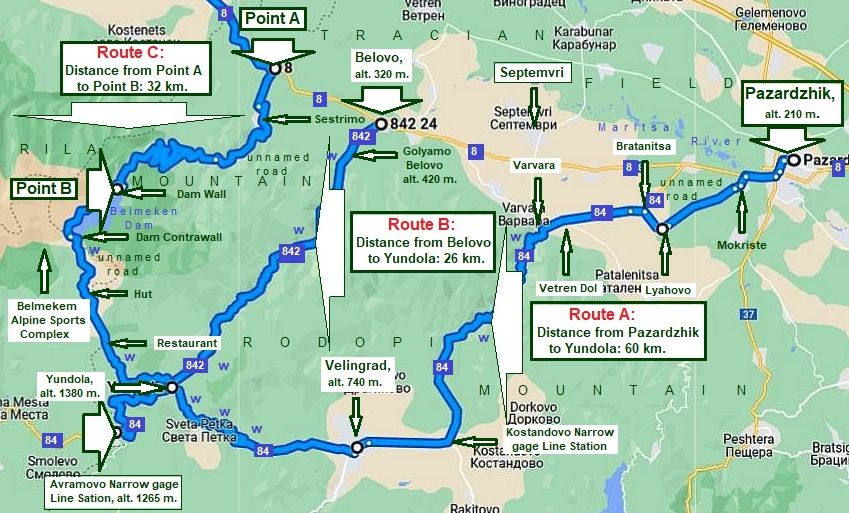
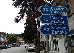
I will show here three opportunities to reach Belmeken Dam: Route a: From Pazardzhik to Varvara to Konstandovo Narrow-gage Line Station to Velingrad to Yundola; |
Route b: From Belovo to Yundola; (Both routes a & b coincide from Yundola to Belmeken Dam) Route c: From Poina A (road 8) to the Belmeken Dam. |
|
|
|
||
|
Looking altitudes I have pointed on the map above, you can choose one of the routes. The start (or end) points of all the routes shown here are on the road 8. Information how to reach all them from Sofia can be seen in: |
Chapter VI. Crossing Bulgaria from west to east. Routes: D. From Sofia to Plovdiv and Edirne (in Turkey) Point 1. From Sofia to Pazardzhik, route a. I will not write about it here. |
|
|
|
||
Route a
According to me, Pazardjik is very appropriate to be regarded as an initial/end point, when the question is about route a.
Pazardzhik is not as big as Plovdiv. Most importantly, the traffic is not as intensive as in Plovdiv, as well as it is easy to find very nice hotel / restaurant in it at an acceptable price. S
In the link below more information concerning this town is available, I will not write about it here. http://en.wikipedia.org/wiki/Pazardzhik
http://www.guide-bulgaria.com/SC/pazardjik/pazardjik/pazardjik
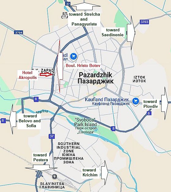
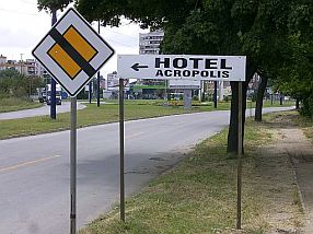
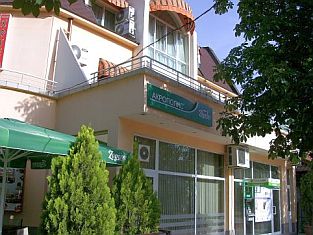
For accommodation in Pazardzhik, I would recommend Hotel Acropolis: http://acropolispz.com/index_eng.htm Pazardjik, Boul. „Hristo Botev“ 17, tel.: 034/45 10 45; cell tel: 0898 662 702, e-mail: acropolispz@abv.bg |
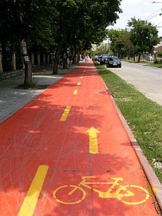 |
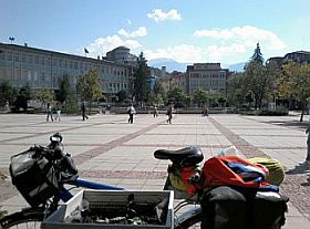
Everywhere in the city there are a lot of labels which will lead you to the hotel, you easy will recognize the place seeing the red bicycle lane in front of it.
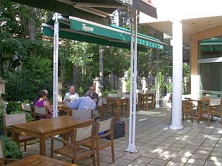
It would be nice to stay and relax here for a night, because: - It is very easy to find; - - The hotel can be recognized easily by the new red bicycle lane just in front of it the right side of the street going to North (the photos below); - - The hotel is clean, the rooms are air conditioned, which is important in this town, where summer temperatures often are more than 40 deg C; - Opinions of the hotel guests are very nice; - - The hotel restaurant offers nice dishes, the staff speak very good English; - The hotel has good Wi Fi; - - There is easy access to a free room for bicycle and pannier storage.
|
|
 |
 |
 |
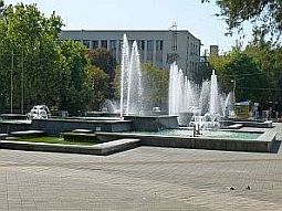
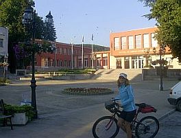
| Several photos of Pazardzhik and its town garden. | ||
 |
 |
 |
 |
 |
 |
 |
||
 |
 |
 |
|
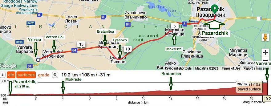
I will increase a little the scale for a part of route a: From Pazardzhik to Mokriste to Lyahovo to Bratanitsa to Vetren Dol to Varvara.
|
||
|
As the traffic along the road 8 and 84, beginning from Pazardzhik, follow the route I point on the map above. |
The next several photos illustrate the countryside from Pazardahik toward Lyahovo and Vetren on different seasons. |
|
 |
 |
 |
 |
 |
 |
|
 |
 |
 |
| The same area - from Vetren Dol toward Patalenitsa and Lyahovo - photos were taken in the best November 2022. | ||
 |
 |
 |
 |
 |
|
 |
 |
|
| February 2024 | ||
 |
 |
 |
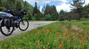
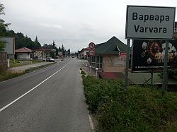
 Varvara and Vetren Dol
 are nice places to be used as base points along this route as well. In Varvara there is a nice motel and swimming pool of mineral water. On weekends in the summer (June - August) this area is very crowded with tourists and room reservations will be needed Friday & Saturday nights in the motel. Some information for Varvara and Vetren Dol:
http://www.guide-bulgaria.com/SC/pazardjik/septemvri/varvara
http://www.guide-bulgaria.com/SC/pazardjik/septemvri/vetren_dol The next photos are complex Varvara - motel and swimming pools. |
||
 |
 |
 |
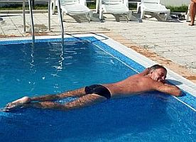
| The place is especially nice April, May, September, October in the middle of the week, when there is nobody there - all the swimming pools will be yours! - the next three photos - the middle of October 2024. | ||
 |
 |
 |
|
There are another possibilities for overnight accommodation in Varvara or Vetren Dol as well. http://www.guide-bulgaria.com/SC/pazardjik/septemvri/vetren_dol |
||
 |
The motel on the left, "Родопско ханче" (Rodopsko Hanche) in Varvara has a nice restaurant and small swimming pool. I recommend it. In the photo on the right is a private home-hotel, "Радовата къща" (Radovata Kasta) in Vetren Dol. |
 |
|
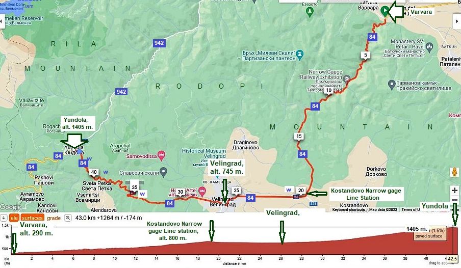
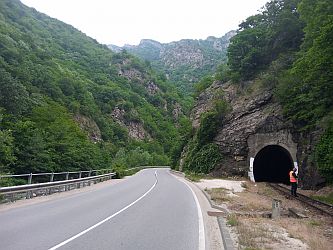
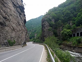
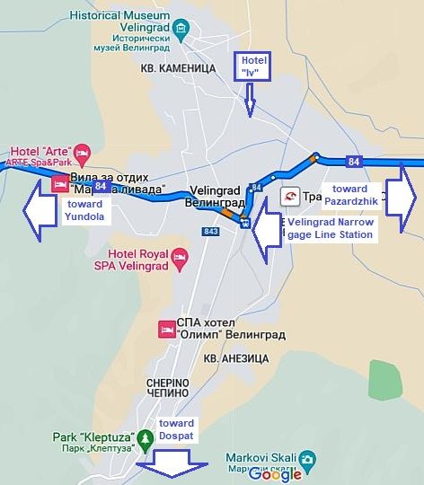
Continuing with the route a: From Varvara to Konstandovo Narrow - gage Line Station to Velingrad to Yundola.
|
|
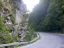
The road profile chart shows the permanent climbing toward Yundola. The gorge from Varvara to Konstandovo narrow-gage Line Station is one of the most scenic gorges in Bulgaria, I have only three photos illustrating it. The road segment Varvara - Kostandovo Line Station |
|
is a beautiful gorge, unfortunately traffic here is quite intensive, the climbing up the mountain is not pleasant definitely. If you tour the back route, this road segment is nice for bicycling - I pedalled it several times in the back direction. Your speed will be almost the same as the one of the trucks. |
 |
 |
 |
 |
 |
 |
 |
 |
 |
|
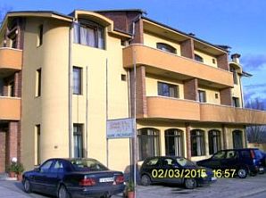
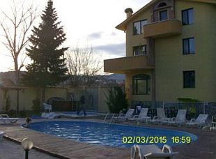
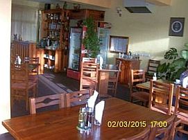
Several words for Velingrad: the city is a place with hotels and springs of thermal water. Information for Velingrad: http://en.wikipedia.org/wiki/Velingrad net/en/velingrad/velingrad.html https://bulgariatravel.org/en/town-of-velingrad/ The city a known spa resort not only in Bulgaria. There |
are a lot of hotels of different quality; a nice place to stay for a night in is Hotel “Iv” (the 3 photos below). It can be found out easy, there is a nice small swimming pool of thermal water next to it, the place is clean, inexpensive, and the hotel restaurant offers nice meals. The staff is friendly, they have an experience with touring bicyclists. |
 |
 |
|
 |
||
 |
||
| And the last 16 kilometers climbing from Velingrad to Yundola. the traffic here is not intensive. | ||
 |
 |
 |
|
Yundola is a little mountain resort placed just on the border between Rila and Rodopi Mountains, overnight accommodation is possible there: |
https://bulgariatravel.org/en/yundola/ Three photos from Yundola toward Avramovo Line Station. |
 |
 |
 |
|
|
||
|
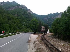
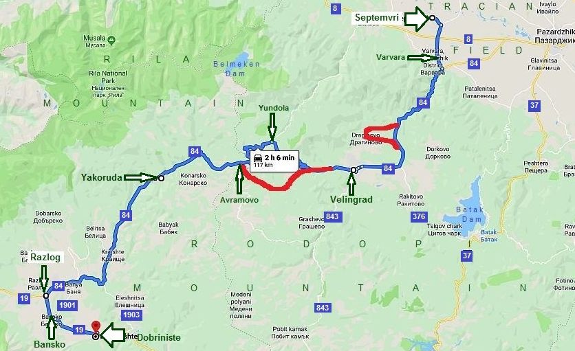
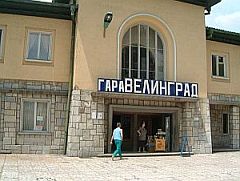
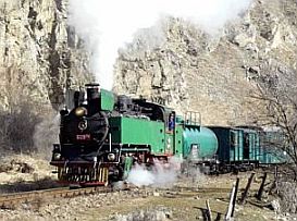
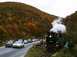
٭An opportunity: As the traffic from Varvara to Velingrad is intensive, especially in the weekends, my suggestion is to avoid it especially up the mountain. So, it would be much better to take on the narrow gage train in Varvara (or in the initial Septemvri Line Station) and enter in the mountain by it. Traveling with this amazing train is exciting! A convenient train up the mountain is available in the morning at 8. 45 or 9.15 (they change the train schedule often): |
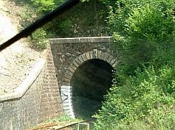
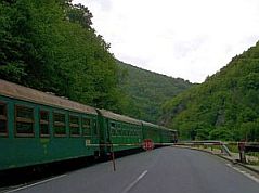
- From Varvara to Velingrad (pedaling after to Yundola); - From Varvara to Avramovo Narrow gage Line Station (pedalind after back to Yundola). Several words and photos for the narrow-gage train Septemvri - Dobriniste. The narrow - gage train serves the line from Septemvri to Dobriniste. The red line on the map below shows places where the line is not next to the road. |
|
 |
||
|
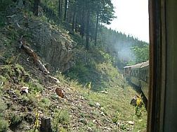
More information concerning this amazing train can be seen here: http://en.wikipedia.org/wiki/Septemvri-Dobrinishte_narrow_gauge_line The narrow gage train can be taken on in Septemvri, but my suggestion is to take it in Varvara. This place can also be used as an initial point to explore Rodopi or Rila Mountains. There are several reason to use this amazing train when you begin exploring Rodopi or Rila Mountains: - I think there are no many such trains in the world. Its velocity is 25 – 30 km/hours, the scenery of the area it is going is marvelous as it can be seen from the photos below; Each year I travel by it at least one time; |
- It is not a problem to load your bicycle in it (if bicyclists are more than 4 – use different carts to load baggage (buy an additional ticket for the bike – 1 EURO); - Some climbing can be avoided: altitude of Varvara is 270 m., Velingrad – 750 m., the highest point Avramovo line station – almost 1300 m. My suggestion to tourists having a restricted time for touring is to take on the train and enter in the mountain; - you can take off the train in Velingrad or in Avramovo Line Station; - In the opposite direction it would be unnecessary to travel by the train. The pedaling down the mountain along the line is extremely pleasant. |
|
 |
 |
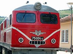 |
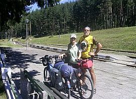
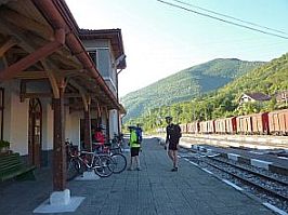
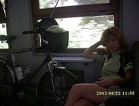
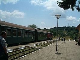
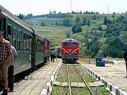
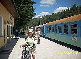
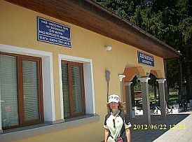
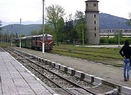
| The line station in Varvara. The train from Varvara to Velingrad is here at 8. 46 am. | Inside the cart - no problem to load your bicycle in it. | The diesel engine - there are such engines made in Romania and former East Germany. At work since 1963. |
 |
 |
 |
| The three photos above Avramovo Line Station - the highest train station on Balcans. | ||
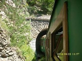
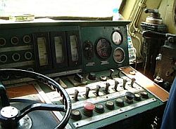
| Avramovo Line Station is the highest one on Balkans having alt. of 1267. | There are a lot of tunnels along the line. | Inside the engine - some time I arrange tourists to travel inside it. |
 |
 |
 |
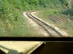
| The visibility in the engine is much better than in the cart, but it is not easy to arrange to travel in it. | ||
 |
 |
 |
| In the mountain there are several serpentines of the line. | Velingrad Line Station. | |
 |
 |
 |
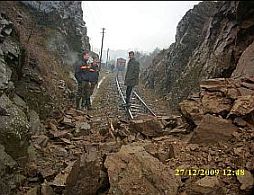
| Rocks on the line after powering rain. Some time in the mountain it happens. | ||
 |
 |
 |
|
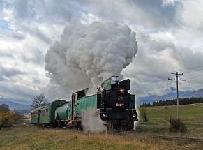
There is one original steam engine still at work, it is used only when there is a group of tourists paying in advance for such a traveling; See the video - speaking in Germans: https://www.youtube.com/watch?v=2JbJvinBQ8s https://www.youtube.com/watch?v=0N2FfKQjvtg |
||
 |
 |
 |
| As a conclusion, you can take off the train: A. in Velingrad; or B. in Avramovo. In the first case you have | to climb toward Belmeken Dam from Velingrad in the second - from Avramovo line station. | |
|
|
||
|
If you choose to take off the train in Avramovo Line Station you have to pedal 9 kilometers back toward Yundola of first. The road is easy for pedaling, the view |
is very exciting. The next photos illustrate the countryside from Avramovo line station toward Yundola. Water supply in the mountain is not a problem. |
|
 |
 |
 |
 |
 |
|
 |
 |
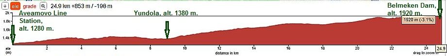
| As it is obvious from the road profile chart, the climbing toward Belmeken Dam from Yundola | is considerable. It is a high mountain area. | |
 |
||
|
If my memory serves, approximately in the middle of this distance there is a little restaurant - the last time (July 2017) I toured in this area, on the grass near |
the restaurant there were more than 20 bicycles of a big group young bicyclists drinking beer there. If my Memory serves, in the summer 2022 the restaurant was working only weekends. |
|
 |
 |
 |
 |
 |
 |
| Three - four kilometers further there is a hut; food and overnight accommodation are available in it. | ||
 |
 |
 |
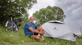
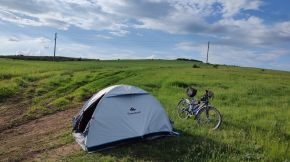
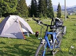
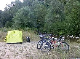
| Higher in the mountain there are nice places to set up your tent, I do not miss to spent a night there. | ||
 |
 |
 |
|
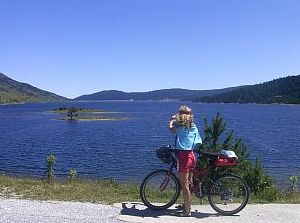
One more time I will mention that a kilometer from the Belmeken Dam contra wall is placed Belmeken Alpine Sports Complex (the road toward is signed). Hotel and restaurant can be found out there: |
https://www.nsb.bg/en/nsb/%d0%b2%d1%81%d0%ba-%d0%b1 %d0%b5%d0%bb%d0%bc%d0%b5%d0%ba%d0%b5%d0%bd-en/ Several photos from the area near the Dam. Drinkable water is available there. |
 |
 |
 |
 |
 |
 |
 |
 |
 |
|
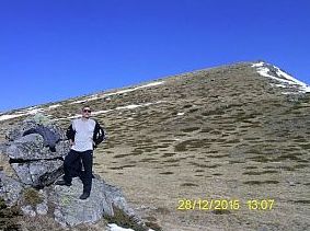
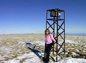
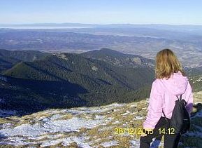
Once reaching the Dam, you can leave your bikes and visit the highest pick in the region - Belmeken Pick. A slow walk to the pick and back is 5 hours (it is not |
necessary to look for a track to the pick and back). An impressive view toward Pirin Mountain to south is revealed. |
 |
 |
 |
 |
 |
 |
|
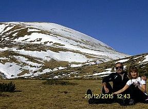
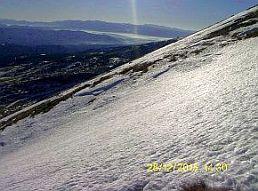
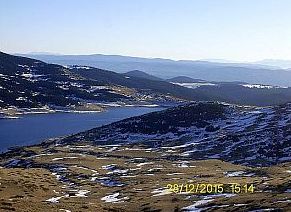
The best year period to visit this place is July - August, but next several photos are taken in the extremely hot and sunny December '15. |
An impressive view toward Balkan, Pirin Mountain and Thracian Field is revealed from the pick. |
 |
 |
 |
 |
 |
 |
 |
 |
 |
|
|
||
 |
||
|
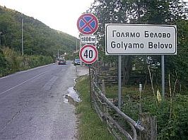
Route b: From Belovo to Yundola: The stronger bicyclists can climb: From Belovo to Goliamo Belovo to Yundola Rezort (E842) to Belmeken Dam. |
The road profile chart shows 42 km. permanent climbing, fortunately the traffic here is negligible. Bring some food with you. Beginning from Belovo, springs of drinkable water are available approximately after 4 km (just after leaving Golyamo Belovo), 9 km, 19 km and 23 km. |
|
 |
||
|
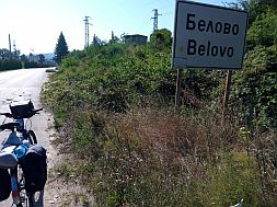
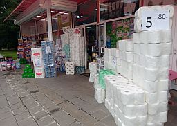
The climbing begin at Belovo. It is a little town, overnight accommodations are available in it. http://www.guide-bulgaria.com/SC/pazardjik/belovo/belovo You easy will recognize you are in the town - a mountains of toilet paper are sailed in the town - the biggest in Bulgaria paper mill (Belana Plc.) that produces |
toilet paper and other disposable paper products is in the town. I can not miss mentioning the great story with the toilet paper in the spring of 2020 . . . still no reliable explanation of the "world wide" panic concerning the toilet paper in 2020. |
|
 |
 |
 |
 |
 |
 |
|
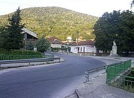
Five kilometers further is Golyamo Belovo - the last place you can find food. |
||
 |
 |
 |
|
Leaving Golyamo Belovo, you will see a nice water spring. From the other side next to the river is maybe |
the only nice place for camp in the wilderness all along the road up to Yundola. |
 |
 |
 |
| So, after 20 km. hard pedaling up the mountain, you will be in Yundola. | ||
 |
 |
 |
 |
 |
 |
 |
 |
|
|
Route c: From Sestrimo to Belmeken Dam:
|
||
|
I would recommend this route up the mountain only for strong bicyclists loving to climb long distances. This road was constructed and purposed for heavy trucks working on the hydro cascade Belmeken - Sestrimo. It is because |
the slope is no more than 10% and it is constant all the distance. I pedaled this route only down the mountain, so I do not remember, if drinkable water was available here. Bring water and food with you. |
|
 |
 |
 |
 |
 |
| So, as a conclusion I can say that the route a is a better variant if you decide to explore this beautiful area combining pedaling and the narrow - gage train. | Both routes b & c are very nice to go back down from the mountain. | |
|
Sector VII. C
Sector VII. C In this sector are two of the objects of interest: 4. Rilski Monastery; 5. Region around the Fish' Lakes. 4. Rilski Monastery |
||
|
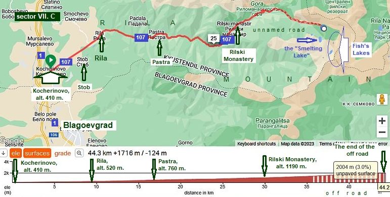
For an information how to reach the starting point of this route from Sofia is given in: III. Crossing Bulgaria from north to south (from Romania to Turkey & Greece) Part II, I will not write about it here. Another place worth to be visited in Rila Mountains is Rilski Monastery. The Monastery itself and especially up the mountain - area near the Fish’s Lakes, are more than amazing. Fortunately the motor road A4 is now in exploitation (Sofia - Blagoevgrad), so the traffic along |
road N1 is not intensive, so already exploring the region by bicycles is no more dangerous. The entire area is a national park - reserve: https://en.wikipedia.org/wiki/Rila_Monastery_Nature_Park The entire route: From Road N1 to Kocherinovo to Rila to Pastra to Rilski Monastery, is 31 kilometers up the mountain. Along the road there are 3 - 4 hotels & restaurants, so water &food supply is not a problem. |
|
|
|
||
|
As it can be seen from the road profile chart, the climbing here is not so hart (except the last 2 - 3 km just before the monastery). |
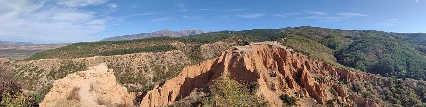
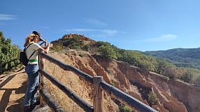
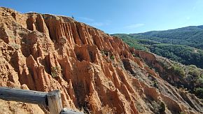
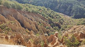
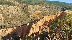
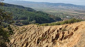
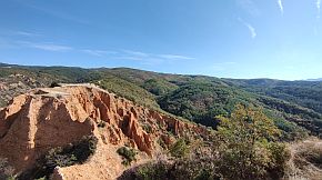
The first interesting place along the road are the sand pyramid next to Stob. The place is not so impressive as the sand pyramid near Melnik, but the place is interesting. |
 |
||
 |
 |
 |
 |
 |
|
 |
 |
|
|
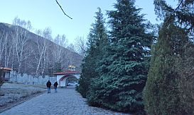
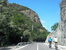
The road toward the Monastery is in a nice conditions, usually in the weekends the traffic here is more intensive. |
||
 |
 |
 |
|
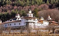
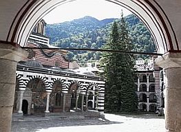
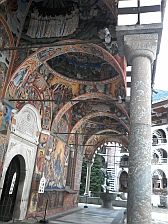
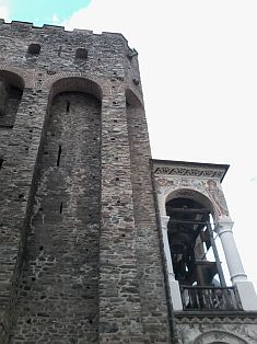
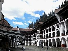
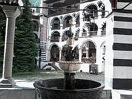
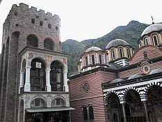
There is a hotel and restaurant near the monastery, 2 - 3 kilometers further – camp place with bungalows and restaurant. The Monastery played an important role in our history, |
more information about it can be seen here: http://www.visitbulgaria.net/en/rila_monastery/rila_monastery.html https://en.wikipedia.org/wiki/Rila_Monastery |
 |
 |
 |
 |
||
 |
 |
 |
 |
 |
|
Approx 7 km. further up in the mountain there is an asphalt road. It is very nice mountain area, the climbing |
here is harder. In the end of the asphalt road there is a small restaurant and bungalows. |
 |
 |
 |
|
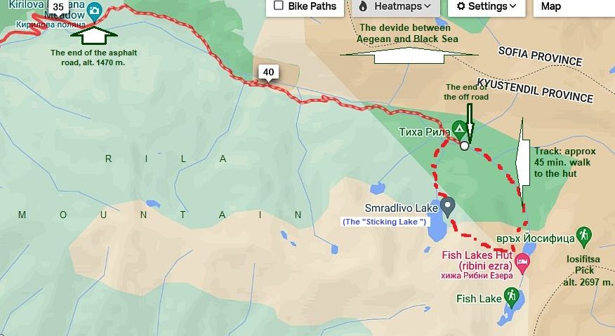
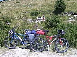
5. The Fish's Lakes Further you can pedal up along off road towards the Fish's Lakes. It is in very nice condition for climbing, but for heavier bicyclists the back road down the mountain would be not so nice.
|
||
|
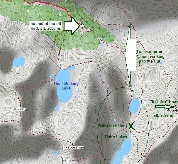
The off-road is 8,6 kilometers (the last 2 kilometers are almost plane area), in its end there is a home, maybe a meteorology station. |
After it to the Lakes there is a track. Never mind it is not steep, it is not convenient for bicycling, especially for heavy loaded bicycles. |
 |
 |
 |
 |
 |
 |
 |
||
|
You can leave bicycles at this home and walk to the lakes. The walk up to Fish's Lakes will be not more than 45 min up in the mountain.
The last 2 photos above illustrate the end of the off road and the highest pick in the region - Iosifitsa Pick, alt. 2697 m.
Between the lakes is placed Fish's Lakes Hut, food and tea can be find in it. Overnight accommodation too. In the same region is placed so called the "Stinking" Lake. Never mind of the awful name, in fact it is very nice lake, the largest one in Rila Mountain, which is worth to be visited. |
||
 |
 |
 |
 |
 |
 |
.jpg)